September, 2020
Pop Quiz, Hotshot. Where’s the last place you’d want to be in the Western United States with COVID-19 still not contained, economic distress, social unrest, the West Coast on fire with over five million acres burned and burning, and record temperatures that are beyond stupid hot? We know! Death Valley National Park, where the AVERAGE daily temperature is at least 110 degrees Fahrenheit and overnight temperatures MAY drop into the 90’s.

We wanted one more adventure before we headed back to Mesa on September 25th for the fall and winter, and figured that Death Valley National Park, being an easy 300-mile drive from our Williams summer home would be perfect. But what about the heat? While making our plans we were pleasantly surprised to find out that historically the average high temperature in September is 95 degrees Fahrenheit and 83 in October…so we figured that during mid-to-late September the heat would be more than manageable.
Well, like everything else in 2020 the predicted temperatures in Death Valley National Park in mid-to- late September were twisted. It was expected to be more furnace-like than more manageable; expectations of highs around 115 degrees Fahrenheit or higher (does it matter at that point?). We had pretty much exhausted our options in the Williams/Flagstaff/Sedona area and undaunted by the threat of HEAT we decided to go for it, packing our bags and driving to Beatty, Nevada, “The Gateway to Death Valley”.

Every wondered why it’s called Death Valley? Legend has it that a group of pioneers got lost in this God-forsaken land in the winter of 1849-1850 and were sure this paradise would be the site of their graves. By the way, if we haven’t mentioned it by now, Death Valley National Park is the lowest, hottest, driest place in the United States.

Our five-hour drive took us out of Williams and west along Interstate 40, north on US 93 through Kingman and Las Vegas, and finally north on US 95. We pulled into Beatty about 3:00pm, quickly unpacked our bags, and began following the tremendous plan Barbara had mapped out – our first stop would be Darwin Falls (!) in the Panamint Mountains. It was about a 90-minute drive up into the mountains to the turn-off onto the road to the trailhead.


We hoped to be able to hike to the falls and back with enough time left over to drive further into the mountains to Rainbow Canyon at Father Crowley Vista Point for sunset. We had been experiencing some minor troubles with the Jeep so we had rented a car for the trip, and unfortunately, the rental didn’t have the same clearance as the Jeep so the 2.5-mile ride over a grated bumpy road from the turnoff to the Darwin Falls trailhead took us longer than anticipated. It was about a mile or so from the trailhead to the falls.
Darwin Falls epitomizes a great paradox. Sitting within the boundaries of Death Valley National Park this is a year-round 25-30 foot waterfall and oasis. How crazy that such a place could exist in such a harsh desert landscape, and how wonderful to think of visiting a waterfall as our first memory of Death Valley National Park! By the way we were at an elevation of 3,129 feet and the temperature was in the 80’s. Amazing.

The closer we got to our destination, the more challenging the hike became. We found ourselves backtracking over, around and through a lush ravine filled with tall grasses, pussy willows, shallow streams from runoff from the falls, and giant slippery boulders.


We hoped the waterfall would still be active and we were not disappointed. A young group of guys were just leaving as we arrived, and they had collected watercress to take home.


We did our best to get to Rainbow Canyon at Father Crowley Vista for sunset. We were about 15 minutes too late but the fading light provided an incredible view.


Back to Beatty and deciding where to have dinner – the Happy Burro Chili & Beer, of course! We each had a bowl of delicious chili and split a cheeseburger accompanied by cold beer. It hit the spot after our long day of driving and our short hike to Darwin Falls.

The next morning we left Beatty about 8:00, heading to the Ubehebe (you-bee-hee-bee) Crater. Leaving Beatty it was already 85 degrees and we watched quietly as the temperature gauge in the car slowly ticked up to an outside temperature of 94.
To be in a park as diverse as Death Valley is so rewarding. From a waterfall last night to the crater left by a volcanic explosion a “mere 2,000 years ago” was remarkable. The belched-up molten rock and solidified hot ash can be seen for over six miles from the rim of the crater.


Next stop? The Racetrack. We were intrigued to see the playa (a dry lakebed) about three miles long and two miles wide that is famous for its strange moving rocks. Erosion causes large rocks from the surrounding mountains to find their way to the Racetrack, where they move across the level surface of the playa leaving trails as evidence of their movements. Reports of large rocks traveling 1500 feet is not unheard of. Research notes that a rare combination of rain and wind conditions is what causes the rocks to move. As little as a half-inch of rain can wet the surface of the playa resulting in a firm but very slippery surface. Strong winds of 50 mph – sometimes more – push the rocks along. We wondered if we would see anything this time of year, expecting the most activity probably occurs in the winter when there is a higher probably of rain, and at times a thin coat of ice on the playa.
As mentioned we planned this trip with our Jeep in mind – the road to the Racetrack is unpaved, and Park signs highly recommended using 4×4 high-clearance vehicles. We were driving our rented Toyota Camry. The 27-mile drive on Racetrack Road was going to take us at least two hours one-way, traveling at 15 mph. There are few visitors to this off-the-beaten-path location in the Park, and there is no water, shade or cell phone coverage. We proceeded super cautiously.

At about mile 5, something caught Brian’s eye. It turned out to be one of the smallest owls either of us had ever seen. It looked to be about 10″ tall; it didn’t seem particularly spooked by us, but it was watching us quite intently. We didn’t dare roll down the window for a photo. We got lucky with a single shot through the window – the owl didn’t hang around long.


Nestled in the foothills of the Panamint Range, and plodding along the long and winding road allowed us to appreciate the constantly changing terrain that is such a big part of this national park. We drove slowly past huge swaths of Joshua trees that gave way to acres and acres of barren rocky land.


We tried to imagine what drew the Timbisha (“red rock face paint”) Shoshone Band of California to this land over a thousand years ago, and we were surprised to learn that a small number of Timbisha Shoshone (between 50-60 people) continue to live in the heart of Death Valley in Indian Village.
After traveling for 90 minutes, we came to the famous Teakettle Junction. What a treat! Little did we know that others who had made this hazardous and challenging trip thought to bring along a teakettle to add to the growing collection that hangs from the crossroads marking the intersection.


We met a fellow traveler who regaled us with tales of his adventures coming to Death Valley for over 10 years, and we exchanged stories of our travels over the past two years. We had encountered a couple of other cars along the way, but this was the first person who had actually stopped to enjoy seeing the teakettles. From here it was six more miles to reach the Racetrack, but we didn’t want to press our luck with a car that shouldn’t have been on Racetrack Road in the first place. So we headed back to Ubehebe Crater.
Driving back to Ubehebe Crater we truly saw how much the smoke from the fires on the West coast has impacted Death Valley. To see a smoke ring hanging like a pale translucent gray fur collar in the distance gave us pause. We knew we were going to be driving into that mess and there was no alternative road. We kept our air conditioner circulating the air inside the car, and for once we were glad we had masks to wear when we ventured outside.


We had four more stops to complete before we headed back to Beatty, and the temperature in the lowest part of the park was already approaching 116. Lunch was peanut butter sandwiches, dehydrated fruit, chips and protein bars. We had packed the cooler with cold water and a power drink in anticipation of the heat. Despite signs that tell visitors to limit hikes to the hours before 10:00 am, we hydrated ourselves and set off for a short walk into the Mesquite Flat Sand Dunes. After all we only have two-and-a half days in the park.


Next stop on our agenda was the Salt Creek Interpretative Trail – a half-mile loop on a wooden boardwalk through a salt marsh.


At certain times of the year there is pooled water at the far end of the boardwalk supporting the desert pupfish who make their home in this section of the park. Pupfish are small – usually about three inches in length, and are found no where else on earth. We were fortunate last year to have seen pupfish at a nature center just east of the Park’s border, but while we did see three or four very pale lizards hanging out in what little shade was available, it was too hot and dry to do any intense searching for the pupfish. Suffice it to say, no water, no fish.


The Artist’s Drive is another distinct attraction of the Park and a treat for the eyes. A one-way, 9-mile roller coaster road takes you down, around and through some remarkable canyons and towering mountains. It’s stunning to see what Mother Nature has done to “paint” the sandstone in this part of the desert. Rich metals and elements found in the ground have oxidized the clay creating a palette of reds, yellows, blues, greens and purples. Because there were so few visitors in the park, we stopped to take photos. The most colorful stop was Artist Palette at about mile 5.


Our last stop for the day was Badwater Basin located just south of Furnace Creek. This was a recommended place to catch a spectacular sunset.

Badwater Basin is the most visited place in the Park, and it is here that visitor’s can experience the park’s highest temperatures. As we pulled into the parking lot, waiting for sundown, we rolled down the windows, relaxed and let the oppressive heat weigh down on us. We dozed and sweated, waiting for the sun to set.
This is the lowest point in North America and was formed by movement of the earth’s crust – Badwater Basin is 282 feet below sea level. Visitors tend to stare out at the salt flat and jagged formations, and you can walk out a mile or so. But turn around and there is a sign about half way up the side of the Amargosa mountainside announcing the location of Sea Level.


Badwater Basin got its name from the “bad water” that comes from a small spring-fed pool found next to the road. If you contrast Great Basin National Park, an exorheic basin (surface water runs into the ocean or into another body of water having a connection to the ocean), with Badwater Basin, you learn that Badwater is an endorheic or terminal basin with no outflow to rivers or oceans. Given the accumulation of salts in the surrounding basin, the water becomes undrinkable. You would think that nothing could exist in such an arid environment and yet pickleweed, aquatic insects and the Badwater snail thrive.


As we ventured out onto the griddle hot basin, waves of heat emanated off the hexagonal honeycomb shapes of the thin salt crust that crunched beneath our feet. We were conscious of the paths that millions of park visitors have created over time on this fragile landscape and yet it continues to exist. Miles and miles and miles of vast salt flats.


Brian had hoped that the smoke from the California wildfires might enhance the colors of sunset, but overall it was pretty disappointing.

Back to Beatty for a shower and dinner at Gema’s Cafe for a delicious meal. Described as a “Hispanic twist to the traditional cafe,” it lived up to it’s hype. Barbara had comfort food: meatloaf, mashed potatoes, gravy, mixed vegetables and a side salad. Brian had carne asada. The food was fresh, made to order, the service was terrific and we got fed for under $25. If we had another day in Beatty, we would have gone back for breakfast.

We decided to follow recommendations and visit Zabriskie Point (part of the beautiful Amargosa Mountain Range) at sunrise. We staggered out of bed at 5:00 to get to our destination by 6:30 – about 10 minutes before sunrise. Zabriskie Point is 45 miles from Beatty; 30 miles to the park entrance and then another 15 miles south to reach the view point. We arrived on time, and found several other early morning, coffee-mug-carrying, adventurous masked (!) visitors who had made the trek from the parking lot up the steep paved pathway to the view point. As the sun began to rise, the badlands exploded into a maze of wildly eroded and vibrantly-colored mountains. This whole area used to be underwater, and over several millions of years, weathering and alteration by thermal waters created the variety of colors visitors see today, and lava from volcanic eruptions has created a hard lava cap that retarded erosion in many places. This cap can be seen most prominently at Manly Beacon, the highest outcrop at Zabriskie Point. The temperature was a tolerable 95, and a gentle breeze was much appreciated. What a peaceful and amazing way to start the day.


We hustled ourselves from Zabriskie Point to the Golden Canyon Trail trailhead in order to complete the 3-mile round-trip hike to Red Cathedral and back ahead of the heat of the day. We had the whole place to ourselves.
The Canyon is a marvel, and the scenery during the slow easy uphill grade held us captive. Every turn was as breathtaking as the previous one, and Barbara’s pockets were soon bulging with rocks she found too irresistible to leave behind. At about a mile into our walk we saw the signpost directing us to Red Cathedral. We had seen glimpses of the cathedral rocks and now they were in full view. Stretching from the floor of the canyon, these majestic red icons were beautifully lit by the early morning sun and they served to deepen our appreciation for this incredible park.


We had experienced the heat and believed the signs that cautioned visitors to keep their hikes to the early hours – before 10:00 am. But we figured the short hike to Natural Bridge Canyon would be doable anyhow.
As the name of this Canyon indicates, the main attraction is a 50-foot tall bridge that was naturally created by the erosion in the canyon walls. The round-trip hike is a little over one mile and it was pretty cool just to walk under this amazing bridge. In addition to the bridge are a number of “dry falls” that seem to pour into the Canyon. A stream flowed into the canyon thousands of years ago, and the long vertical chutes were created when the canyon eroded much more rapidly than the stream bed above. What was equally impressive as we hiked back to our car was the remarkable view of the south end of Death Valley and the massive salt flats with the towering (if haze-covered) Panamint Mountain Range looming in the distance.


We took a quick trip to see the Devil’s Golf Course – an immense area of rock salt eroded by wind and rain into jagged spires so incredibly serrated that “only the devil could play golf on such rough links”.

Our farewell to Death Valley National Park would be taken from the overlook at Dante’s View. At 5,476 feet it was almost refreshing to step out of the car into 85 degrees after the blistering heat of the Valley. It took us a couple of minutes to realize that the view we were seeing from the top of the Black Mountains was Badwater Basin. We were looking out over the side of the mountain where we had been looking up at the Sea Level sign just yesterday! If you have ever tried to imagine how big Death Valley is (over 3.4 million acres), the view from Dante’s View staggers the imagination with its stunning panoramic views of the entire valley. From the parking lot there are a number of paths to various viewing points that allow visitors to fully appreciate so much of the beauty and wonder that Death Valley National Park has to offer.


And for all of our nerd friends: Yes. We learned that Dante’s View was the film location for the 1977 “Star Wars” movie. For 10 extra points, can you name the scene that was shot from this Death Valley location?
This landscape is home to more than 1000 plant species that can flourish in this stark and barren land. We may not have seen them, but it has been reported that this is home to desert bighorn sheep, desert cottontail rabbits, roadrunners, the mojave fringe-toed lizard, the desert tarantula, coyotes, bobcats, nine bat species, great horned owls, burrowing owls, gophers, kangaroo rats, badgers, ringtails, the kit fox, and even some mountain lions.
Death Valley National Park is everything we thought it would be and more. Sure it was beastly hot in the valley, and it’s supposed to be so. The salt flats, desert environment, sand dunes, and canyons that make up the valley have a uniqueness not found anywhere else we know. But on each side of the valley and well within the boundaries of the Park are mountains with their own beauty and vistas at 5,000 feet or higher that are begging the visitor to ascend, feel the coolness, and take a moment or more to look down upon the valley itself. And then there is the waterfall!
We know we didn’t get to see and do everything there is to experience in Death Valley National Park; the extreme heat and the wildfire-induced smog curtailed our daily activities. We loved it all and wonder what it would be like to go back in the Winter – would we experience the Park differently?
As we’ve said all along…stop, look around and be amazed at what you find. You’ll certainly find more than the expected at Death Valley National Park.
Barbara and Brian
Brian notes that he does, on occasion, enhance or mess around a bit with the color in some photographs; however, the light in Death Valley National Park can change so rapidly and a picture with warm tones may become bleached out in 2-3 minutes (Mesquite Sand Dunes) or colors may change with elevation and the sun’s angle on the photograph (Ubehebe Crater – each of the 3 pictures of the Crater were taken 100 feet in elevation apart) or the colorfulness at sunrise at Zabriskie Point becomes bland and washed out an hour or so after first light. He promises that he did not mess around with the colors and that all of the photographs were included to represent this phenomenon.
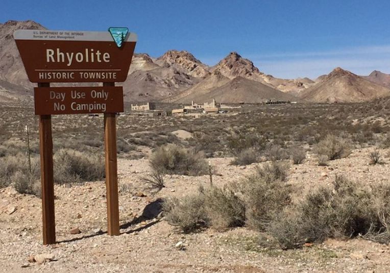
Rhyolite, Nevada is 4 miles west of Beatty, and is home to a ghost town and an unusual museum that is free and open to the public. A must stop if in the neighborhood.
The mining town of Rhyolite got its name from the silica-rich volcanic rock in the area. The history of the place credits two prospectors who discovered “free gold” in the quartz and soon the gold rush was on. The town enjoyed a boom period beginning in 1904 and grew to more than 2,500 people, but the town went bust a mere 10 years later. Tourists can visit remnants of Rhyolite’s glory days.
The unusual museum is the Goldwell Open Air Museum – a 7.8-acre outdoor sculpture park.

Goldwell Open Air Museum is a nonprofit museum that was established in 2000 following the death of Albert Szukalski, the Poland-born Belgian artist who created the site’s first and most popular sculpture in 1984.
The piece that attracts the most attention is The Last Supper, a life-sized recreation of Leonardo da Vinci’s famous painting, only Szukalski’s interpretation consists of ghostly forms arranged like the iconic Apostles. Trust us: this sculpture will be forever seared into your brain. Szukalski created these freaky forms by draping plaster-soaked burlap over live models until the plaster dried enough to stand on its own.

Visitors will also find two other Szukalski ghost-like figures: Ghost Rider holding a bicycle, and a whimsical ghostly figure that looks like an artist holding a palette of colorful paints.


Additional sculptures include Belgian artist Dr. Hugo Heyrman’s giant garishly pink woman figure, Lady Desert: the Venus of Nevada. The full radiant pinkness of this piece stands in stark contrast to the more subdued and muted colors of the desert. The sculpture looks like a naked, blonde, 25-foot tall Lego-like lady, complete with breasts and blonde pubic hair. So much for folks who may think this is a religious park!

Additional sculptures include a 24-foot tall prospector and his penguin sidekick made out of rusted steel, and a mosaic sofa which visitors are allowed to sit on – albeit carefully. Make sure it’s not too hot!


Barbara and Brian
Additional sculptures from the Goldwell Open Air Museum


Wow – plenty of great photographs again, naturally. And there is so much to take in! Darwin Falls looked amazing. The Ubehebe Crater is almost moon-like. The Racetrack’s walking rocks sound fascinating, and the tiny owl looked full-sized in photographs. Tea Kettle Junction was fun-looking, and the Mojave Fringed-Toed Lizard was very interesting to look at (those toes!). The Salt Flats with their crystal structures look like snow / ice, which must be awkward when it’s over 100 degrees outside!! The Dry Falls were unusual to see as well. And I really enjoyed all the images from the Open Air Museum. I’m a sucker for art, though. Hope you’re keeping cool(er) & breathing easily.
LikeLike
Interesting that the Death Valley photographs have elicited a bevy of my favorite picture is votes…so cast your vote, please? We saw another piece by the Open Air Museum artist, Albert Szukalski, north of Salt Lake City…very imaginative and creative guy. It is cooler in Mesa than expected. Of course, having a full resort, with swimming pool and water volleyball daily helps tremendously. Overnight lows in the upper 60’s daily highs in the mid 90’s – stay out of the direct sun and it is pretty pleasant. So which pic was your fav?
LikeLike
Picking a favorite is impossible! I really enjoyed the warm tones (in stark contrast to later pictures) of the first photo of Ubehebe Crater. The panoramic photos on Artist Drive are also really striking! But Zabriskie Point and Golden Canyon had awesome views as well. The lonely sandy boardwalk, the lizard in the shade, the crossroads of TeaKettle Junction, the strange ghost figure statues, keeping Lego Naked Lady and Metalic Origami Bird company … how could you possibly pick one? If forced, honestly, I’d pick the Owl — but only because I’m partial to owls. My grandmother has collected Owl things for as long as I can recall, and she is my very first thought whenever I see an owl, and that’s comforting, I think. So … Owl.
LikeLike
NICE!
LikeLike
Death Valley is easily one of my top 3 NPs. The two times I visited it was not crowded and minimal traffic in park and views that go on forever. It is a huge, huge park and definitely takes a few days to explore. And reasonably close to Vegas, Great Basin, Mohave Desert. Keep living the dream my friend – might as well keep exploring and stay away from TV on Saturdays. Good grief.
LikeLike
The views and unexpected treats in DVNP are spectacular…I don’t believe we did it justice in the 21/2 days we explored from sunup to sunset. And yeah, Saturdays are not days i look forward to this year. 2020 is such a conundrum…I suspect that Rutgers and Illinois will play for the Big 10 title!!
LikeLike
Theoretically either PSU or Michigan will get at least one more win. I have to believe Harbaugh is done by Christmas – can’t extend him with this meltdown going on and can’t have him recruiting with only a year left on his deal. Franklin has another 5 years on his deal so he is safe.
LikeLike
I’m a harbaugh guy, but he has run his course at Michigan and if he goes the entire staff has to go, every single one of them…new head coach, new staff, new program. not sure we can beat rutgers this weekend though…ever think the we’d be playing each other to stay out of the basement of the Big 10 East?
LikeLike
Nope – never thought we both might end up looking up to see RU, IU, MD. And never thought UM fans would be calling for Harbaugh’s head because he lost to PSU – because it was their only win of the year. I guess he can finally “beat” OSU if they end up cancelling and that blocks OSU from B10 title game and costs them shot at CFB playoff. He does that and he better stay out of Ohio for the rest of his life.
LikeLike