August, 2021
From Troutdale, it’s 126 miles pretty much due south to Eugene and then approximately 180 miles to Medford, just about on the California border. We had planned on stopping in Eugene in order to explore the southern Oregon coast, take a trip out to Redmond and Bend, hike through an amazing forest, learn about lava casting, and see a bit of the University “Nike built.” And then from our campground in Medford it would be an easy trip to Crater Lake National Park.
What we didn’t count on was the impact from wildfire smoke…but more on that later.
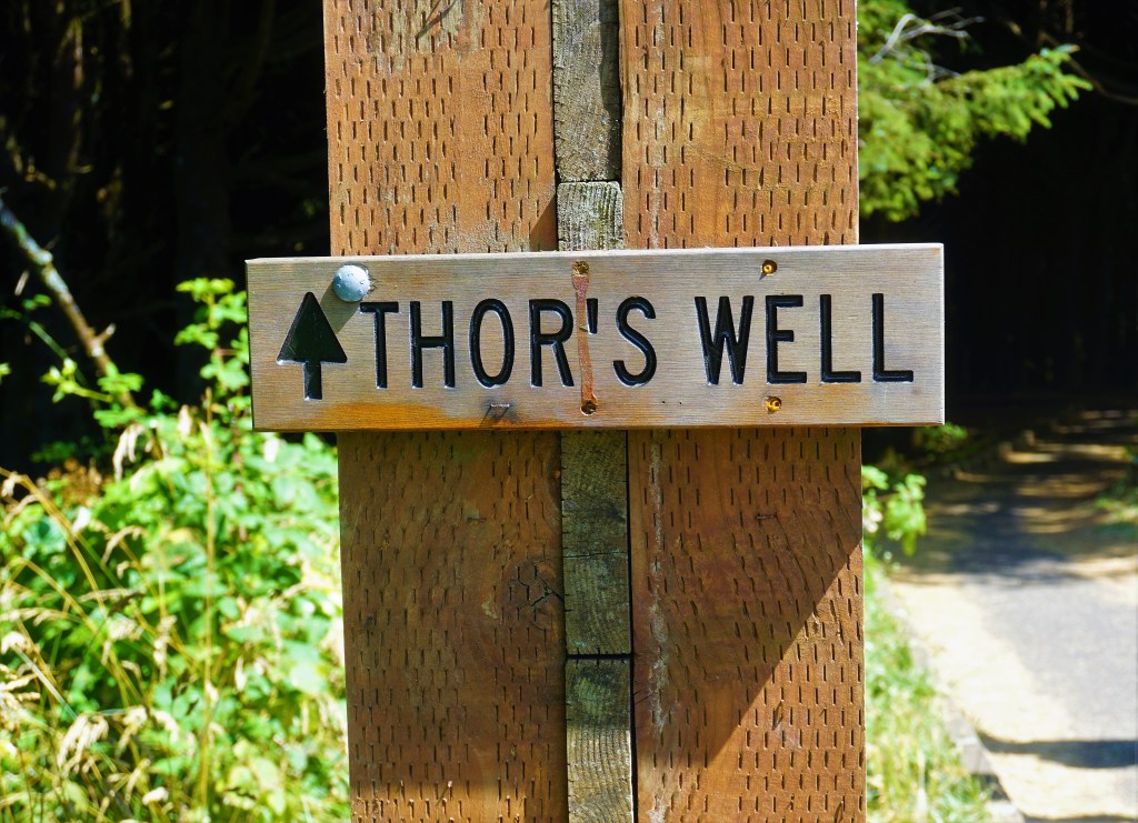
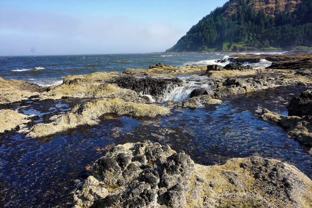
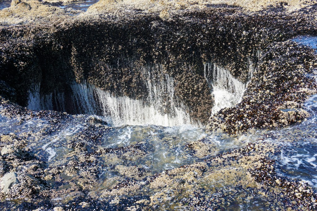
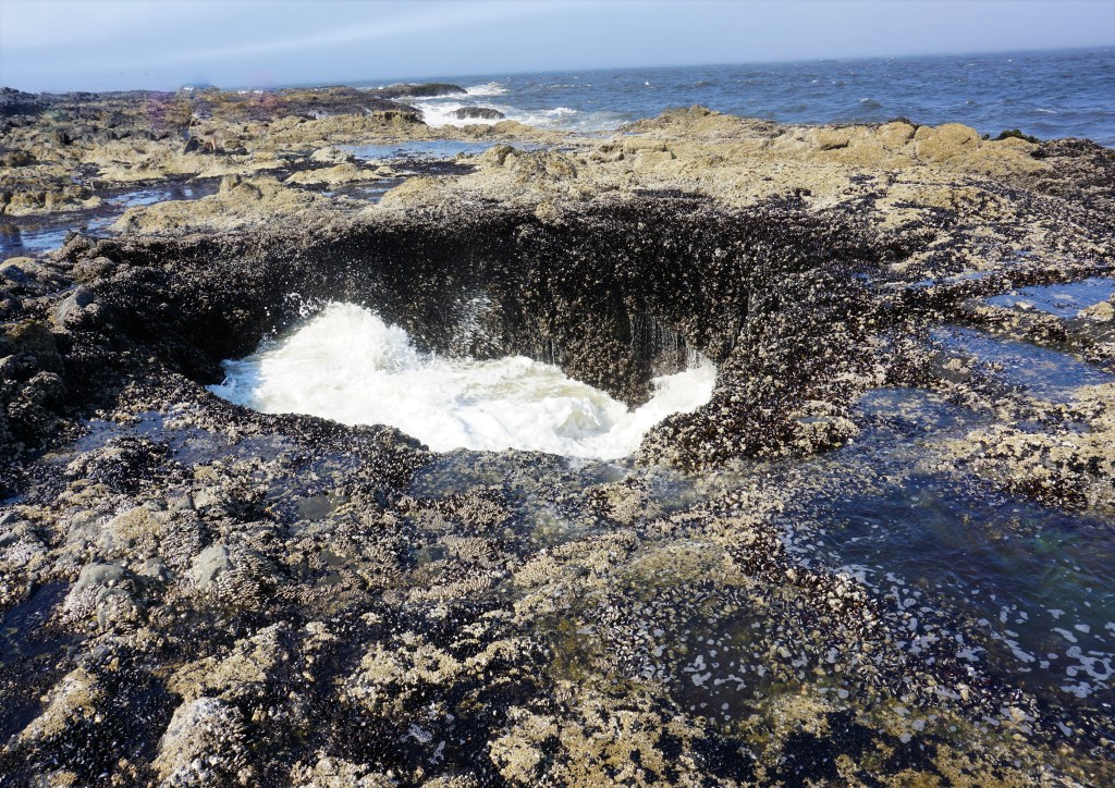
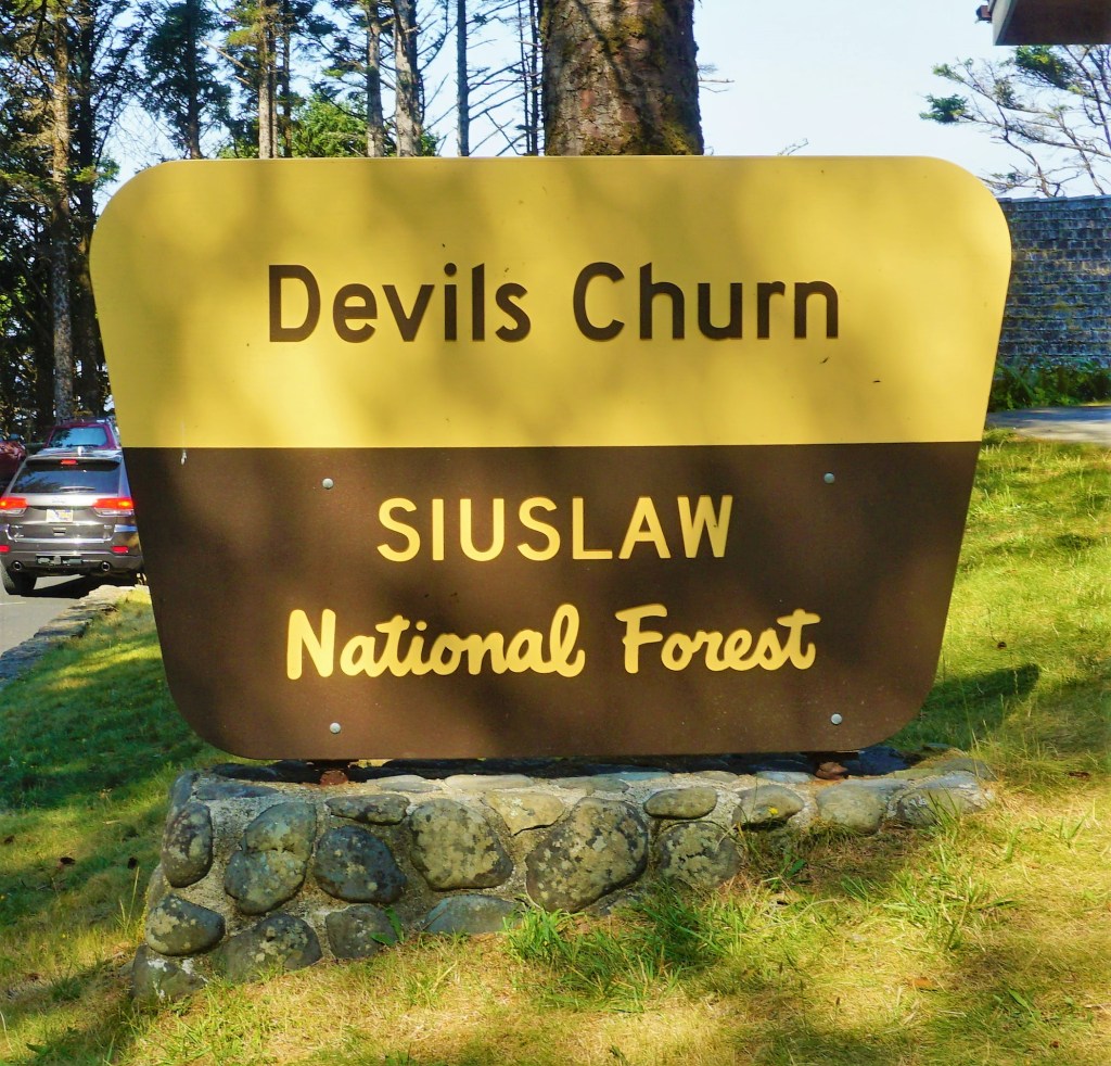
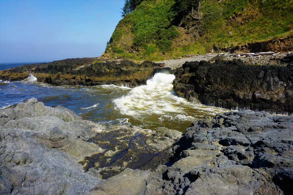
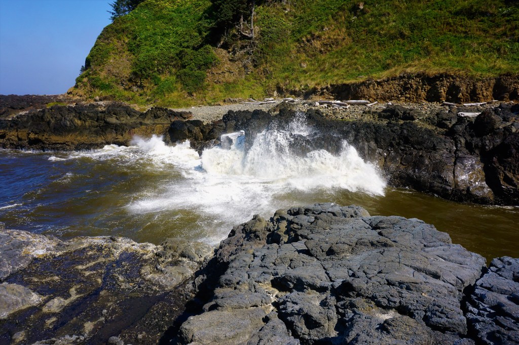
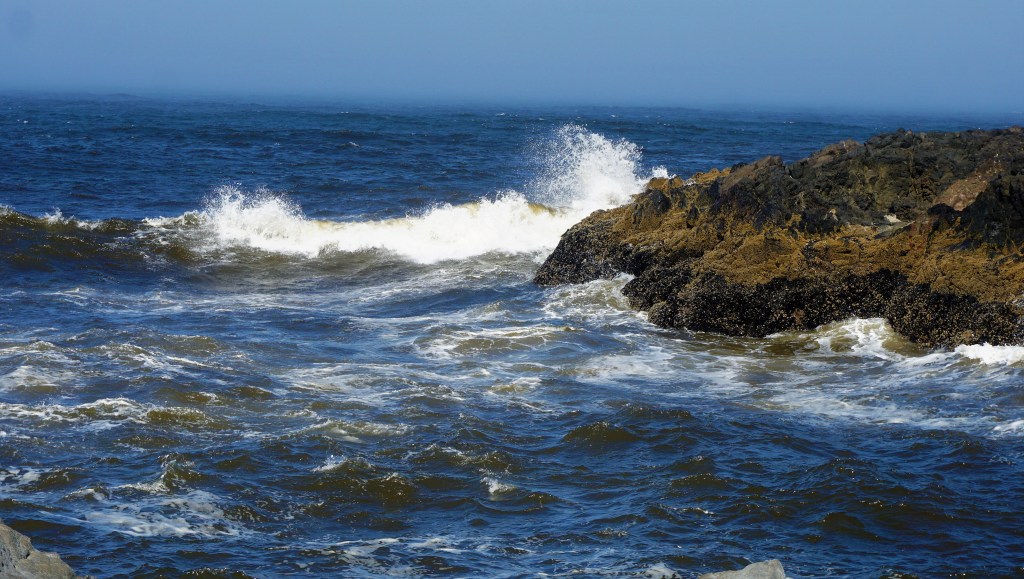
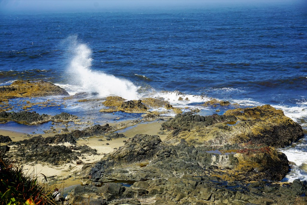
Heading west out of Eugene we’d turn north when we saw the Pacific Ocean and head towards Yachats, Oregon – just south of the city where we’d find Cape Perpetua. Cape Perpetua is home to Thor’s Well and The Devil’s Churn.
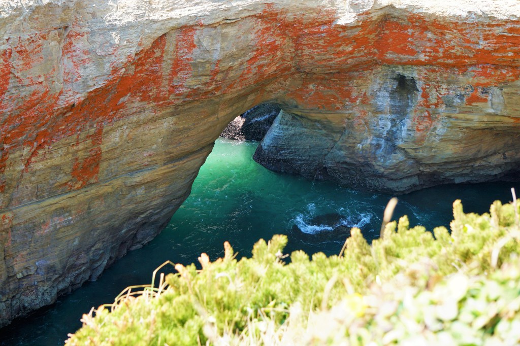
A hike down the hillside onto 40-million-year-old lava rock and past the sheer sided inlet known as Cook’s Chasm is Thor’s Well – a gaping seemingly bottomless hole in the ancient lava rock pre-shore that appears to drain water from the ocean.

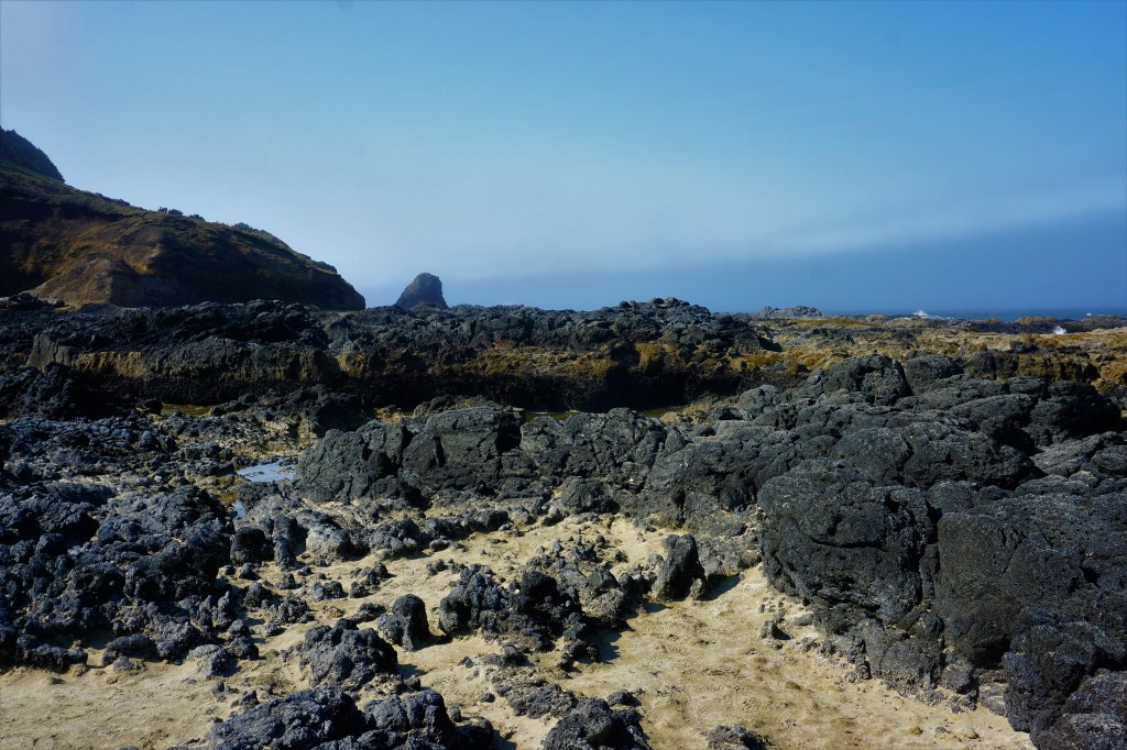
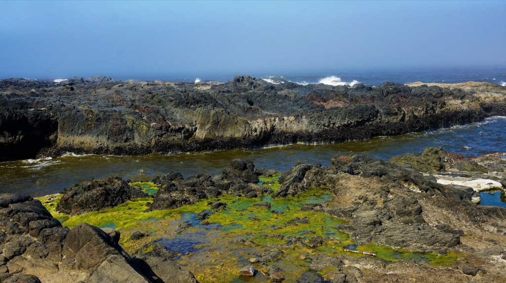
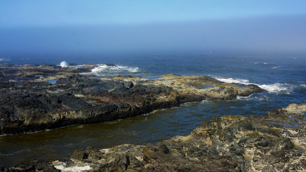


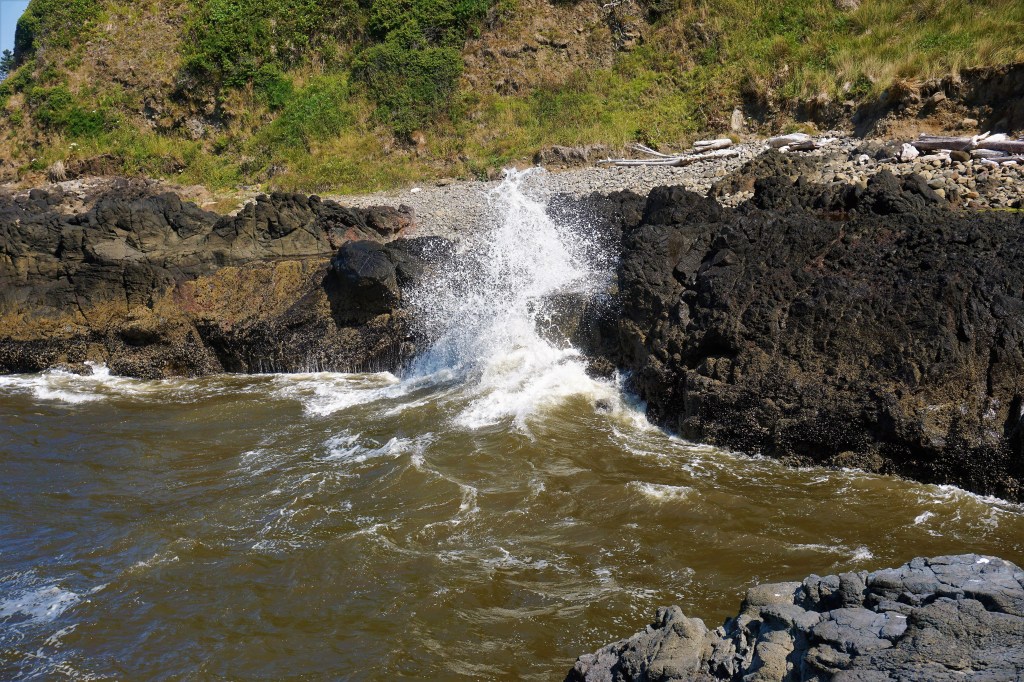
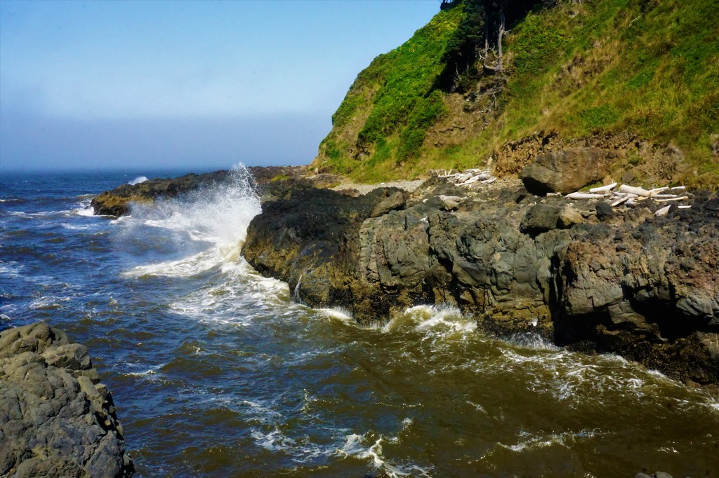
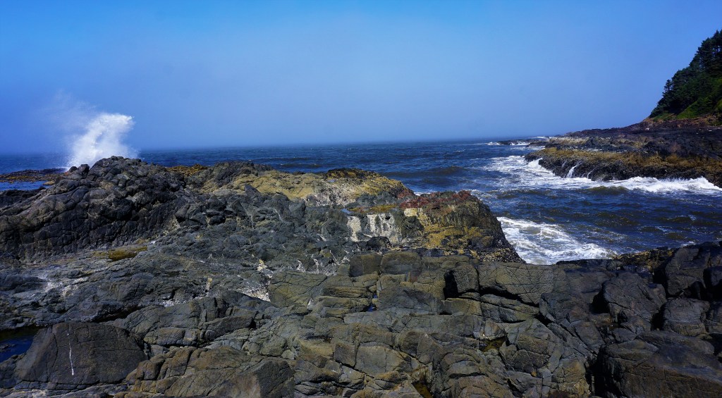
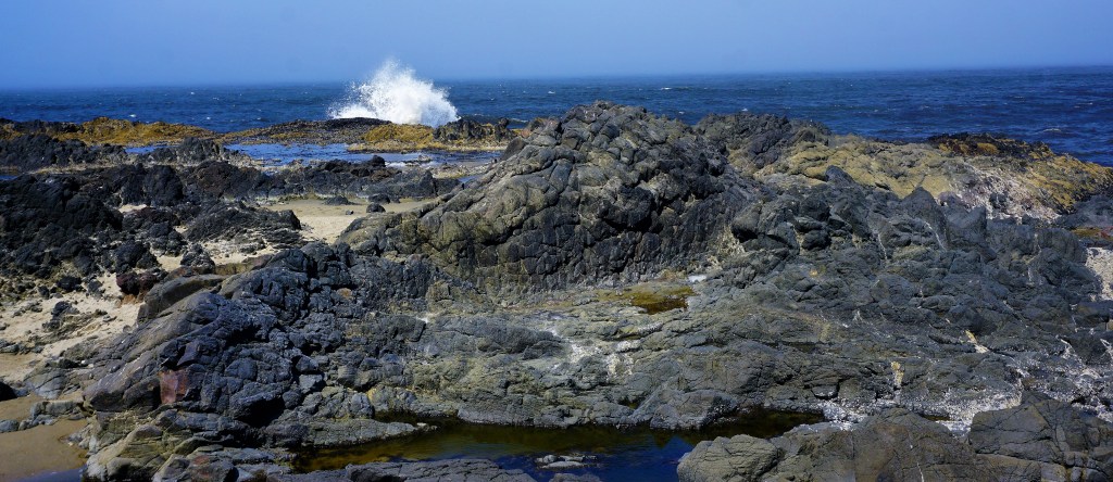
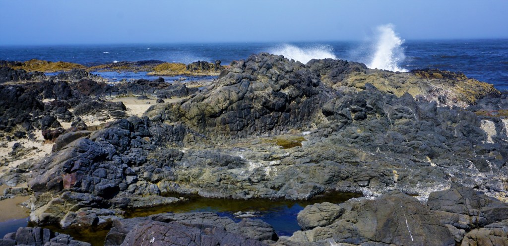
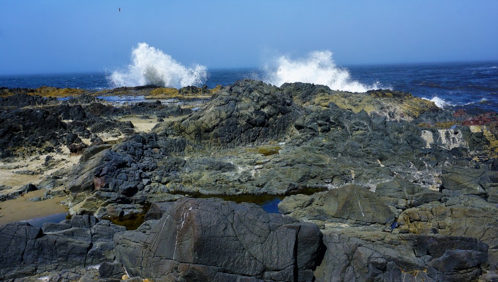
A half-mile trek down the road and we found ourselves at the trailhead to Devil’s Churn – a wave carved inlet featuring a perpetually crashing swirling flow of sea water.

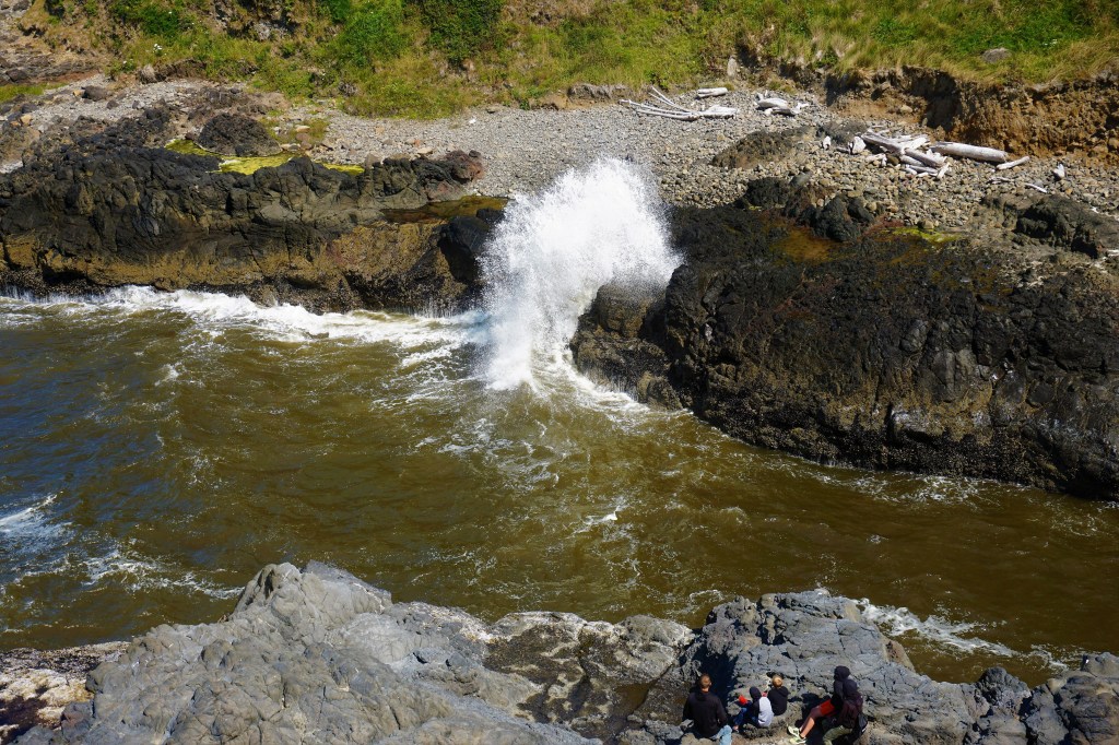
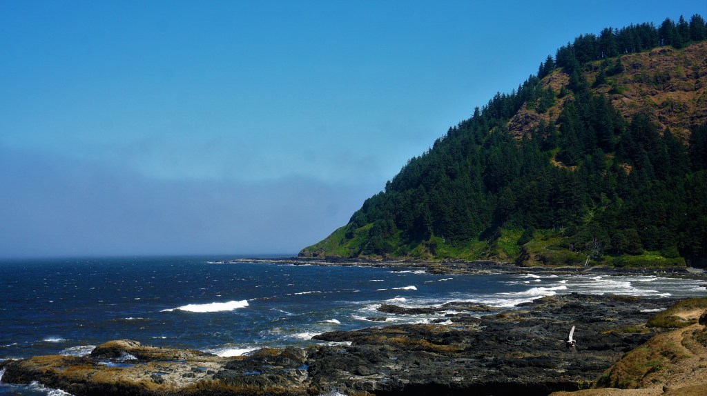
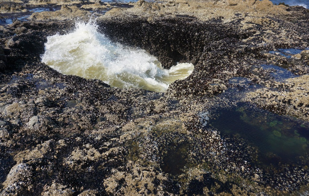
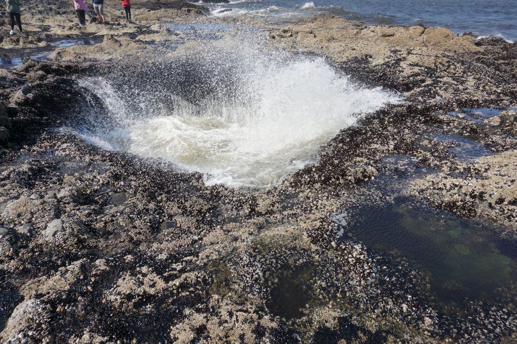
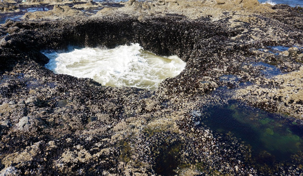
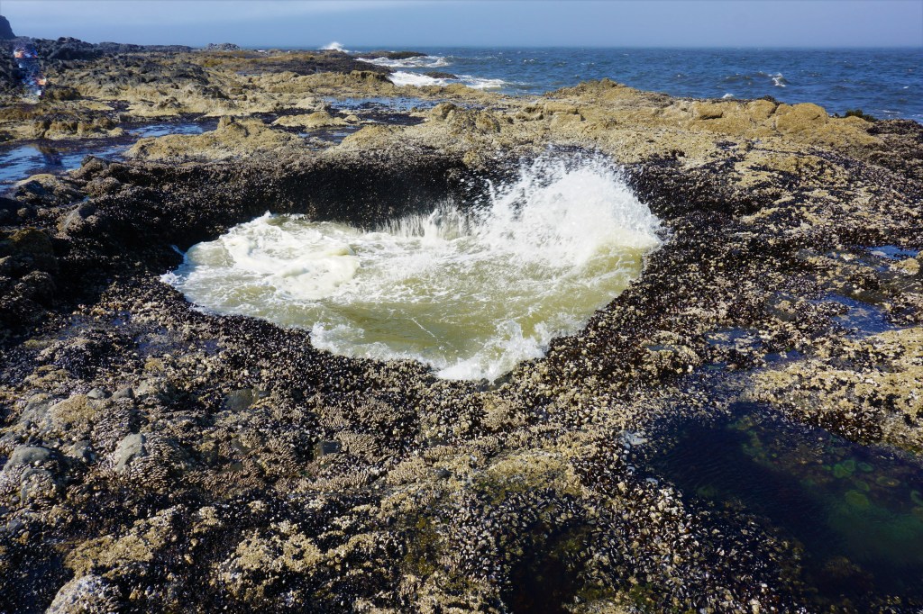
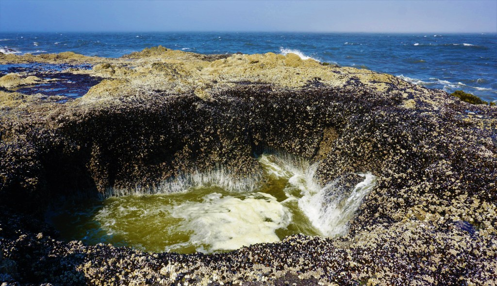
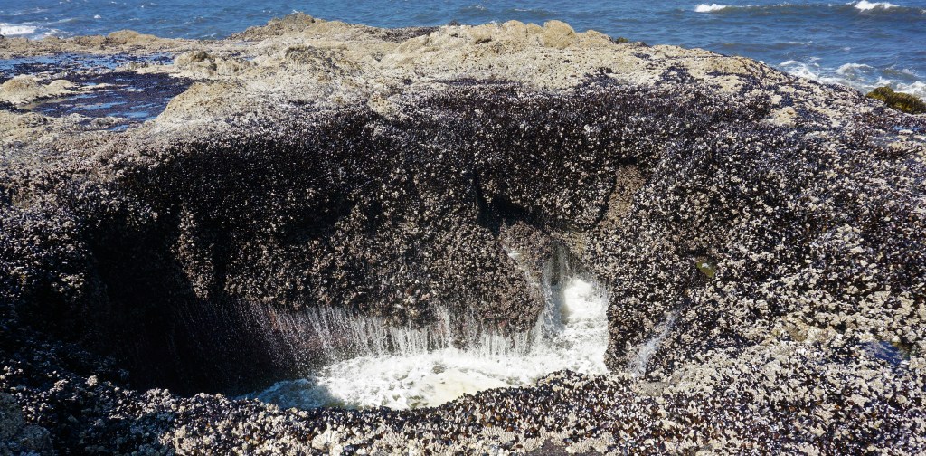
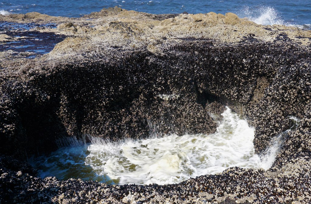
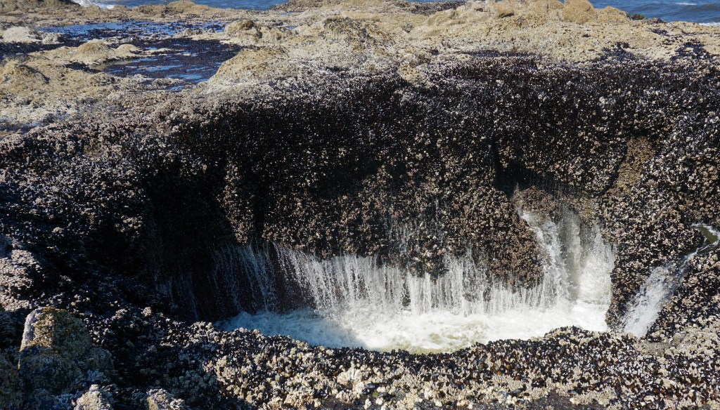
The Devil’s Punch Bowl is south 10 miles or so from Cape Perpetua on US Highway 101 along the beautiful Oregon coast towards Depoe Bay. Probably the result of a collapsed sea cave, The Devil’s Punch Bowl is a large, circular hole in the rocky coastline.


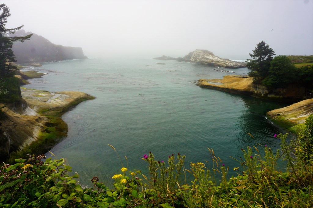
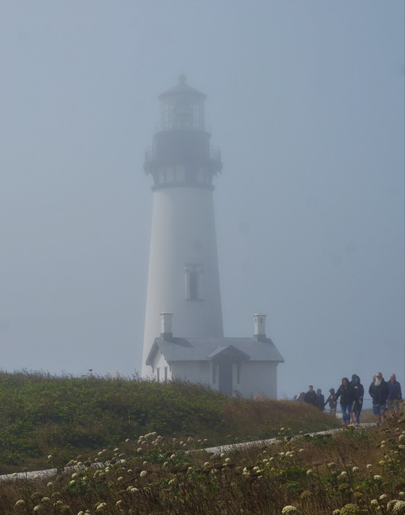
As we continued down the coast fog became our companion and made for a very “otherworldly” view of Newport Bay and the Yaquina Head Lighthouse.

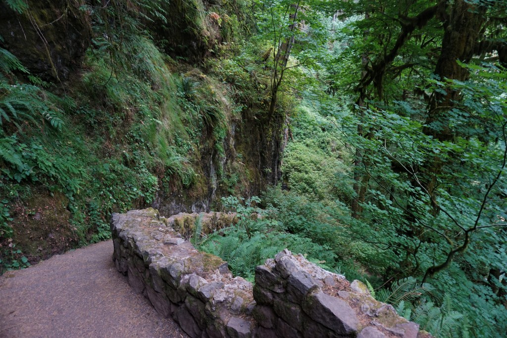
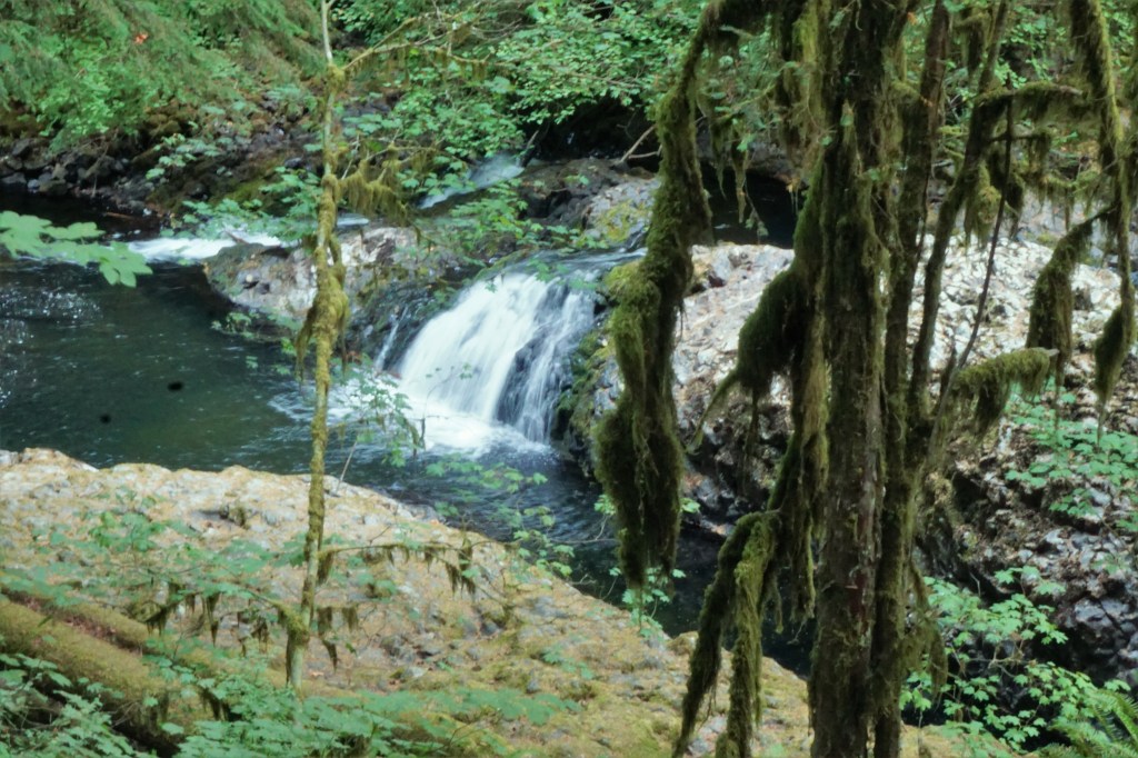
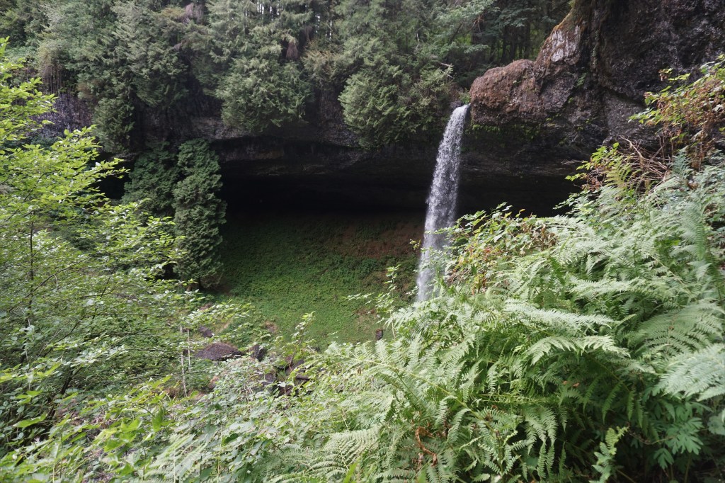
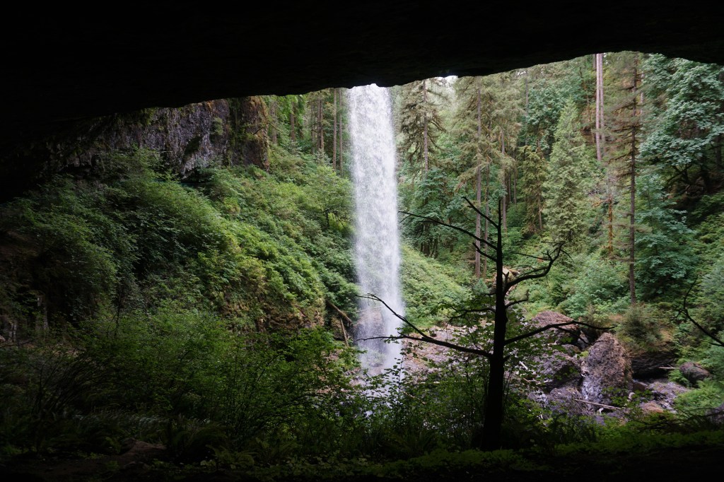
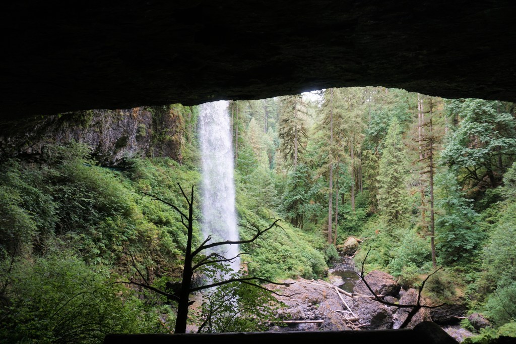
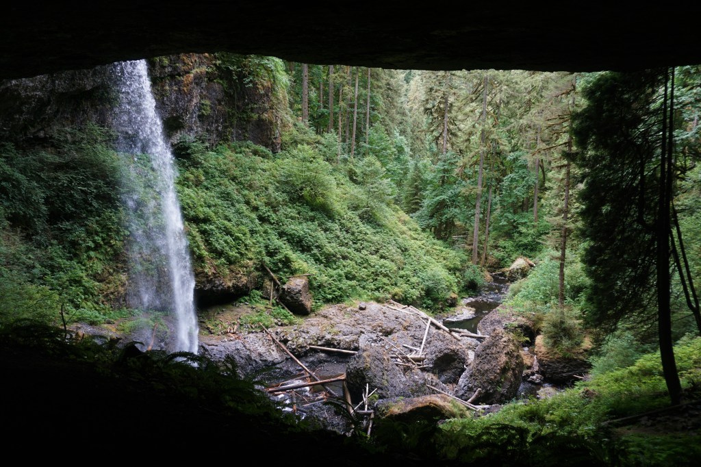
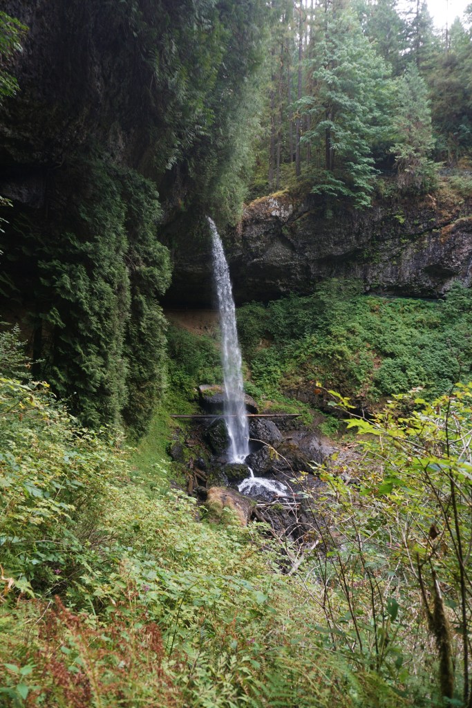
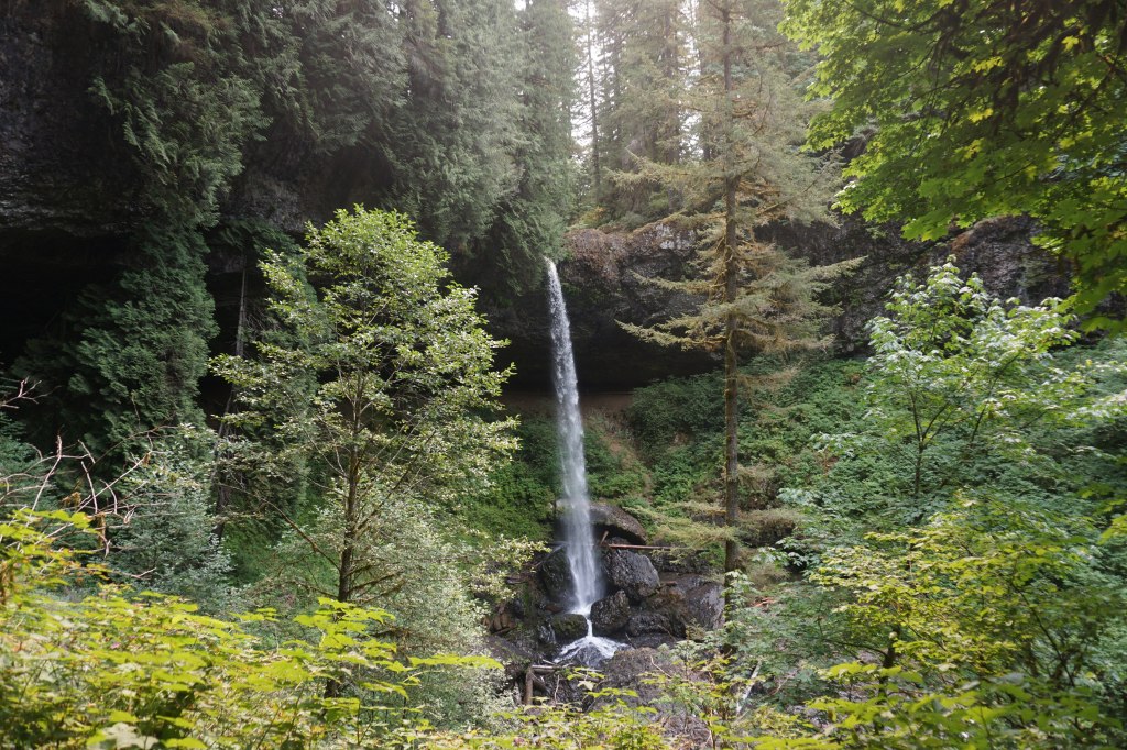
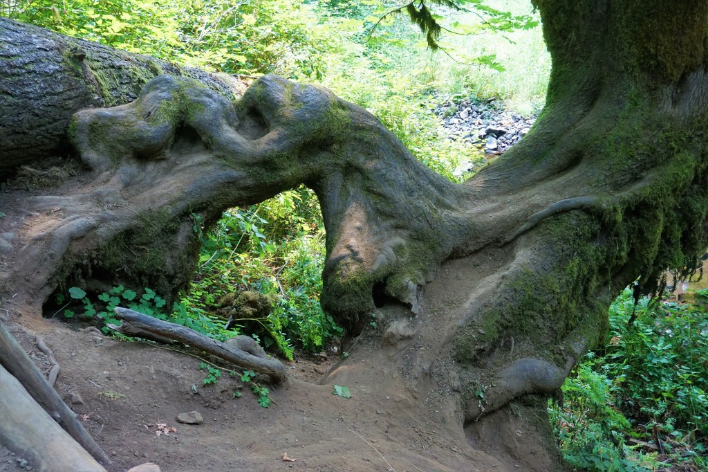
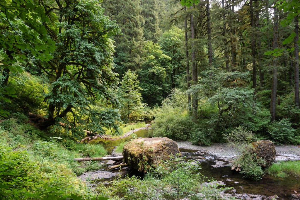
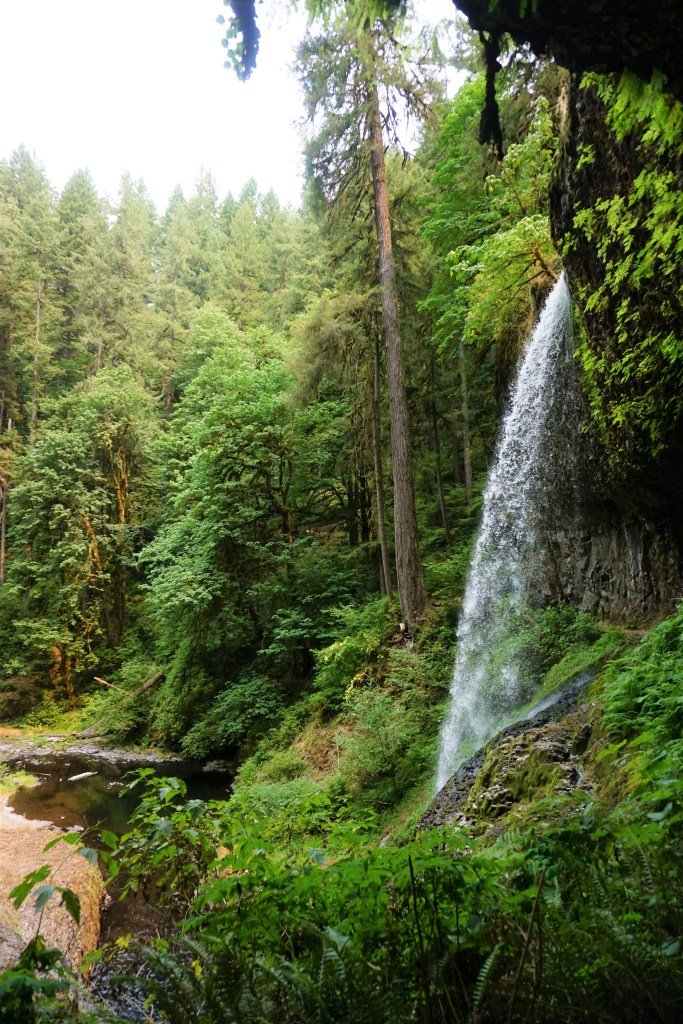
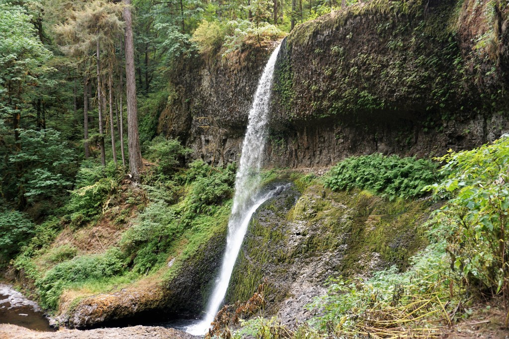
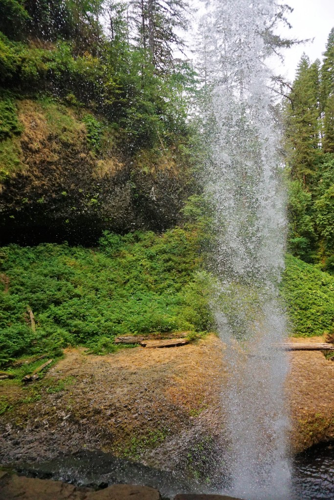
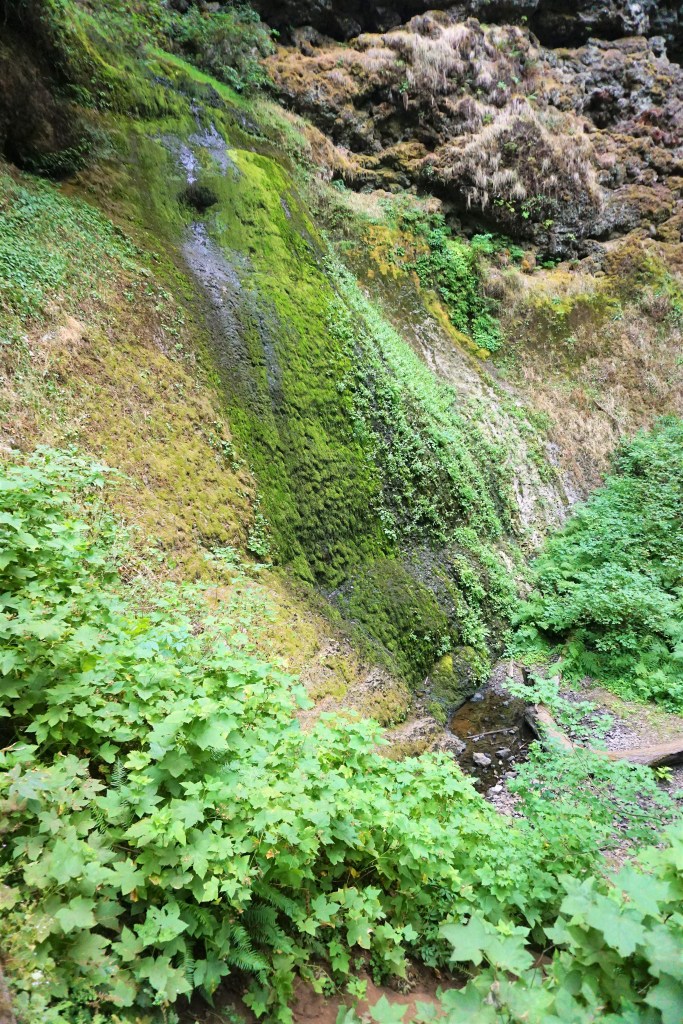
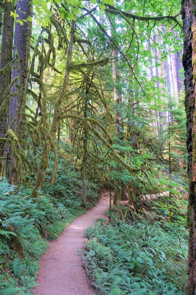
At more than 9,000 acres Silver Falls State Park is Oregon’s largest state park. It includes more than 24 miles of walking trails, 14 miles of horse trails, and a 4-mile bike path. The most popular hike in the Park is the 8.7-mile Canyon Trail/Trail of Ten Falls that runs along the banks of Silver Creek and past ten waterfalls. 8.4 miles is a bit too much for our old legs to bear, but from the North Falls Trailhead we did manage to take in a few of the waterfalls during a glorious hike.
This one amazing, spectacular and wonderful park…well worth more than one visit!

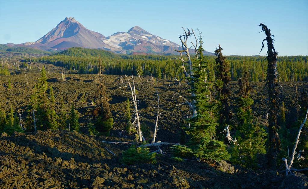
On the way to Newberry Volcanic National Monument, we caught our first glimpse of Three Sisters Peaks…

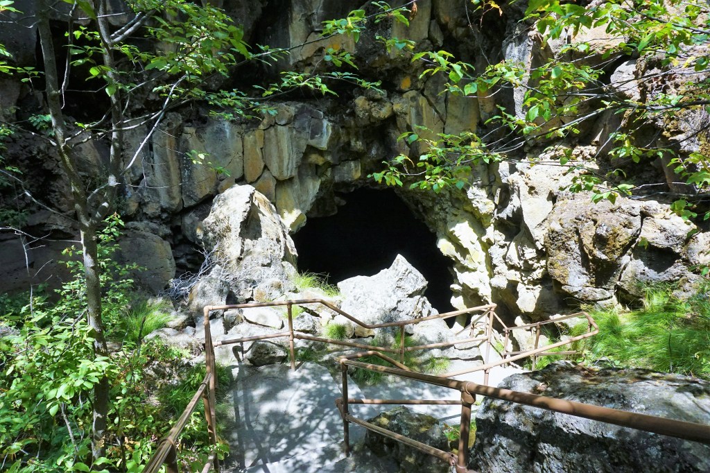
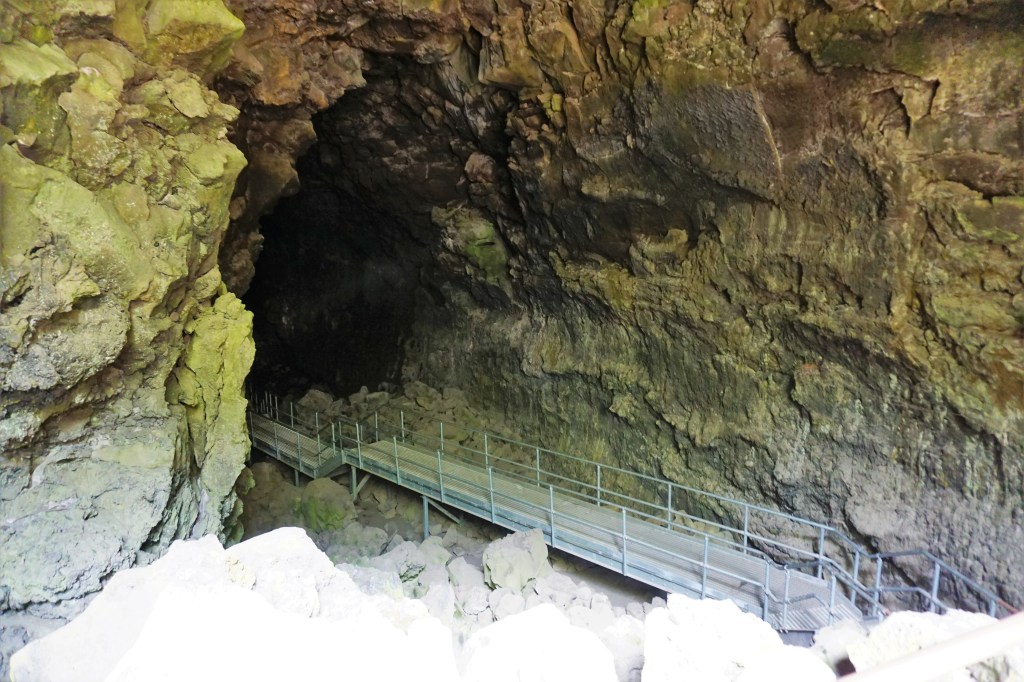
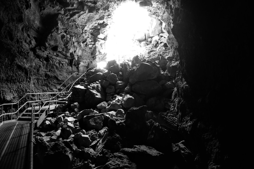
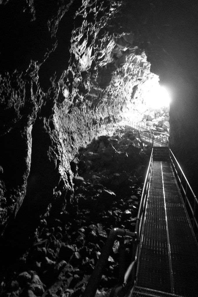
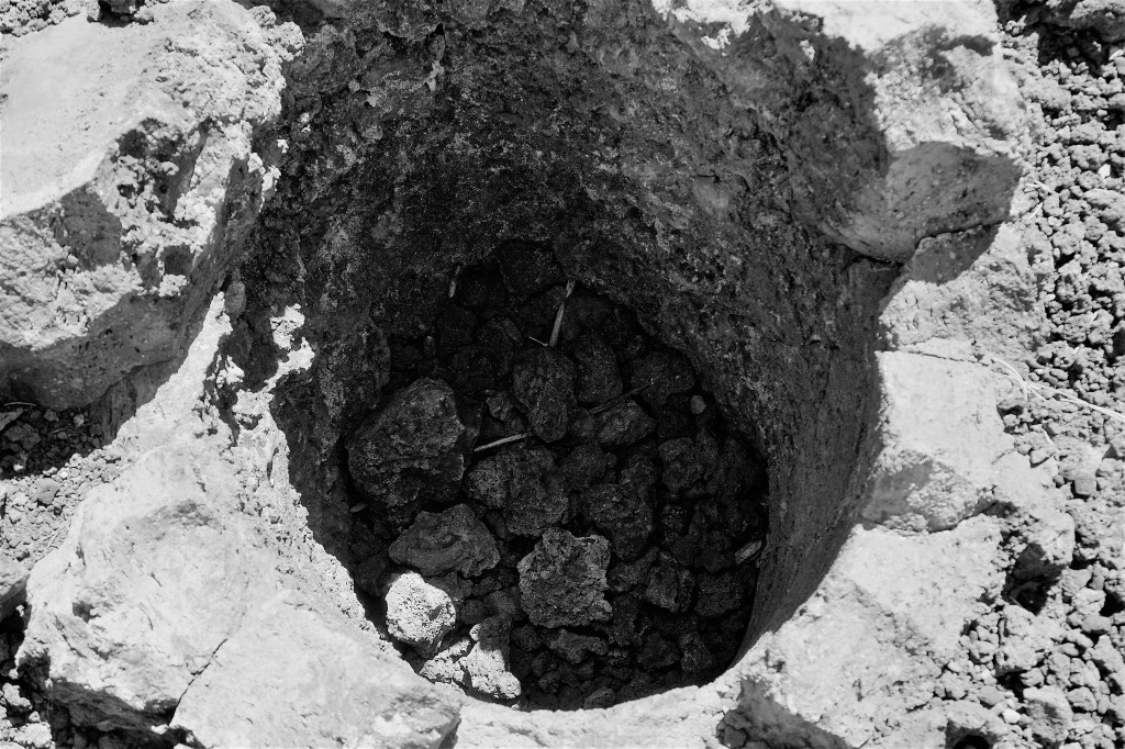
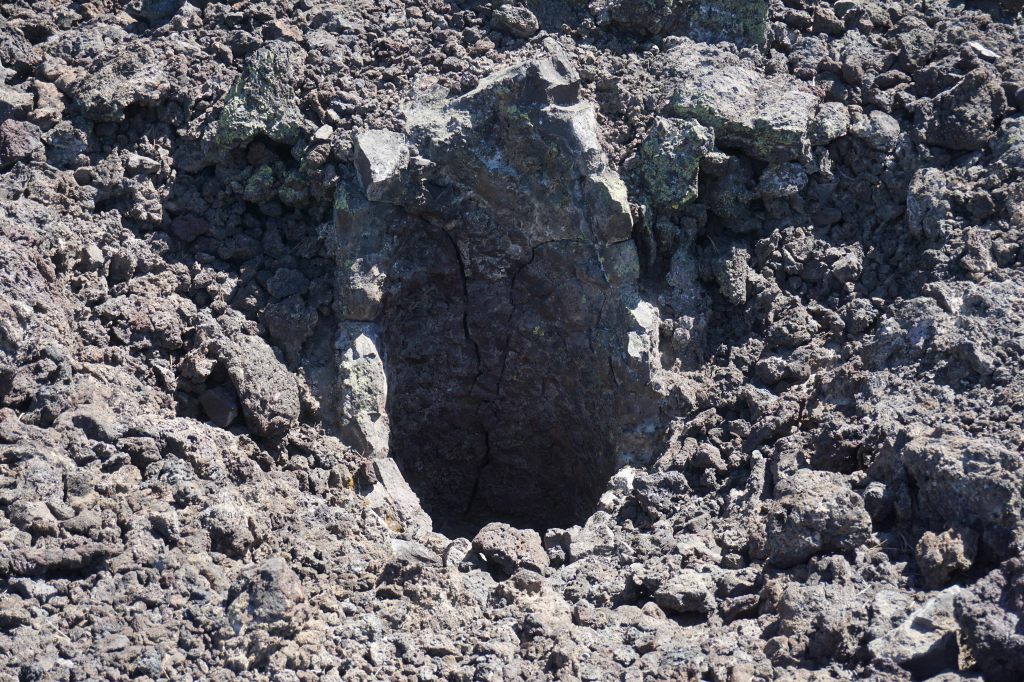
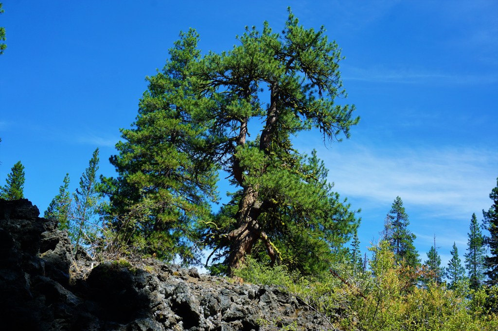
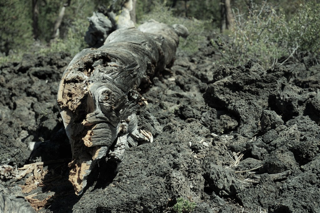
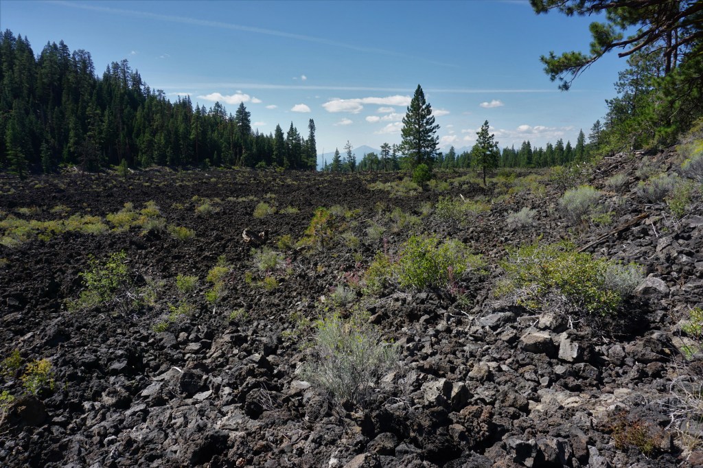
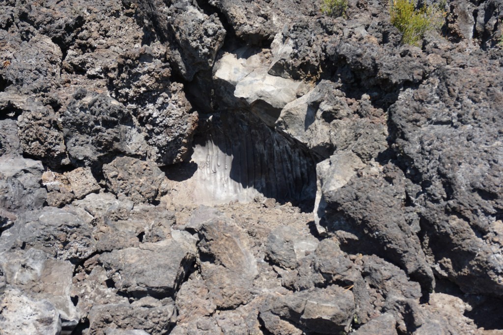
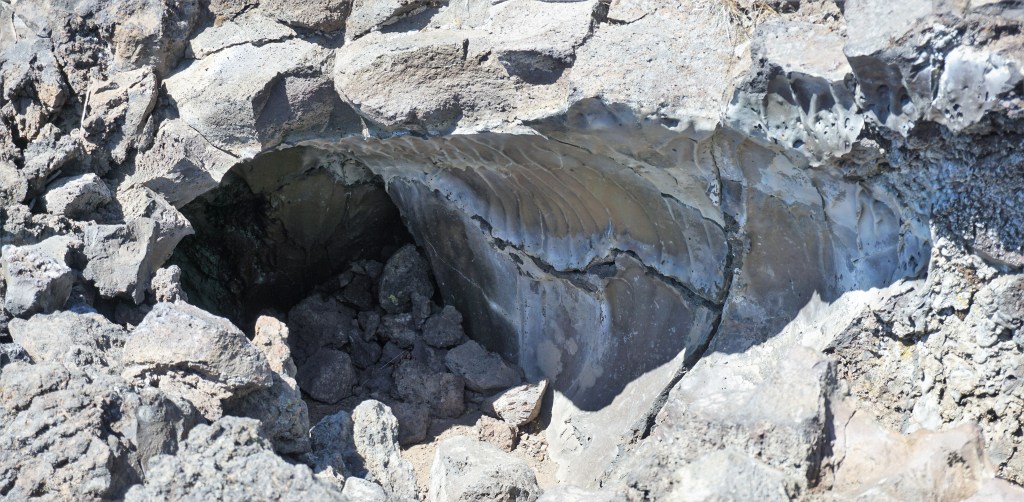
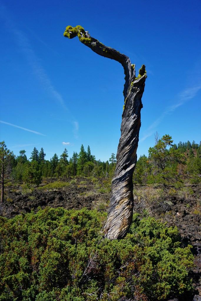
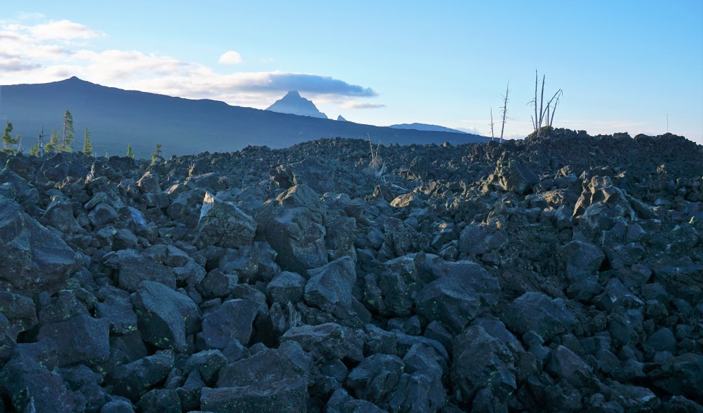
Newberry National Volcanic Monument is a terrific place for exploration and learning about the Cascade Mountains’ volcanic past – we found ourselves attracted to the lava river cave and lava cast forest.
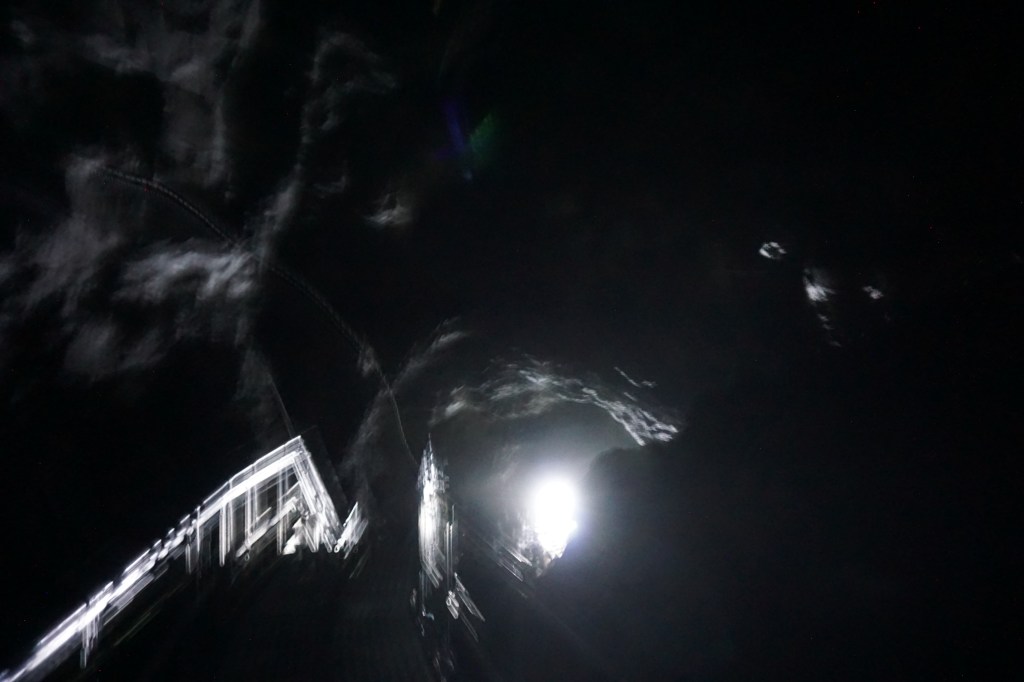
A lava river cave is formed when the flow below the surface continues while the lava above cools, solidifies and creates the cave’s ceiling. Many of these caves are far enough below the surface to permit exploration, albeit in almost total darkness…bring your flashlight!

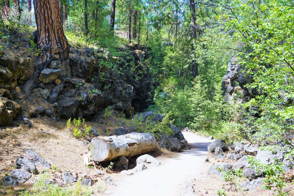
A lava cast forest is formed when the lava flow overtakes an old-growth forest and cools to form casts of the trees that once stood there. We needed to use a little imagination to complete the gestalt, but it was simple enough – we didn’t know lava casts existed in the first place. Always learning something!


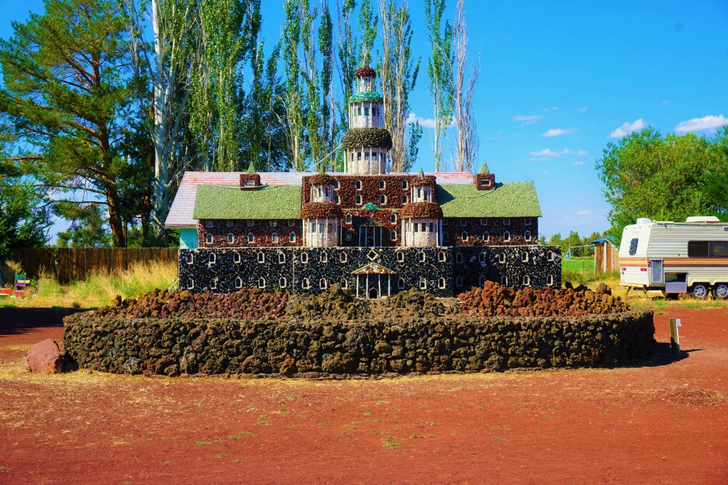
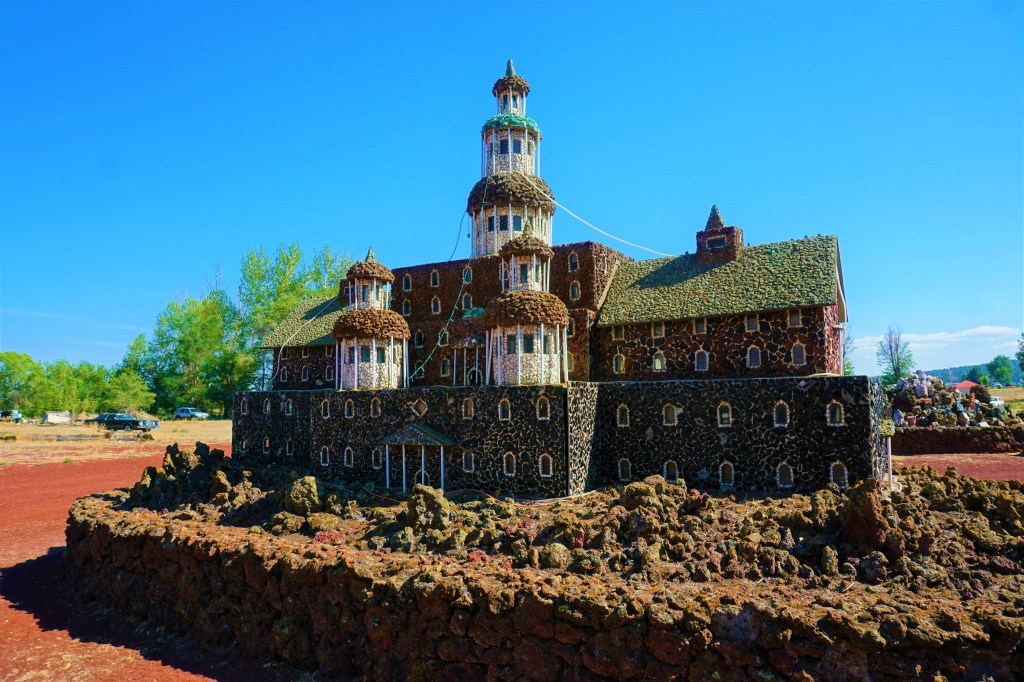
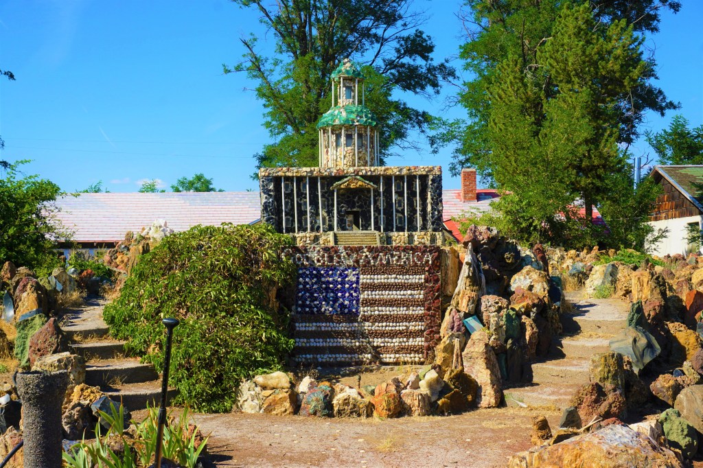
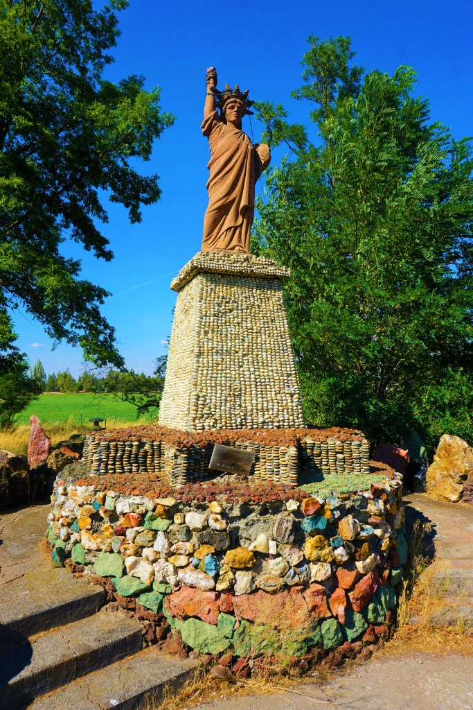
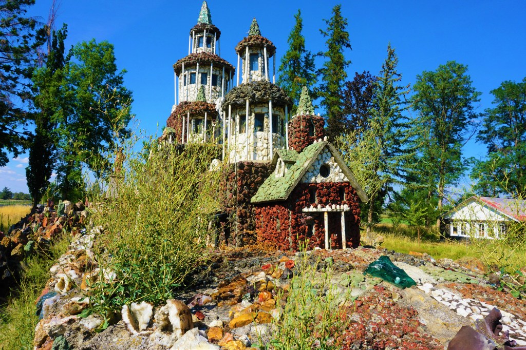
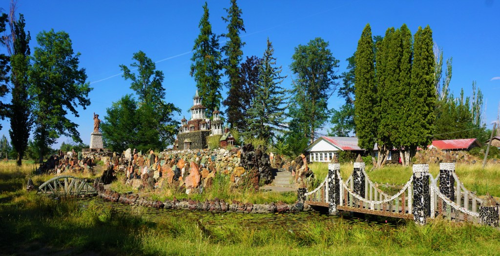
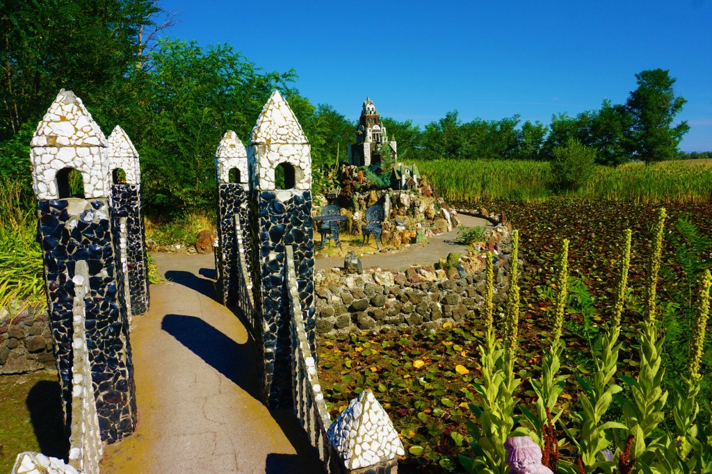
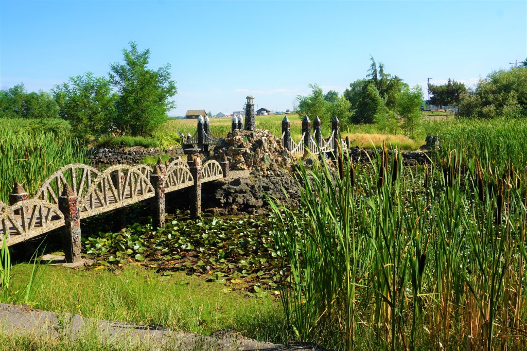
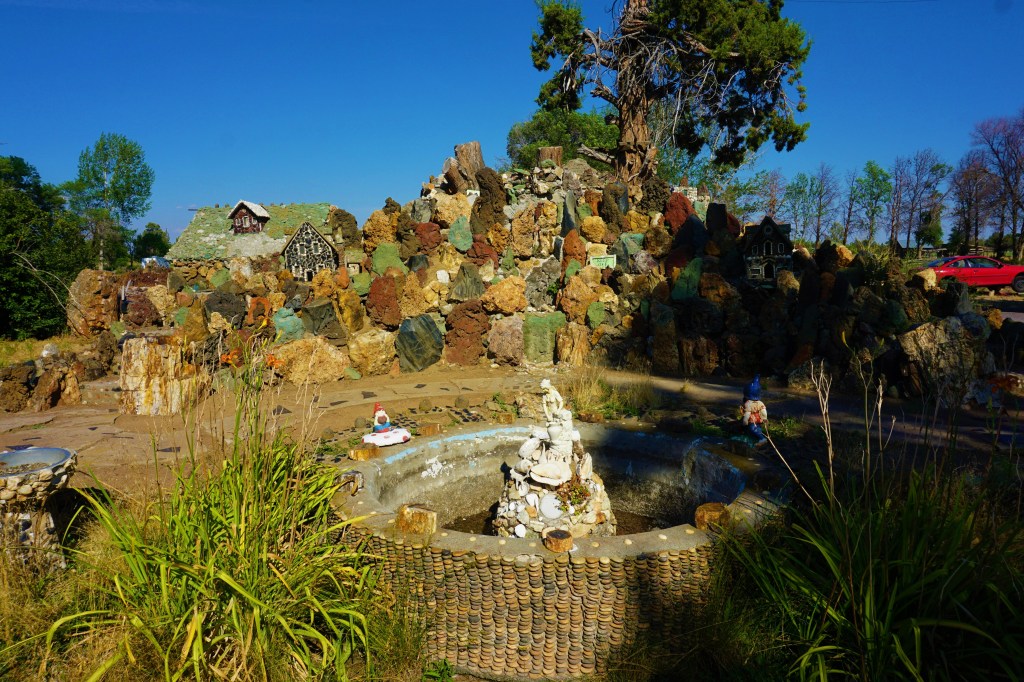
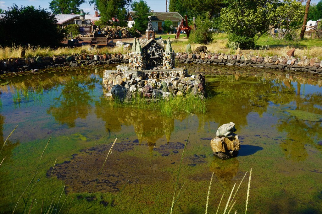
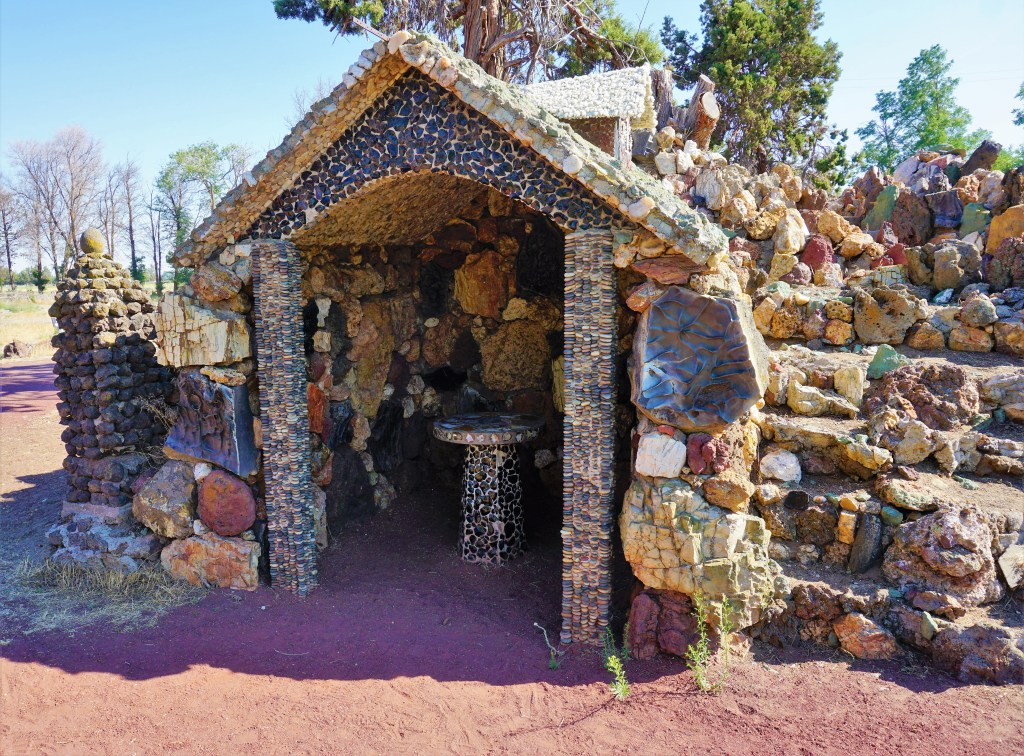
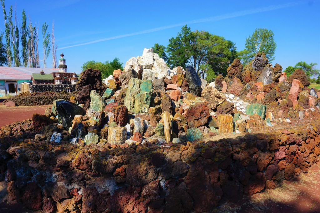
Using a variety of rocks found within an 85-mile radius of his family home, Rasmus Petersen constructed detailed miniature castles, churches, other small buildings and monuments. Bridges, water features, and natural landscaping were incorporated into his designs creating a virtual community of rock sculptures. Petersen worked on the garden from 1935 until his death in 1952, and the garden has remained in his family’s care since then.
Petersen Rock Garden is an Atlas Obscura “not to be missed” attraction…

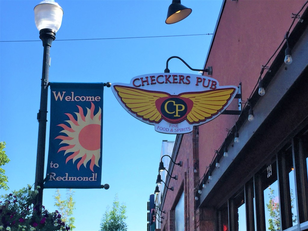
New friends from the last winter season at VDO, John and Cheryl Williams lived in Redmond, Oregon for quite a number of years. They told us about a terrific pub that was perhaps more of a home to them than their actual home! We had to stop in at Checkers Pub, meet Susan the owner, have a beer and some lunch, see a couple of archived pictures of the couple and, of course, swap stories about John and Cheryl.
The route back to our campground in Eugene mapped us through the remains of a burned and destroyed forest along very windy Route 242 and over McKenzie Pass. Guess it is the shortest route back; however, the ghosts of wildfires past were our constant companion until we reached the top of the Pass, found some great views, and were back in rich forests for the remainder of our trip this day.
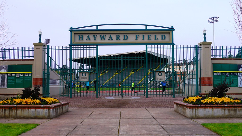
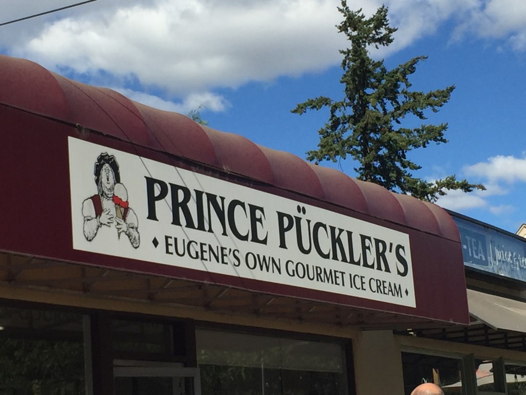
Staying in Eugene, we had to visit the campus of the University of Oregon…Nike founder and owner Phil Knight’s generosity supporting the U and an unusual assortment of uniforms worn by the sporting teams.

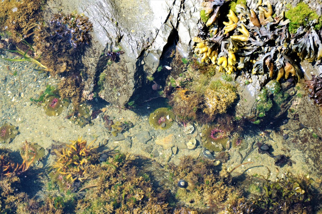
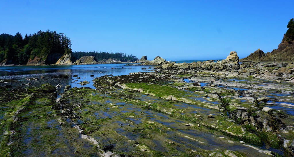
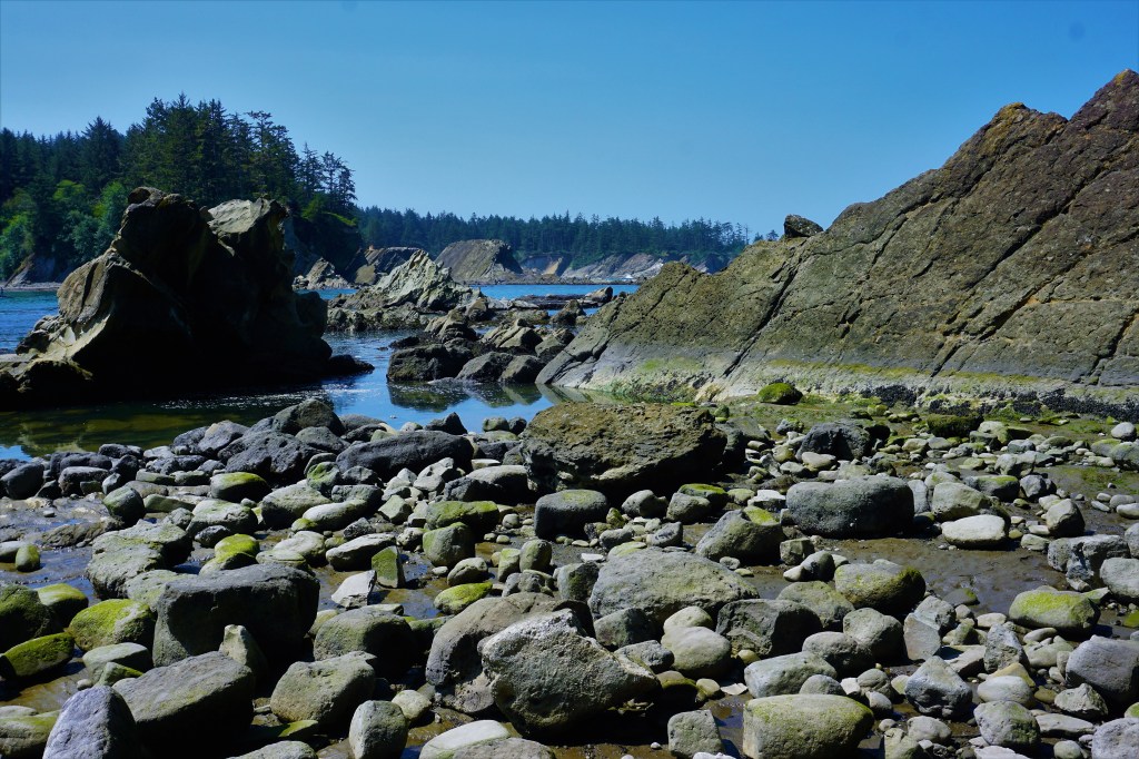
Heading further down the Oregon Coast we stopped to check out a tidal pool near the city of Coos Bay…


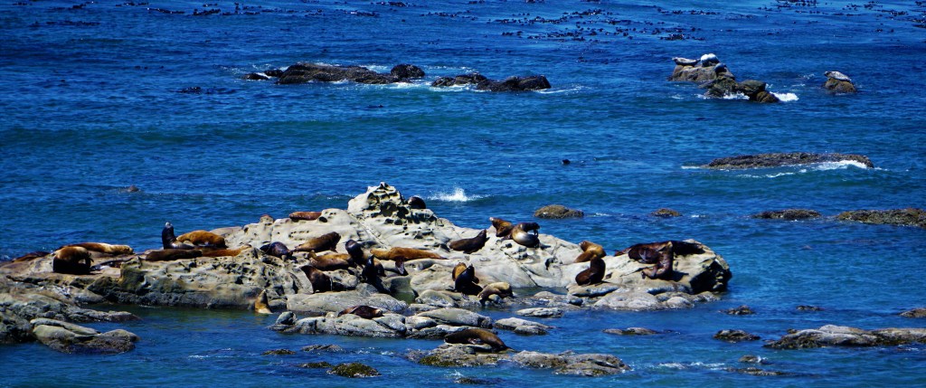
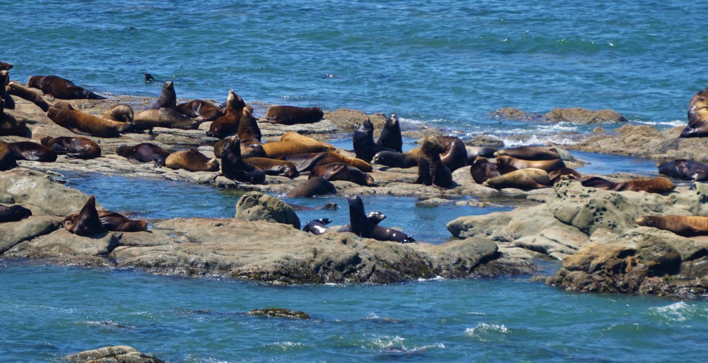
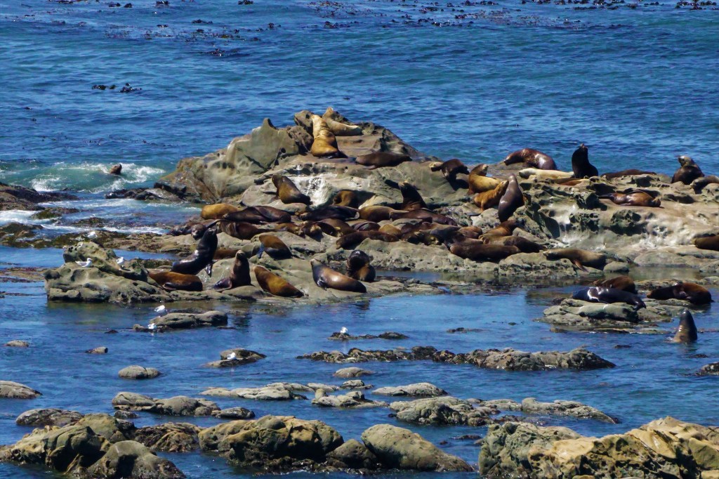
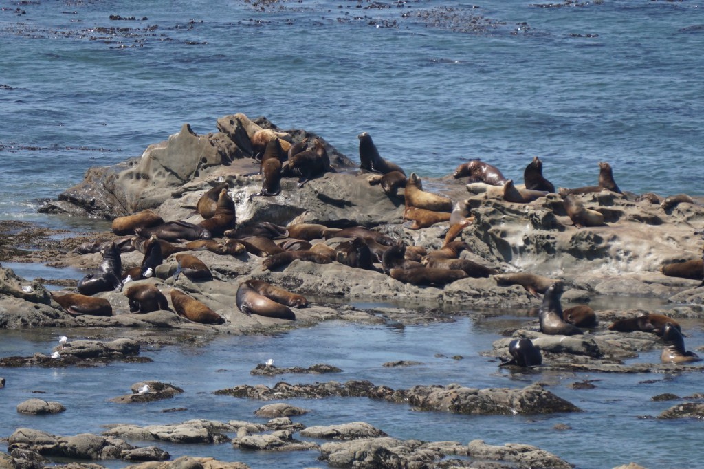
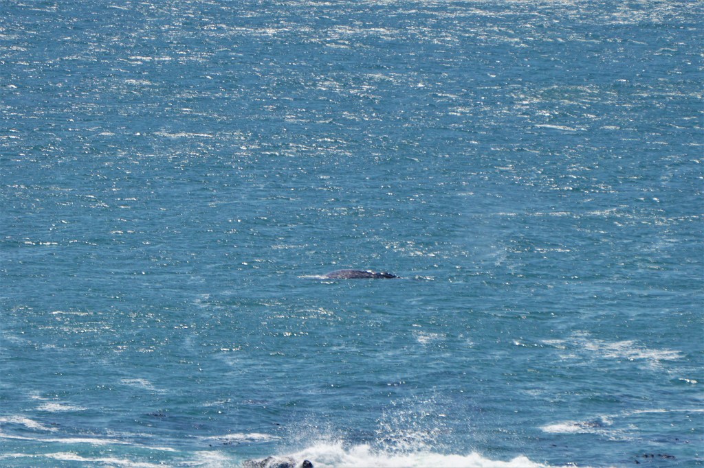
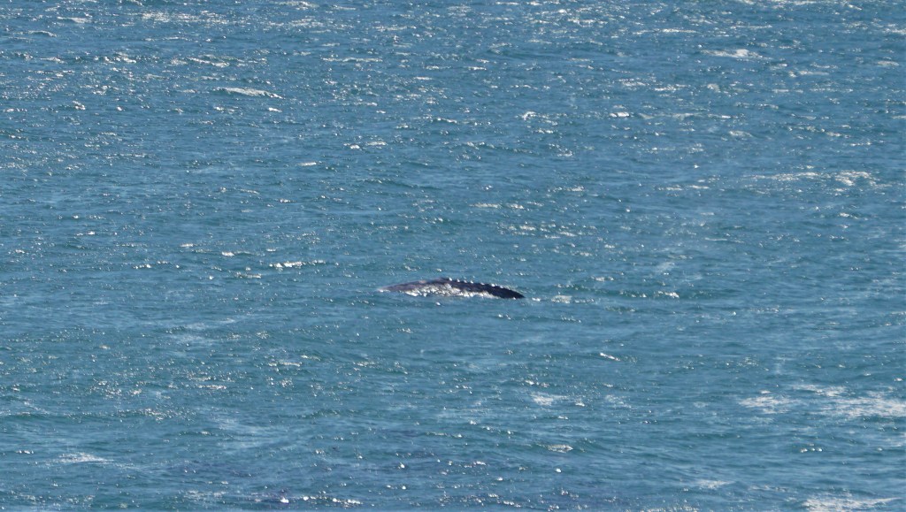
…and to watch the sea lions and seals, and gray whales from Cape Arago…


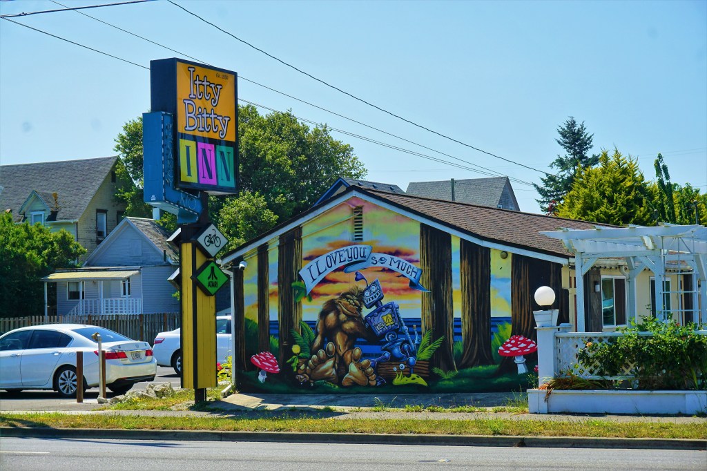
…to find a curious image worth capturing…
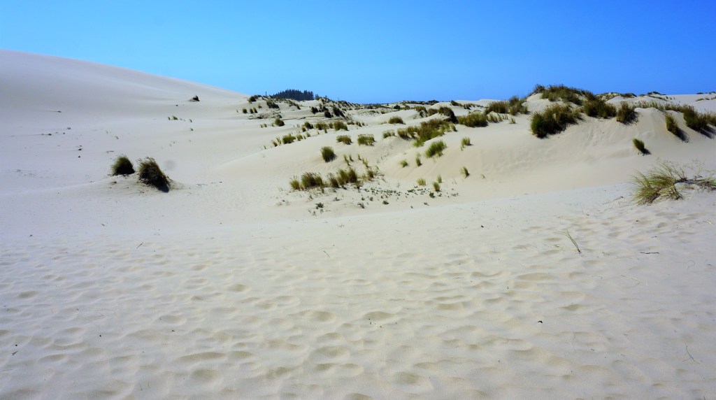
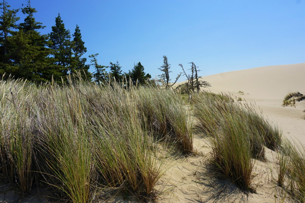
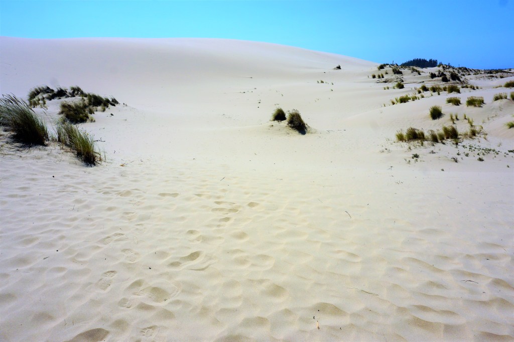
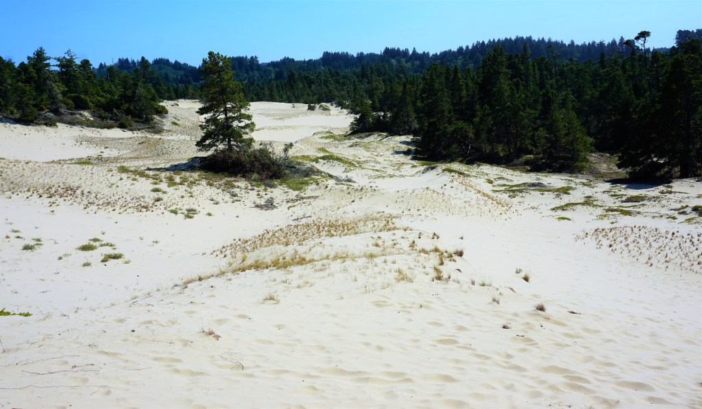
…to take a hike in the Oregon Sand Dunes…

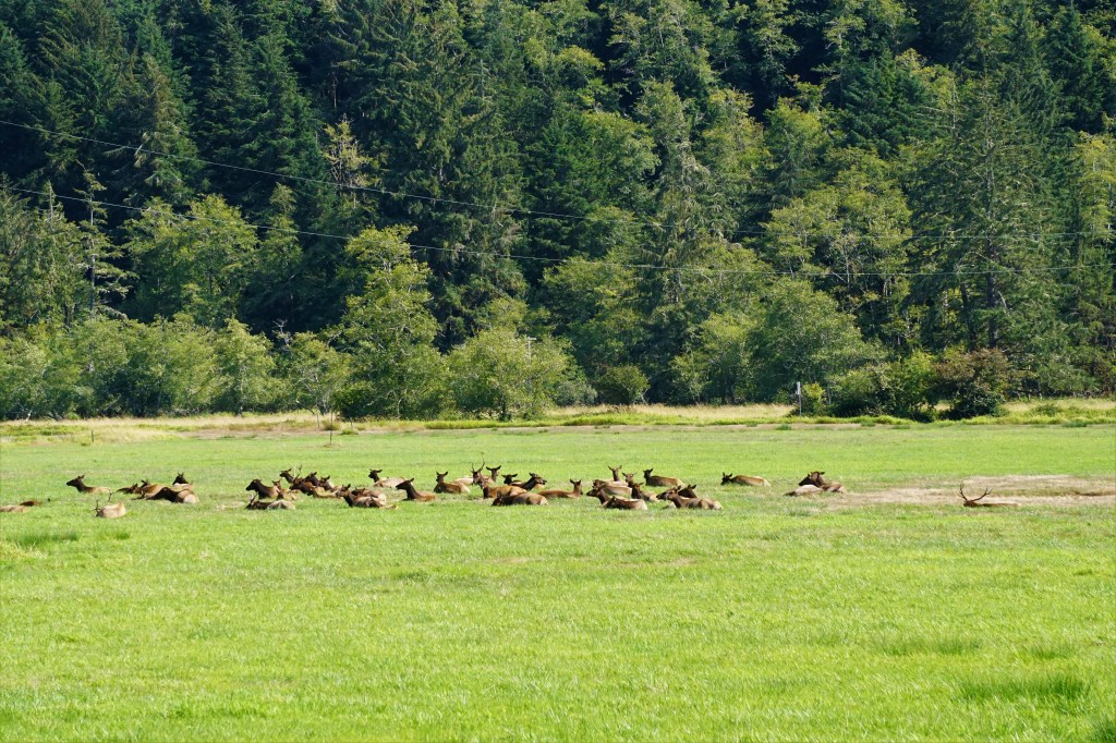
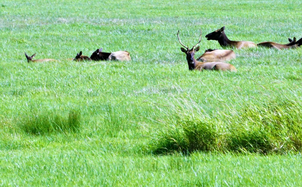
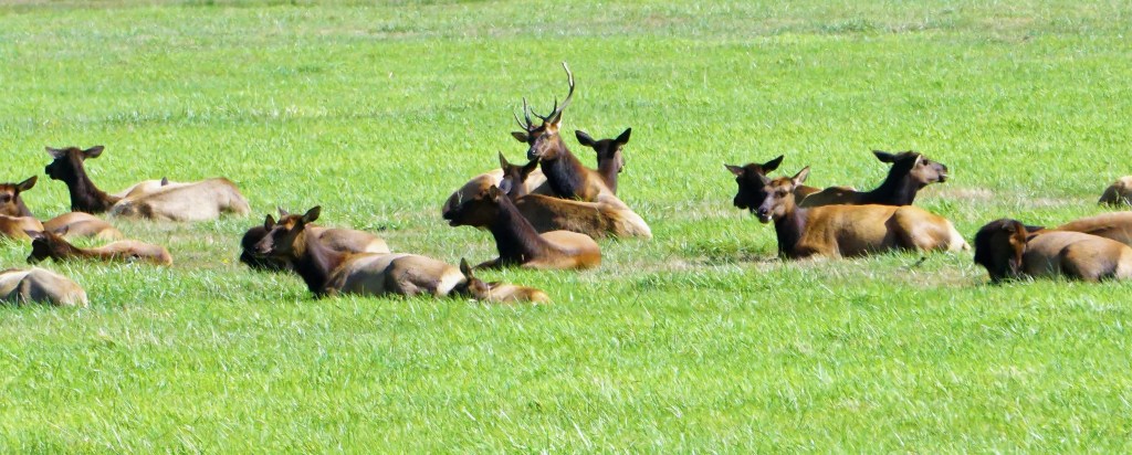
…and then bump into a herd of elk all in the same (long!) day!
Our plan leaving Eugene was to continue south, spend some time in Ashland/Medford, and then back track through Grants Pass and into California, camping in Crescent City for our visit to Redwoods National Park. As we headed south the visibility became markedly poorer and poorer, the air started to taste of burning timber, and the daytime light was shrouded in smoke.
The Bootleg Fire was still burning and impacting the Medford area so thoroughly that we had a health concern for staying even one night. Sure, there were diehard golfers out on the links in numbers, but did we want to chance aggravating our respiratory systems? We called our campground in Crescent City to see about arriving 3 days early. They could accommodate arrival “tomorrow” – tonight was booked. We had no success booking a campsite at another campground on the northern California coast, so we hoped that staying 1 night in Medford wouldn’t be too bad?

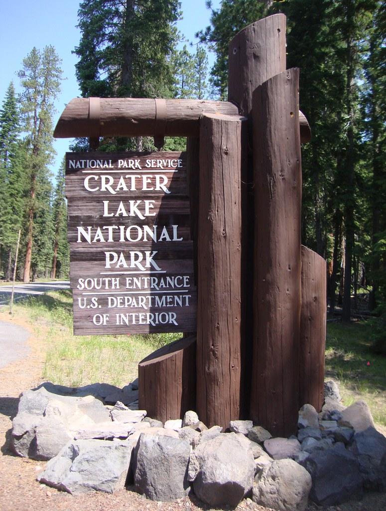
Having decided to stay the night, we set-up camp and took off to see Crater Lake National Park hoping that the wildfire smoke wouldn’t limit our ability to enjoy the Park. And just for reference, we couldn’t visit the other landmark attraction in the area, Klamath Falls…the bootleg fire was just too close for comfort.
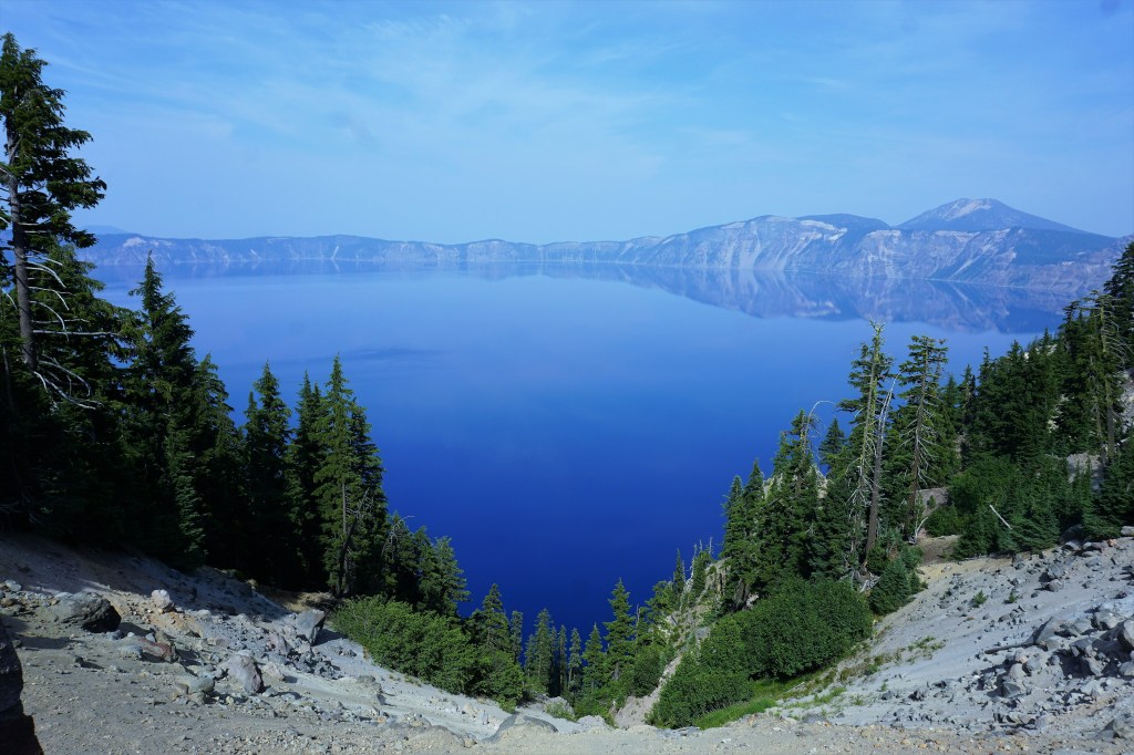
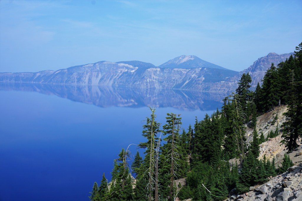
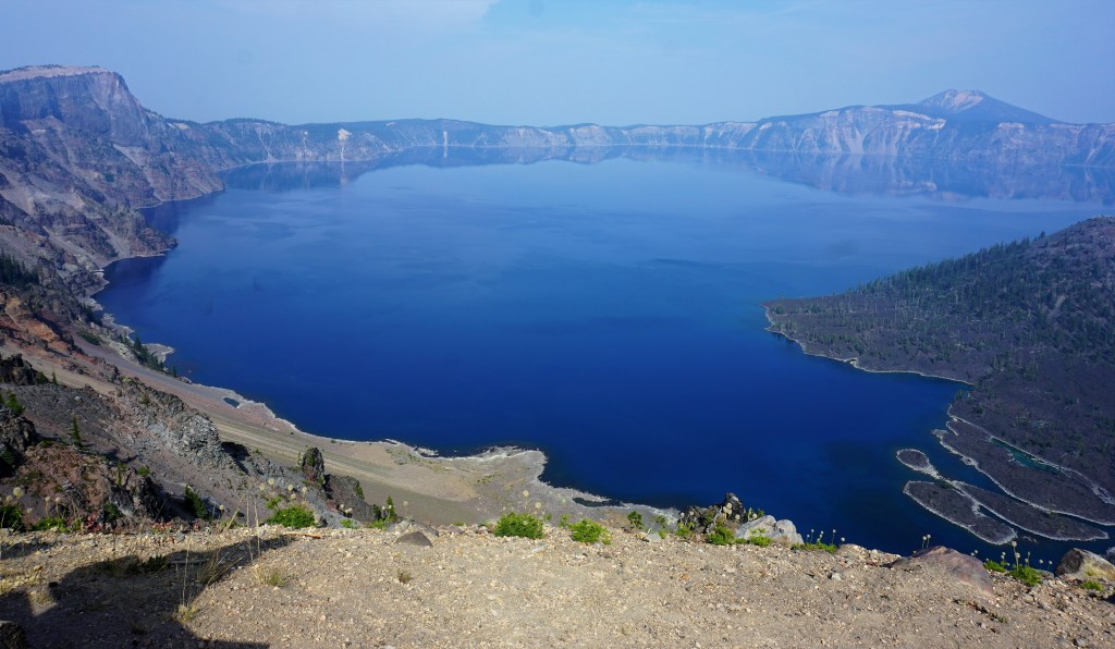
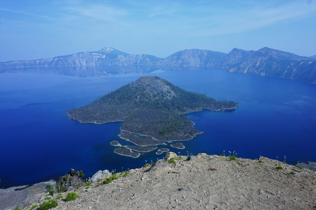
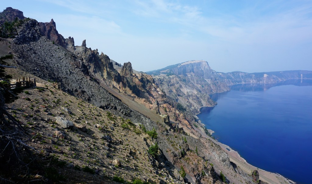
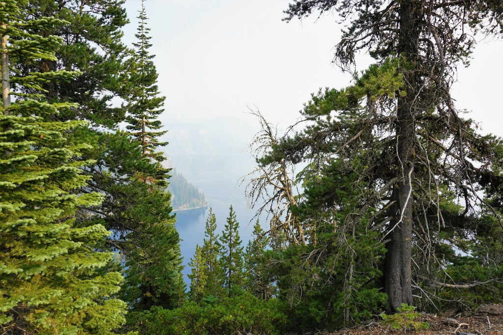
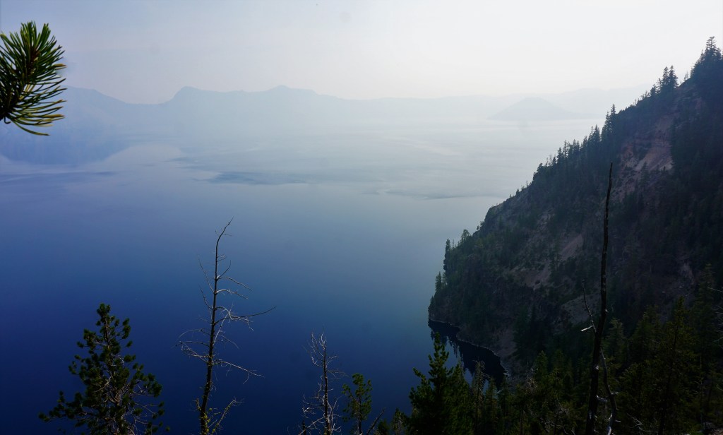
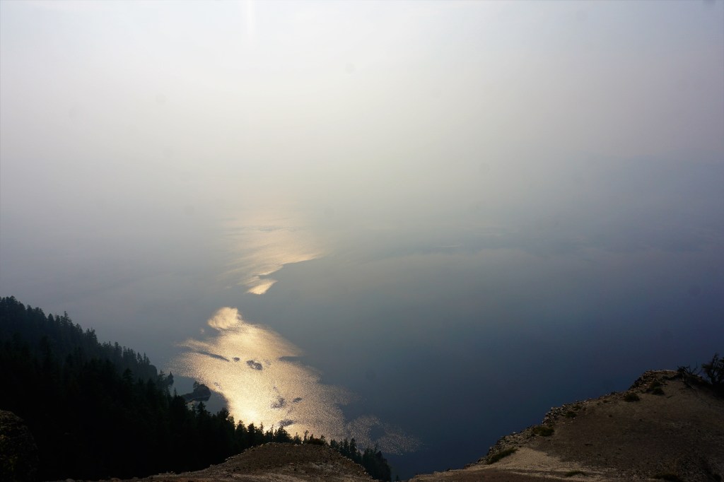
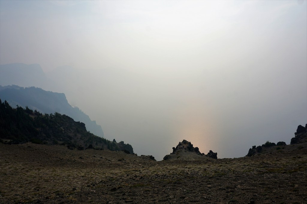
It is roughly 80 miles to Crater Lake National Park from Medford, and we would experience an elevation change of +4000 feet rising to an elevation of 6023 feet above sea level. Would the elevation help to keep the skies clearer? Unfortunately, the answer was no; the skies at Crater Lake National Park were hazy at best. Undaunted we followed the Rim Drive stopping every so often to observe the Lake as it slowly became enveloped in wildfire smoke. Within an hour we could no longer see the shoreline nor the water.
Established in1902 Crater Lake National Park is the fifth-oldest national park in the United States, the deepest lake in the US, and the only national park in Oregon. The park encompasses the caldera of Crater Lake; it is the remnant of a destroyed volcano, Mount Mazama.
The National Park Service states that the Lake is minimally 4.54 miles across and 6.02 miles across at its widest point, at its deepest depth the Lake is 1,943 feet deep, holds 4.9 trillion gallons of water, and is known for the brilliant blue color of the water. There are 16 hiking trails in the Park, the Rim Drive affords multiple overviews of the Lake from as high as 8,000 feet, and trails will take one down to the water!


For Oregonians there’s a fine balance between the good and bad. The number of Portland’s homeless citizens is overwhelming, the rain in the fall/winter/spring, and Mother Nature’s thinning of forested lands through wildfire is all equally so. But the Columbia River Gorge, Oregon’s beaches, Mother Nature’s glory in Mount Hood, Crater Lake, volcanic lava fields, sand dunes, tide pools, forests, waterfalls, lakes and streams are just simply spectacular.
The Oregon we experienced in the summertime of 2021 was a treat, and we have memories to keep dear for a lifetime.
But for now – California here we come. The Redwoods are calling!
Barbara and Brian
“It’s not what you look at that matters, it’s what you see.“ – Henry David Thoreau

The places you’ve been to and the sights you’ve seen. Amazing!
LikeLike
While I always love the natural wonders you visit and capture I always marveled at the cool, funky, eclectic art and side trips you seemed to find everywhere you go – and now you’ve revealed your secret …. Atlas Obscura!
So if your fans want to be “insiders” like Biran and Barb – check the link below.
https://www.atlasobscura.com/
LikeLike
Giving away our secrets are you!? There are a couple of other websites to check out as well…the crazy tourist and roadside attractions are the best alternatives. Spring yet in Bethlehem?
LikeLike
We kind of skip spring now – the first few weeks were regularly in the 40s with overnight lows in the 20s and this week we jumped to 70s. Hopefully we can get a few weeks with some mild 60-65 temps to ease us into summer
LikeLike
Just catching up on my reading, now that I’m in the recovery phase … such a gorgeous array of pictures. I especially like the foggy ones, actually. Gives them a moodiness.
LikeLike
Glad to know you’re on the mend…nasty covid infection so sez your friend Barbara. Sorry you had a struggle with the virus. You and I do like those evocative photos!
LikeLike