You’d think that having hiked a good 30 miles or so during the last week while we were visiting Canyonlands’ Island in the Sky and Needles and Arches National Parks that we’d want to rest our weary bones a bit. Nah…too much to see and do.
Next on the Barbara and Brian hit parade belonged to Moab Adventure Center…yup-a 14 mile, all-day whitewater rafting trip down the Colorado River, lunch included. We were picked up at our campground, driven to the company’s depot, checked-in and fitted with our life vests; herded onto an old school bus, driven about 25 miles out of town to Hittlebottom Launch, assigned to our raft and our lives given over to our, maybe 24-year-old-winter-snowboarder guide, Josh. We boarded and pushed off onto the river. Wouldn’t you know that these 2 Jews ended up on a raft with another member of the tribe, his Jew-by-choice-raised Mormon wife and their 2 children, a young woman from the Netherlands, and a mother and daughter celebrating their 70th and 30th birthdays on a trip of a lifetime.
Every whitewater rafting trip starts out with a safety lecture, introductions to your raft mates, a quick lesson and practice paddling as a team, and a smooth river. There are a couple of rapids to run that are generously rated perhaps class 1. Josh was fantastic as a guide, quickly engaged everyone – kids included – told us tales of the river and the people that live along its shore, past and present. He had us all telling stories and swapping lies within a short period of time! Along our river journey we were invited to slide over the side of the raft and, within an arm’s length, drift along with the Colorado’s currents. One of our raftmates lost his cell phone to the god of the river…his sacrifice afforded protection for the rest of us!
We ran a couple of class 2 rapids, which, as it turned out, gave us just enough practice for the class 3 rapids we worked through just before lunch, and for the monster class 3+ (maybe 4?) rapids waiting for us just after the great meal we were served. For the rest of the trip, the Colorado was flowing smoothly.
Fantastic time…if you’re in the neighborhood we highly recommend taking the journey.
The Jeep needed some easy (read: inexpensive) dealer-type maintenance work, and the closest dealership to Moab is in Grand Junction, Colorado. We made an early a.m. appointment and decided to make the most of our time there. Once the car was finished, we picked up a few things at Walmart, and headed out for a late breakfast at a local joint. Our waitress overheard our conversation of hitting up the local Good Will and recommended we visit their downtown to shop at a hospice 2nd-hand store instead (Brian scored 3 pairs of shorts, Barbara 3 tops and a pair of pants). The downtown is quaint and busy – lots of shoppers and families in the streets, traffic well controlled, outdoor seating for many of the restaurants, a few bars and night clubs; there were venues for live theater and music, and wonderful sculptures lining the streets. What a great find!
Taking Highway 191 about 10 miles south of our campground, we suddenly came upon Wilson Arch. The Arch was named after the 1st superintendent of Arches NP. We had to stop and hike up to the arch in order to take a look through and see what was on the other side. Well, it’s just a few hundred feet drop off!
Wilson Arch In All Its GloryLooking Up Close And Through Wilson Arch
So why were we heading south from our campground on Highway 191? We had heard that Monument Valley Tribal Park, Mexican Hat, and Valley of the Gods State Park were not to be missed.
Monument Valley Tribal Park is a land of sandstone buttes, plateaus, mesas and spires that tower to heights of 400 to 1,000 feet above the desert floor and below the ever-glorious expanse of the bluest skies in Southeast Utah. The Park is entirely within the lands of the Navajo Nation, and only through their generosity could we tour and appreciate its natural beauty. Monument Valley has been and is still a popular site for filming western movies; the director and producer John Ford so loved Monument Valley that many of his best-loved western movies were filmed on-site.
Castle ButteElephant Butte and Merrick ButteEast Mitten Butte and (From A Different Direction) Merrick ButteWest And East Mitten ButtesThree Sisters From John Ford’s PointCamel ButteElephant ButteThe Valley From John Ford’s PointTotem Pole
The name “Mexican Hat” comes from a curiously sombrero-shaped rock outcropping on the northeast edge of a census designated place with a population of 31. The rock measures 60-feet wide by 12-feet tall, and it has two rock climbing routes ascending it.
The hillsides on the road between Monument Valley Tribal Park and Valley of the Gods State Park are magnificent.
Valley of the Gods State Park is a scenic sandstone valley near Mexican Hat in San Juan County, southeastern Utah, and has rock formations similar to those in Monument Valley with tall, reddish brown mesas, buttes, towers and mushroom rock – remnants of an ancient landscape.
The La Sal or Salt Mountains stand ever at sentry watching over Moab from its eastern horizon. Driving here and there we kept seeing signs for the La Sal Mountain Loop, and we wondered just what we’d experience if we took the drive. Well, the Loop provided a pretty spectacular vista, some curious insect activity, and a free range cow as the local representative to bid us farewell to all Moab has to offer!
Check Out The Colors In Them Thar Hills…Spectacular!Collecting PollenLunchtime? Not Sure What These Buggers Are Up To?From The Roadway’s Summit Into The ValleyFrom The Roadway’s Summit To The Highest PeaksThanks for Visiting…Hope Moab Mooooved You To A Happy Place!
Our time in and around Moab ended with a smile for what we have seen and excitement for what we’ll see and do in North Salt Lake and Idaho Falls on our way to our second trip to Yellowstone National Park. If we haven’t conveyed it clearly enough in earlier blog posts, Arches National Park is frankly unbelievable and has earned its place in our top 5 stops along this journey started so long ago.
The wonder, beauty and uniqueness we found at Zion, Bryce Canyon, and Capitol Reef National Parks far exceeded our expectations. But since we found Canyonlands to be just ok, we were skeptical as we entered Arches NP. Maybe we’ve become spoiled?
Getting into the Park begins by passing through the entry station and obtaining your map and Park newsletter. On a busy day, particularly during the summer vacation season, the line of vehicles waiting to enter can back up a full half mile or so during the prime hours of 10am – 4pm (hint, hint). Once through the entry station the visitors center is less than a quarter mile’s drive; a good place, as with all National Parks, to talk with the Rangers about any programs being offered and to get tips on hiking trails, to view a 20-minute video about the Park, and to stretch your legs/use the facilities/have a picnic/buy souvenirs, etc.
From the visitors center we drove up a fairly steep incline, through a couple of easy switchbacks, past some glorious views of the valley below and mountains in the distance to come upon the beauty of Arches NP – it took our breath away. We found a landscape of contrasting colors, land forms and textures unlike any other we had yet to see. It’s a land of amazing formations, soaring pinnacles, massive fins and giant balanced rocks. Most of the Park’s more than 2,000 natural stone arches are not accessible to any but the hardiest badass backcountry hiker, but those we had a chance to see were magnificent. To say we were pleasantly surprised is a gross understatement – we happily and with anticipation of each visit, spent 4 days (!!) in the Park exploring the different districts that make up Arches NP.
We first took a driving tour of the Park in order to become familiar with the terrain, the access to the iconic rock figures, and to figure out which hikes would best suit us in order to see a maximum number of arches. Balanced Rock and Delicate Arch are the Park’s icons, and not to be missed…the former easy to see, the latter best seen after a grueling 3-mile uphill slickrock hike (more on this later).
Balanced RockBalanced Rock
Early on the driving tour we stopped at the La Sal Mountains and Courthouse Towers viewpoints to see the rock formations: Dome Rock, The Organ, The Courthouse, Three Gossips, and Sheep Rock.
Dome Rock And The CourthouseView of Three Gossips and Sheep Rock From The La Sal Mountains ViewpointCourthouse Rock With The Organ To The RightThree GossipsSheep Rock
The road from the entry station to Devils Garden, the furthest point in the Park, is approximately 16 miles; hiking Devils Garden leads to 4-5 arches. There are 2 side roads, each leading to several clusters of arches; 2 miles from the main road to The Windows and a little more than a mile from the main road to the Wolfe Ranch parking lot and just a little further to the parking lot for a far away look at Delicate Arch. We drove to each of the major parking areas: The Windows, Wolfe Ranch and Delicate Arch viewpoints’ parking lots and Devils Garden.
From the Devils Garden Trailhead there is an easy 1.6 mile hike to Landscape Arch.
Landscape Arch
Continuing on the trail from Landscape Arch, the hike to Double O Arch and the other 4 arches that can be viewed along the way is a difficult and a steep 2.6-mile scramble over narrow sandstone slabs, uneven surfaces with narrow ledges and severe drop-offs. We went about a half mile into this torture, and we decided that it was just too much for us. Primitive Trail is an alternative route to Double O Arch, but after an easy 2 miles or so we encountered rock scrambling, narrow ledges, and uneven surfaces. By now we were into today’s hikes well over 5 miles – it was time to admit how much we enjoyed what we had seen, and recognizing our limitations was indeed the best course of action.
We woke up early in order to hike to Delicate Arch for sunrise, but we didn’t do our homework and badly miscalculated the timing…reaching the summit takes at least an hour and a half from the Wolfe Ranch trailhead. From the Delicate Arch parking lot it’s a half-mile hike to a terrific viewpoint. Turned out to be a wonderful start to our day.
Delicate Arch At SunriseAmazing Resemblance To A Human Head!This Young Fella Wondered What The Heck We Were Doing
We took an easy 1 mile hike to Turret Arch.
Turret ArchThe Windows Looking Through Turret Arch
The Windows Arches are an easy 50-yard walk from Turret Arch.
The Windows
We took the primitive hike behind The Windows and were rewarded with a different view of the Arches.
South Window ArchNorth Window ArchThe Windows or The Old Man In The Mountain?
Heading out in the opposite direction from the parking lot there’s an equally easy half-mile hike to Double Arch…Barbara’s favorite!
This Formation Is Referred To As The Parade Of ElephantsCrazy What Wind Will Do To Soft Sandstone!See The Face?Yes, That’s A Hole In The RockDouble Arch
The Tower Arch trail is a difficult 3.4 mile hike that starts out across a valley, meandering through sandstone fins and sand dunes. On the way we were able to view Sand Dune, Broken, Pine Tree, Tunnel and Tapestry arches. At about halfway the trail ends at Devils Garden Campground, and the choice is to return the way you came or, as we found out, a bit of scrambling over and down slickrock to reach the fairly level trail back across the valley; didn’t hurt us one bit.
Sand Dune ArchBroken ArchThe Other Side Of Broken ArchTunnel ArchTapestry Arch
We just had to complete the 3-mile roundtrip hike from the Wolfe Ranch parking lot up a steep slickrock slope with a 480-foot elevation change, across a rocky flat to a narrow ledge for about 200 yards to a viewing area for Delicate Arch. We were greeted at the top by fellow hikers and a flock of ravens who call the cliff home.
On the way back from Delicate Arch, we couldn’t resist hiking a little farther to see the petroglyphs.
Couldn’t forget our hike to Pine Tree Arch…
Pine Tree Arch
And our quick stop to see Skyline Arch…
Barbara’s favorite trail was a moderate 2-mile hike called Park Avenue. After a steep descent into a canyon, the hike is fairly level. The canyon is lined by sheer monolithic formations, and we thought it might have been better called Wall Street. Walking in the canyon we noticed the surface of the rocks that had been patterned by water so many millions of years ago. It brought to mind what it must be like to walk on the bottom of a sea.
The beauty of Arches National Park can be enjoyed by a driving tour and a few easy hikes, exhausting hiking miles, and miles of trails up, down, around, and over sand, grassland and rock or something custom fit to, well, a couple of aimless wanderers. Cliché as it is, Arches NP molds itself to the visitor. We never felt pushed or rushed by fellow adventurers; we never felt any area of the Park was overcrowded; we found our own pace and our own way of feeling a part of the Park itself. This is one spectacular place on earth.
There are 5 National Parks within Utah’s borders that collectively are known as “The Mighty Five.” In the southwest corner of the State, Bryce Canyon and Zion are easily reached from Kanab. If you don’t stay in Torrey to visit Capitol Reef in the southcentral part of the State, Richfield’s a decent choice for a couple of nights. Arches is in the east central part of the State and actually has a Moab address. Canyonlands Island in the Sky is nearby to Moab, and Canyonlands Needles is about an hour away.
Our ride from Richfield to Moab ran a little north then eastward along Interstate 70 – we drove between mountain ranges north and south, and the road was a little hilly, but there were no major changes in elevation along the route to challenge Aimee. The last 30 miles of the trip ran south on Highway 191 into Moab…our campground was about 6 miles south of town and about a mile off of the Highway. Highway 191 begins in Malta, Montana (go ahead – find it on the map!), passing south through Billings and into Yellowstone National Park, continuing through the Tetons and into Utah and through Arizona before ending up at the Mexican border at Douglas, AZ. It’s a major north/south road, and we guessed that Highway 191 is one of those alternatives to an Interstate. Our apologies, that’s certainly more than anyone could ever care to know about Highway 191 – just know it’s a damn busy road 24/7.
Moab’s city limits is just across a bridge over the Colorado River, and it is a first-rate small town of 5,235 full-time residents. The population swells to about 7,500 as many college students, young adults and retirees (yup – workampers, too!) find Summer employment as guides with the local “adventure” companies or in the National Parks as Rangers, interns or volunteers.
We guessed that Moab would be among one of America’s thousands of sleepy small towns along the country’s major roadways if not for Canyonlands and Arches National Parks.
Millions of years in the past this, as well as other areas in a large region extending from the Gulf of Mexico to northwest Colorado, was home to the dinosaurs. We thought our grandkids would appreciate a couple of pictures from Moab’s touristy collection.
Canyonlands National Park is comprised of three distinct districts: Island in the Sky, Needles and The Maze. The Colorado and Green rivers wind through the heart of the Park, and after centuries of cutting through layered sandstone, two deep canyons, a colorful landscape, and numerous smaller canyons, mesas, and buttes were formed.
Island in the Sky – Most visitors spend their time at Island in the Sky, which is about 32 miles north and mostly west of Moab. Island in the Sky is a flat-topped mesa more than 6,000 feet above sea level, resting on sheer sandstone cliffs that are over 1,000 feet above the surrounding terrain. Every overlook offers a different perspective on Canyonlands’ landscape.
Hiking to Shafer Overlook, Mesa Arch, Grand View Point and Upheaval Dome are the most popular trails in the Park.
Shafer Overlook is named after early settlers in the area. The Shafer brothers were cattle ranchers who drove their herds from the valley below to the top of the mesa for summer grazing. The Overlook is best seen at sunup or sundown – the colors just absoultely pop.
Looking East – Canyonlands From The Shafer Overlook. View Of The La Sal Mountain Range In The Background.Different View Of The Eastern Side of Canyonlands
Mesa Arch is pretty cool in the daytime.
Looking Through Mesa Arch. The Hoodoo Formation To The Left Is Called Washer Woman.
…but Mesa Arch really shines at sunup! Of course we drove into the Park in the dark, and hiked our way out to the Arch for sunrise.
Grand View Point is at the southernmost point of the Island in the Sky scenic drive. There’s a 3-4 mile roundtrip trail that ends up at the furtherest out-point…well-worth our hike for a view that included the white rim canyon as well as features in The Maze, The Needles, and distant mountains.
Looking West During Our Hike To Grand View PointLooking WestFrom Grand View Point – Looking EastReturning From Grand View Point We Found This Lizard In The Same Exact Position As When We Passed An Hour Earlier. We Suspected That He Had Passed On To The Great Lizard Habitat In The Sky. The Lizard Didn’t Move As Brian Approached, But Then His Eyes Began To Blink. Not A Very Good Way To Avoid A Predator!
We’ve always enjoyed Ranger talks, particularly if they involve the night sky. Canyonlands is designated an International Dark Sky location and wouldn’t you know that there was a Ranger Night Sky Program offered every Saturday night? The talk was superb, but the chance to view the skies from 6 telescopes and have the Ranger in charge of each telescope talk about what we were seeing was phenomenal. We were like overly excited little kids seeing stars and nebulas millions of light years away; to see with our naked eye the International Space Station, zig zagging across the sky looking like a bright white LED light attached to a string; and to see through a telescope’s eye the band of Jupiter and the movement of Jupiter’s moons over the couple of hours we had to view the sky.
We couldn’t pass up a 4-mile strenuous hike along the Upheaval Canyon Trail to see as much of Upheaval Dome as we could. Upheaval Dome is the deeply eroded bottom-most remnants of an impact crater, most likely caused by a meteor strike. How cool is that?
Looking WestLooking West – Glorious SkyUpheaval DomeUpheaval Dome
A fellow camper and devout off-roader suggested that we follow Shafer Road either to the top of the mesa or back down. Either way, our access was Pot Ash Road, which would take us past the pot ash plant (pot ash = potassium salts in the form of nitrates, sulfates and chlorides dissolved in water pools, allowed to air dry, and harvested as a powder to be used in fertilizer).
We started down Shafer Road at 4pm and it was 7pm when we made it back to Moab! Remember it’s only 32 miles by “normal” roads from Moab to Canyonlands. Shafer Road is 16 miles of 1-1/2 lanes of steep decent hell, sharp switchbacks, blind corners, and 1000 foot drops. Vehicles going uphill have the right of way, so at blind corners, those of us going downhill have to use pullouts against sheer drop-offs to let them pass; and occasionally, when too far into a blind corner, those going downhill have to back-up into pullouts. Exhilarating!
I can’t claim the following 2 pictures of Shafer Road…looks like fun, no?
At the bottom, Brian’s “WhooHoo!” could have been heard for miles and miles. But then we realized there were another 30 miles of unimproved off-road adventure ahead of us. The 5-10 miles an hour avoiding boulders, jutting rocks, puddles hiding unforeseen hazards, and an abyss or 10 made into an obstacle by Satan got to be a bit tedious. We had hoped that the pot ash plant would have made improvements to the roadway for their trucks but logic did not avail itself. We can say we made it without incident, but honestly, once was enough – we had no desire to try the route from the bottom up!
Colorado River View During Our Shafer Road Experience
By the way – the last scene of Thelma and Louise was filmed at the top of Shafer Road!
The Maze – Few visitors explore The Maze. It is the least accessible district of Canyonlands due to the district’s remoteness and the difficulty of roads and trails. The National Park Service is even more clear: “visitors must be prepared for self-sufficiency and the proper equipment or gear for self-rescue.” We easily crossed The Maze off of our “to do” list.
Needles – Needles forms the southeast corner of Canyonlands and was named for the colorful spires of Cedar Mesa Sandstone that dominates the area. There are also entrenched canyons, natural arches and sheer-walled cliffs in the rugged landscape. We enjoyed a great scenic drive, a couple of short hikes, and a nice picnic lunch during our time in the Park.
Relic Of A Native American HomeWooden Shoe ArchEponymous NeedlesThese Rocks Reminded Brian Of A Mom And Baby ElephantThe Impressions In The Rock Are Dried Pools Within Which Hibernating Life Is Waiting For Water. The Pool Center Left In This Picture Is One Location And Home To A Species Of Snail Only Found In Canyonlands Needles
We’ve said this before, but while hiking we make sure to take a moment to do a 360 – we never know what we’ll find. Flowers we don’t know as well as different flower colors tend to draw our attention.
Barbara had been to Canyonlands when her children were in grammar school, and she had excited anticipation to relive those wonderful memories from 40 or so years ago. The memories and visions of her time here with Kea and Jordan will always be locked in her heart as wonderful. And now new memories were created during our visit to Canyonlands National Park.
Who knew we would so thoroughly fall for “The Greatest Earth on Show?” Didn’t matter whether it was Bryce Canyon NP, Antelope Canyon, Lake Powell, The North Rim of the Grand Canyon, the Marble Canyon Loop, or cookies (!); local hikes, daredevil climbs, driving to see cars stacked against a slot canyon wall, hiking to view dinosaur footprints, or our favorite National Park, Zion…it was all, short of time with grandkids, the best stop in this journey started so long ago. Sadly though we had to leave…there were 3 more National Parks to visit in Utah before continuing on our way to Glacier NP.
Brian had thought that just maybe we could make it up to Capitol Reef National Park from our campsite in Kanab (it looked like a pretty easy 2 and 1/2 hours to the Park?). But then again, we figured, the Park is on the way to Moab, and Moab was our next stop – our base for visiting Canyonlands NP and Arches NP. Hmmm – looking at the map the town of Richfield is 146 miles from Kanab and it’s 174 miles from Richfield to Moab. Richfield is the closest town along a major highway to Capitol Reef NP, and there’s a well-rated campground in Richfield. Easy decision!
On the morning we left, the weather prediction for the route from Kanab to Richfield was for overcast skies with a chance of rain, and Richfield was forecast to be clear by the afternoon. OK – no big deal. A little rain while on our short transit in Aimee, get to Richfield, set-up and enjoy a nice afternoon. But Brian forgot the one rule about driving in the mountains – what is rain at lower elevations just might be snow at higher elevations. Time of year doesn’t matter!
Kanab’s at 4925 feet above sea level, and the road rises to at least 8,000 feet around Bryce Canyon. As the elevation increased the rain turned to sleet and hail, which then turned into a serious snow storm. At first the snow was immediately melting on the roadway due to the ground/road temperature, but when we reached the higher elevations and for a distance of about 5-7 miles the snow was sticking. We dropped our speed and Aimee handled the road like the champ she is! As soon as the elevation dropped down to less than a “mile high” the snow stopped, the sun eventually became our traveling companion, and we enjoyed our anticipated easy trip into Richfield.
We were up early the next morning to make the drive into Capitol Reef NP. The first part of the drive was a substantial climb out of Richfield to connect with Utah Highway 24 which would take us through the small towns of Loa (population 585), Bicknell (population 327), and Torrey (population 241). Torrey, Utah is the gateway into Capitol Reef NP. Little did we expect to find one of the most scenic drives we’ve encountered in more than a year of being on the road.
Snow-capped mountain peaks on either side of the road with meadows of wild flowers and grasslands in between, beautiful vistas as far as the eye can see, deer romping, cows grazing, and a herd of bison! Nature’s entertainment at its absolute best.
The area that is now Capitol Reef NP was the homeland for the Fremont Native American Peoples who settled in the area around 500 CE. Petroglyphs etched in rock walls and painted pictographs remain as evidence of their habitation. We found the Freemont Peoples pictographs and petroglyphs to be more sophisticated than others we had experienced in other locations.
Although This Depicts Mountain Peaks, A River, And The Hand Of A God Reaching Out To The People…Could It Also Be Charlie Brown’s Shirt?
Bear, Coyote and Deer
Tribe Members – Each With A Specific Role Defined By Their Depiction
Explorers, Mormon pioneers and others arrived in the 1800s, settling in what is now the Fruita Rural Historic District. They planted and nurtured orchards of apples, pears, and peaches. The trees still bear fruit that is harvested and used by a local merchant to make pies, jams and jellies.
The National Park Service as well as several of the written guides to the Park make it a point to recommend getting pie at the country store operating in Fruita. We couldn’t pass up such a high recommendation, and we do have to rate the strawberry-rhubarb pie as one of the best we’ve ever tasted. Get there early for an also highly recommended hot cinnamon roll, and to be sure to have your pick of pie as they do sell out by late morning to early afternoon.
Capitol Reef NP was designated a national monument on August 2, 1937 by President Franklin D. Roosevelt; however, it was not until 1950 that the area officially opened to the public, and it wasn’t until 1971 that it became a National Park.
The Castle
Guess Who Loved This Rock?
With little more than 1,000,000 visitors per year, the Park ranks 21st on the hit parade of national park popularity. Maybe it’s the location; maybe it’s because the other 4 national parks in Utah are supposed to be sexier or maybe it’s who knows what, but this is a hidden treasure filled with cliffs, canyons, domes, and bridges.
Fern’s Nipple
Navajo Knobs
Chimney Rock
Capitol Dome
The Pyramid
…a wonderful waterfall after the rain…
The Park is part of a geologic monocline called the Waterpocket Fold, which extends almost 100 miles in a sorta north/south direction. The origin of the monocline begins with the deposit of “soft” Navajo and Wingate sandstone atop layers of sedimentary rock in an area surrounded by a giant sand sea. Sand, pushed by incessant winds, slammed against the hills and mountains thinning the base of the rock and causing the top sandstone layers to lean “with the wind.” Add in the movement of the earth’s tectonic plates pushing the hills and mountains upward, which accentuates the lean of the sandstone cap. Now, toss in a deeply buried fault between 2 hill and mountain ranges and the carving effect of flash flood erosion. A geologic monocline or, in this case, the Waterpocket Fold is created. Not sure we get it either, but that’s Brian’s interpretation of what makes Capitol Reef NP so special.
…photo taken after the rain, the waterfall almost wiped out the road!…
If all else fails, it’s just a really cool place to visit. There are 2 driving tours; one of about 12 miles directly across the park on Highway 24, and the other an 8-mile “scenic drive” through the Historic Fruita District. Each of the drives has a number of recommended stops for sightseeing and hiking trailheads. The Park Service has identified 15 hiking trails from 0.2 miles to 9.4 roundtrip miles in length, and of course rated from very easy to strenuous with elevation changes up to 1,620 feet.
For the more adventurous, there is an undeveloped roadway that runs just outside the entire length of the eastern boundary of the Park that gives the explorer another look at the “fold” and a chance to explore several canyons and one set of narrows. We tried to travel this way, but the recent rains had made the road impassable for our vehicle.
Where We Couldn’t Go
We did thoroughly enjoy touring the roadways of Capitol Reef NP, stopping to snap some photographs, and wearing ourselves out with a couple of hikes.
We hiked the 1.8 mile, 400-foot elevation change, rated moderate, Hickman Bridge trail our first day in the Park, and we made it all the way to the Bridge before the skies opened up and reminded us that we should always carry a couple of ponchos with us! On the way back Brian slipped a couple of times on slickrock – nothing serious, but our hike certainly became more treacherous during our descent.
Volcanic Rock?
Turtle Head Rock?
See The Corner Of Hickman’s Bridge?
Looking Through Hickman’s Bridge
Here Comes The Rain!
After the rain, we hiked some of the easier trails leading to overlooks and icons like the Gooseneck Overlook, Panorama Point, Sunset Trail and Chimney Rock.
See The Fold?
See The Fold?
On our second day, we decided to hike the 4.6 mile, 1110-foot elevation change, rated the second most strenuous hike in the park: Rim Overlook Trail. We decided to have lunch at the summit. If we haven’t talked about cairns before, these are small rock piles that previous hikers (and Park Rangers) have formed along the trail to let others know where the trail exists. Thank goodness for cairns as we’d have been lost many a time without them. Unfortunately rude hikers will destroy cairns or move them. This was one of those trails with intermittent markers, but eventually you figure out where to go.
Why is it that the steepest part of a trail is the closest to the summit? Oh, well… We sat ourselves down at the summit to one grand view, caught our breath and ate our picnic lunch. The hike up took more out of us than we imagined, and we felt that heading back down was more strenuous than we thought it should be. Pretty exhausted but a real feeling of accomplishment when we finished.
Company Along The Way – Short Tail Lizard?
The Sky Is Unbelievable!
Another New Friend
View From The Rim Overlook…See The Fold?
In our opinion, Capitol Reef NP is way under-rated and far more enjoyable than many other National Parks, even others in Utah. It’s compact enough to thoroughly enjoy with only one day to visit, and complex enough to spend 2-3 days (or more?) if you have the time.
And don’t forget to take a look around to see all of the beauty Mother Nature has brought to this Park!
Heliotrope Phacelia
Tahoka Daisy
California Aster
Scarlet Globemallow
Narrowleaf Yucca
Colorado Four O’Clock
We were so glad that we had the time to explore the wonders of Capitol Reef National Park. It’s one of those places to consider adding to your bucket list.
While walking around the small town downtown of Kanab, Utah we couldn’t help but notice that there was a plaque, about every 10 steps, recognizing the Hollywood stars that had come to town to work on western movies or a TV show. In its day the Parry Hotel was the local home to all the stars, whose pictures line the walls of the old hotel and playhouse ’round back.
If a western movie was made during the early years of Hollywood, it probably was filmed near Kanab. Up until 2001 TV shows and movies filmed here included Gunsmoke, The Outlaw Josey Wales, The Lone Ranger, Death Valley Days, The Six Million Dollar Man, Have Gun Will Travel, The Life and Times of Grizzly Adams, Lassie, Wagon Train, How The West Was Won, F Troop, The Misfits, Sargent’s 3, The Desperados, Mackenna’s Gold, The Man Who Loved Cat Dancing, The Apple Dumpling Gang Rides Again, Windwalker, Beastmaster II, The Flintstones, Point Break, Broken Arrow, and Planet of the Apes. Since 2001 things have slowed down dramatically.
We toured the Little Hollywood Movie Set Museum. There’s no charge to wander about the movie/tv set, but you do have to walk through a gift shop and out the back door…the set is outside. The reconstruction of a small western town is pretty rundown and in need of some attention, but on each building there is posted a list of the movie/tv show, the year and stars that were involved in the filming.
Moqi Cave is a museum housing Native American Artifacts, dinosaur tracks, fluorescent minerals, rocks and fossils.
The docent is the granddaughter of the founder, Garth Chamberlain. Garth had been a professional football player for the Pittsburgh Steelers in the mid-late 1940s. He grew up in Salt Lake City and attended BYU in Provo. When asked by a friend to come back to where he grew up and play semi-pro football, he didn’t have to be asked twice.
Garth and his wife Laura purchased the cave in 1951, and they turned it into Southern Utah’s first dance hall and bar. During the week, one could grab a bite to eat and something cool to drink at their fully functional bar, and a live band would come play on Friday and Saturday nights. The movie and TV stars in town became regulars.
A museum was always in their sights. The exhibits on display are Garth’s personal findings after years of studies and collecting. Thein collection includes more than 1,000 arrowheads, ceremonial points, jugs, pots, bowls and working tools from the Puebloan Era. There is a sizeable collection of dinosaur tracks and fossils, most of which were found in the surrounding area. Their fluorescent mineral displays is one of the largest in the U.S. We felt it was worth the $5 admission to view one man’s marvelous collection, but more so for the stories Garth’s granddaughter would share if asked.
Within shouting distance from downtown Kanab there were other marvelous adventures waiting for us.
Pipe Spring National Monument – Our Paiute docent told us that there were 3 stories for us to learn during our visit to Pipe Spring National Monument: the importance of water in the desert, the history of the Kaibab Band of the Paiute Nation, and the impact of the Mormon settlement that stands today as an artifact of that era.
Water rules in the desert, and settling here was natural – this place has water. As far as the eye could see the grasslands were as tall as a horse’s chest, crops and game were plentiful. The ancestors of the Kaibab Band of the Paiute Nation are the Puebloan Peoples. (Sound familiar? The Puebloan Peoples are also known as the Hohokam or Anasazi…we’ve encountered them as Native Americans indigenous to the Western US in many communities we’ve visited.) The Paiutes thrived, becoming experts at hunting, growing crops, pottery and basket weaving. Spanish explorers and Catholic missionaries had visited the area from the early 1500s, and they lived in peace with the Paiutes. The Mormons came to the area in 1858, and they built the “fort” that stands to this day. Their job on behalf of the Church was to maintain a dairy herd to supply butter, cheese (made on premises), and cattle for surrounding settlements. They overgrazed the grasslands and enslaved the Paiutes to their task. By the time they abandoned the “fort” in 1895 the grasslands, with the aid of a sustained drought, had been decimated, and the number of Paiutes reduced from 1,200 to under 400.
Mormon Encampment At Pipe Springs
Johnson Canyon – 10 miles east of Kanab a turn north onto Johnson Canyon Road took us along a 16-mile driving tour past the Gunsmoke TV Set, a lion’s head rock formation, the eagle gate arch, Indian writing, Cowboy glyphs, a Pioneer billboard, and a road sign for Grand Staircase – Escalante.
Gunsmoke Set
Belly of the Dragon – 16 miles north of Kanab, a turn west brought us onto a dirt road for just a short distance. After parking our car, a short walk and then a climb down some concrete pilings we were able to walk through a carved tunnel (Belly of the Dragon) that goes under the Highway. Once through the tunnel we were able to walk a mile or so along the wash.
Belly Of The Dragon
Sand Caves – Drive 5 miles north of Kanab, park on the side of the Highway, and plan on a half-mile round trip hike that begins and ends with a trip up and down some severe slickrock until you’re on the same level as the caves. Originally dug as part of a mining venture they were quickly abandoned, and they have become a challenging hike with a wonderful view through the remaining eyes of the caves.
Dinosaur Tracks – Drive 3 miles north of Kanab and park near the porta potty at the back of the Port of Entry parking lot, and then walk through the sage brush until you see an old dirt trail and head east looking for an opening in the rocks that will take you up to the next level. Look for cairns along the way. Follow the faint trail to the right and along the ledge to the top of the butte.
Catstair/Detriot Rip-Rap – 39 miles east of Kanab there is a break in the guardrail on the southside of the road. Carefully turn in and park at the end of the road. The trailhead starts off down a short hill. We turned “downstream” in the wash, walked a short while and then the canyon began to narrow. Wow – 2 nice neat stacks of old crushed cars that have been wired together and placed against the sandy hillside. Why? Some think it’s to stop the erosion of the hillside…we thought it was someone’s crazy idea. Atlas Obscura strikes again!
We had to go a little further in the canyon, and we encountered some pretty cool “slot canyon” sandstone formations.
Slot Canyon Sandstone Formation
Love The Way Rain and Wind Are Mother Nature’s Artists
Dark Ranger Telescope Tour – Bryce Canyon is an official International Dark Sky Place (as are all of Utah’s 5 National Parks), and we hoped that the Rangers would be offering a dark sky lecture similar to what we had experienced in Yosemite some years ago. Unfortunately Ranger-led dark sky programs would not begin until after we had left the area, but an independent company run by some folks (both professional and amateur astronomers) out of the University of Utah had set up a dark sky viewing area in the shadow of Bryce Canyon. There was a group of about 12 of us, and after a brief discussion and lecture about “the sky” we were able take turns gazing through the eyepiece of each of the 3 telescopes, and the 3 young men guiding our evening would periodically change the vector on their scope so we could observe different parts of the sky. What a terrific opportunity to see some incredible sights in the sky, ask a million questions about the sky, stars, planets, black holes, dark matter and dark energy, and just wonder at the vastness of our universe. The temperature fell into the lower 30s as the sky got darker, but our guides kept things going until we “cried uncle.”
Mount Carmel, Utah – Just a quick shout out for the Thunderbird Restaurant, home of “Ho Made Pies.” Notable because this motel/restaurant/gas station/9-hole golf course started life as a gas station. The owner’s wife would give the truckers a piece of pie with their fill-up. She was told her pies were so good that she ought to start a restaurant. The neon sign did not have room to spell out homemade, and the legend of “Ho Made Pies” became history!
Farewell to The Greatest Earth on Show – Trying to describe the landscape in Southwest Utah and Northwest Arizona is nearly impossible. The diversity of shapes, configurations and breathtaking bluffs, unconceivable colors, mesas, plateaus and monolithic edifices are incredulous. There is nothing in our traveling experience to date that compares to what we witnessed here. Over time these giant limestone and clay structures have been altered by rain, wind and snow, daily erosion, and the movement of tectonic plates that has resulted in an incredibly beautiful landscape. Millions of years of geology stare us right in the face! It’s a geologist’s library – a wealth of geologic history catalogued over time by the stacks and stacks of millions of years of the results of repeated deposition, uplifts, drainage, and erosion. The infinite number of layers of rock often resemble fine flaky pastry, precise and defined; colorful and uniform. Some of these grand structures have collapsed in places; others are just huge mounds of swirling color. The telltale evidence of the seas that once covered this entire part of the continent are evident everywhere. Tall and gangly spires and hoodoos look like chess pieces or Terracotta Warriors – powerful guardians standing watch over this unimaginable landscape. We thought we would get jaded or tired of seeing the same old places, day after day. No way! With the ever-changing and unpredictable weather patterns in Utah, we were treated to different perspectives daily.
It’s hard for us to imagine anywhere else that will be as special to us as this part of the Country. But finding that out is what our adventure is all about, isn’t it?
So what were we going to do around Kanab if we ever got our fill of the National Parks, Antelope Canyon and Horseshoe Bend?
With help from a delightful and professional young woman at the Kane County Visitors Center, which just happens to be in Kanab, we ended up with a handful of 2-sided full- color, don’t-miss places to go and things to see…all referred to as part of “Abra Kanabra”! Gotta admit there is something magical about this part of the Country.
#1 to do…The Marble Canyon Loop! It is a 191-mile, 14 stop driving tour along Route 89 in Utah connecting to Route 89A in Arizona (or the other way around) . The Wave lottery, Antelope Canyon and Horseshoe Bend are 3 of the Loop stops. Since these had been checked off of our bucket list, there were 11 sightseeing locations remaining for our tour. We divided the Loop into two days…one day for the Utah or northern half of the Loop, and the second day for the Arizona or southern half of the Loop.
Day 1 We purposely headed south into Arizona on route 89A for the first day of our Marble Canyon Loop for 2 reasons. The young woman who was so much help at the Visitors Center made us promise to go to the Jacob Lake Inn for their (who can pass them up?) famous homemade cookies, and because several of the locals assured us that California Condors were hanging out on the Vermillion Cliffs. The Vermillion Cliffs are part of the southern half of the Loop, and, oh yeah, seeing condors is on Barbara’s wish list.
The first stop may have been our favorite. The LeFevre Overlook offers the visitor a full and complete view of the entire Grand Staircase-Escalante. In Brian’s simple terms, each level of the region’s topography is visible to the naked eye…from flat desert plains to towering heights in a series of what appear to be stair steps.
Onward to Jacob Lake and those famous cookies. The cookie is pretty much a standard soft sugar cookie. But it’s the toppings and/or the interior of the cookie that make the Jacob Lake Inn worth the trip. Can there be too many raisins in an oatmeal raisin cookie? Too many chips in a chocolate chip cookie? Too many chunks in a chocolate chunk cookie? A thick delicious “gob” (thank you Grandma Viola) centers the top of the German chocolate (plenty of coconut and pecan); raspberry or lemon (both gloriously sweet tart) cookies. Sorry – the cookies didn’t last long enough for a picture. BTW – the Jacob Lake Inn is right at the intersection of Highway 89A and Arizona Route 67 – the road into the North Rim of the Grand Canyon.
The Vermillion Cliffs and Condor Viewing site were our next stops. Wonder how the Cliffs got their name?
We purposely traveled past the Vermillion Cliffs twice just in case the condors were shy the first time around (or was it the wrong time of day to see them?)…alas and alack we didn’t see the majestic birds soaring on the thermals either time.
To the south of the Vermillion Cliffs was an unimproved hardpacked roadway calling our name. We started off on what was to become a 20-mile roundtrip backcountry ride through the sagebrush desert to see if we might spot wildlife. Birds accompanied us on this adventure, and we think that’s the tail end of a pronghorn. The flora was…well, enjoy the pictures.
We gave the next 2 stops a drive-by only. Perhaps the history is worth knowing, but the Cliff Dwellers Lodge and the Marble Canyon restaurant/bar and shopping area were less than impressive.
The Navajo Bridge over the Colorado River was our last stop the first day. There are 2 bridges: a foot bridge for pedestrians to enjoy a scenic stroll across the Colorado and a bridge for vehicle crossing.
Navajo Vehicle Bridge Over The Turbid Colorado River
Day 2: Heading east out of Kanab along Highway 89 our first stop is an off-road trip into the Paria Valley (thanks to Tom and Landa for their tip on the Valley). The colorful rocks and layered cliffs hold the secret of a small town that used to be hidden there.
Toadstool is next. Yeah – Toadstool. It’s an easy 1-mile hike from the parking lot to the unusual rock formations that give the area an otherworldly appearance and its name. Imagine being surrounded by wild flowers and unending moody craggy formations, and the hike takes no time at all.
Crownleaf Evening Primrose
Evening Primrose
Red Dome Blanketflower
Sego Lily, Arizona State Flower
Coulter’s Lupine
Lee’s Ferry is in Glen Canyon National Recreation Area, and it holds an important place in history. This is the only place for many miles that the Colorado River was able to be crossed. Sheer cliffs line this part of the river, but due to the severe turn south just up river from this location, a beach formed on each bank. In the 19th century John Doyle Lee operated a ferry service ushering passengers across the river. Rafting trips begin or end here; it’s a great place for kayaking or paddle boarding or to just to sit and enjoy the flow of the Colorado. For reference, the first rapids of the Grand Canyon are about 100 river miles south – a nice 4-day rafting trip.
Like Lee’s Ferry, Lake Powell is part of the Glen Canyon National Recreation Area. It can be used for swimming, picnics, boating, fishing, bicycling, and/or camping. Commercial boat tours are way cool. The Lake was formed by the Glen Canyon Dam on the Colorado River, and contrary to our vision of a lake being one big body of water, Lake Powell meanders giving its visitors many different places to explore. There’s a great overlook on the way to the Dam, as well as a nice mile or so hike from a trailhead on the west side of the Dam. Both afford terrific views.
Glen Canyon Dam
Colorado River North Of The Dam
Lake Powell
Wooly Locoweed
Lake Powell
Solitary Rock
Lake Powell
Almost all of the Marble Canyon Loop is top notch, and it was well worth our time. Traveling the Loop gave us a true feel for the geographical variance in this corner of Utah and Arizona – and we were well away from the attractions. If you’re in the neighborhood give it a go.
Remember the sign post for Kanab and its “The Greatest Earth On Show” logo? Remember the 4 compass points – Bryce to the North, Zion to the West, Lake Powell (Page, Arizona!) to the east, and The Grand Canyon to the south? Depending on wintry weather or flash flooding that can occur any time of year, Bryce, Zion, and Lake Powell are accessible 24/7/365. Parks and US Recreational Areas never close – really. Even though the elevation of Bryce Canyon ranges between 8,000-9,000 feet above sea level, and Bryce has an average annual snowfall of 10-14 feet and there are 200+ nights below freezing, the Park remains open for winter recreation – snowshoes optional but probably desperately needed. We’re sure that public safety is foremost in the Park Service’s mind, but our guess is that if you can get there you can enjoy the Park.
However, the North Rim of the Grand Canyon is not open 24/7/365. There is a single 2-lane road into or out of the Park, and it is 45 miles to the entry station from the intersection of US Route 89 and Arizona Route 67. Route 67 is a paved roadway, but it is officially closed October 15 and reopens May 15…approximately. Early blizzard-like conditions as well as substantial snow fall well into the spring and frequent heavy rains make the road into the Park impassible. There had been frequent Spring rains, which due to the Park’s elevation, translated into mid-May snow storms all along Route 67. But sunny days well into the 40s, and conscientious plowing by both Utah road crews and the Park Service kept the roadways as dry as possible. We would be able to visit the Park!
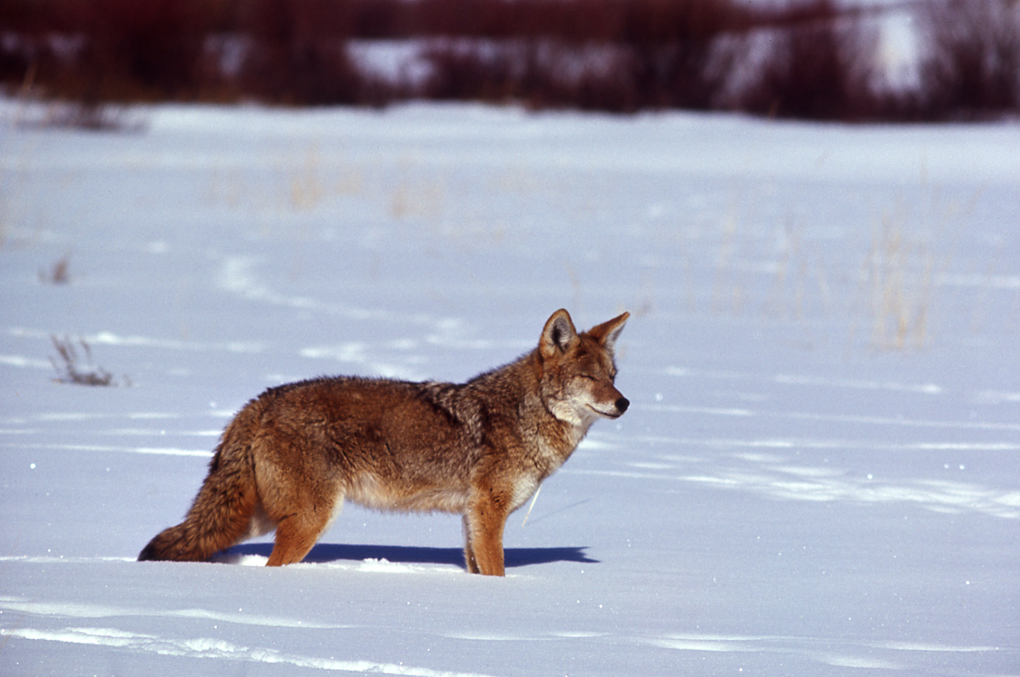
You pass through majestic pine forests, beautiful meadows and glistening ponds all along the 45 miles of Route 67. There are signs signifying the stupidly of people – having to remind them (certainly not us!) that driving motor vehicles off of the roadway and onto the meadows is not permitted, and that approaching wildlife is an unwise act (or would it support Darwinism?). There are also signs for bison and deer crossing…how cool would it have been to see a herd of bison grazing or deer romping across the snow? No luck seeing bison, but we did see herds of deer grazing when leaving later in the day. And while driving into the Park we did spot a coyote out on its early morning hunt for breakfast.
Quick Fact – Annually the South Rim of The Grand Canyon has over 5 million visitors per year, the North Rim 1 million, and the West Rim just 200,000 visitors.
Thank goodness for having already purchased our National Parks geezer pass several years ago…we sailed passed the entry station and, although the main parking lot was already busy early in the morning, we easily found a spot. Sunny weather with temperatures in the mid to upper 40s was predicted…the bright sun and our excitement at visiting The Grand Canyon kept us warm all day!
Our habit is to spend some time at the Visitors Center chatting with Rangers and volunteers about recommended hikes and seeing the exhibits. We appreciate some reconnaissance before setting off on our visit, and there have been times that other visitors offered some pretty good advice about what to do or avoid. It’s a treat for us, and we love seeing and hearing children (and sometimes adults, too!) take their junior ranger pledge after a day in the Park.
We enjoyed the scenic overlooks and places for photo opportunities, but truly appreciate each Park so much more by walking several miles, and experiencing the topography and slopes, panoramas and vistas from a multitude of angles…the sights, sounds and smells. Doesn’t have to be backcountry hiking or even a hike off the beaten path, but who knows what you’ll find if you slow down, see where the day takes you, and really take a good look no matter where you are?
Incongruous? Not At The North Rim In May!
There are 3 primary observation points at The North Rim: Bright Angel Point, Point Imperial and Cape Royal. The road to Cape Royal had not yet been opened for the season, but we weren’t going to miss the other 2 observation points…and then wondered what other adventures could we muster?
We could access the Bright Angel Trail by walking through The Grand Canyon Lodge or simply following the trail from the Visitors Center. But once we heard that there was a Ranger talk on the geology of The Canyon somewhere in the Lodge, we knew which direction was for us. Welcoming and made of warm dark wood, the Lodge overlooks Transept Gorge, Bright Angel Canyon and Roaring Springs Canyon – all named parts of The Grand Canyon. There are sitting areas on the patio right outside the back door, allowing visitors some R&R time as well as affording terrific views into the Canyon. It is 21 miles from here to the South Rim, and on most days your view goes well beyond that landmark – a never ending horizon! We found about 25 people listening to the Ranger’s excellent 20 minute talk, and walked away remembering that The Canyon was formed by DUDE: deposition, uplift, drainage and erosion.
Bright Angel Trail is the most popular hike in the Park – a 1-mile round trip steep trail out to an observation overlook. The trail is paved and wide enough…but there are no guard rails and the drop-off is severe. Visitors were taking a lot of pictures – selfies included – and there were some risk takers standing way too close to the edge. During our hike out to the point we were thrilled to see a Western Tanager!
View West From Bright Angel Point
Some Plants Find A Toe-Hold Anywhere – Along The Bright Angel Trail
Looking South It’s 21 Miles To The South Rim
Southeast View Humphrey’s Peak
Snow on the ground was not a deterrent to our hiking the 1.6-mile Bridle Path Trail through the beautiful and fragrant pine forest from the Lodge to the backcountry office followed by a 2-mile return hike with panorama vistas of The Canyon along the transept trail. Feeling accomplished and tired we figured that was enough hiking for the day.
What’s This Cold- Blooded Guy Doing Running Around? Remember There’s Snow On The Ground And Temperatures In The 40s
It’s a short 10-mile drive from the Visitors Center parking lot to Point Imperial, cutting through the forest and moving up an elevation of almost 1000 feet. We weren’t sure, but it did look as if lightning had started a fire or there had been a prescribed burn to quite a lot of the forest prior to the Point Imperial/Cape Royal turn-off – quite a lot of new growth along the road. At 8803 feet above sea level, Point Imperial is the highest point in the Park, and in our opinion, offers the best views of The North Rim.
The North Rim of The Grand Canyon is not as commercialized as the more popular South Rim. Sure, there are mule rides into the Canyon, but the Lodge is modest and there are only a handful of cabins for overnight accommodation; the Visitors Center is crowded at 10 people, and there’s no theater showing a film about the Park. The Park Service operates it all – there are no outside vendors. We came to believe that The North Rim is more for exploring and finding your own path. Sure, we could find our “own path” at any one of the Parks, but we’re sure The South Rim’s popularity creates a different culture (taking the train from Williams to the Canyon, staying overnight at the bottom of the Canyon, etc.). When we are able to visit The South Rim we’re sure other comparisons will be inevitable.
Timing was right for us to be able to visit The North Rim of The Grand Canyon, and we were fortunate to have been amongst the early visitors in 2019. We left The North Rim tired, with wet feet from our hikes in the snow and slush, smiles, and life-long fond memories.
Why Page? How about slot canyons like The Wave or Antelope Canyon? How about Horseshoe Bend National Monument? To just say “take a look at our pictures” wouldn’t do justice to these unbelievable natural phenomenas.
A slot canyon is a narrow canyon formed by the wear of water rushing through rock, and it is significantly deeper than it is wide. Some slot canyons can measure less than 3 feet across at the top but drop more than 100 feet to their floor. It’s particularly dangerous to be in a slot canyon when it rains – flash floods often occur and drownings are not unusual! Slot canyon tours are not conducted when it rains…imagine that.
The Wave is the most sought-after slot canyon hike in the US. Perhaps it’s because of the the patterns formed in the sandstone or the fragility of the formations. Perhaps it’s because a permit from the Bureau of Land Management (BLM) is required, and from a daily lottery drawing of over 100 applicants, only 20 permits are granted (as of May 9th, BLM has proposed an increase in permits to 96 per day). We talked with other RVers who had been trying to win the lottery for a number of years, and they were staying in Kanab until they obtained their permit. Is it the mystique about the place or is it just that cool? Regardless, it is considered the premier photographic destination in the US Southwest. I have to admit being jealous of the photographer who had the chance to take this picture of The Wave.
We thought about entering the lottery, but we didn’t want to give up our mornings hanging around waiting for the BLM drawing, and we decided to tour Antelope Canyon instead. Antelope Canyon is a slot canyon on Navajo land east of Page, and it includes two separate scenic sections, referred to individually as “Upper Antelope Canyon” or “The Crack”; and “Lower Antelope Canyon” or “The Corkscrew.” Tours are conducted by a member of the LeChee Chapter of the Navajo Nation. Some friends in Tucson recommended we tour the lower canyon. They said the upper canyon was best only with the right midday lighting; the lower canyon was exceptional every day tours are conducted.
We pulled into the parking lot and immediately noticed the flat colorless topography. We met our guide, and as we took a short walk along a dusty flat slickrock gray bland trail we started wondering if this whole slot canyon thing was over-rated. What did we get ourselves into?
OK, OK – give it a chance. From a metal landing we took a series of stairs to an 8-story descent into the canyon. Think being immersed into the earth and the darkness being shattered by sunlight exposing amazing colors, amazing designs swirling around you 360, and being overwhelmed by what to look at, or where to look. Up, down, forward and back is ablaze. The tour was over far too quickly. Check it out…
Just Starting Our Descent
See Valdemort’s Face?
Smiling Shark?
Lion’s Head
2 Intimates Sharing A Secret Or Maybe A Kiss?
Don’t Forget That This Is Sandstone Formed By The Force Of Water – Truly Remarkable
Ice Cream Cone?
This Is Brian’s Version Of A Famous Photograph That Sold For Over 7 Figures. See Both The Face And Woman’s Profile?
Pretty Cool, Huh?
Six miles south of Antelope Canyon is the Horseshoe Bend overlook. After paying the fee and parking our car we started off on a 3/4 mile hike to a lookout point. It’s not a very difficult hike but it is up and down through a lot of sand. The Colorado River meanders along a horseshoe-shaped path around an eye-level butte before continuing its course 130 miles south to the Grand Canyon and flowing eventually into the Gulf of California. Not only beautiful, but the 1,000-foot drop from the overlook to the Colorado River below makes the view breathtaking.
Looking West From The Overlook
Horseshoe Bend
Mother Nature’s artistry is infinite, and she continually finds ways to make alterations to her canvas. Some of those ways are subtle; some rendered with such force that we can only hope she will show more temperance the next time around. What we saw in Antelope Canyon and Horseshoe Bend will be different the next day…will be different the next day…will be different the next day. We found ourselves wondering what our grandkids and their grandkids will see should they take the opportunity to stop in Page, Arizona on their own journeys. May they see the canvas Mother Nature puts before them to be every bit as wonderful as the one we experienced.
It’s supposed to be 90 minutes from Kanab to Bryce Canyon National Park, but the transit time really depends on wildlife, the vehicles ahead of you, the weather, and your own desire to see another of Mother Nature’s wonders. Deer slow you down. Due to the Canyon’s elevation and negotiating the steepness of the hills, Over-the-Road Vehicles, RV’s or a family out for a Sunday drive all slow you down. Freak snow storms slow you down. Traveling early on a nice sunny day, the trip barely takes an hour.
From Kanab we headed north to head east to reach Bryce Canyon NP. The road into the Park passes through Red Canyon State Park and Bryce Canyon City. Red Canyon State Park gave us a splendid introduction to the beauty of weathered iron rich sandstone formations.
It’s all about the Hoodoo’s! Canyons are usually formed by a process of deposition (receding seas leave a deposit of sediments, soils and rocks which is added to a land mass); uplift (the earth pushes up; i.e. shift of tectonic plates and/or underground volcanic activity); drainage (patterns of river flow from headwaters to mouth), and erosion (the process by which soil and rock particles are worn away by gravity, wind, water or ice). Or as one park ranger explained, “DUDE, it’s complicated.” Hard to really say which is the most powerful of these factors; just that some form of water “on the move” is involved for millions of years.
The uniqueness of Bryce Canyon is that it wasn’t the DUDE process, but the process of frost wedging that created the canyons and the things we call hoodoos. Hoodoos are statuesque spires of sandstone that started life as a wall of sandstone. Through erosion, narrow walls separate from the larger wall and are called fins. Water trickles into cracks in the fins. Freezing enlarges the cracks (water expands when freezing) creating holes or windows in the fins, and thawing ensures that water remains in the cracks. Annually Bryce Canyon experiences 200+ nights below freezing, ensuring that the freezing/thawing (frost wedging) process remains on-going. As the windows enlarge their tops eventually collapse leaving a sandstone column. Rain and wind finish the process and a hoodoo is born. As we studied the hoodoos in Bryce Amphitheater, we realized that part of their beauty comes from their strange shapes and patterns, and that new hoodoos are formed as older ones dissolve into lumps of clay – an ever-changing panorama.
A brief word about Bryce Canyon City. In 1916, Reuben C. (Ruby) Syrett brought his family to Southern Utah, establishing a ranch near the present entry into Bryce Canyon NP. A few weeks after his arrival, Mormon homesteader and nearby rancher Ebenezer Bryce told Ruby of the canyon. It is said that Ruby and his family made a Sunday visit to the canyon rim, and they were so impressed by what they saw that they not only took full advantage to tell people of the canyon’s beauties, but they also became hosts to its visitors. By 1919 they had obtained permission from the state to build a lodge…hence Ruby’s Inn, which in 2007 was incorporated as Bryce Canyon City. The town encompasses 3.5 square miles and has a population of 223. Everything, and we do mean everything in town is owned by the Syrett family.
There are so few parking spots within Bryce Canyon NP that by 8am, when the Park officially opens, the visitor center and trailhead lots are full; avid hikers are already on the trails. As an alternative we parked for free in Bryce Canyon City – just outside of the Park. The Park Service maintains the spacious parking lot. Starting at the shuttle center, buses pick-up and drop-off visitors at each of the Park’s 14 stops. The Park Service’s shuttle system is impressive; drivers are pleasant and welcoming, each affording a wealth of knowledge about the Park, and they are well able to describe the attractions and hiking trails associated with each of the shuttle stops. Perfect…
We made a reservation for the free (!) Rainbow Point Tour; a multi-stop, narrated 3.5-hour, 40-mile round trip from the shuttle center to Rainbow Point, the highest and farthest point in the Park, and we figured that the tour would be a great introduction to Bryce Canyon NP. The Rainbow Point Tour begins at Bryce Point, where the Park shuttle begins its return journey to the shuttle center, and includes 7 different opportunities to walk to the rim of the canyon, look down onto the hoodoo formations and look out on the forever horizon. We made friends with our tour guide and shuttle driver, George, and found out that he has lived, camped and worked in this part of Utah his entire life; he taught his children to love and respect the beauty of the land, and once retired, he volunteered with the Park Service as a tour guide. He has a full repertoire of jokes, clichés, and quips at the ready to entertain, but it is his incredible level of knowledge about the Park’s geology, its vistas and views that made for a terrific tour.
At A Little Over 9,000 Feet There Was Still Snow On Our Walk To Rainbow Point
Over 14 Feet Of Snow (!) Fell In Bryce Canyon NP This Past Winter
View Looking South From Rainbow Point
Poodle Rock
“The Castle”….White Sandstone Hoodoos
Arch Rock
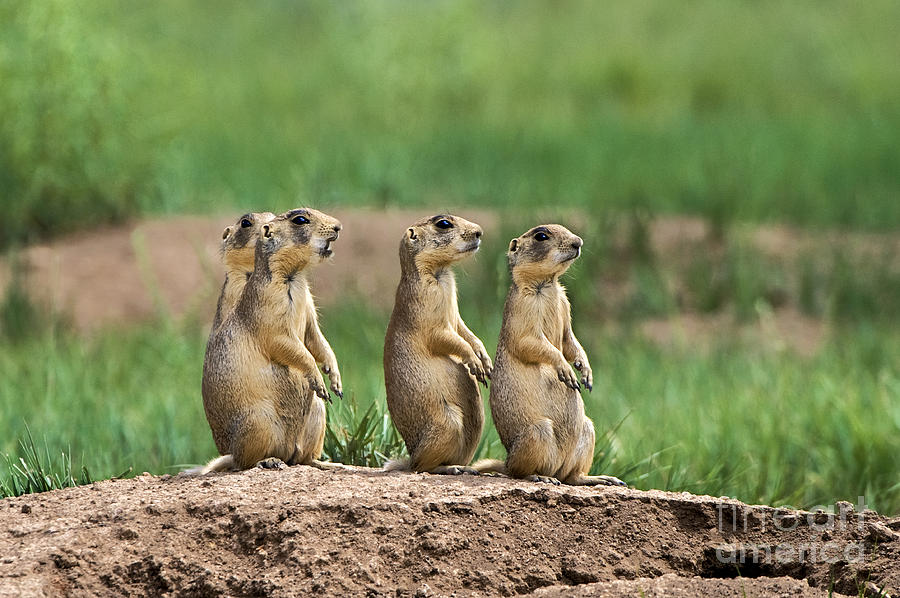
The famous Bryce Canyon National Park prairie dogs always arrange a welcome for visitors to Bryce Canyon NP.
After our tour it was time for a quick lunch and then on to “hike the rim.” The Rim Trail in its entirety is 11 miles – far too much for us to do in a day, if at all. But there is a 3-mile section of the trail that begins at the Bryce Point (shuttle stop), passes by Inspiration Point and Sunset Point and ends at Sunrise Point (shuttle stop). Our first glimpse of Bryce Amphitheater literally stopped us in our tracks, and brought Barbara to tears…it is so incredibly beautiful.
The cool part about this section of the Rim Trail is that it permitted us the opportunity to see the Bryce Amphitheater from a number of different angles. We found ourselves trying to complete gestalts, wondering what shape those columns of chocolate, vermillion, pink, gray and white sandstone had taken on. Are those terra cotta warriors? Is that an ancient walled city? Or does each of the hoodoos hold the spirit of the ancestors as the indigenous Paiute’s believe? Only each individual’s mind’s eye defines what it sees.
We felt that the Rainbow Point Tour and our rim hike was not enough to properly experience Bryce Canyon NP. Brian wanted to hike “under the rim” and amongst the sandstone spires…amongst the hoodoos. We wanted to hike the Fairyland Loop, but the trailhead is between the shuttle center and the formal entrance to Bryce Canyon NP and therefore not a shuttle stop. The trailhead is about 2-3 miles from the road and 4 miles from the visitors center; the first shuttle stop inside the park. We were early, but the parking lot was full.
Second choice? The Queens Garden trail is rated as an easy 1.8 mile hike…liar, liar pants on fire! The description failed to note that the Queens Garden trail also drops 357 feet into the canyon at a consistent 2-4 degree angle to slope down and, silly human, back up. Let’s see, what’s Brian always saying? It’s stress on the knees going down, and stress on the cardiovascular system going up. But taking an easy pace and with plenty of rest along the way down and up we joyfully completed the hike in 90 minutes.
Queen Victoria Hoodoo!
We had hoped to pair the Queens Garden with the Navajo Loop, but it was closed due to the condition of the trail. Next choice? The Tower Bridge trail is rated as a strenuous 3-mile hike dropping 802 feet into the canyon, and as we discovered, at an even greater angled slope than the Queens Garden trail. We completed about 1/2 to 3/4 miles of the trail before enough was enough. We really were exhausted…oh, did we forget to mention that the rim of Bryce Canyon varies from 8,000 to 9,000 feet. An excuse for not completing the second hike? Perhaps, perhaps.
The horizon affords its own beauty as well – we could see the buttes of the Paria and Kaibab Plateaus standing tall in defiance of the surrounding geology. Our Rainbow Point tour guide pointed out the rise in topography that, 156 miles south, seen here on the horizon was the North Rim of the Grand Canyon. Yes, it is that clear!
“Mollie’s Nipple” Is More Than 40 Miles From Rainbow Point. The Rectangle Rising In The Background Is The North Rim Of The Grand Canyon.
Yeah – It Really Does Look Like That!
Unbelievable Vista!
A Little Moodier Sky!
We loved our hike amongst the hoodoos. We loved the ever-changing picture and color of Bryce Amphitheater from the rim. We loved imagining Paiute encampments and the stories passed on from generation to generation around their campfires. The vistas are breathtaking…
We have been on the road for almost a year – it doesn’t seem possible – and we have been blessed to see so many beautiful and amazing, unusual and incredible places all across America. Hands down the BEST we’ve seen so far is Zion National Park. Seriously, put a trip to this geologic wonder on your bucket list. There is no other place on earth like it. We have spent countless hours in conversation trying to figure out how to adequately describe Zion to people who have never experienced its beauty.
We first visited Zion NP a couple of days after we first arrived in Kanab, went back with Graham and Leigh when they were staying in the Park for a get-away weekend they had planned for several months; again when friends from Bath, PA were in the area for a few days while on vacation, and then a 4th time because we wanted to hike to Angel’s Landing and maybe see nesting condors. And, of course when given the choice of driving through or taking a route circumventing the drive through the Park, we just had to enjoy our favorite sights one more time.
We visited when the day began warm and sunny, and we had our day shortened when a driving rain fell. We hiked about with Mother Nature’s full blessing and cooperation, and we carried forth while a light rain kept us company. The weather did not dampen our love for being in the Park nor lessen our amazement at the majesty and beauty of Zion NP. The colors stay vibrant and tend to change with the weather, but even at its worst, it is a hauntingly beautiful landscape.
Storms Rolling Into Zion NP…See The Human Figure?
This Was Taken After A Downpour…Looks Like The River’s About To Overflow Its Banks!
These Were Named By The Mormon Settlers As The Patriarchs…Abraham, Isaac, And Jacob.
Checkerboard Mesa. Horizontal Lines From How The Sandstone Formed; Vertical Lines From Water Erosion.
We found out that waterfalls and graceful run-offs were an unadvertised benefit of rain in the Park!
From The Lower Emerald Pool Trail
From The Riverwalk Trail
Below The Weeping Rock Trailhead – Love The Small Waterfall In The Background
Weeping Rock
Those Dashes Are Water Droplets From The Top Of Weeping Rock Frozen In Time
On The Way To Weeping Rock
On The Trail To Angels Landing
On The Trail To Angels Landing…This Is One Of Brian’s Favorite Pictures Of The Park
Every one of our adventures into Zion NP was as exciting as the first. We were transfixed by the magnificence of the majestic monoliths reaching to the heavens, and we understood why the native Paiute people referred to the land as “straight up earth.”
Zion’s multicolored polychromatic pastel hues of orange, green, red, pink, purple and blue have no equivalent to any rock formations we have previously encountered. The sandstone hillsides we saw in the Valley of Fire State Park just north of Las Vegas were spectacular, but the enormity of the dynamic and powerful projections in Zion are breathtaking.
The Virgin River Winds Along The Canyon Floor
Not Sure Those Trees Are Supposed to Be In The Water?
Just WOW!
You can enter Zion National Park from either the east or south. The east entrance is definitely the more spectacular, dropping over 1000 feet into the canyon, driving down the steep roadway, around several severe switchbacks, and through the 1.1 mile Zion-Mt. Carmel Tunnel to reach the floor of the canyon. All along the trip there are pullouts and parking areas thoughtfully placed for photos and hiking opportunities. From the south you enter the Park through the town of Springdale; a boutique community of motels/hotels and RV parks, small shops and restaurants all in place to host visitors to Zion NP.
The majesty and beauty of Zion NP begins once you pass the entrance from the east or when you enter the city of Springdale from the south – no fooling!
Prior to going through the tunnel (or just after if you come from the south entrance) there’s a wonderful one-mile round-trip hike up to the Canyon Overlook, and just east of the trailhead there’s a parking lot. On one of our planned trips to the Canyon Overlook we were joined by Desert Big Horned Sheep who came down the slope for their breakfast. Check it off of the bucket list!!
The Canyon Overlook Trail is actually very challenging, and the heights can be dizzying as there are portions of the trail that are very narrow with severe drop offs. The kid in Brian couldn’t resist seeing if the canyon would echo, and he made a few friends “hooting” back and forth as we hiked the path. The trail winds up, down, around and sideways to the summit, but it is SO worth the effort! We made the journey every time we were in the Park, and we were spellbound each and every time.
Starting Up The Canyon Overlook Trail…That’s The Entry To The 1.1 Mile Zion-Mt Carmel Tunnel
Near The Summit Looking Into The Park
From The Summit…Breathtaking View! And A Favorite Picture.
Even with a hint of bad weather, the view from the top of Canyon Overlook is pretty special.
The drive through the tunnel can be a little claustrophobic at 25 mph; there is no stopping and it is very, very dark. However, once we were back in the sunlight, the adventure was just beginning. We “oohed” and “aahed” our way into the canyon and to the Visitor’s Center parking lot.
The Sun Coming Up Over The Canyon Overlook
Despite the fact that we reached the Park by 8am, the lot was nearly full. The Rangers at the Visitor’s Center were very helpful and provided suggestions and a guide to some of the best features of the Park.
“Bambi” Seemed Awfully Comfortable Hanging Out By The Visitor’s Center. Charged $5 A Picture Too!
There are 15 primary hiking trails in Zion NP. 3 trails were closed due to rock slides, and/or impassable trail conditions were a result of the amount of rain that had fallen this Spring, and 1 trail was reserved for horses. The most famous trail in Zion NP is The Narrows – a 9.4 mile round trip, most of which is spent wading in the Virgin River. The Narrows was closed to visitors as the water run-off had increased the flow of the river in The Narrows to over 40,000 cubic feet per second. We were told that’s the equivalent of 40,000 basketballs hitting you dead-on every second – each basketball’s volume about 1 cubic foot. Talk about being swept away! While we were in the Park we did hear a couple of “booms” which turned out to be the Park Service using dynamite to break up large rocks embedded in the trails.
Wish You Could Hear The Rushing River, See Its Rapid Flow And Feel The Power
Hiking distances vary from 1/2 mile to just about 10 miles round trip. Distance doesn’t tell the whole story, however. Add a change in elevation, and there’s a great difference between a 5-mile hike with a 50-foot elevation change (easy – most people regardless of age can complete the hike, and the trail may be paved making it accessible as well) and one with a 1,488-foot elevation change (rated strenuous; iconic world renowned trail). And yes, we did hike 4.3 miles up the West Rim Trail, and managed the 1,488-foot elevation change to reach Scout’s Landing. Scout’s Landing is the trailhead for the Angels Landing Trail, a 1.1 mile round-trip trek that requires the use of an anchored chain “rope” as well as the necessary arm and shoulder strength to complete the hike – the slope is just too steep to not use the chain rope or not have the needed strength. But rain the day before and an intermittent light drizzle the day of our hike made the sandstone too slippery and hazardous for us old folks. We had taken this trail for the challenge, and we also hoped to see nesting condors rumored to be at the top flying in the thermals. Great hike with ever-changing weather; unfortunately no condors.
Starting To Reach New Heights
Great View Of The Canyon
The Clouds Rolling In
From Scout’s Landing…A 1000 Foot Drop
To access all of the hiking areas within the Park a free, hop on/hop off shuttle takes visitors to each of 9 stops.
A Tom Welcomes Us To Zion NP
I’m Thinking Roasted Wild Turkey
There are multiple places to camp, or visitors can stay at the beautiful Lodge or small cabins that provide all the comforts of home. We were entertained on the shuttles by a host of narrators describing the history of the Park and the geology and formation of Zion. We also heard from Ben, a Paiute native whose voice was so familiar, we assumed it was the same Park Ranger who was our guide when we had visited Pipe Spring National Monument on the Kaibab Paiute Indian Reservation.
Despite the thousands of people from all over the world who come to the Park every day, we never felt the crush of crowds or had to wait too long to use the facilities. We were overjoyed to discover that Zion NP is truly one of the happiest places on earth…it is a magical place. Visitors and employees alike smile and have kind words for each other; on hikes and while hanging out on the front porch of the Lodge, we observed the renewed closeness and joy of families and friends, missed during the frenetic pace of daily life and electronic entertainment. We engaged in and heard conversations connecting people to people, and genuinely developed a feeling of internal peace. Didn’t matter what the weather conditions were – this is what we saw and experienced.
“Zion” Bluebird Of Happiness?
Guests are also told repeatedly that personal safety is their responsibility. Footing can be challenging at times as the sand from the rocks is everywhere, and when it rains it can be quite slick underfoot. Overlooks, near drop offs and cliff edges bring heightened awareness on some of the more moderate/strenuous hikes. We took our time and stopped when we needed to catch a breath. We were also warned to be aware of the threat of thunderstorms and lightning and a range of varying weather conditions including flash floods. We have learned to dress in layers and to carry our rain ponchos as temperatures in the park can chamge so dramatically. Preparation and common sense are key.
Rain did not discourage people from hiking or just sitting on the porch of the Lodge in a rocking chair. The Virgin River, which runs through the Park, was swollen, rapid and muddy. In front of the Lodge there is a large grassy area where groups of tourists and families congregate for lunch or just hang out and get some sun. The Spring flowers were just starting to bloom and the newly budding leaves on the trees looked lime green.
Desert Paintbrush
Red Riding Hood Penstemon
Zion NP is such a peaceful place in the world, and it’s easy to understand how the ancestral Paiutes came to embrace this place as sacred ground.
Jim and Roma, our friends from Bath, PA were on vacation in Utah, and after a whirlwind tour of Arches, Moab, Canyonlands National Park and Bryce, they travelled to Kanab in order to visit Zion NP. We just happened to be in the neighborhood! As we had discovered, they also found that Zion was their favorite National Park. Roma commented that she hadn’t felt so relaxed in a long time, and she speculated that it was the clean air and all the extra oxygen from all of the trees! Can’t say for sure that’s why everyone seems so carefree and at peace in Zion, but she may be on to something.
Driving through the Park one last time brought Barbara to tears. She guessed that the Park re-awakened her deep-rooted connection to the Colorado mountains of her youth and young adulthood (or at least until this flatlander entered her life!)
It was difficult for both of us to see Zion National Park for the last time…this trip. We will be back.
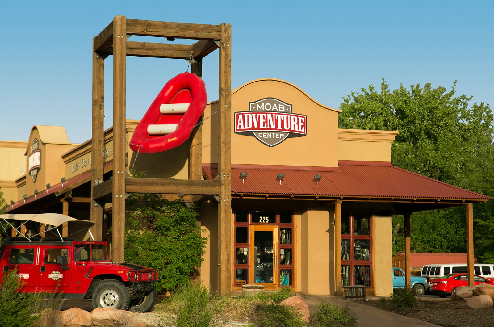


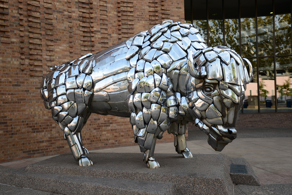 Taking Highway 191 about 10 miles south of our campground, we suddenly came upon Wilson Arch. The Arch was named after the 1st superintendent of Arches NP. We had to stop and hike up to the arch in order to take a look through and see what was on the other side. Well, it’s just a few hundred feet drop off!


 The hillsides on the road between Monument Valley Tribal Park and Valley of the Gods State Park are magnificent.

 Valley of the Gods State Park is a scenic sandstone valley near Mexican Hat in San Juan County, southeastern Utah, and has rock formations similar to those in Monument Valley with tall, reddish brown mesas, buttes, towers and mushroom rock – remnants of an ancient landscape.


 The La Sal or Salt Mountains stand ever at sentry watching over Moab from its eastern horizon. Driving here and there we kept seeing signs for the La Sal Mountain Loop, and we wondered just what we’d experience if we took the drive. Well, the Loop provided a pretty spectacular vista, some curious insect activity, and a free range cow as the local representative to bid us farewell to all Moab has to offer!


 Barbara’s favorite trail was a moderate 2-mile hike called Park Avenue. After a steep descent into a canyon, the hike is fairly level. The canyon is lined by sheer monolithic formations, and we thought it might have been better called Wall Street. Walking in the canyon we noticed the surface of the rocks that had been patterned by water so many millions of years ago. It brought to mind what it must be like to walk on the bottom of a sea.