RAMBLING ALONG ROUTE 66

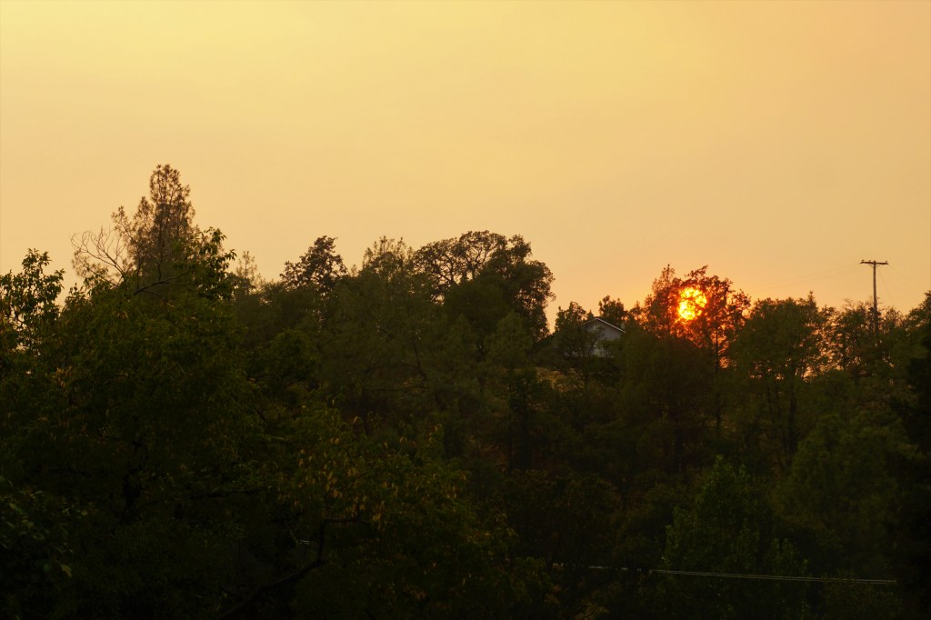
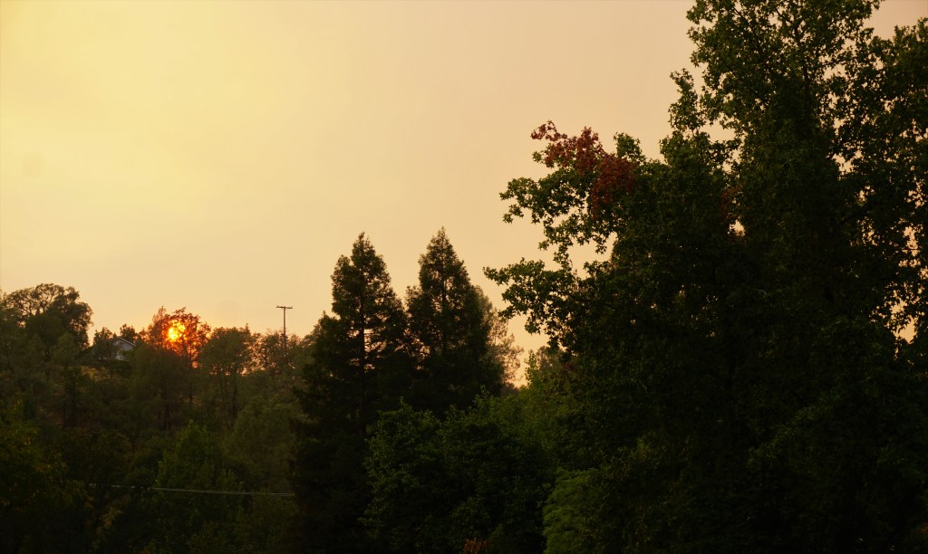
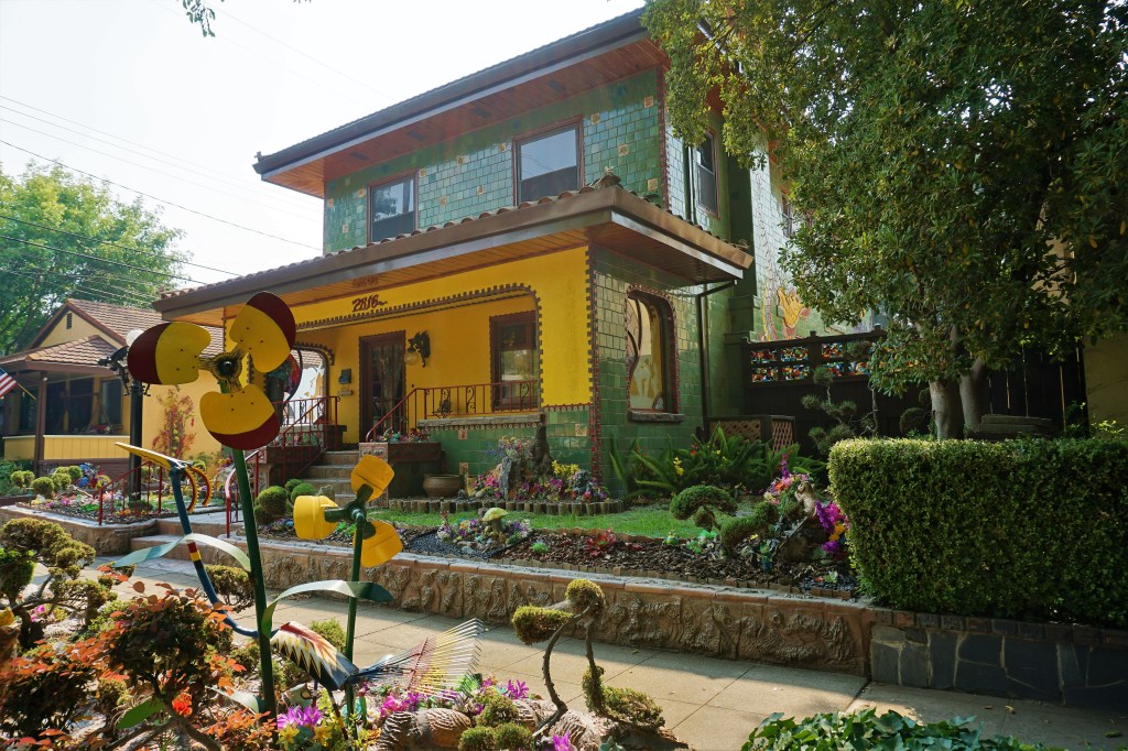
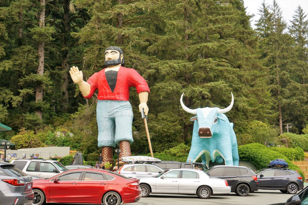
Well, Howdy Pardner! It’s again time to get your cowboy on and ramble along with Barbara and Brian seeing what mischief those little doggies got into while straying eastbound in the general direction of the Windy City. Oh-yeah – this is part 2. Yeehaw!

This Iconic Ferris Wheel Began Its Life At The Santa Monica Pier In California, And Appeared In Many, Many Films. It Was Purchased, Relocated and Restored In 2008.

April – May, 2022

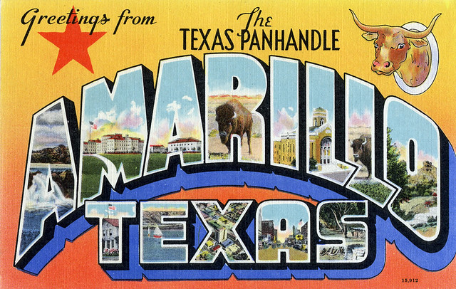
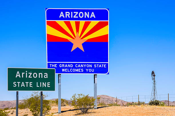
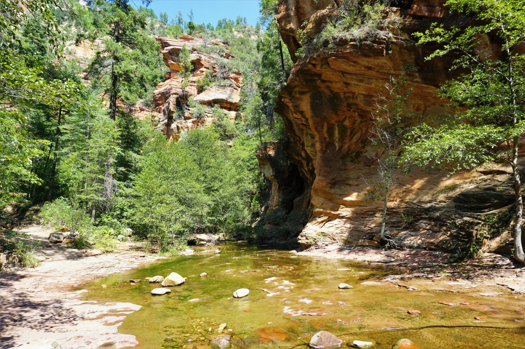
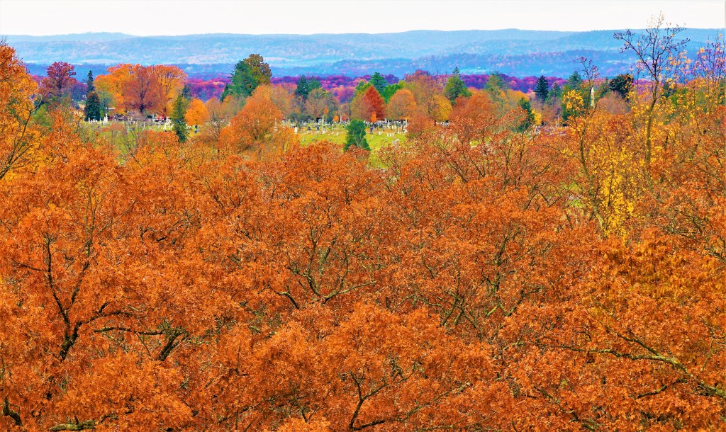
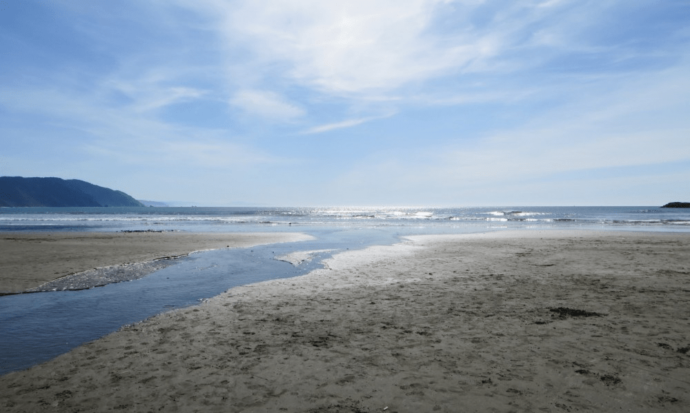
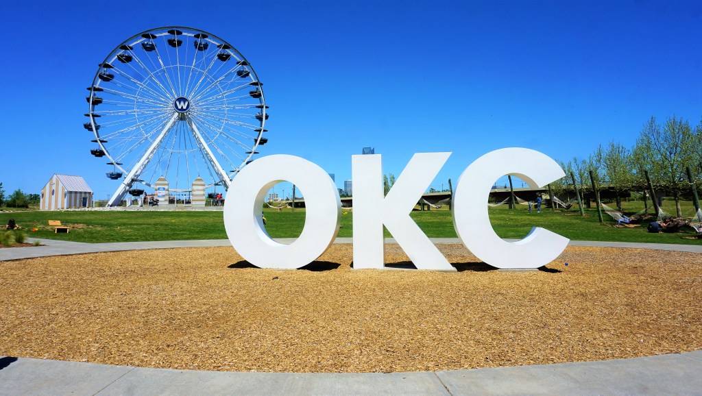
A mere 258 miles northeast of Amarillo we found ourselves in Oklahoma City. Barbara had made one visit to Oklahoma in the early ’80’s spending a dusty hot time marching on behalf of women’s rights (wonder how much better things are in 2022?). This was Brian’s first time in the Sooner State.

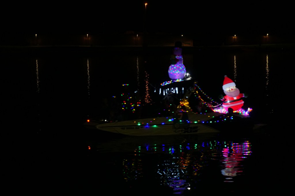
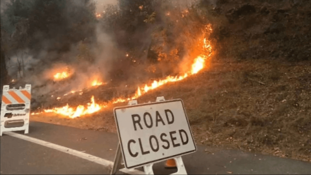
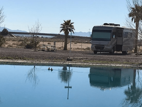
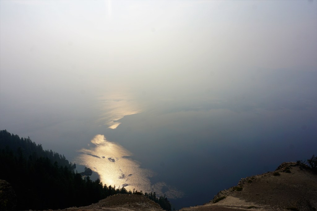
When checking in at our campground the hostess casually pointed out the two (!) tornado shelters on property! Guess we had forgotten or never knew that Oklahoma’s infamous tornado alley included OKC. During our stay there was a hellacious mostly daylong LOUD thunderstorm with torrential rain that curbed our sense of outdoor adventure. The warning siren never did sound, so we prefer to believe we were safe.

VDO friends Steve and Kathy Lewis are living temporarily in town, and we figured on a nice visit. Steve had been coaxed out of retirement by his former employer on a limited time contract, and well, they assigned him to OKC. Turns out that Kathy had to deal with a family issue and was not in town, but we had a great time visiting with Steve and getting the “low down” recommendations of things to do.

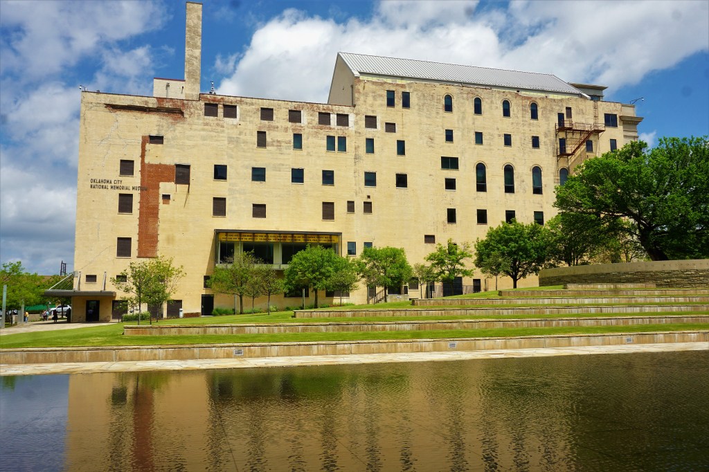
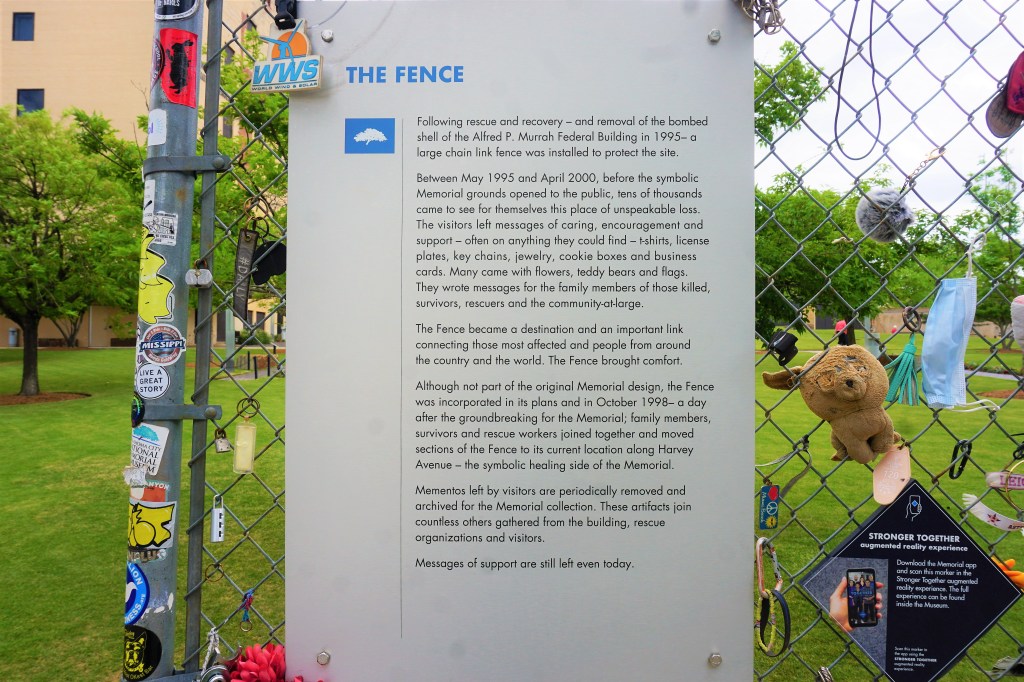
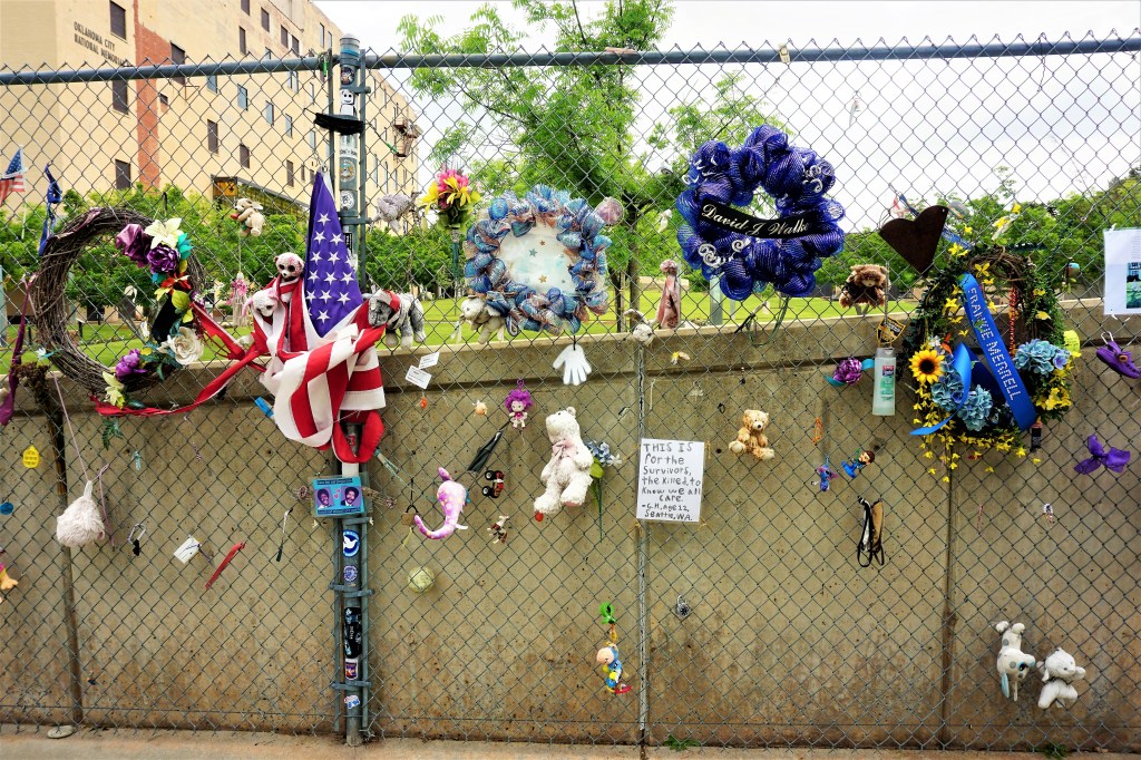
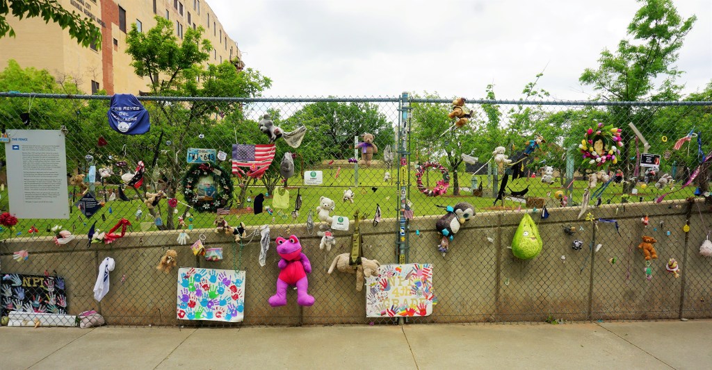
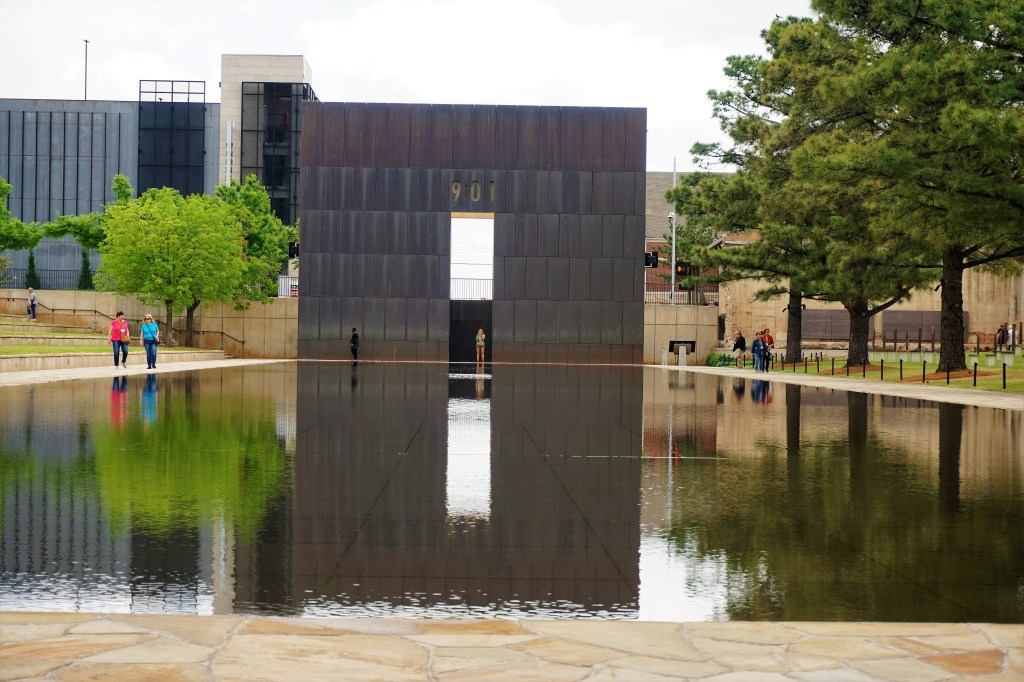
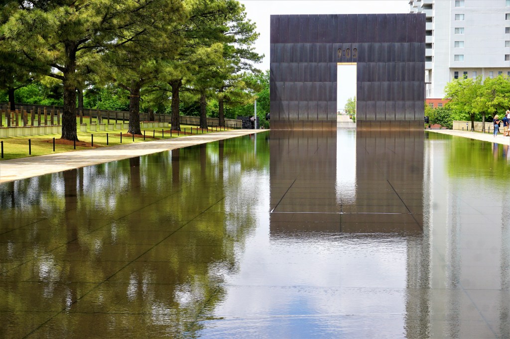
While neither of us had ever spent any time exploring OKC, our primary reason for visiting here rather than Tulsa was to pay our respects to the victims, survivors and rescuers who died or were affected by the Murrah Federal Building bombing on April 19, 1995.

The outdoor grounds of the National Memorial and Museum are hallowed and present a tribute to those who were immediately and lastingly impacted by the bombing. The museum is a chronological timeline tour of interactive displays recalling the events of the day, the response of rescuers, pursuit of the criminals responsible, and stories remembered by the survivors, rescuers and affected families. All-in-all quite sobering and touching.

…as is our tradition we said a silent Kaddish in remembrance of those who lost their lives…

Children’s Wall Of Tiles
Remembered Still
Standing/Remaining Part Of The Murrah Federal Building
Each Empty Chair Memorializes and Honors The 168 Souls Lost, 19 Of Which Were Children

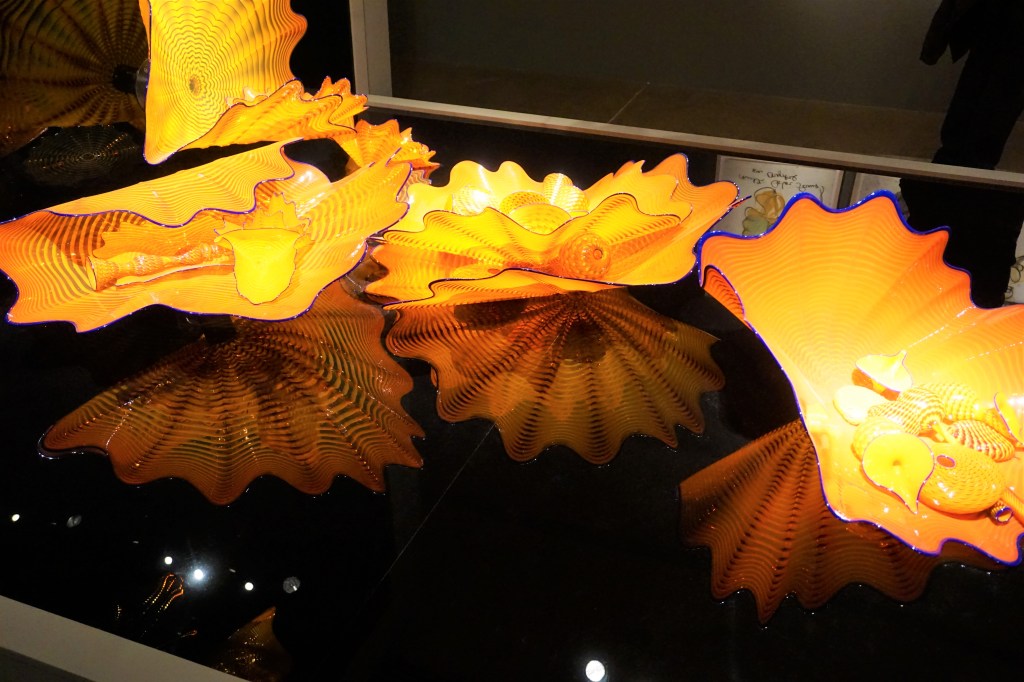
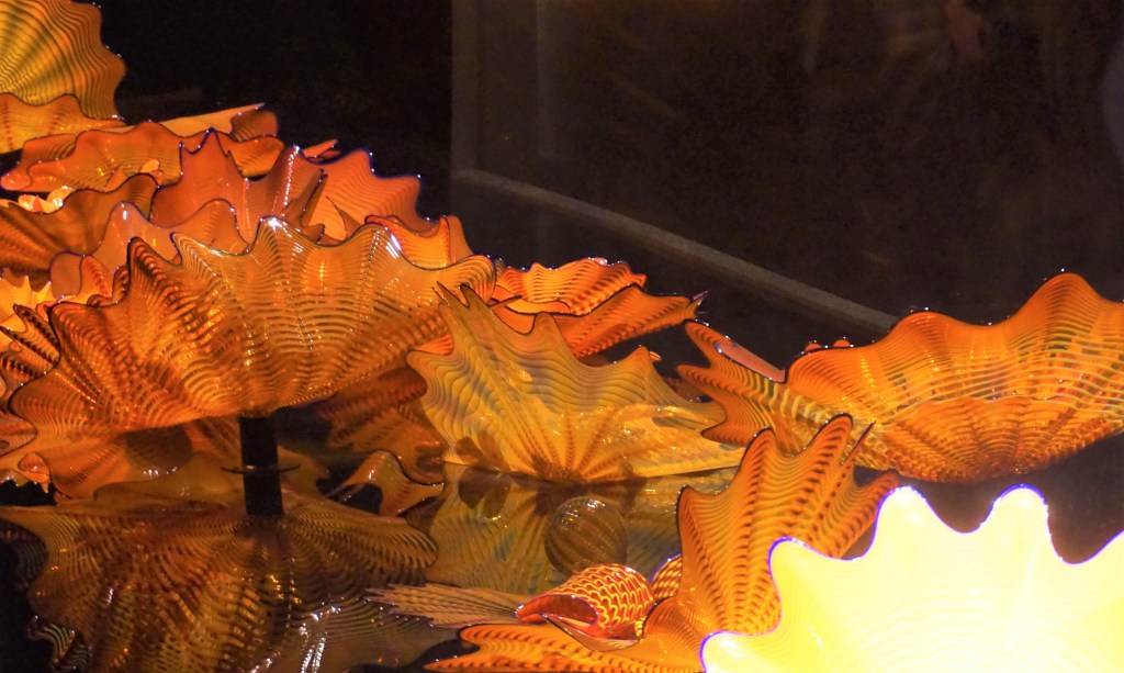
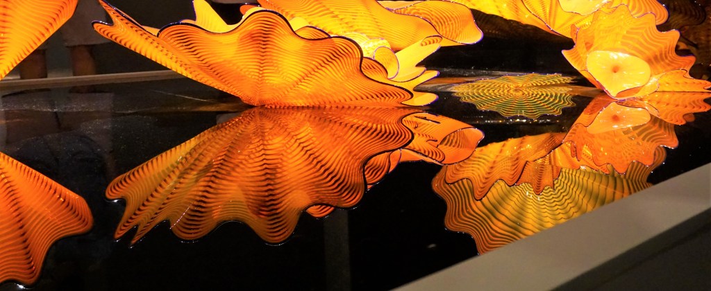
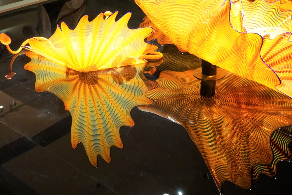
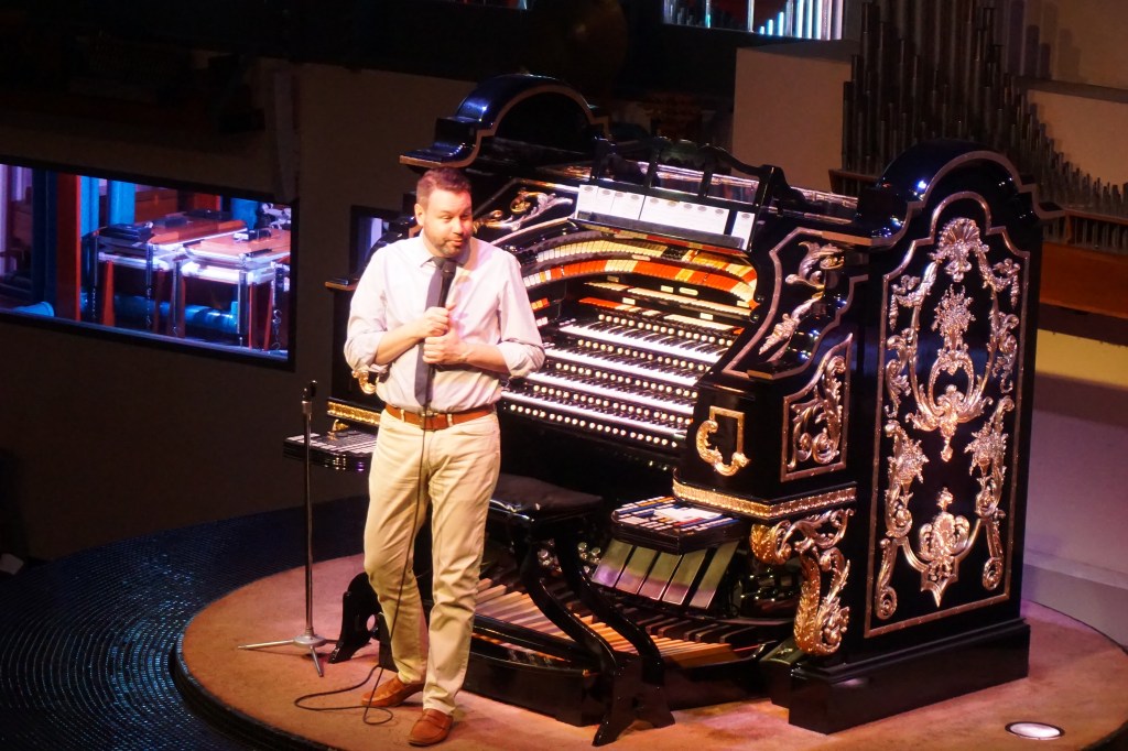
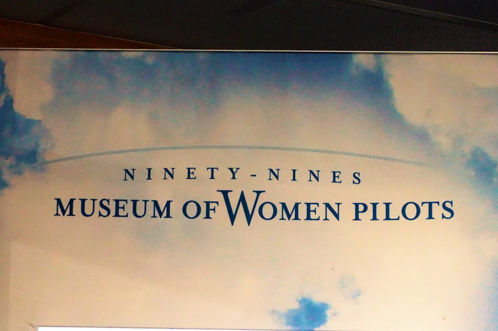
In 1929, 99 courageous (remember those were misogynistic times) women pilots formed the 99s, an international organization of and for women pilots. The mission of the newly formed organization was to promote the “advancement of women in aviation through education, scholarships, and mutual support while honoring their unique history and sharing a passion for flight.” Seems like near about everyone knows something about Amelia Earhart, but how much do we know about the other pioneering women who helped put aviation into the public’s eye? Google (to name a few) Jean Batten, Sophie Blanchard, Margery Brown, Bessie Coleman, Mae Jemison, Elizabeth Lippincott McQueen, Blanche Wilcox Noyes, Eula “Pearl” Carter Scott, or Ruth Stewart. The museum is a fascinating look into those early years of aviation and international flight. 

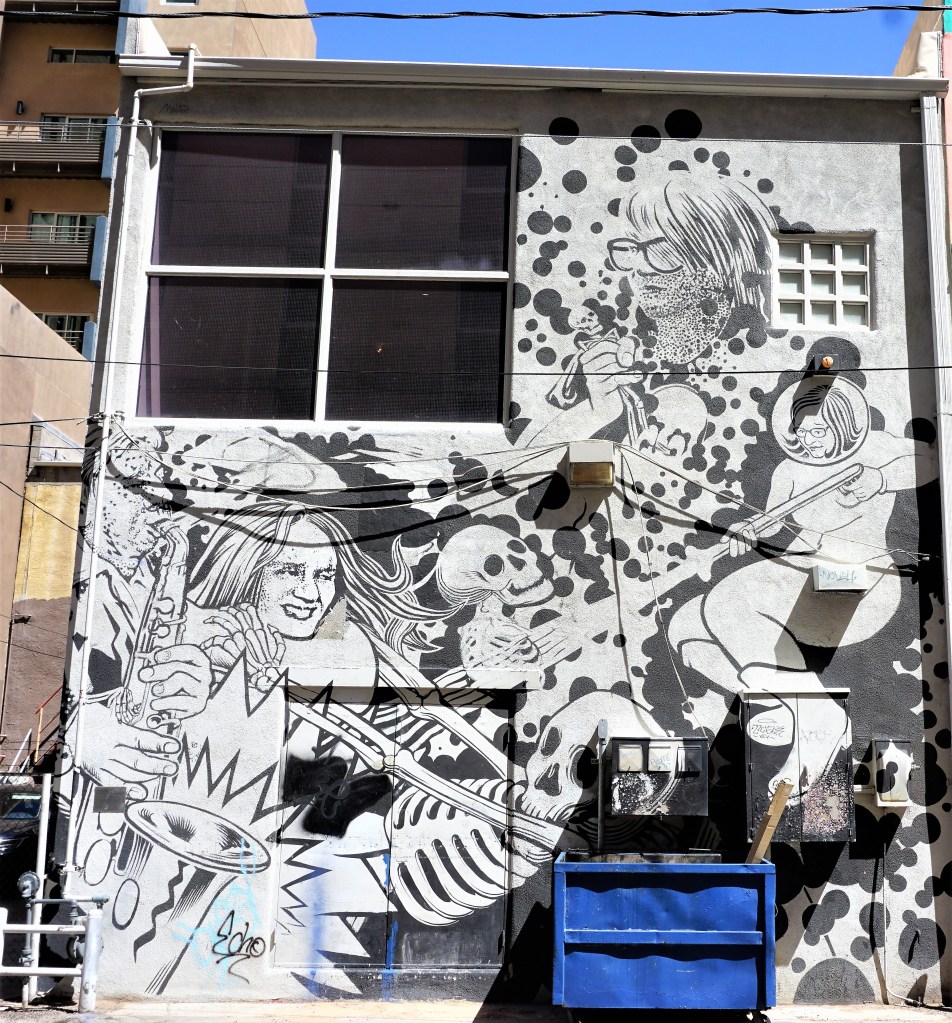
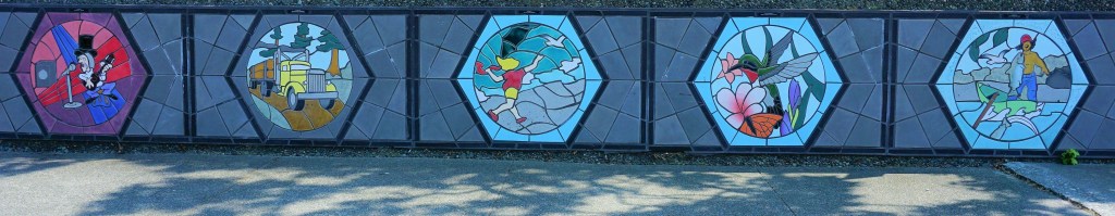
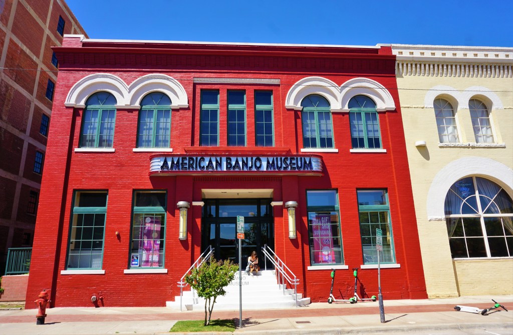
On moving from Brooklyn, NY to Austin, TX our nephew, Jon, made the transition from being “a guitarist” and the founder and lead of the free form jazz group Jon Lundbom and Big Five Chord to being a banjo loving banjo picking bluegrass playing fool. This is in honor of Jon.

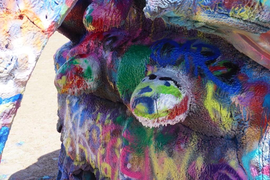
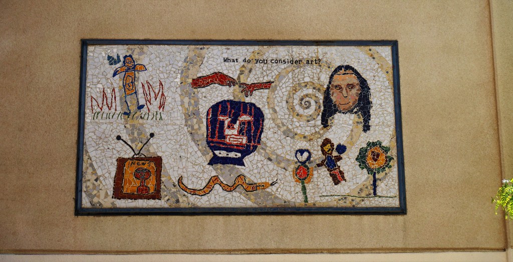
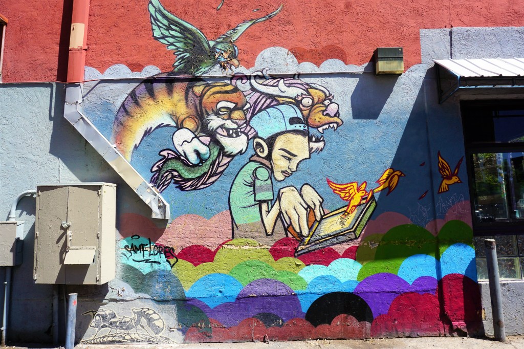
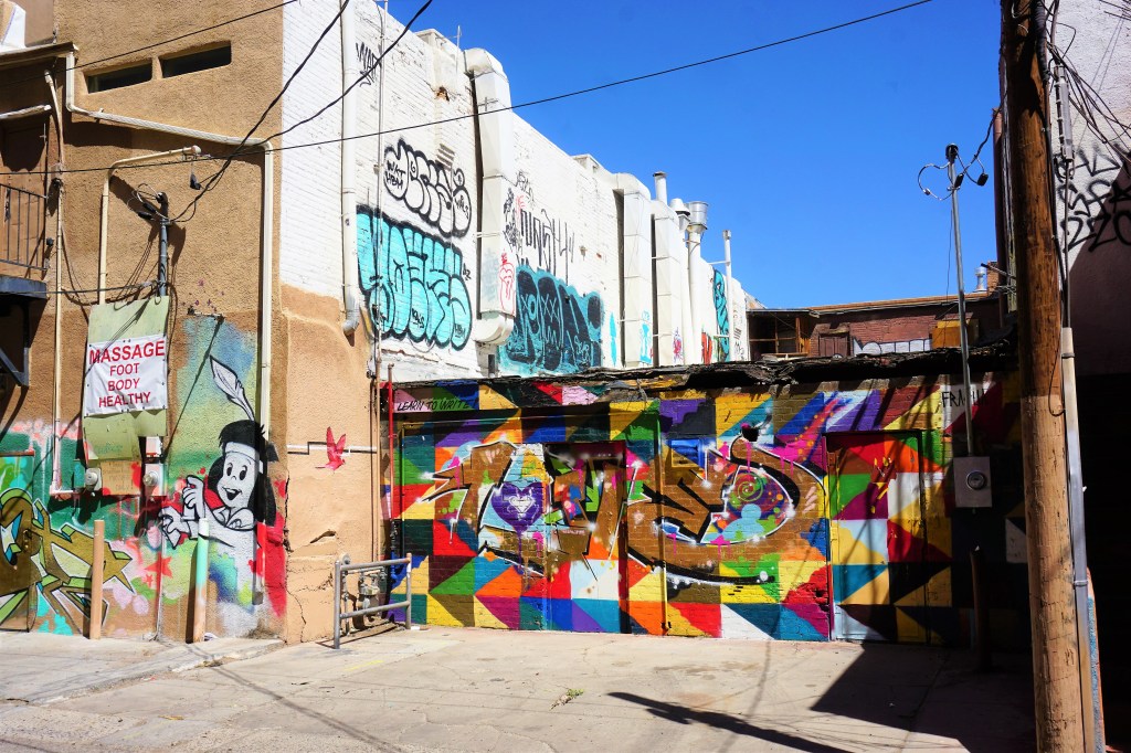
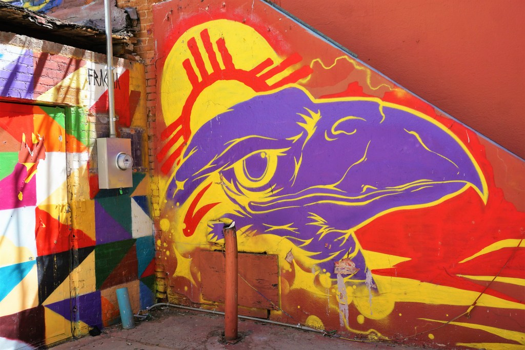
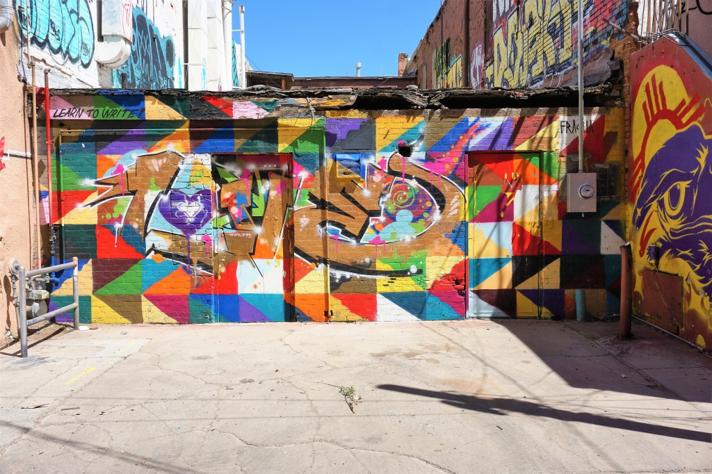
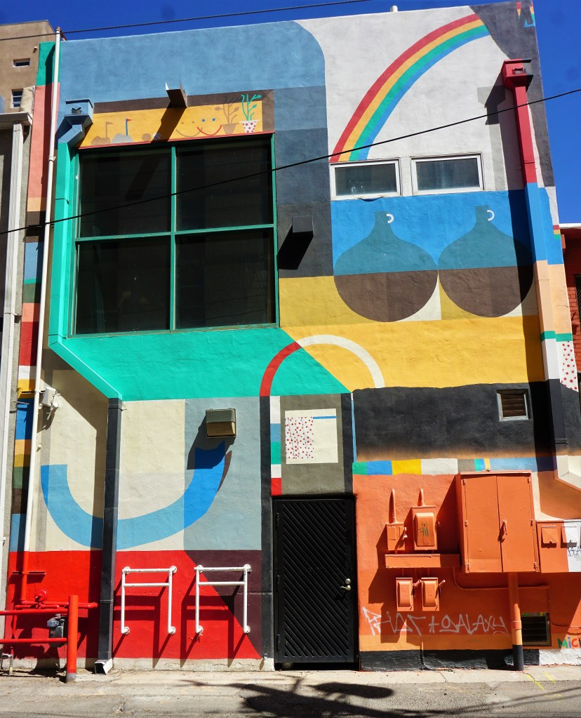
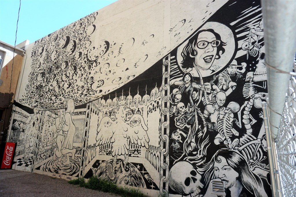
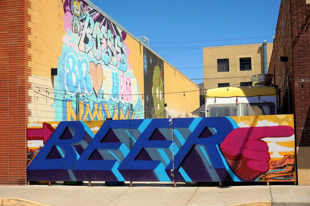
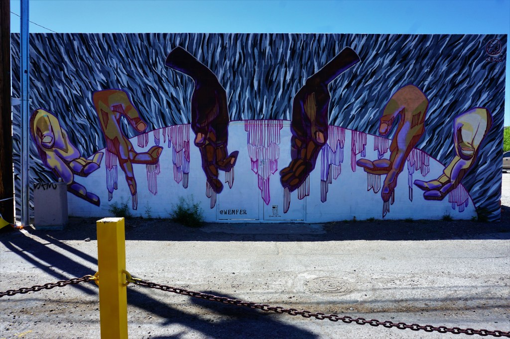
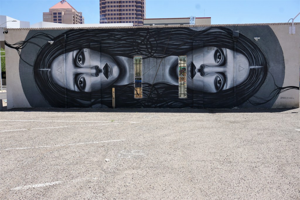
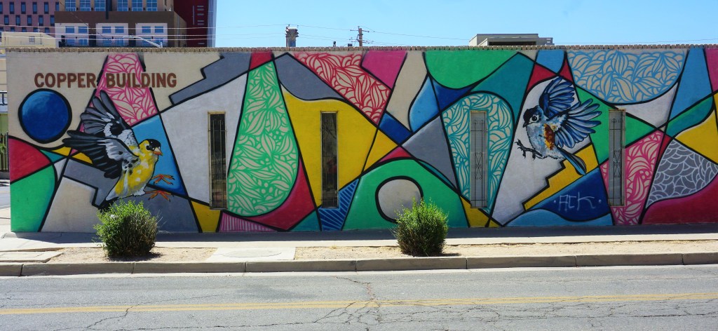
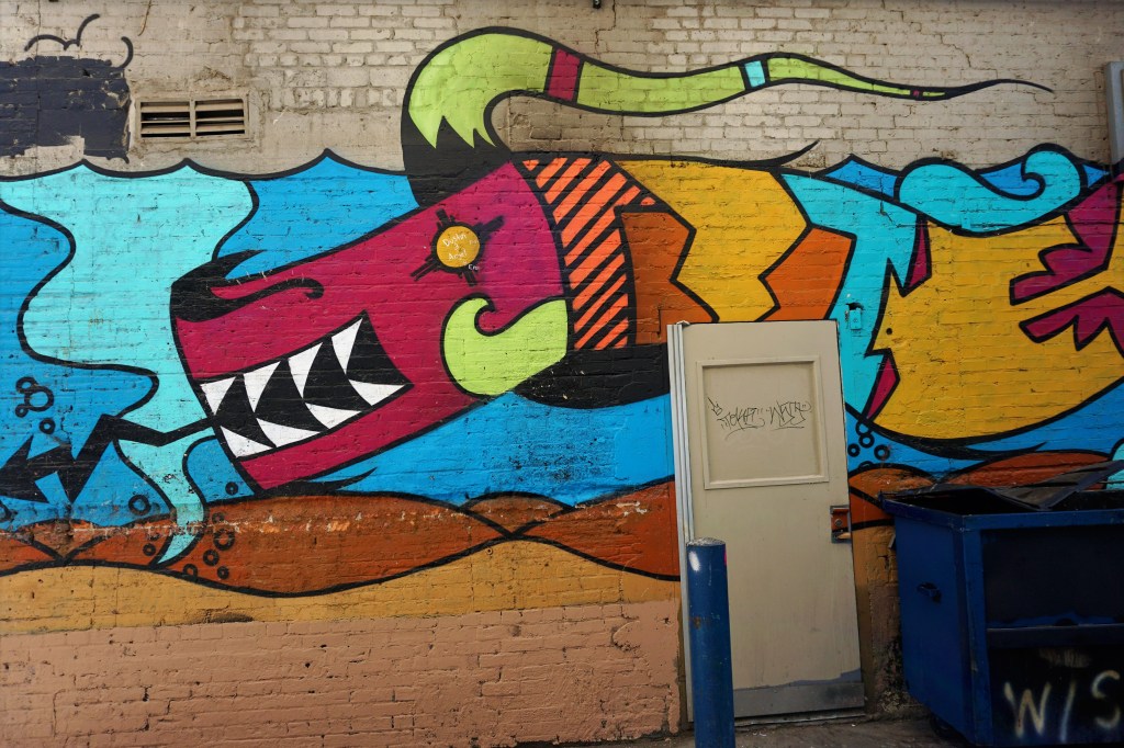
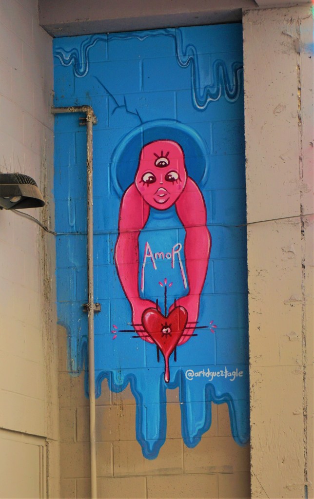
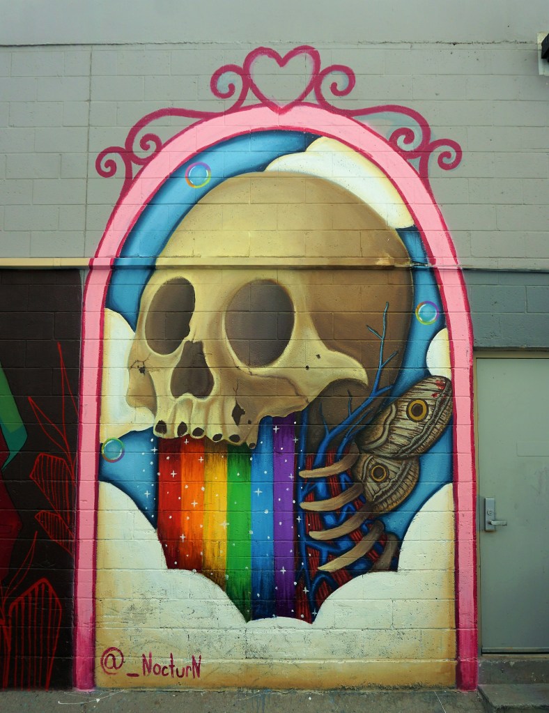
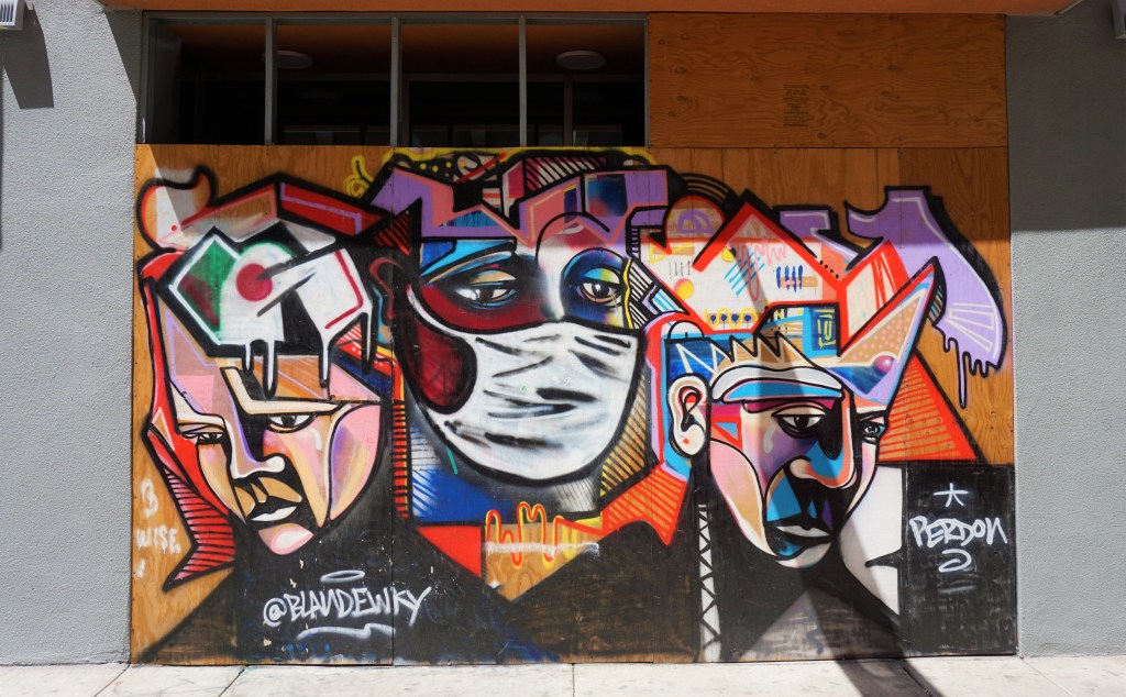
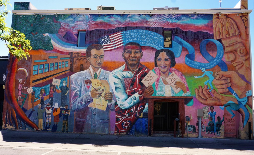
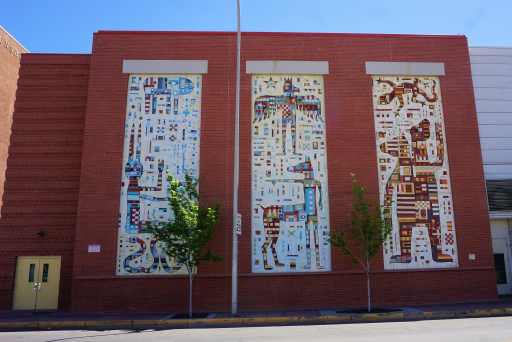
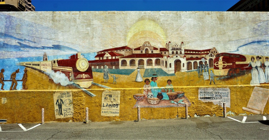
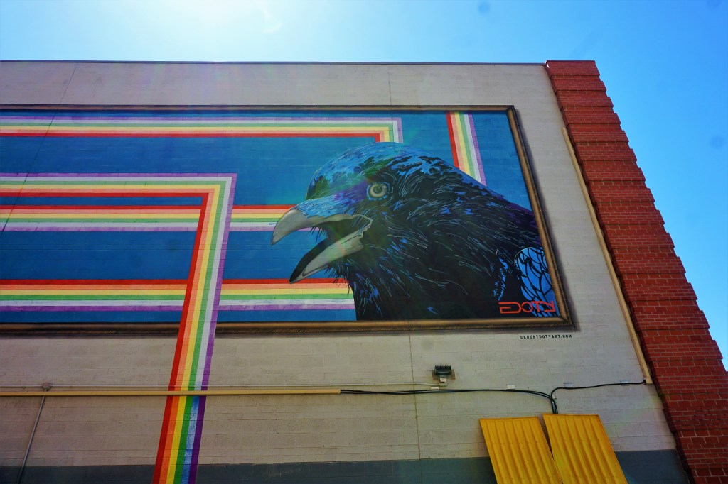
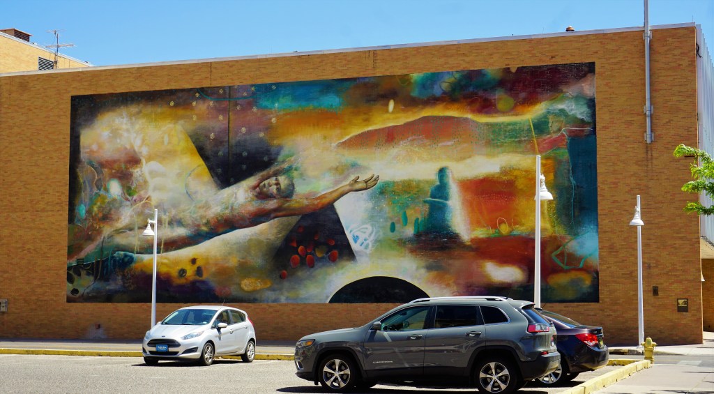
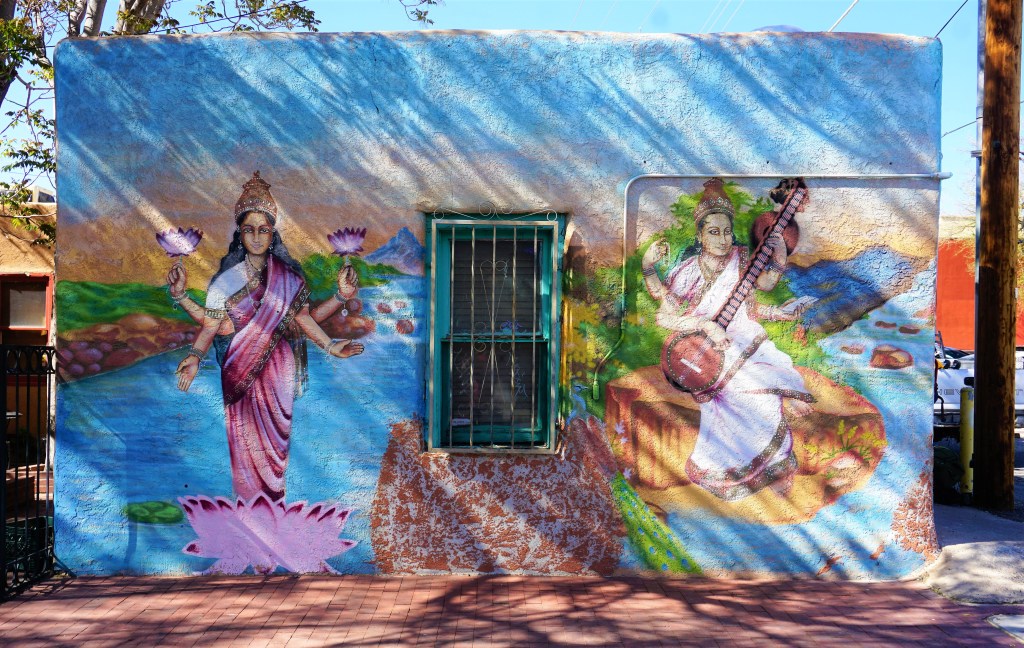
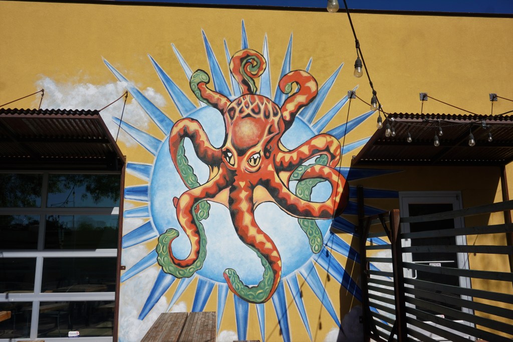
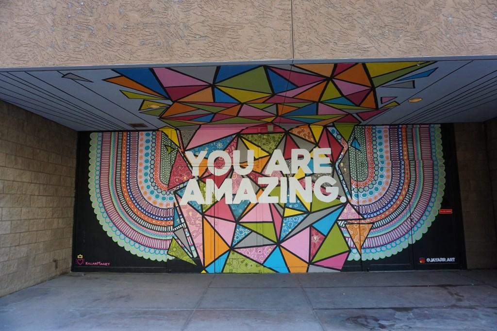
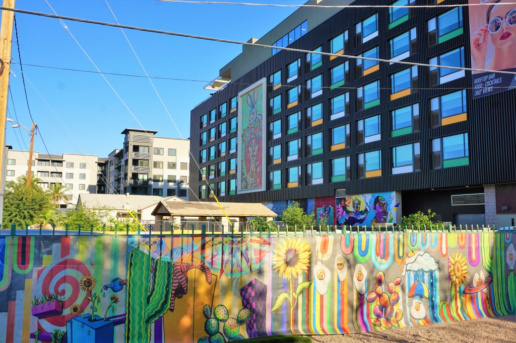
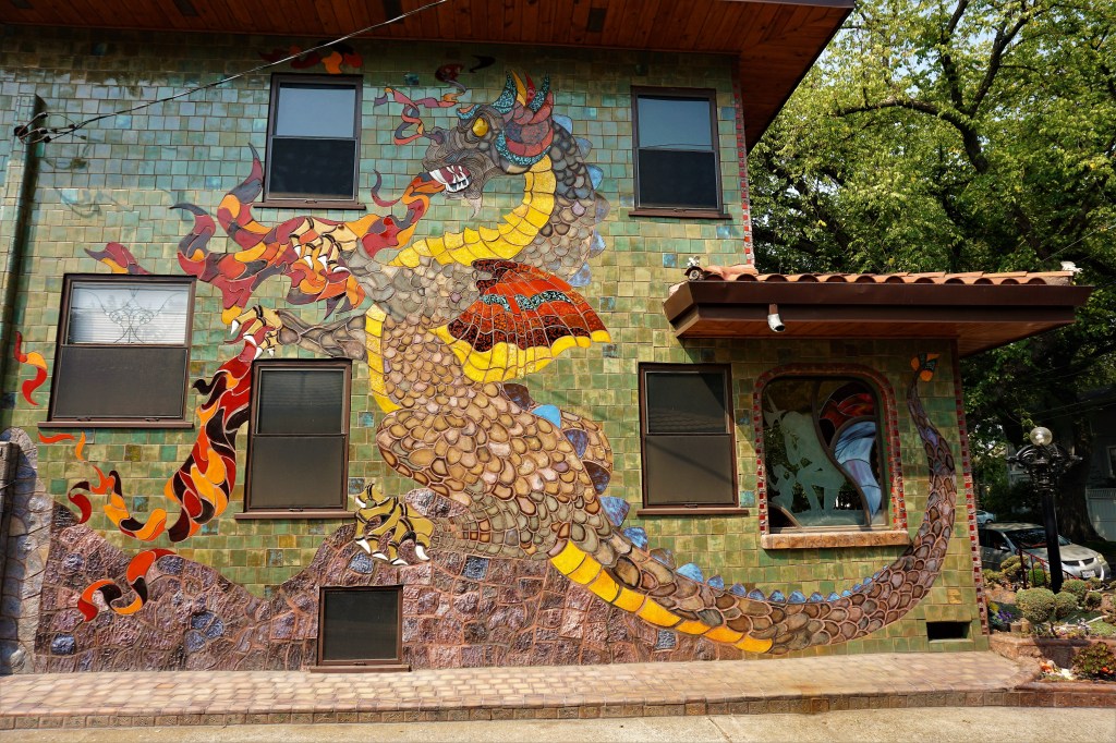
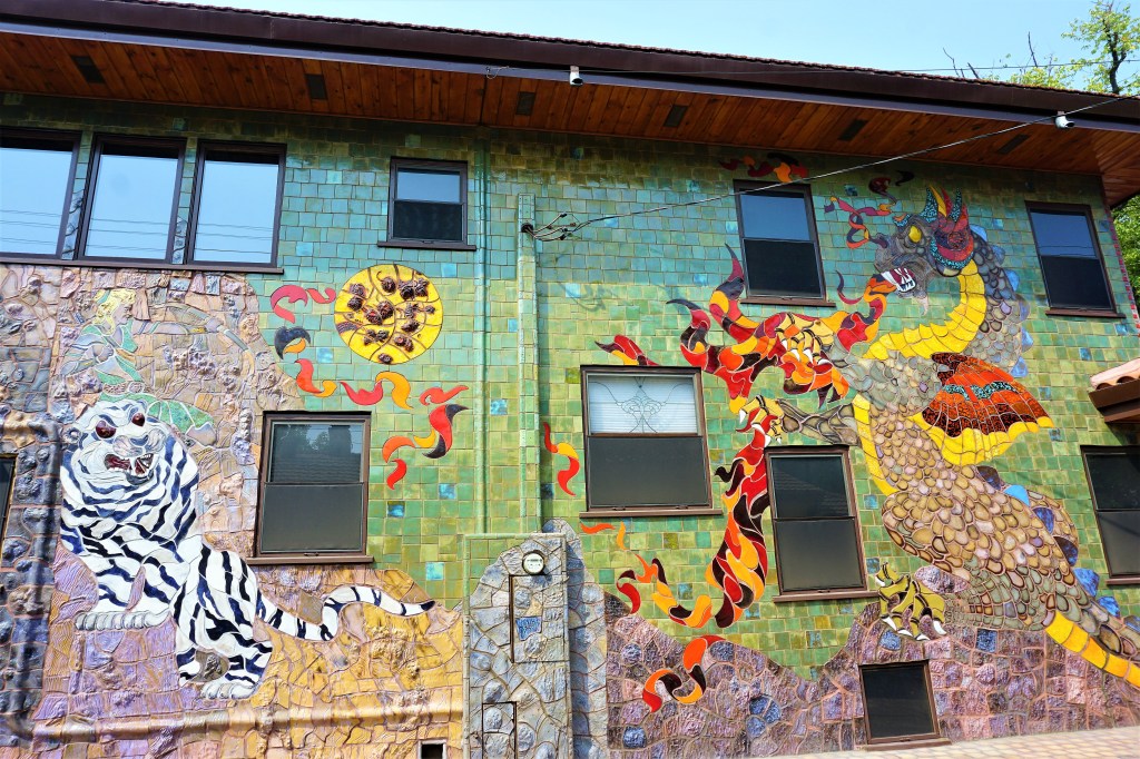
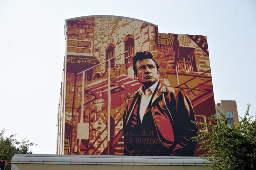
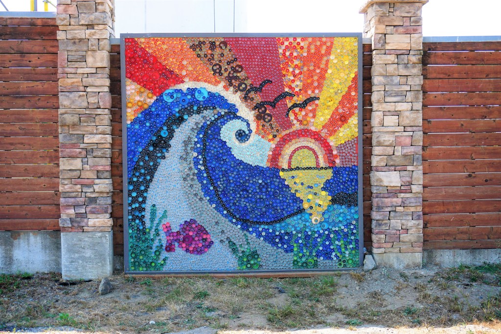
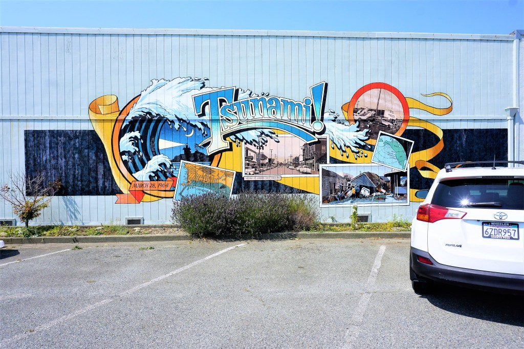
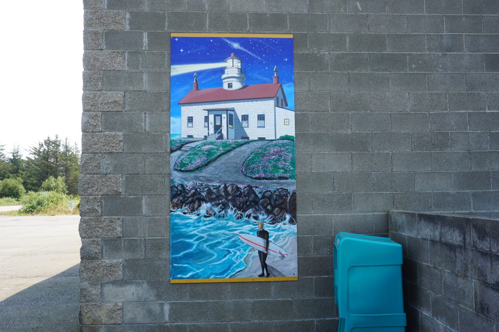
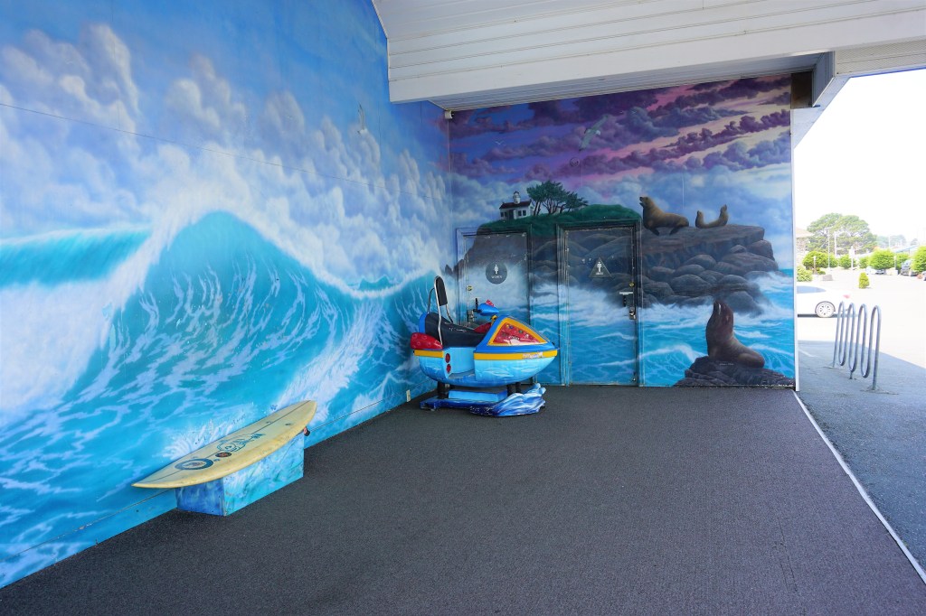
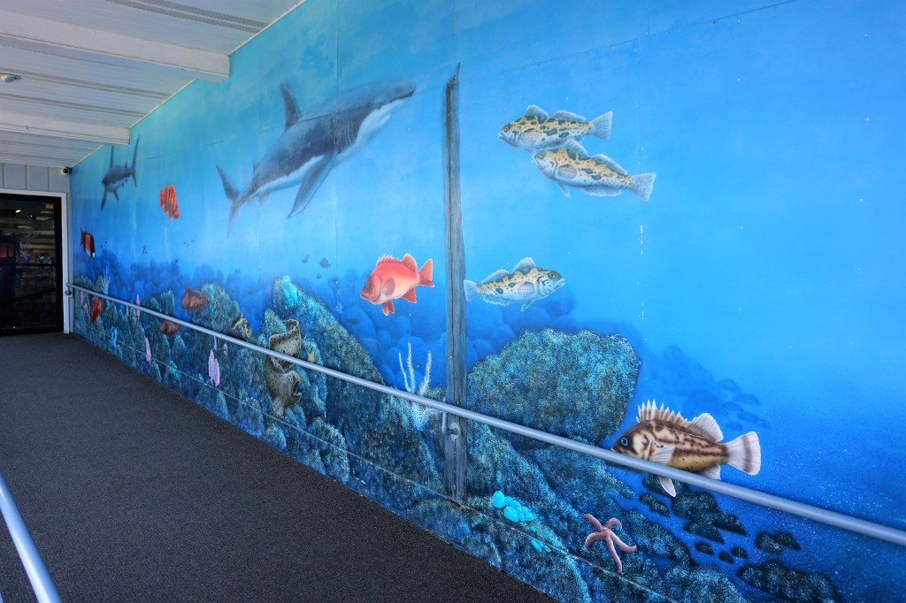
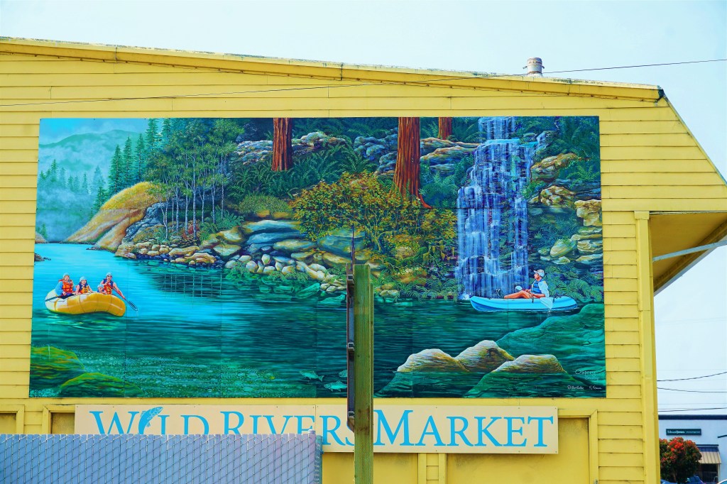
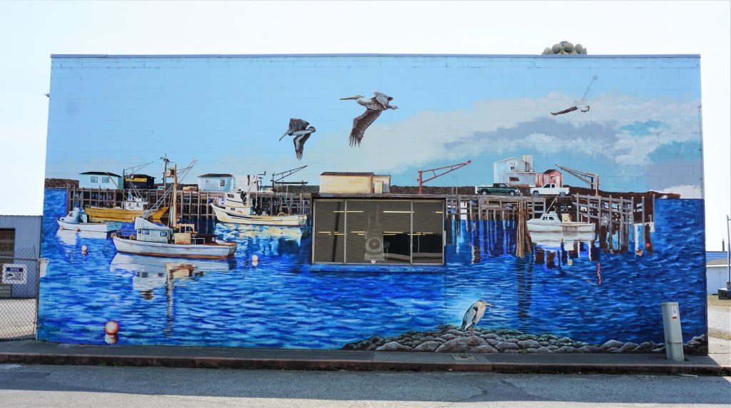
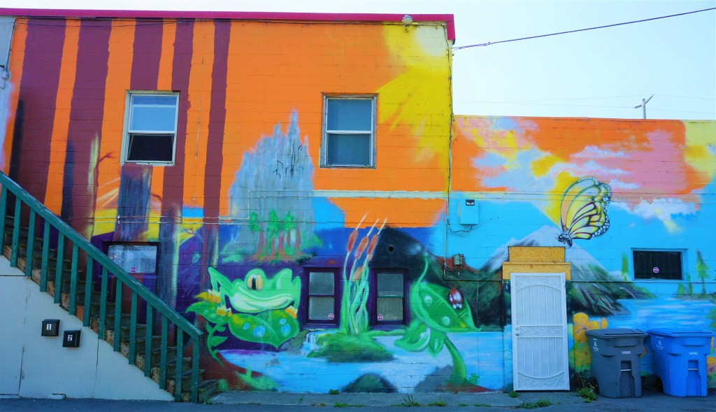
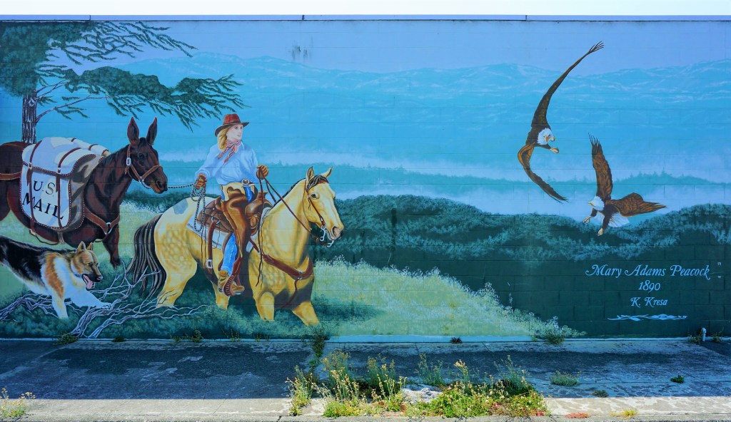
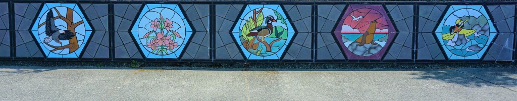
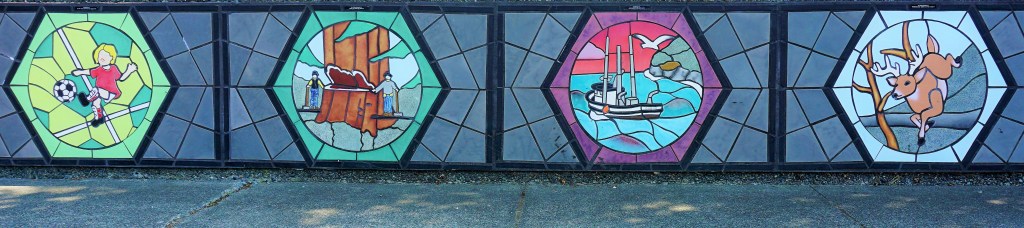
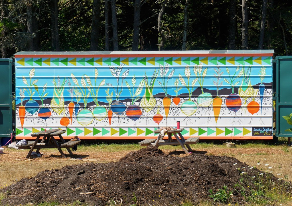
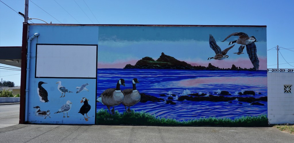
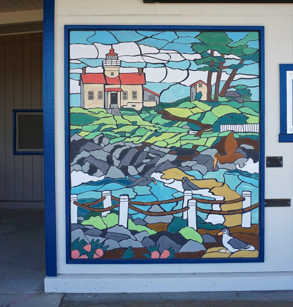
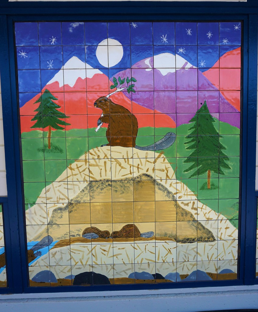
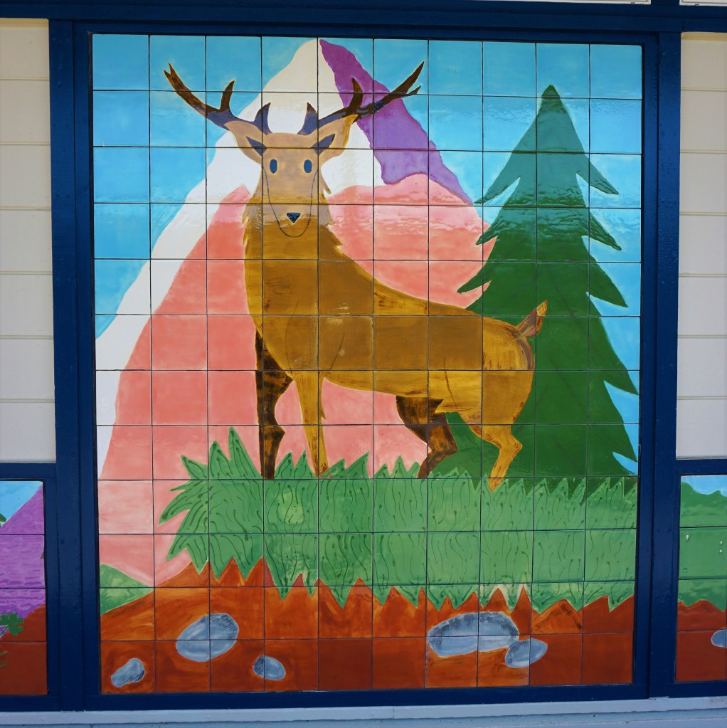
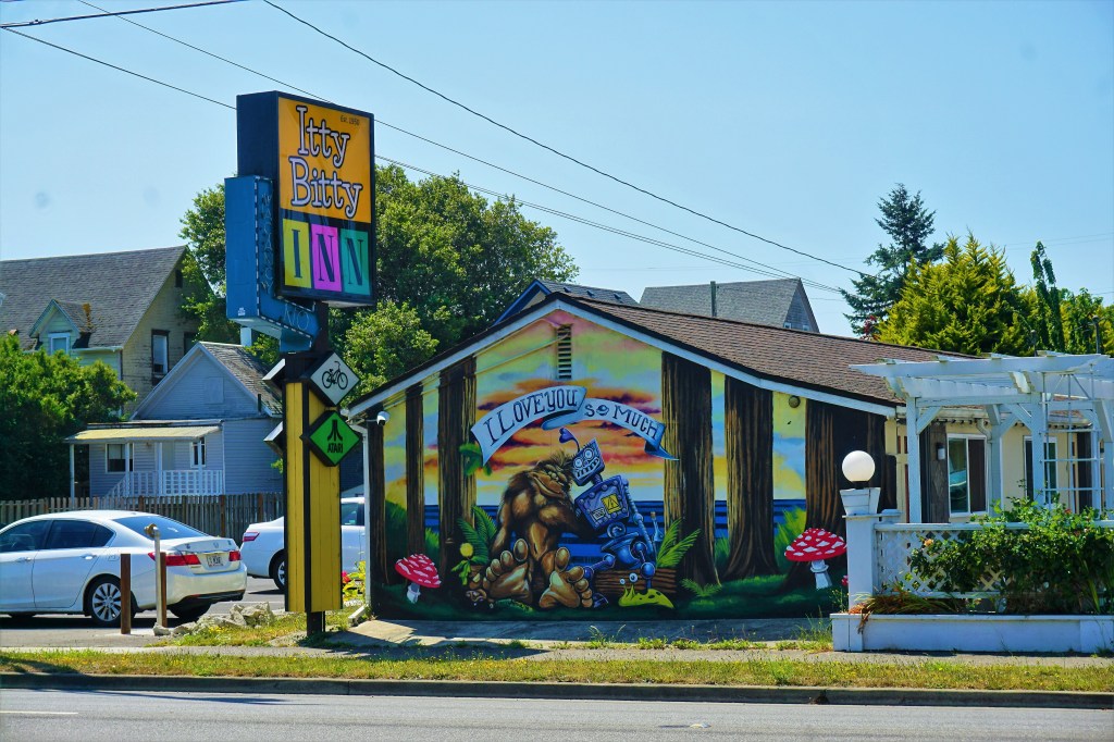
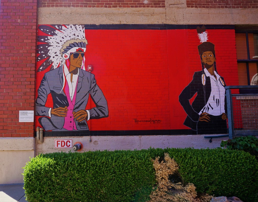
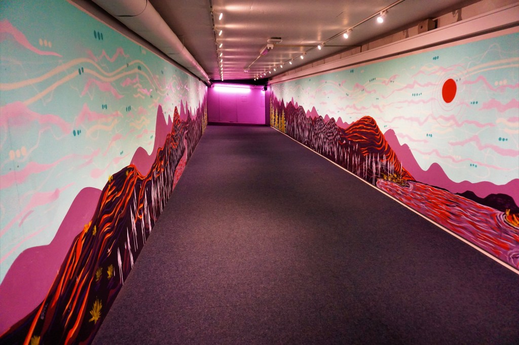
…just liked the mural…

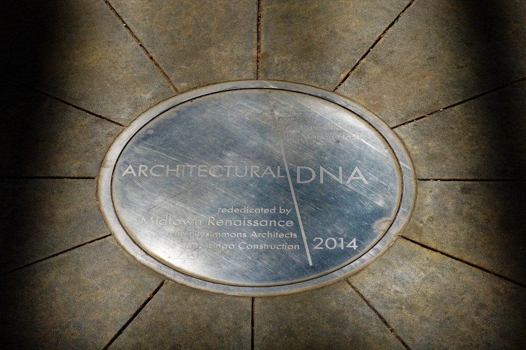
Originally built in the early 20th century, a now rusted spiral fire escape was salvaged from the nearby Marion Hotel in downtown OKC. It was then suspended between two buildings as a quirky piece of public art and named after the double helix it resembles.

Just down the street from the Architectural DNA sculpture sits Frontline Church. Barbara admired the architectural style of the building.

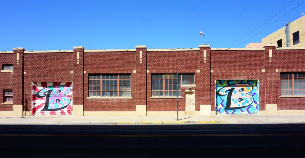
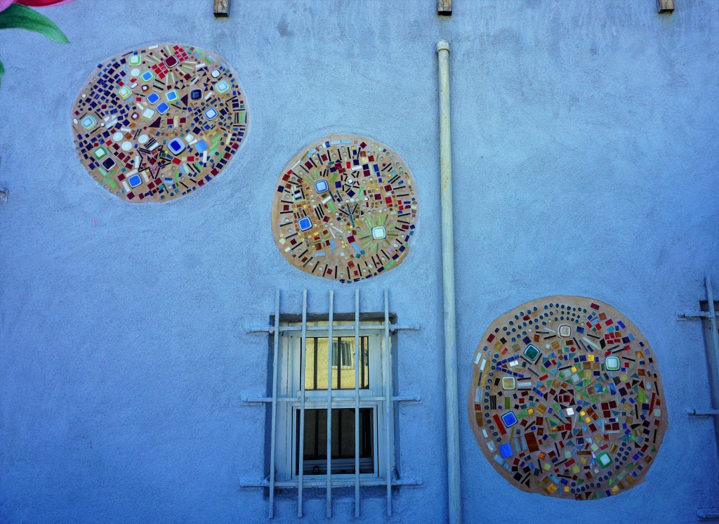
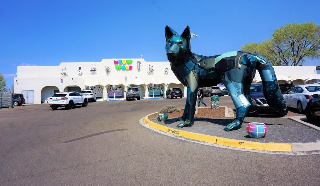
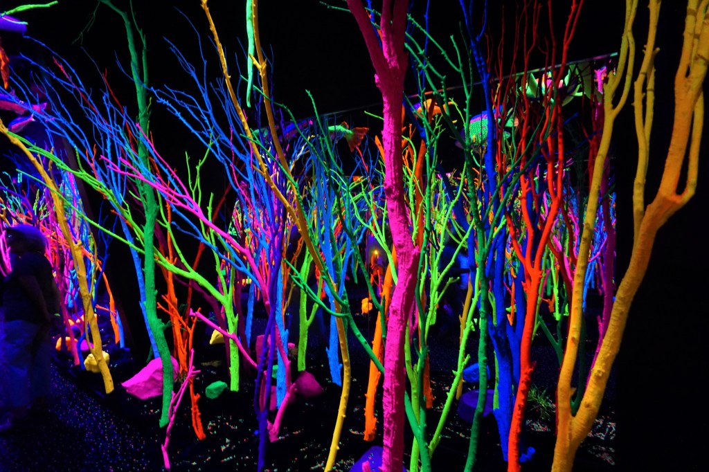
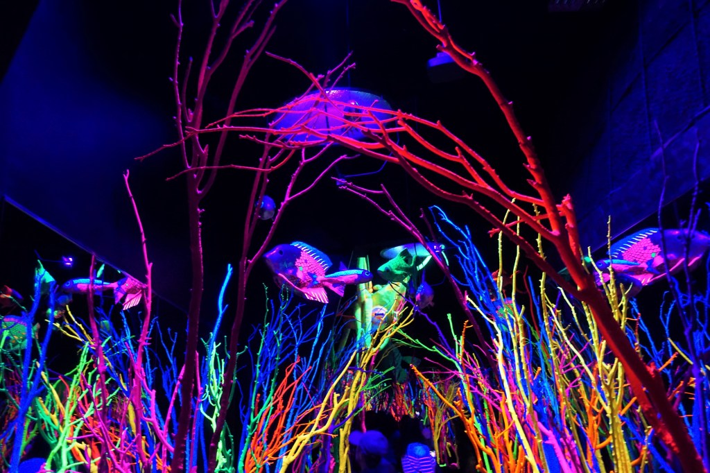
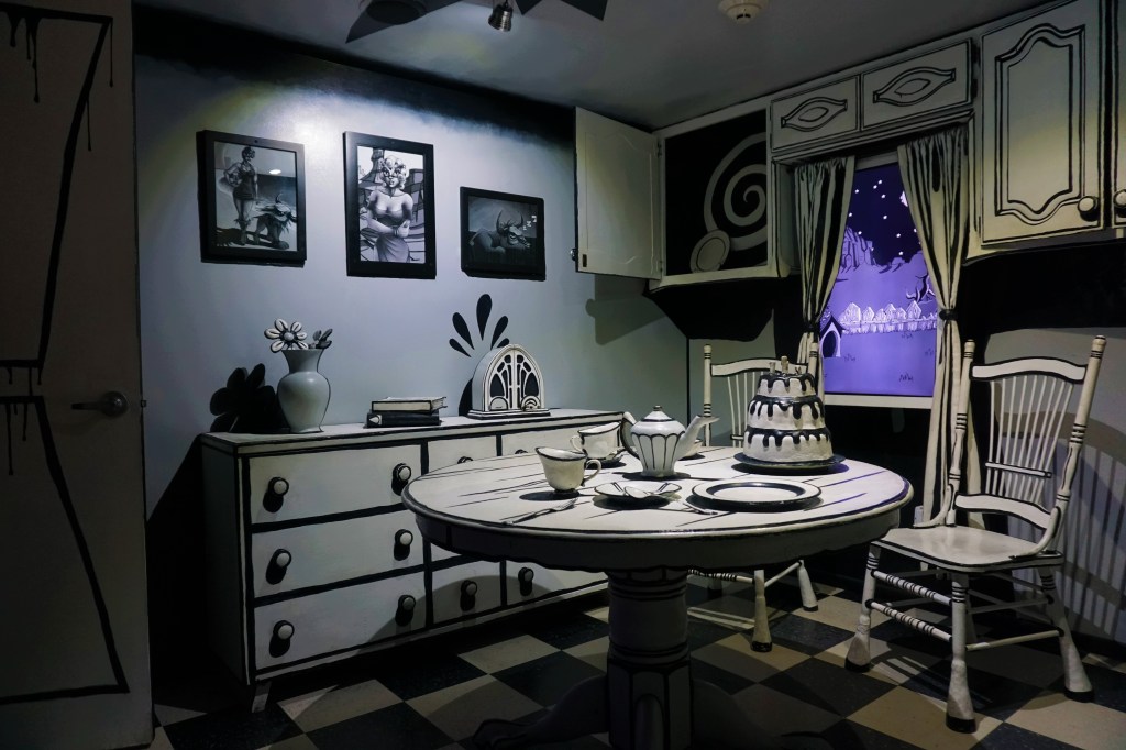
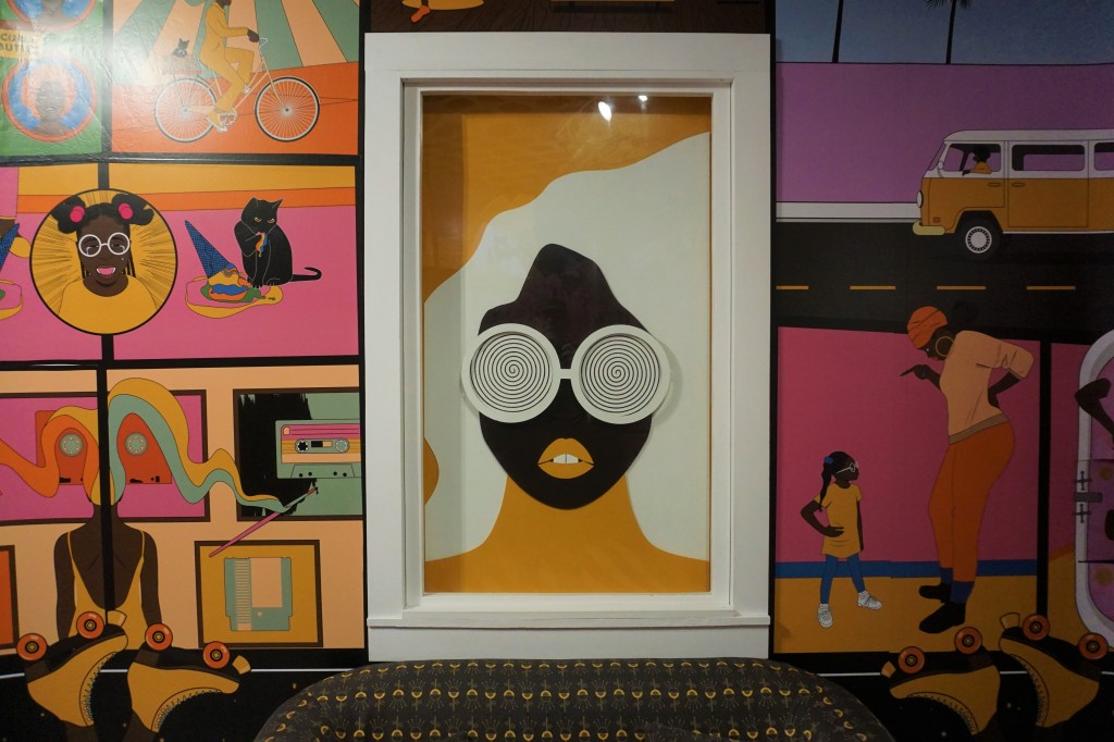
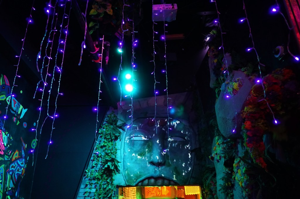
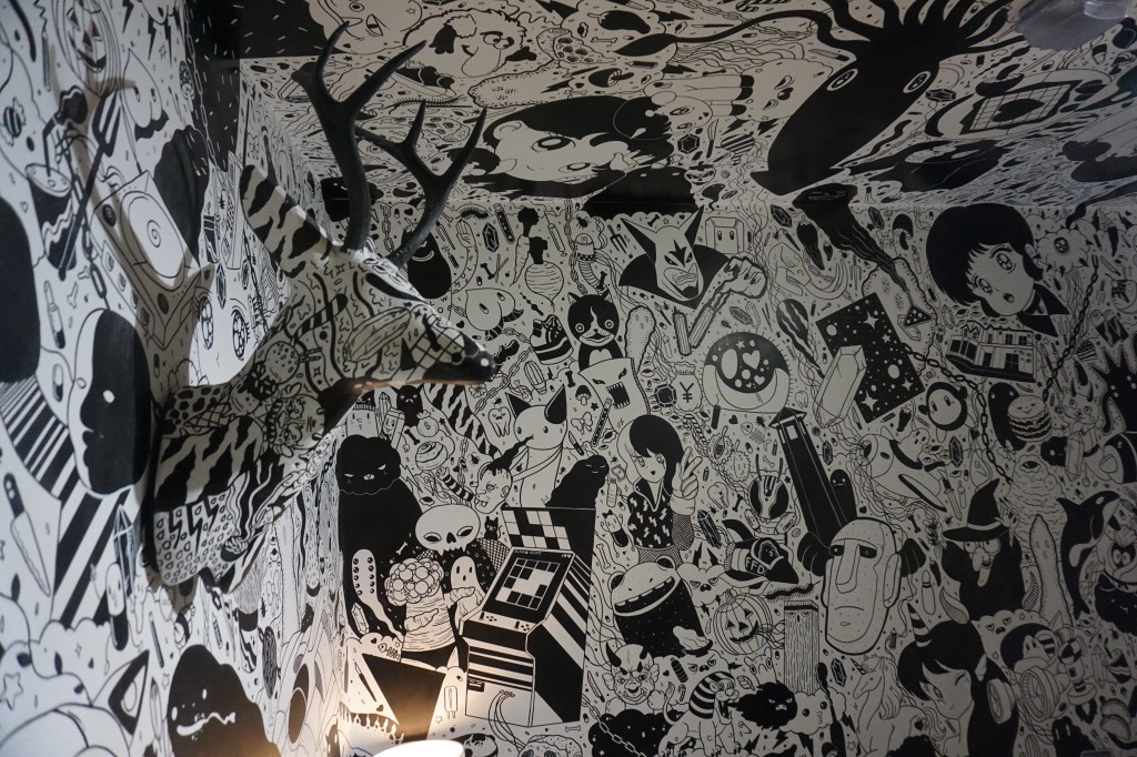
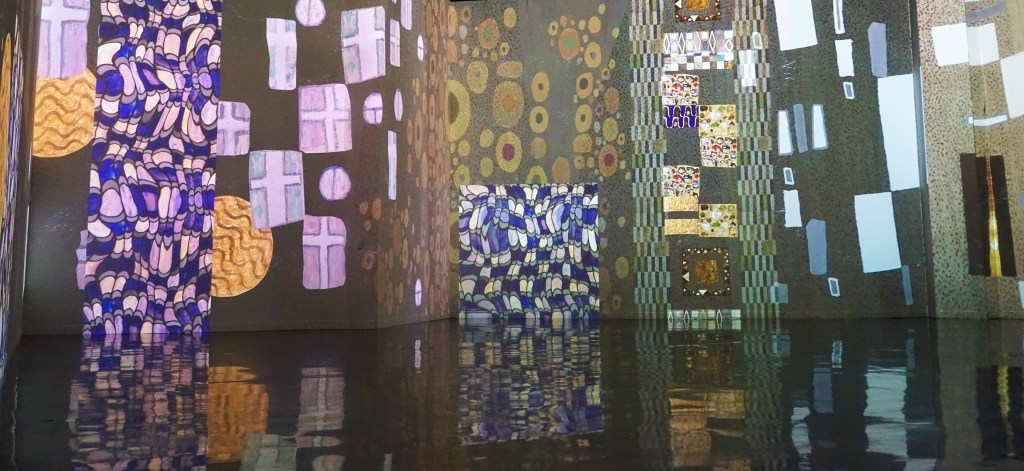
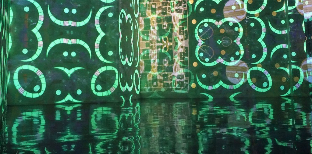
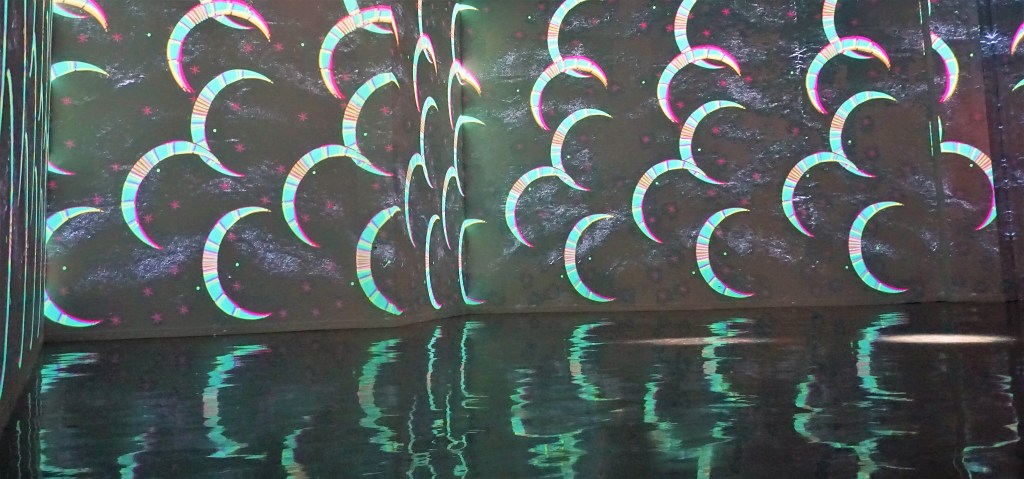
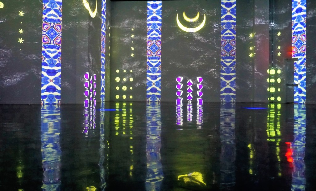
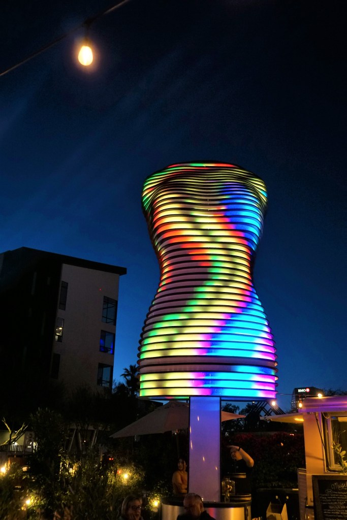
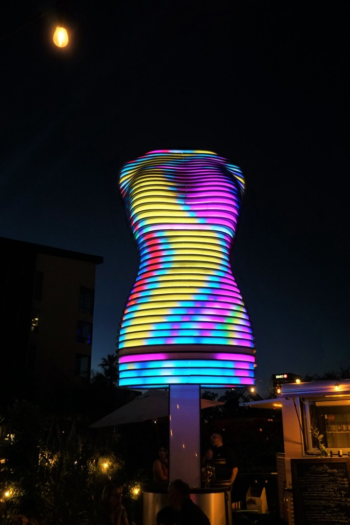
Check out Factory Obscura, which states it is “a city-based collaborative company creating immersive experiences that awaken wonder, build community and make the world better.” Sounds like a local version of Meow Wolf? We just liked the front of the building.

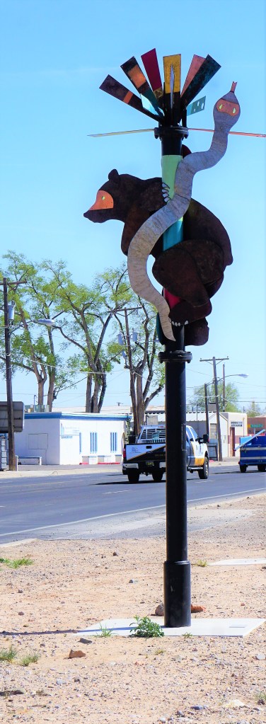
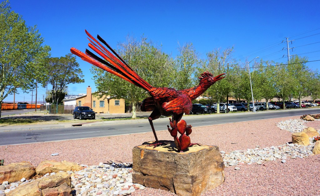
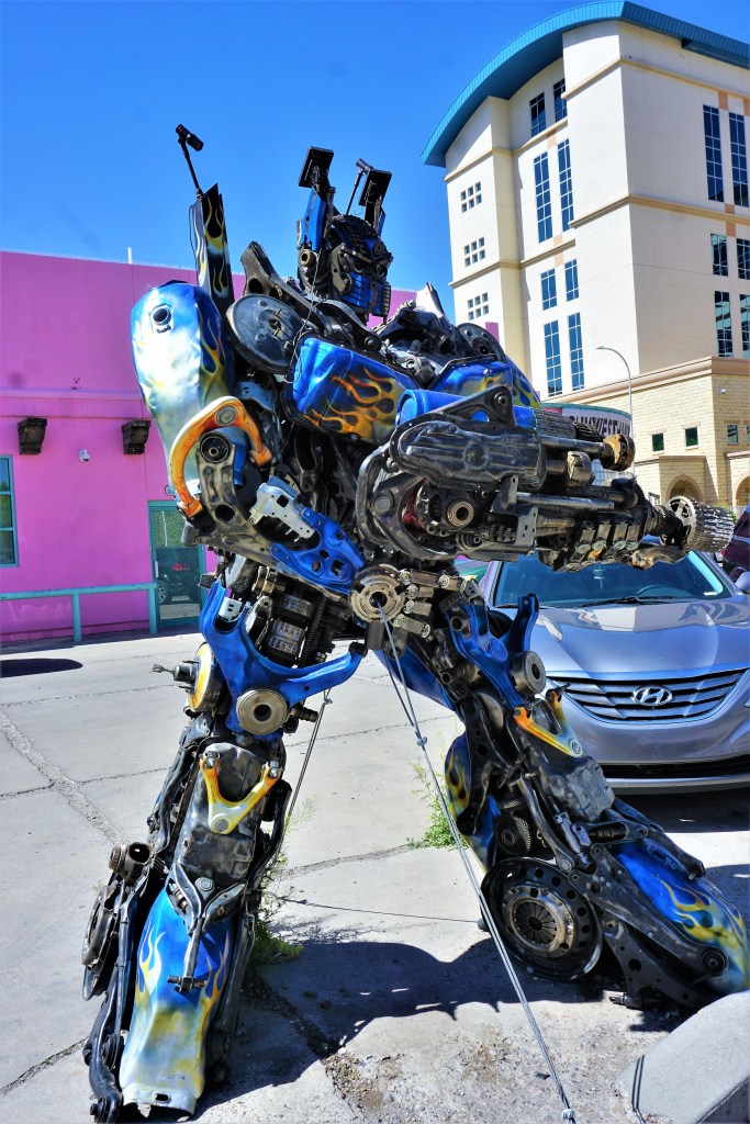
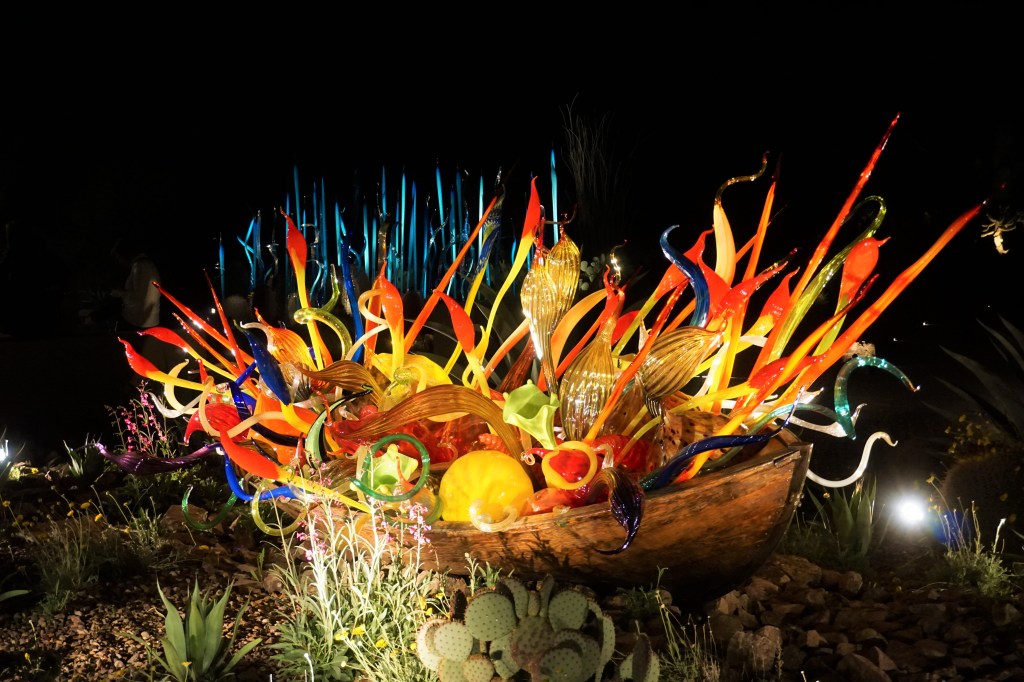
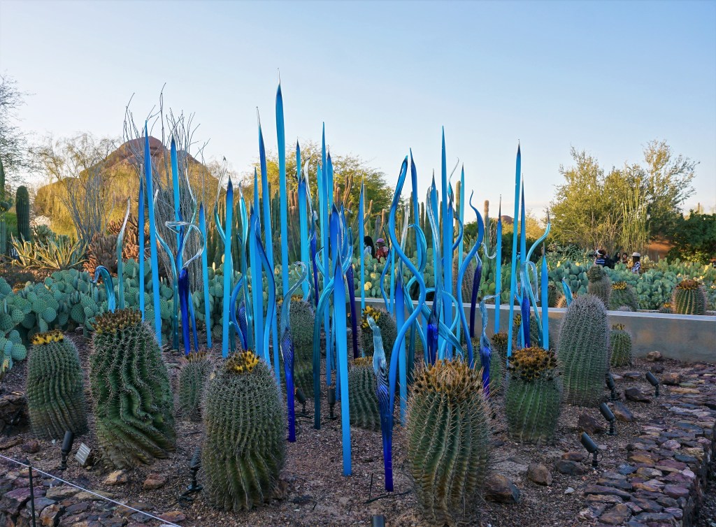
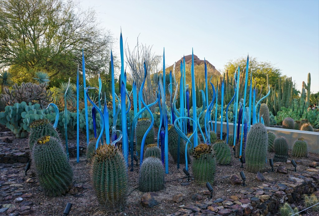
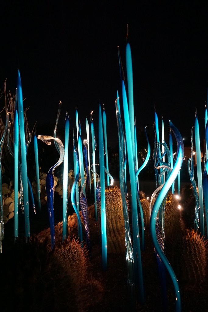
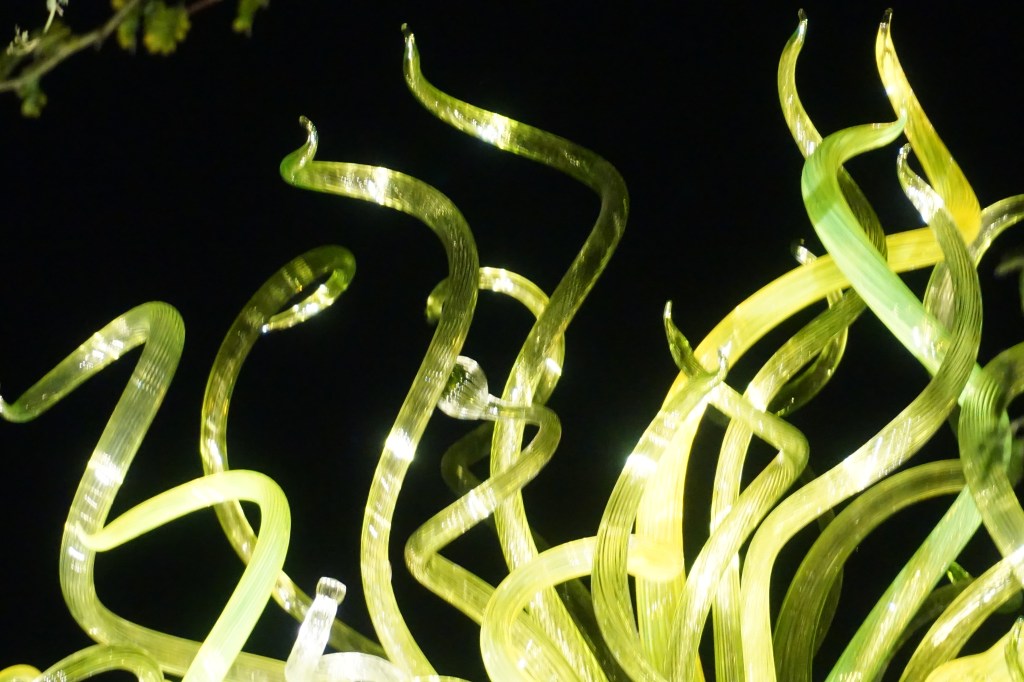
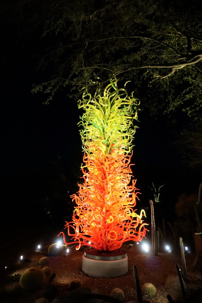
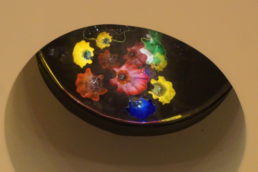
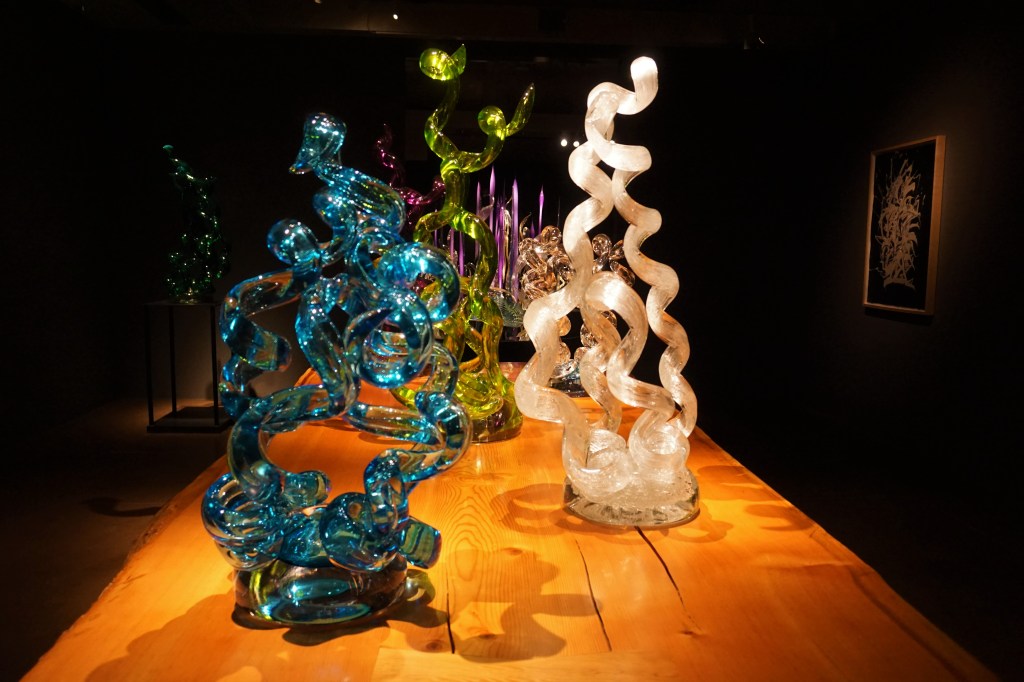
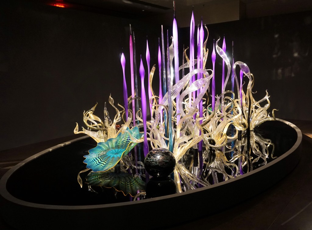
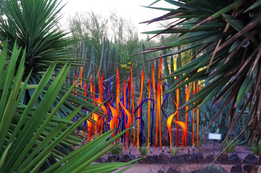
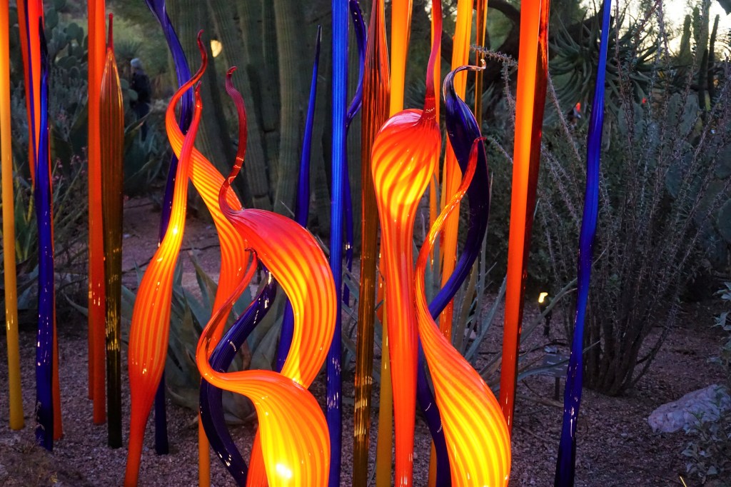
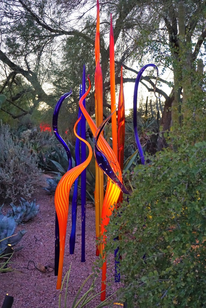
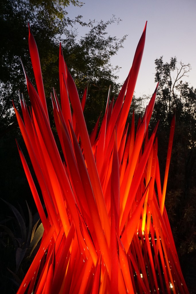
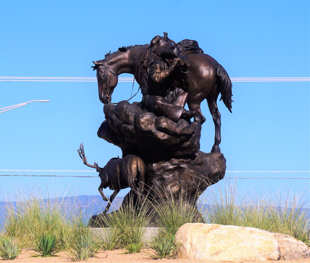
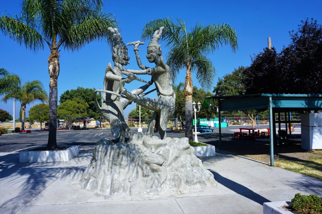
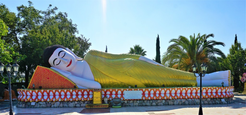
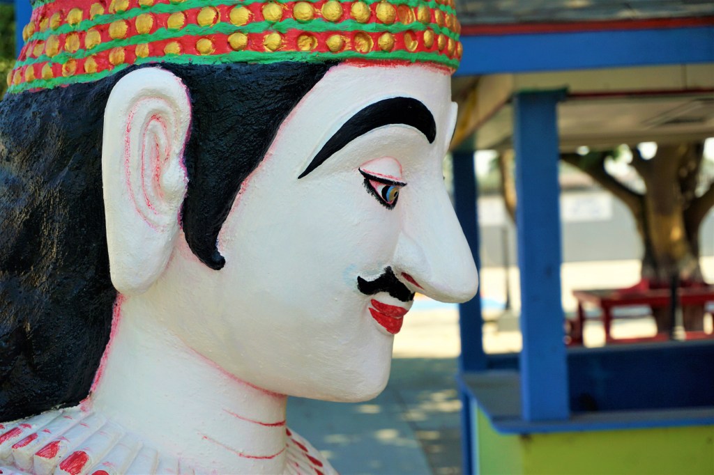
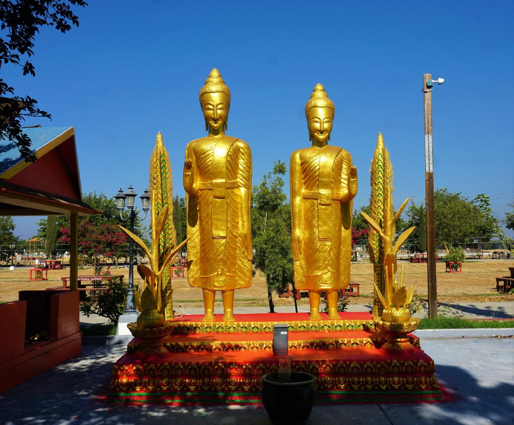
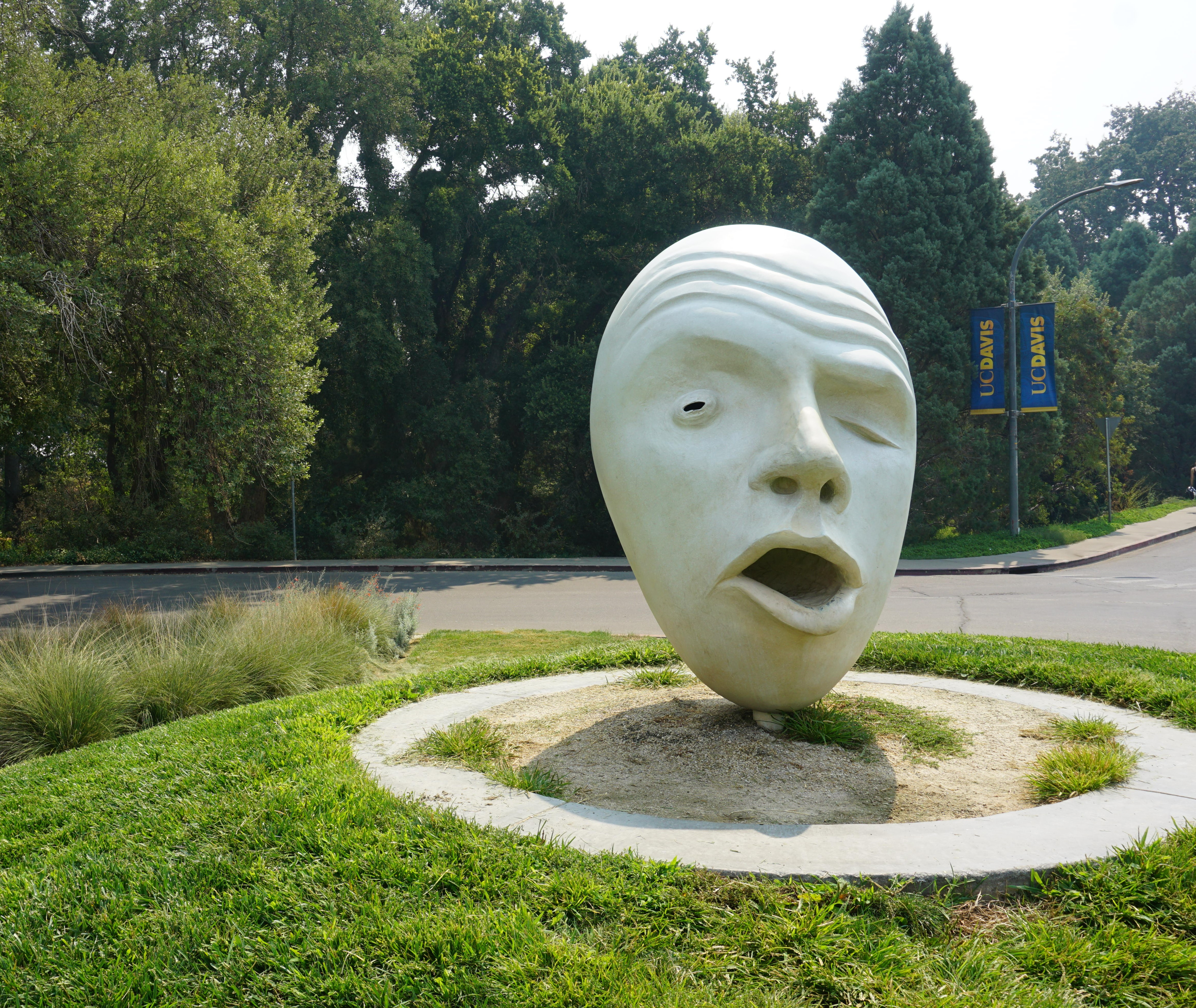
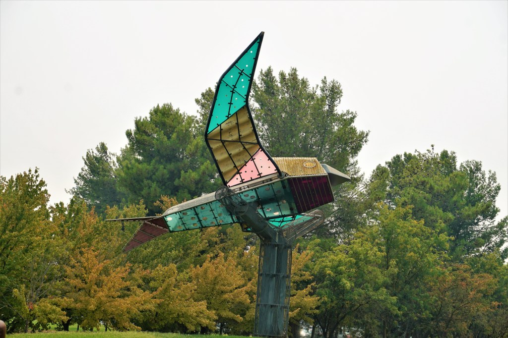
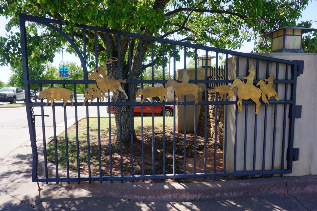
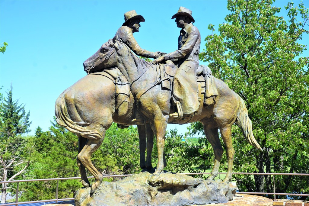
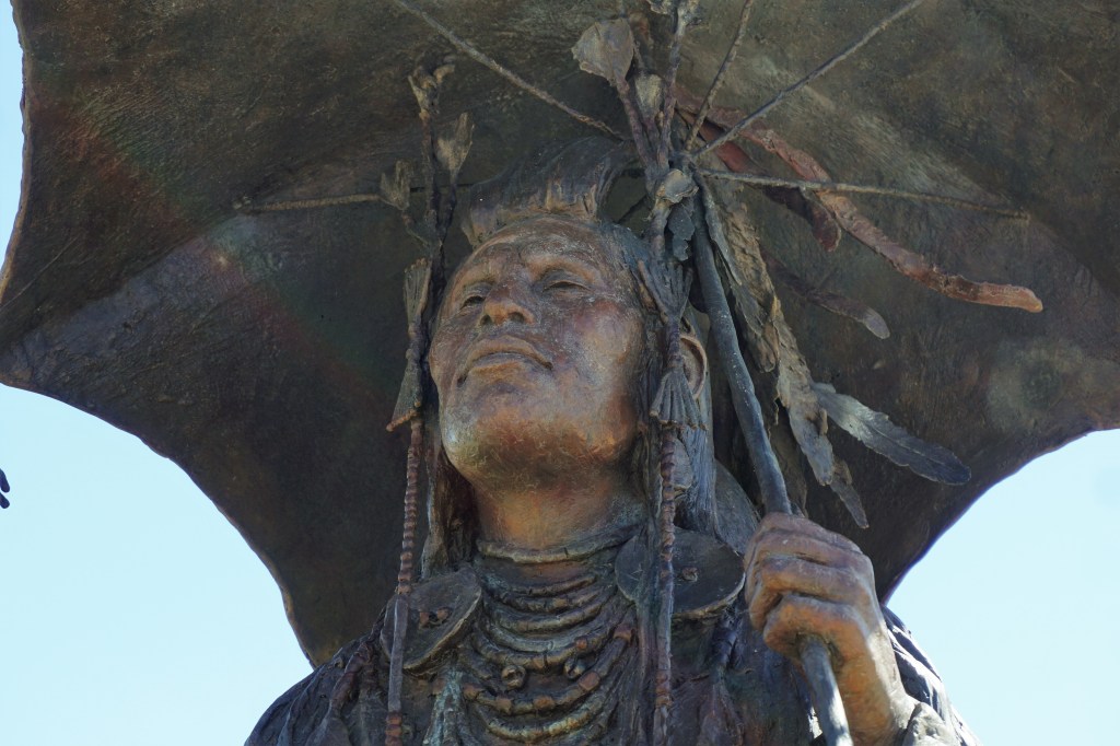
We toddled on over to the National Cowboy and Western Heritage Museum because there were reportedly some pretty impressive sculptures on the grounds. The bright sun made photographs difficult, but Brian did capture a few shots to reflect the quality of the artists’ skill.

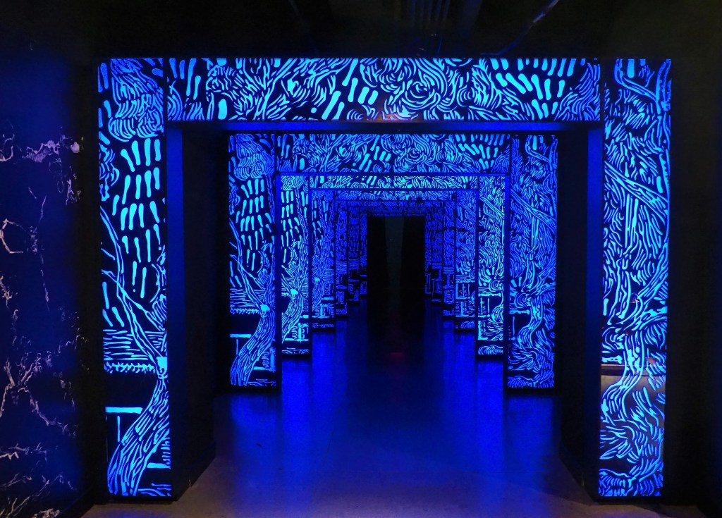
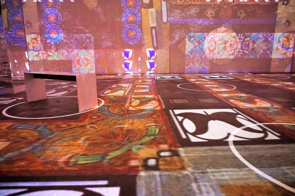
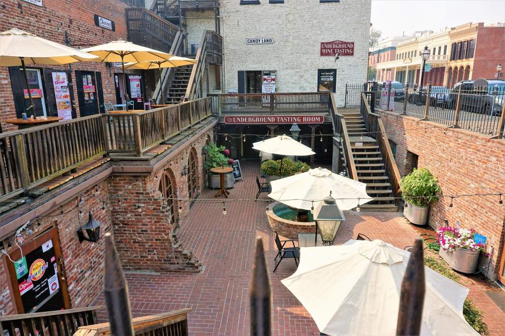
Atlas Obscura finally failed us. It described the OKC Underground as: “over 20 city blocks, filled with art and history exhibits that illustrate the individuality of the state and its residents. There is no one entrance to the Underground, but rather many secretly well-known entrances scattered throughout downtown. Opened in 1974 the series of tunnels stretches for about a mile underground and includes a plethora of stores, shops, and even a post office.”

Well, nope.

Yes, it was underground. Yes, there are any number of entrances, secret or not all over downtown. But what we found was a winding array of differently colored neon lit walkways, some with photographs of times gone past (too much florescent lighting and reflection off of the glass for photography), but no shops, stores, restaurants or post office. Nice little walk with thoughts of what once was or maybe never was?

Apparently Not One Of The Secret Entrances

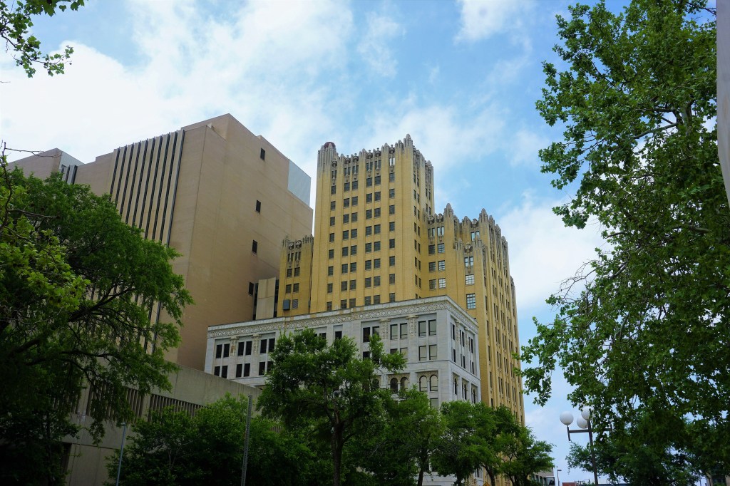
Barbara loved the juxtaposition of old and new architecture…

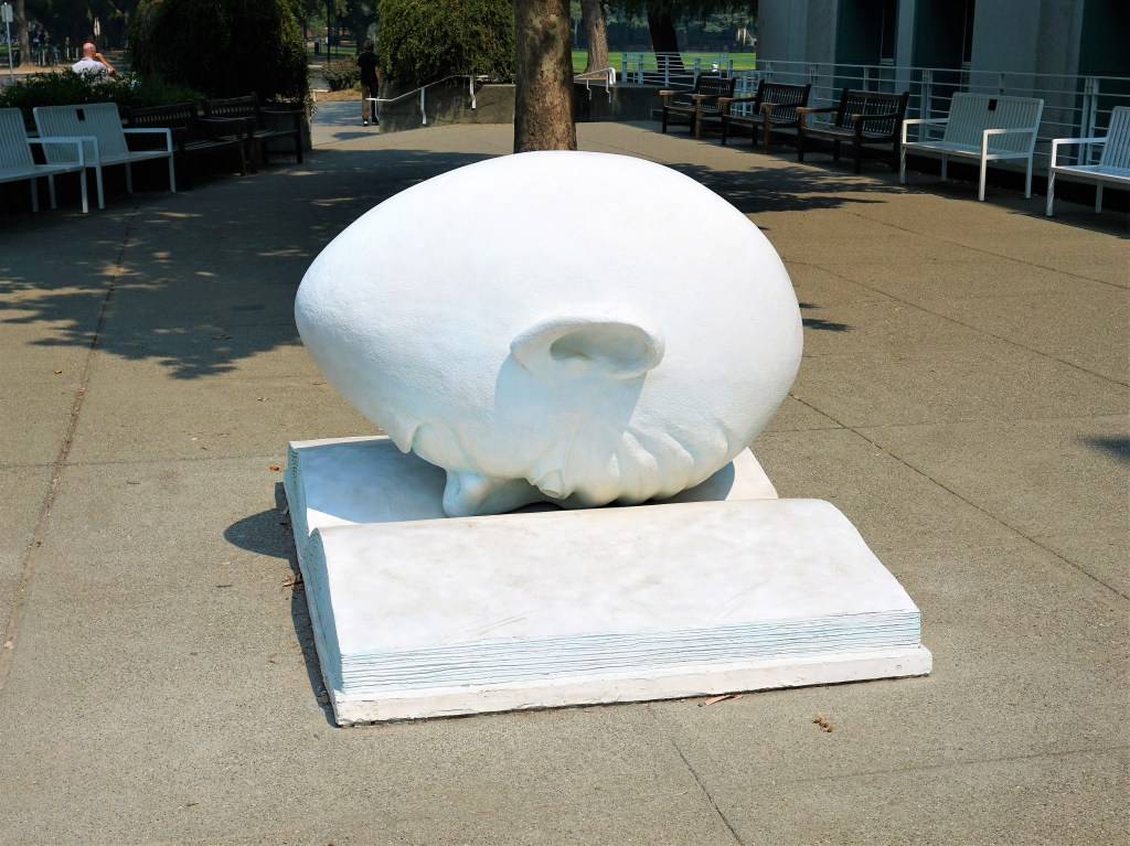
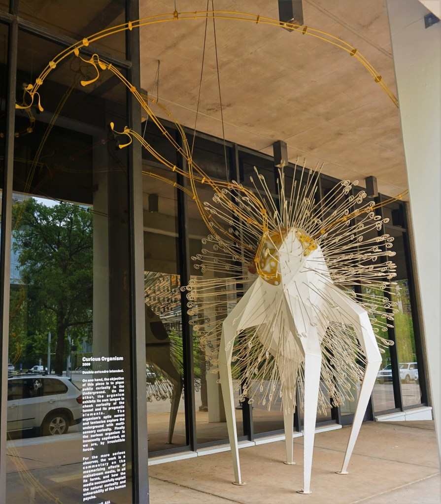
“Curious Organism” is a 2009 steel sculpture by Stan Carroll, resembling a bacterium surrounded by cilia, standing on four legs.

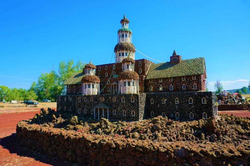
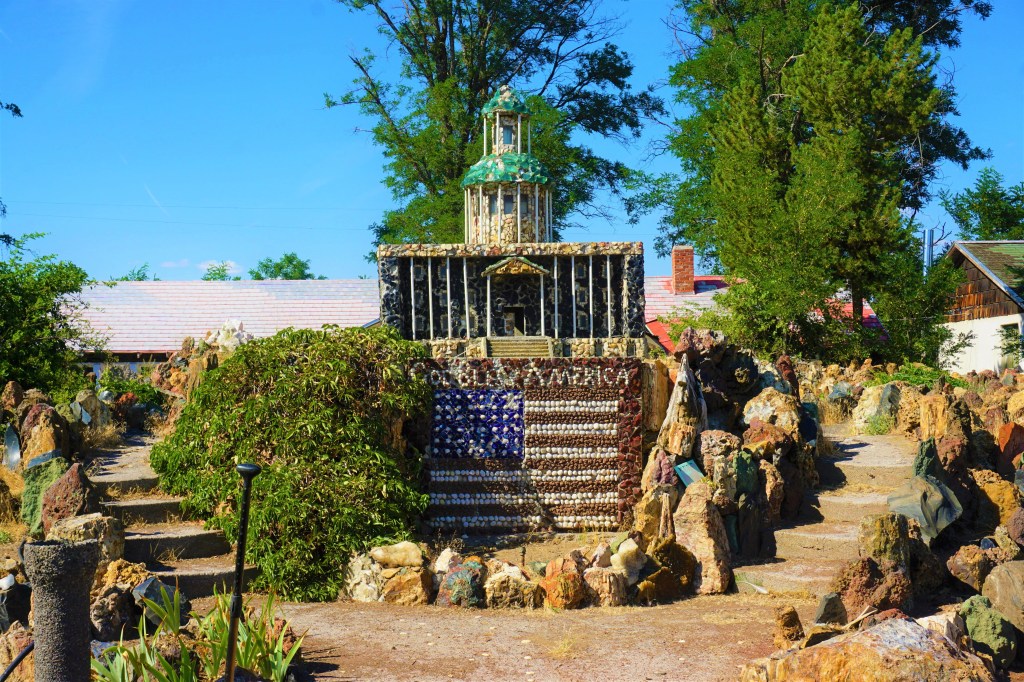
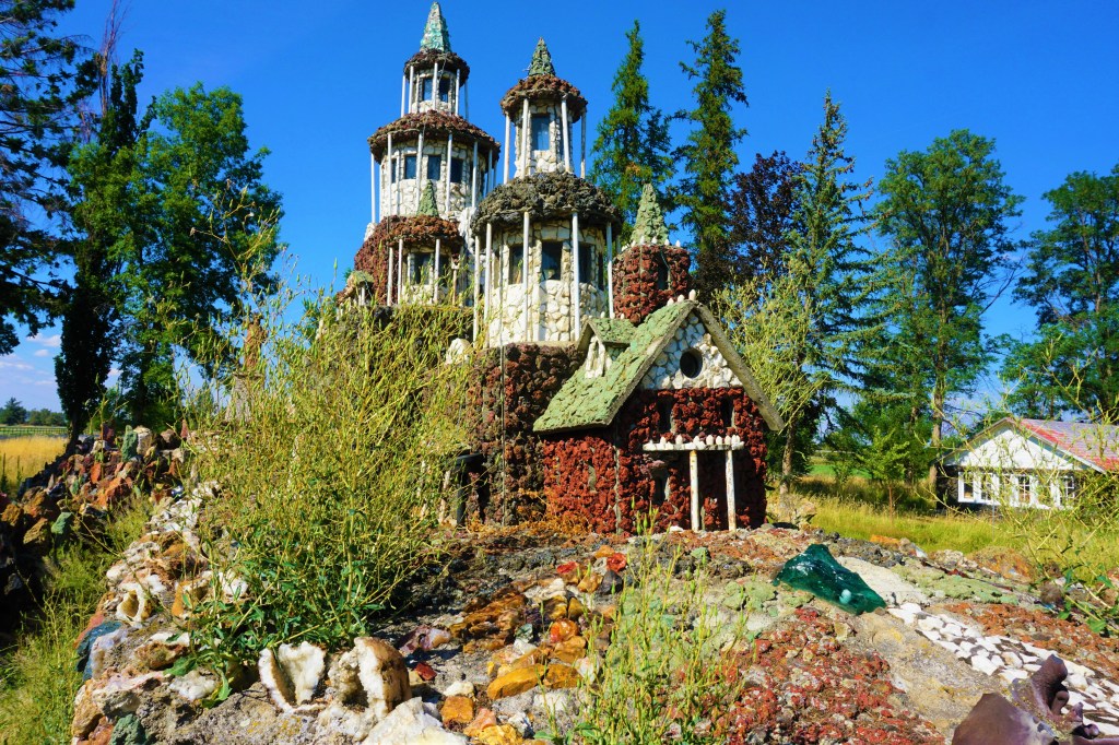
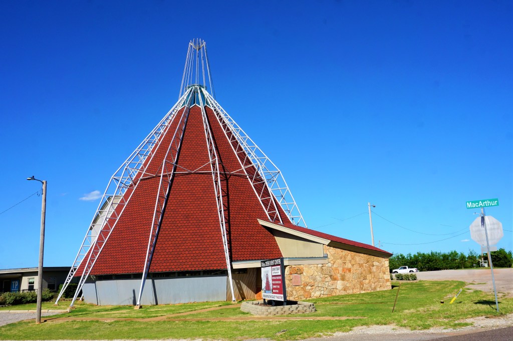
The Hopewell Baptist Church was built in the 1950s by roustabouts and roughnecks using oil field parts (e.g., drill pipes used for exterior supports) and made to resemble a teepee. Due to maintenance issues the church was abandoned in the 1980s and the congregation moved temporarily to a structure next door. With renovations funded by the generosity of a private donor the church has been able to reopen.

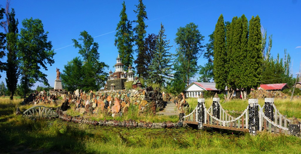
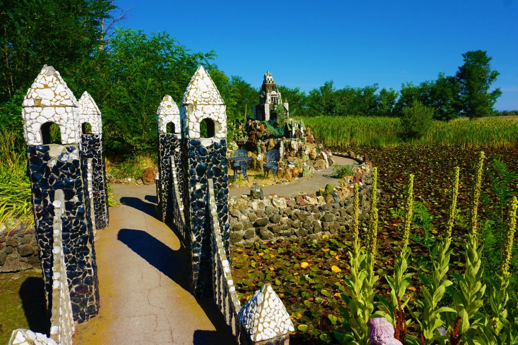
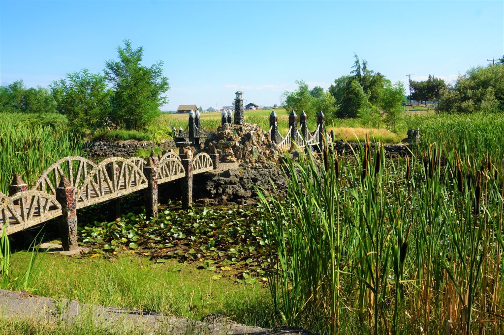
The Arcadia Round Barn was built in 1898 by a local farmer named William H. Odor. No one is sure how Odor came up with his design, or his rationale as to why this barn must be round. But by building a loft underneath the open round ceiling and effectively splitting the building interior in two the barn proved to be useful for not only housing livestock and grains but for community-wide dances and events as well.

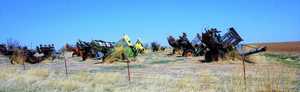
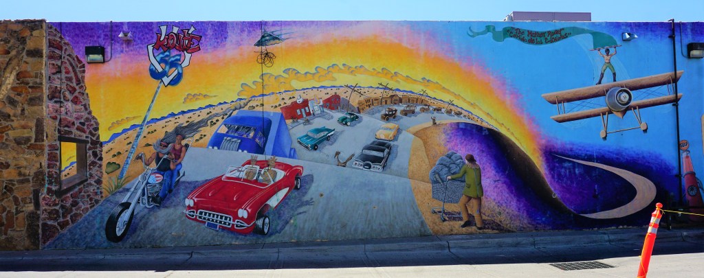
When The Mother Road wound its way past the Acadia Round Barn, visiting tourists found it enough of a curiosity for the structure to become an iconic stop.

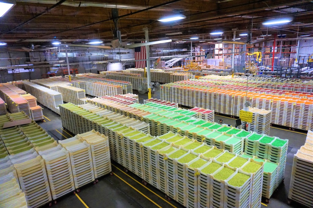
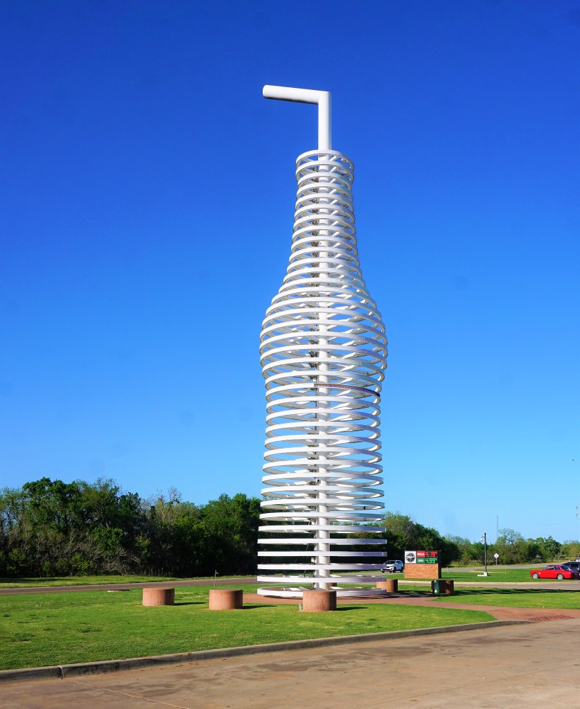
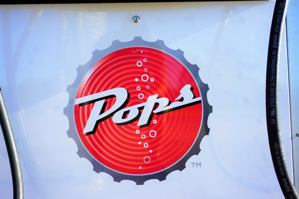
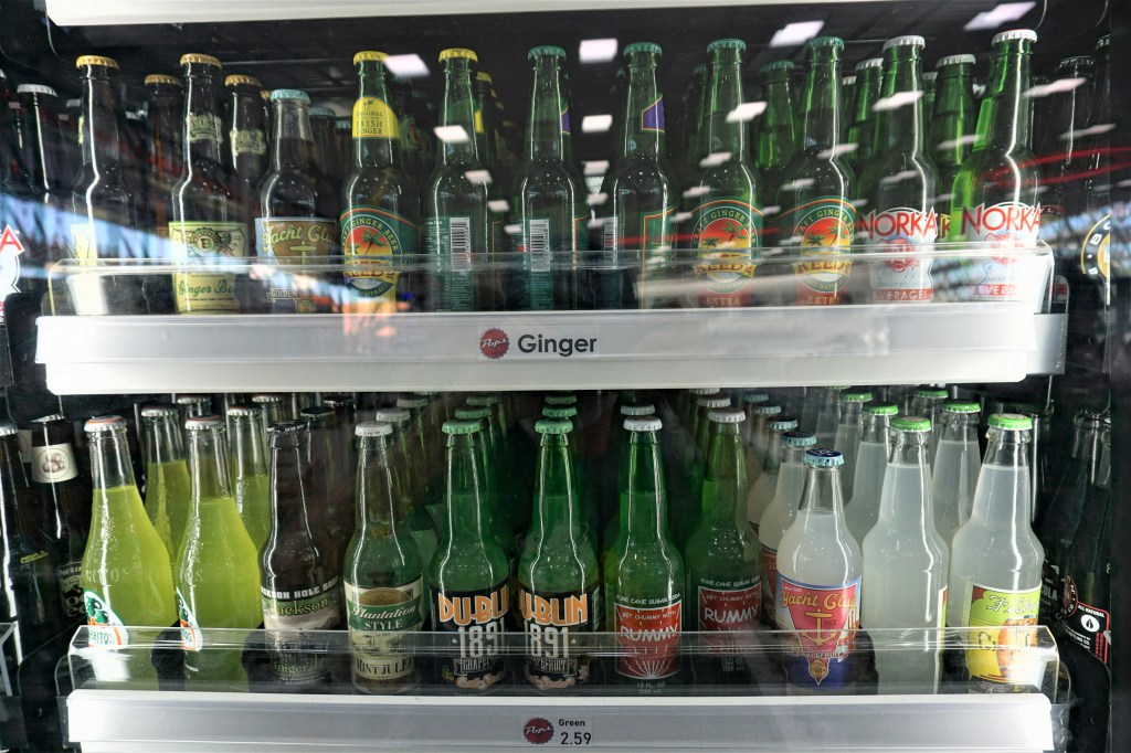
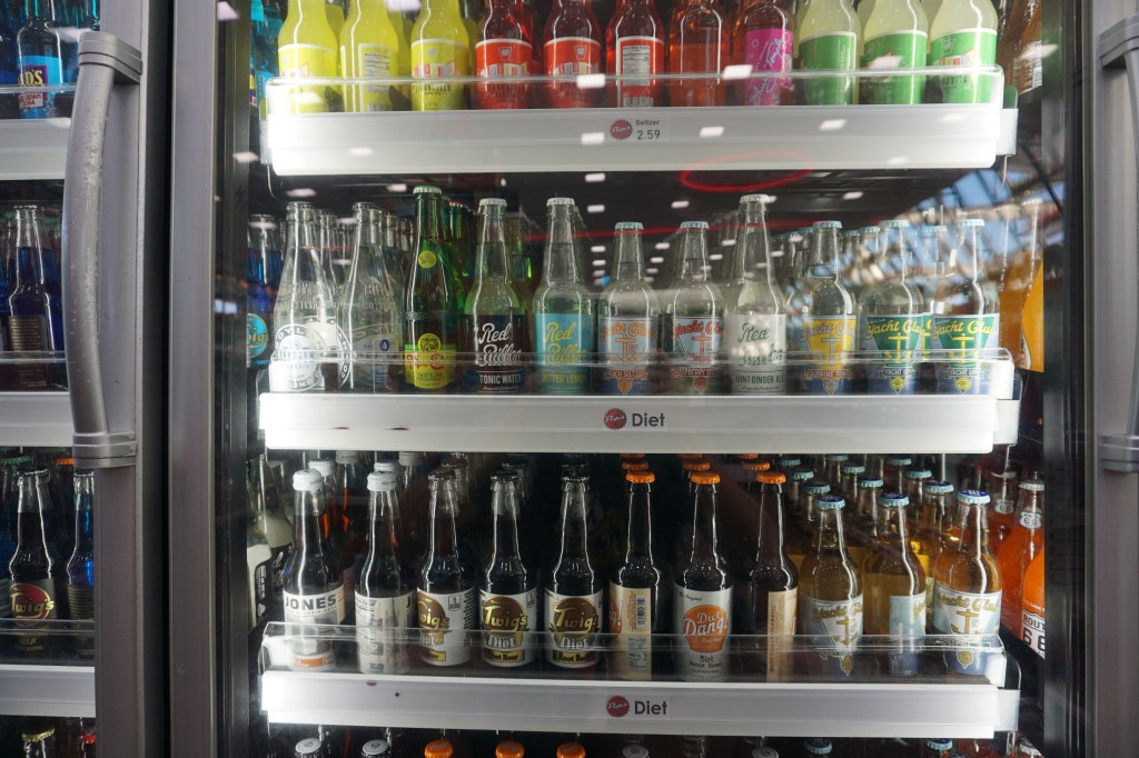
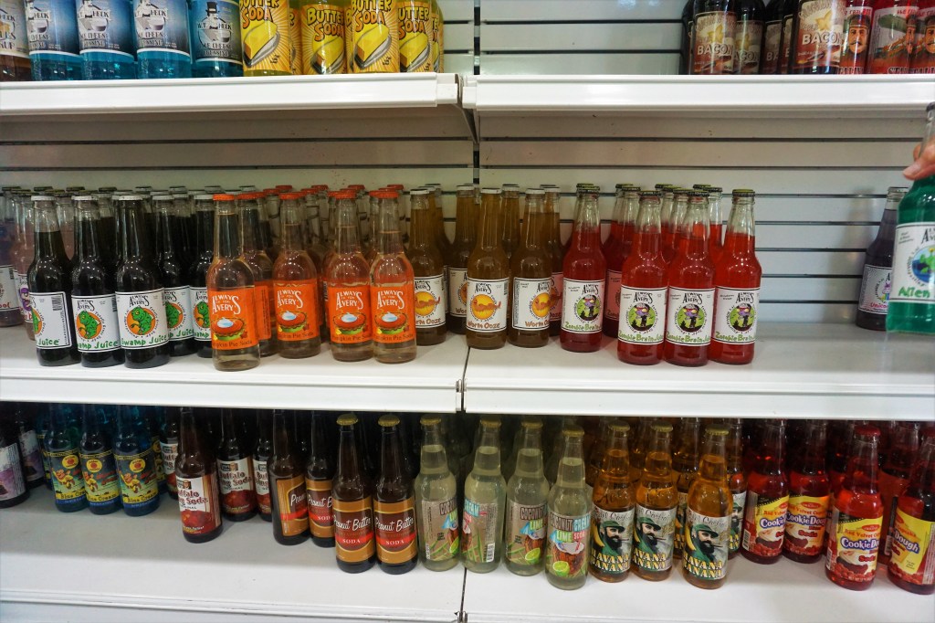
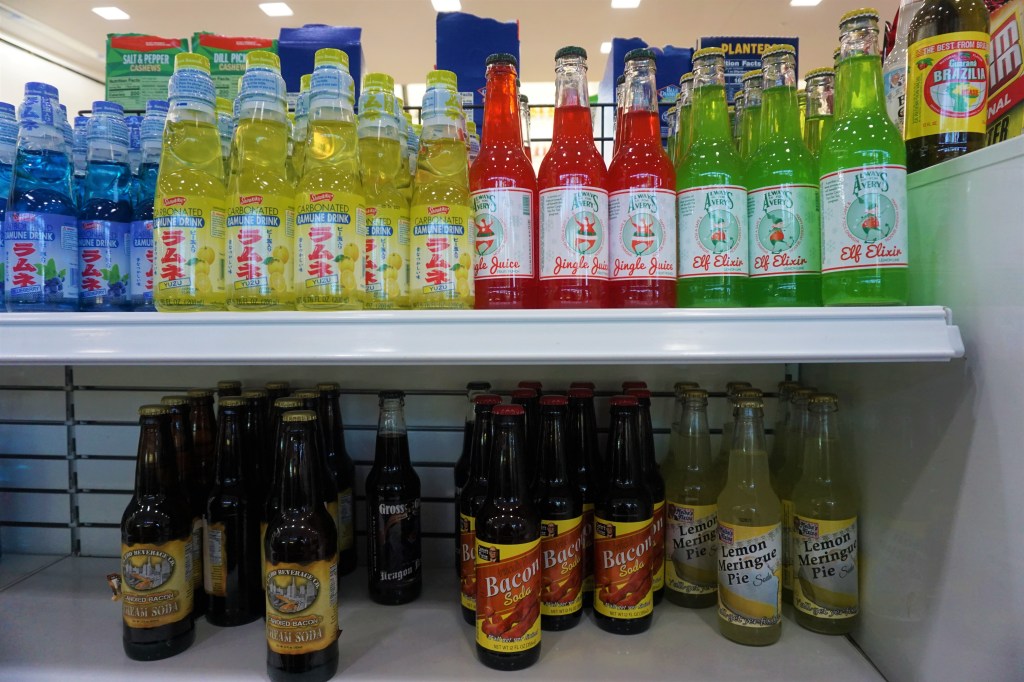
What is a gas station, restaurant and purveyor of over 700 different types of soda pop?

Pops was established in 2007 as a futuristic take on a classic roadside attraction. The building itself is designed in an ultra-modern style, all angular steel and glass, and once Inside a huge wall of soda bottles greets the visitor and draws well-earned stares. But it’s the stroll through the coolers and shelves bursting with so many types and brands of bottled soda pop from around the world that is just the best! It’s near impossible to resist buying a bottle or 2 or to purchase a pick-your-own 6-pak. What flavors would you try?

66-Foot-Tall Neon Soda Bottle
Wall Of Bottles Arranged By Color

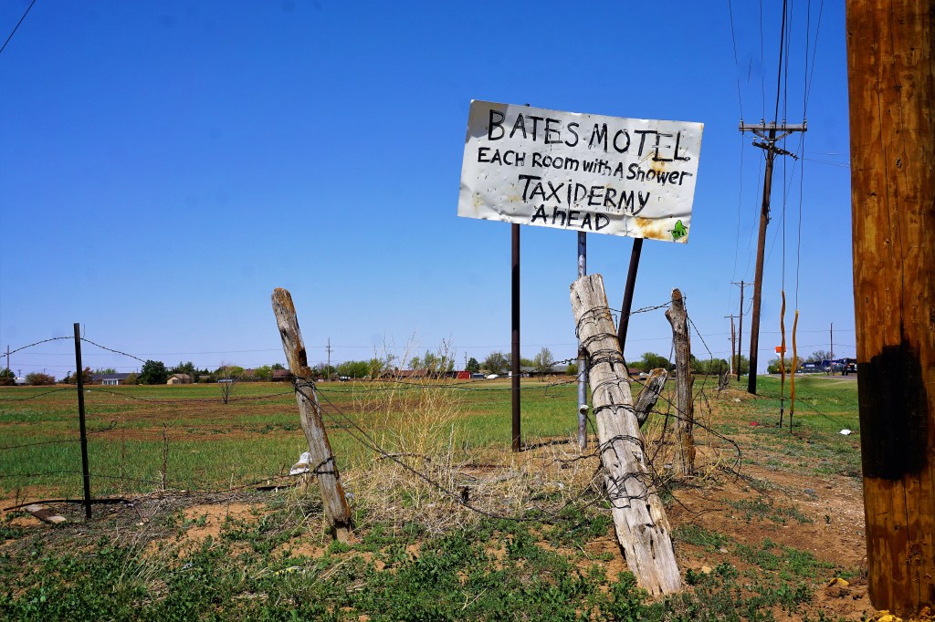
…check out the names…

No Pepsi Or Coke Products Found Here

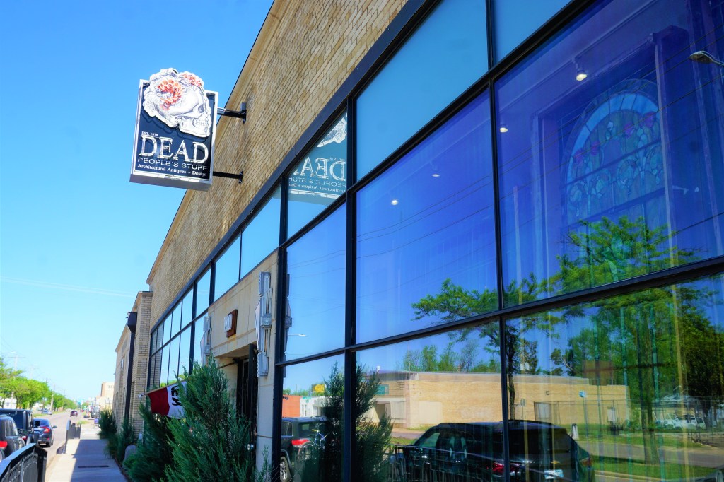
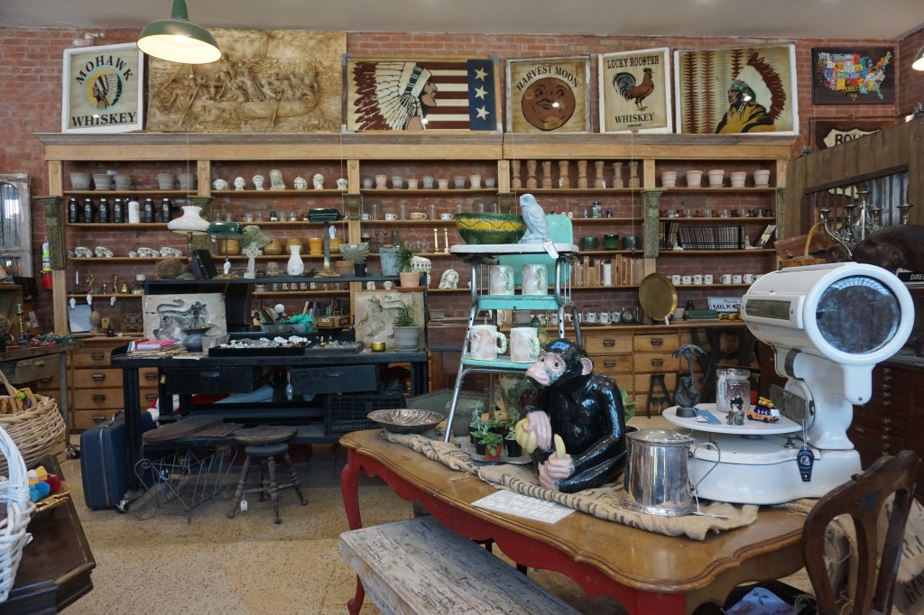
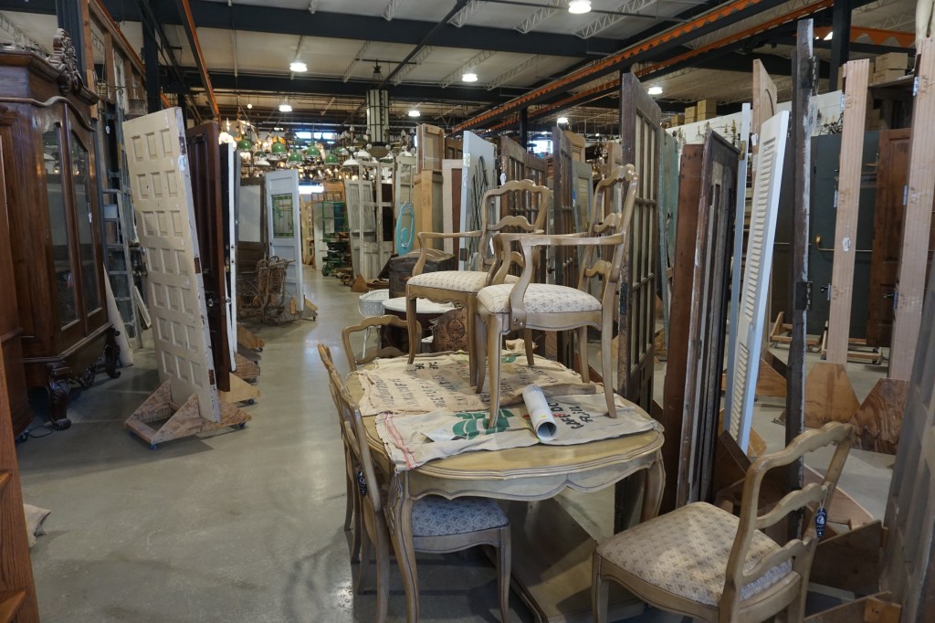
There are billboards all over town advertising “Dead People’s Stuff.” Barbara was intrigued; after all, the name alone earned the store a visit!

Dead People’s Stuff describes itself as a “home and office-decor warehouse where unique, extravagant wares from all over the globe are displayed and are for sale.” Think an upscale consignment or second-hand store. Think a Hippo Hardware (of Portland fame) plus high-quality estate sale furniture and other architectural stuff and lots and lots of purses.

We have a friend in Mesa who was born and raised in OKC. Kevin is a Boomer Sooner – he bleeds red and white, believes only the toughest and most skilled can play Sooner football, and that the OSU Cowboys are, well, little brothers to the men in Norman. Apologies for the University of Oklahoma references, but bear with us…

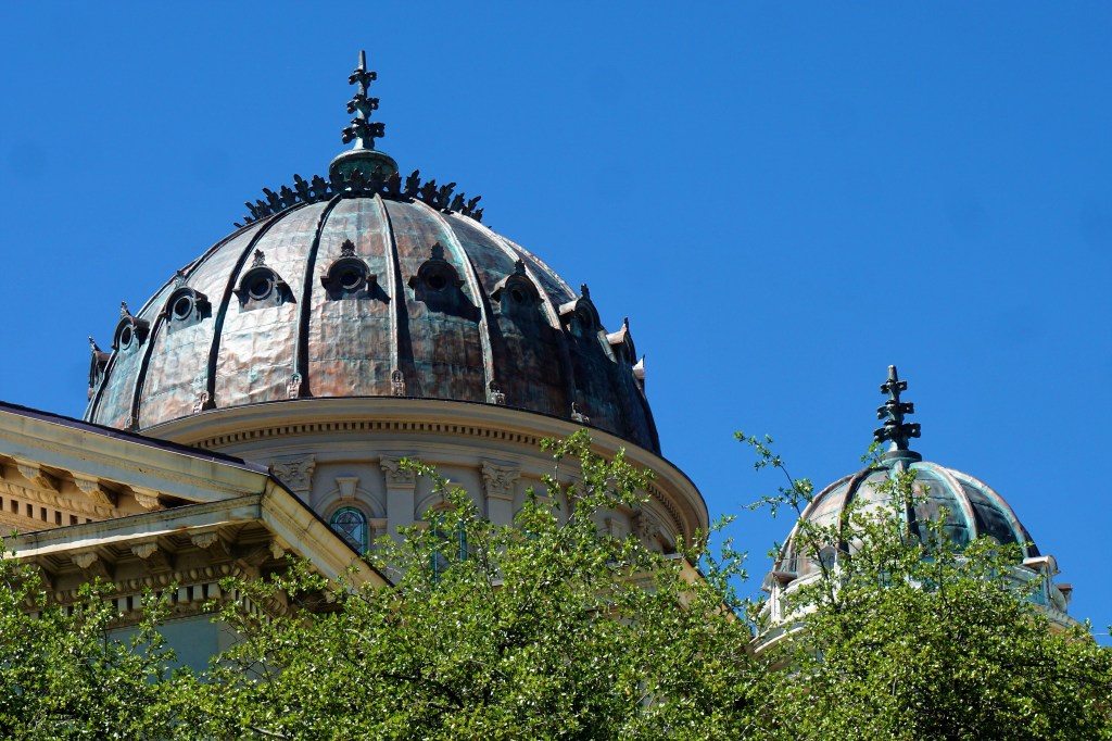
We asked – we really did – about the highlights, the not to be missed while we were in town. The answer from a number of locals, Kevin included, was: “well, I guess after the National Memorial the stockyards are pretty cool or you could take in a minor league baseball game.” Some even added: “Tulsa’s only 100 or so miles away.” There was no oh my goodness you have to see the OU campus, no discernable excitement about the OKC downtown, drop dead gotta try restaurants, organized outdoor art, bustling upscale neighborhood with boutique shops and coffee houses or even crowds of people, save at the National Memorial site, and even then it was not particularly crowded. Not at all what we expected of a city of 700,000 or so citizens. And it’s the State Capitol – not even a recommendation to see the Capitol building? Perhaps it’s what you grow up with, but from our experience Oklahoma City is just lacking that sense of civic pride, and not a place we’d want to call home.

If in the neighborhood we’d very much recommend a trip to see the National Memorial and Museum, and if a fan of the era of the cowboys and settling the west a stop-in at the National Cowboy and Western Heritage Museum would be a must.

We enjoyed the novelty of what we found in and around the area, and of course were very moved by our visit to the footprint of the Murrah Federal Building.

Barbara and Brian

“It’s not what you look at that matters, it’s what you see.“ – Henry David Thoreau

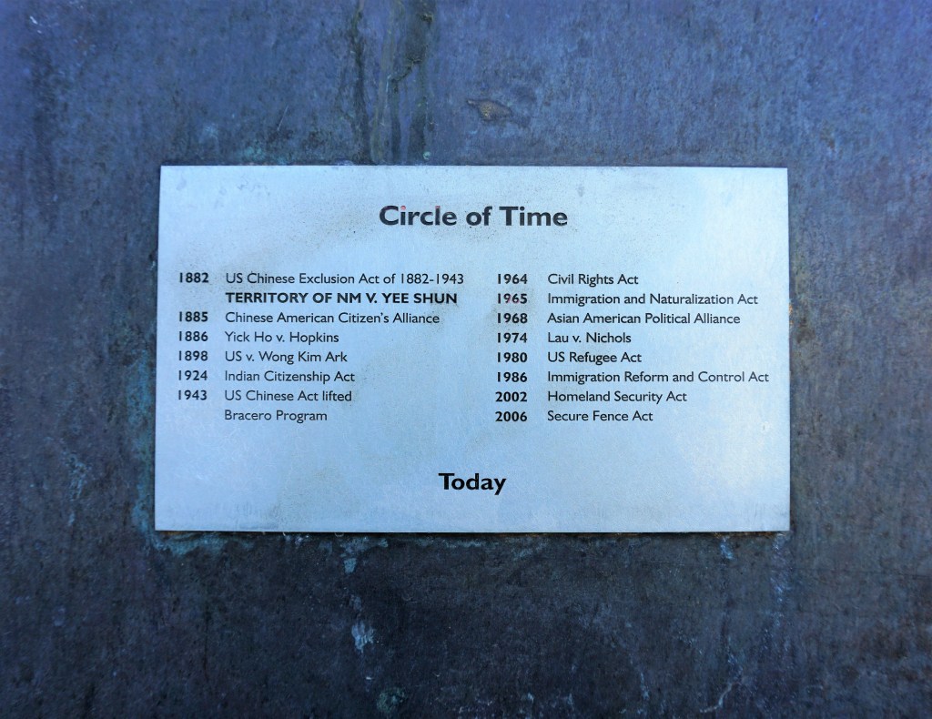
PS – Begging your pardon, but time for a little editorial: Oklahoma’s nickname is the “The Sooner State,” a term that dates back to 1889 when the Indian Territory was opened to white settlers. Thousands of people lined up on the border and, when the signal was given, they raced into the territory to claim their land. Some people went in early to claim their land, and became known as Sooners. That may explain the state’s nickname, but doesn’t excuse ill-treatment of the Indigenous Peoples who had so long called most of the West home, those in this region driven onto land that encompassed most of what we now call Oklahoma, then driven from that piece of turf to make room for white settlers and ultimately “herded” onto unwanted territorial lands.

MOSEYING ALONG ROUTE 66

Well, Howdy Pardner! It’s time to get your cowboy on and spend some time with Barbara and Brian seeing what mischief those little doggies got into while straying eastbound in the general direction of the Windy City. Oh-yeah – this is part 1. Yeehaw!

April – May, 2022

Amarillo, Texas is home to the Cattle Farmer’s Association, who at one time banned Oprah Winfrey from town for encouraging her audience to eat less beef. Brian had a customer whose headquarters was in Amarillo and he spent more than a few nights in and around the town (just ask him sometime about his first trip to the jewel of the Texas Panhandle), but he had never spent any time sightseeing. Thanks to Atlas Obscura, the Crazy Tourist and AllTrails we found a thing or two to occupy our time.

At 120 miles long and averaging 6 miles across, Palo Duro Canyon is Mother Nature’s second biggest hole in the ground in the United States, and, as if you couldn’t guess, its size is only exceeded by the Grand Canyon itself. Referred to as Texas’ Grand Canyon it is home to hoodoos (look out Bryce Canyon National Park!), many, many caves to explore, campgrounds and glamping (yup – the Texas Dept of Parks and Recreation has installed old fashioned trailers complete with air conditioning, kitchens and comfy beds on site and for rent). Wildlife within the Park includes the Palo Duro mouse and Texas horned lizard both of which are endangered species, and a visitor might observe wild turkeys, white-tailed and mule deer, coyotes, bobcats, roadrunners and many species of snakes and lizards. There are miles and miles of biking and hiking trails for exploration and enjoyment.

The most popular trail is known simply as Lighthouse. It’s a 5.7 mile out and back moderate hike – the tougher part of the hike is the trek from the base up onto the formation that gives the trail its name.

Missouri Milkvetch
The Lighthouse
From The Lighthouse Looking South
“Larry”
“Moe”
“Curly”
From The Visitors Center Looking The Length Of The Canyon

We’re pretty sure that it is illegal to visit Amarillo and not have a meal at the Big Texan. The steakhouse and gift shop (with adjacent motel and nearby RV park) has gained notoriety for its 72-ounce steak dinner challenge…the rules specifically state that you must swallow the steak, a shrimp cocktail, salad, baked potato, roll and butter in an hour – simple right? However, since its inception in 1962, odds of completing the challenge are a mere 11% (10,077 winners/87,000 attempts) – interestingly more women than men have eaten the entire meal in the allotted time. BTW – if you fail, the tab is $72. We had the good fortune (?) to observe 2 men and 1 woman attempt to complete the challenge – all failed. And, for the record, our meal was excellent!

There are any number of non- traditional sights to see in and around Amarillo…

The Britten Water Tower is located on Old Route 66, now along-side US Interstate 40, in Groom, Texas. Wait a minute – Britten Water Tower in Groom, Texas? Entrepreneur Ralph Britten built a truck stop on this site, and from 20 miles away hauled in a second-hand water tower, set it at a 40-degree angle, and painted Britten USA on the side as a marketing ploy. Passing motorists would stop to sound the alarm of the falling water tower only to be assured that all was fine and “oh by the way would you like a meal or fuel or both?” Actually worked out pretty well – at least until the truck stop burned down and was not to be rebuilt.

Take a look at this ingenious use for old bikes…a merry-go-round! Wondering how long it took until the kids were bored?

Just south of Amarillo, two gigantic legs, unmercifully spray painted, can be seen from the roadway. A plaque near the gigantic legs reads: “In 1819, while on their horseback trek over the Great Plains of New Spain (now Texas and New Mexico), Percy Shelley and his wife Mary Shelley (author of Frankenstein), came across these ruins.” Here Shelley penned his immortal lines, among them: “I met a traveler from an antique land who said: Two vast and trunkless legs of stone Stand in the desert…” And on the pedestal these words appear: ‘My name is Ozymandias, King of Kings, Look on my works, ye mighty, and despair!’ Have these legs stood the test of time or are they a more modern installment? Reality or urban myth?

Whatever is fact this is Ozymandias of the Desert…

The Floating Mesa was the creation of eccentric millionaire Stanley Marsh, who has also given us Amarillo’s famed Cadillac Ranch. Whenever the sky is the right shade of white there is an illusion that the top portion of the mesa is floating. Today wasn’t one of those days.

The 2nd Amendment Cowboy pretty much speaks for itself.

The Helium Centennial Time Columns Monument was built in 1968 to commemorate the 100th anniversary of the discovery of helium. It is a six-story high stainless-steel structure containing four time capsules, three of which form the legs of the monument, the other standing erect. The capsules are intended to be opened at 25, 50, 100, and 1,000 years. Each of the columns is filled with helium. The time capsule opened in 1993 represented our dependence on natural resources, and the one opened in 2018 featured industry and the use of natural resources.

Just a few miles east of Amarillo and along Old Route 66 sits Slug Bug Ranch – an installation consisting of decayed Volkswagen beetles. No one really knows the when or why or even who owns the property. Cars are partially buried at approximately 45-degree angles, their noses facing downward into the dirt, left to disintegrate over time, with visitor participation encouraged in the form of spray painting.

The Slug Bug Ranch – Panhandle, Texas

According to Atlas Obscura ” A West Texas farmer’s wife said it as kind of a joke when her husband Orville Ladehoff didn’t know what he was going to do with a broken-down old combine. She said, “why don’t you just bury it.” That was the spark that ignited the farmer’s crazy idea — not to bury, but to “plant” combine harvesters, many at a 45-degree angle, on his two-acre plot of land just south of Amarillo. And14 combines later, Orville had himself a “Combine City.”

Combine City
45 Degree Angle?

Cadillac Ranch is a public art installation and sculpture created in 1974 that was the brainchild of Amarillo millionaire Stanley Marsh who commissioned a local art group – the Ant Farm – to complete the installation. It consists of ten vintage era Cadillacs buried at a 45-degree angle nose-first in the ground — spanning successive generations of the car line from 1948-1963, and the defining evolution of their tailfins. Painting graffiti on the cars is strongly encouraged and the cars undergo ever-mutating layers of paint.

10, Count ‘Em 10, Cadillacs

Why are the vehicles at the Slug Bug Ranch, Columbine City and Cadillac Ranch buried at a 45-degree angle? Theories are plentiful on the internet. As is often the case, the Urban Dictionary sexualizes the term and gives special meaning to gay and lesbian uses of the phrase. A Christian interpretation advises that at an angle of 45 degrees, we look both up and out, and this is a good paradigm for life – we can view both up: seeing and loving God, and out: seeing and loving our neighbor. There’s the theory that it is a sign of massive change, and then again, it’s near impossible to bend backwards more than 45 degrees without falling over. Barbara’s theory is that it’s a quirk of quirky Amarillo locals – they felt compelled to bury something and we guess it just looks right to them. Brian wholeheartedly agrees!

And finally just a bit of whimsy from the Texas Panhandle…

What fun we had hanging out in Amarillo – days were filled with so many interesting sights and places to find and visit. We loved our hike in Palo Duro Canyon, and would encourage visitors to the area to take some time to explore what a fine job the Texas Department of Parks and Wildlife has done in making this park a special place.

Barbara and Brian

“It’s not what you look at that matters, it’s what you see.“ – Henry David Thoreau

“HOMEWARD” BOUND

April – May, 2022

April, 2022 found Barbara and Brian able to once again travel the highways and by-ways of America (apologies to our Canadian friends whom we had hoped to visit, but alas and alack the boarder opening was delayed, delayed and delayed), and over the past year, as this blog has evidenced, we’ve experienced some pretty amazing places and seen oh so many amazing things.

Our time wintering in Mesa was more difficult this season than in previous years, spending less time with friends, and more time workcamping. Something was rotten at VDO as only 1/2 the number of workcampers necessary to “do the job” signed on for the season, and that meant that Barbara and Brian worked far more than that required to pay their rent. The events that needed our presence were usually in the evening; little interference with pickleball, softball, occasionally water volleyball, workouts and other day-time activities. However, evenings were royally screwed-up, and honestly by the end of the week exhaustion had set in, and, of course, there was the catching-up on those life maintenance things everyone not workcamping at VDO could do at their relative leisure. For the record Barbara and Brian WILL NOT workcamp at VDO again.

During the May/June and November/Thanksgiving visits with grandkids and kids we discovered that longer stays weren’t always better stays. There’s a fine line between the excitement of seeing family, having great times together and staying too long. We love each other and for the most part really really really enjoy our time together, but each of our children has their own family and their own traditions and customs and pace of life and expectations of each other and their own brand of normalcy and we mess up all of that staying too long. No one would ever say (at least Brian doesn’t believe so) “move along,” but why mess with the forces of nature?

Barbara and Brian did a bunch of soul searching and talking and lot more talking about this question – how could we continue the vagabond lifestyle we’ve come to love as well as be in a location to spoil our grandchildren; i.e., closer to family? Graham and Leigh negotiated with their employers an arrangement to be able to work at home, and decided to move from Arlington, Virginia to East Grand Rapids, Michigan – to be closer to family. Could Barbara and Brian do the same?

A plan was developed for the homeless vagabonds to find a “summer” home – some place close enough to children and grandchildren that would be just far enough away to maintain everyones’ individuality and yet not interfere in the family our family had developed. Make sense?

But where? If a central location was to be chosen, it looked like Morgantown, West Virginia might be the epicenter of equidistance. But for Barbara and Brian it has an appeal rating of 1 or 2 out of a top score of 10…now Ann Arbor, Michigan has an appeal rating of 8 or 9, but is 2 hours to Rowan and PJ, 3 1/2 hours to Maggie and Penny, 5-6 hours to Kyra, 7 hours to Helena, and 8 hours to Ben and Dan. Longer overall to some of the grandkids than Morgantown, but definitely manageable as retirees (and certainly closer than anywhere in the Western United States). It’s pretty easy to know why Ann Arbor, Michigan has such appeal – just ask Brian.

The 2022 plan was to leave Mesa mid-April in order to make it to Ohio for Maggie’s 11 birthday on May 19th, and then skedaddle into Michigan and look for a condo in or in close proximity in the land of Maize and Blue. Rest assured though that we will continue travelling!

In previous years a journey through Austin and a visit with nephew Jon and family then through Memphis and Nashville guided travels. However, a more direct route to Ohio was chosen – heading pretty much northeast from Mesa to Gallup to Albuquerque to Oklahoma City to Amarillo to Springfield, MO to St Louis, then a slight detour to Bloomington/Normal, Illinois to visit sister Karen, niece Terri and family, and then into Bloomington, Indiana and Yellow Springs, Ohio before settling into a campground in Grass Lake, Michigan for a couple of months.

Brian and Barbara had been to Gallup and Albuquerque previously, but new worlds waited for the remainder of the trip.

SO LET’S GET THIS PARTY STARTED!

Founded in 1706 by Nuevo Mexico governor Francisco Cuervo y Valdes as La Villa de Alburquerque, Albuquerque was named in honor of the Viceroy of New Spain, the 10th Duke of Albuquerque.  The city was an outpost on El Camino Real linking Mexico City to the northernmost territories of New Spain. It is the most populous city in New Mexico with a population reported by the 2020 census of just over 560,000.

…and it’s known for absolutely fabulous green chili cheeseburgers!

While in Albuquerque it is possible, if not mandatory, to pay homage to Walter White aka Heisenberg from the TV Series Breaking Bad...one of the most evil bad asses in TV history.

Many scenes from the series were filmed at the El Camino Hotel and across the street at the (you guessed it) El Camino Dining Room. The hotel is now (maybe always was?) an apartment building.

According to Atlas Obscura “the De Anza Motor Lodge was a burnt-out, run-down motel on Route 66 that would have been torn down long ago if it weren’t for the priceless Native American artifacts in its basement. Today it is a dilapidated old building that was nearly razed to make way for a grocery store. If it were not for the priceless, one-of-a-kind Native American artwork in the basement conference room, the De Anza would be a memory. Instead, it is now protected by 24-hour security.”

“The basement contains seven, 20 x 4-foot murals depicting the Zuni’s sacred Shalako ceremony. The Shalako ceremony is a series of ceremonies and dances unique to the Zuni people and performed at Winter Solstice – the most important ceremony of the year. The murals were painted by famed Zuni artist Tony Edaakie. Edaakie is considered a major figure in 20th century Zuni painting, making the murals in the basement of the De Anza not just sacred, but priceless, one-of-a-kind treasures. There is nothing like them anywhere else in the world.”

A definite must see – no? What wasn’t known or advertised to us “out of towners” is that there are only certain days and times that Zuni docents provide a lecture and tour of their sacred location. We stopped in and a local business owner was kind enough to give us confirmation about the murals, but also informed us that today was not one of those days.

When in town a visit to Old Town Albuquerque is recommended – there the visitor will find wonderful adobe structures, hanging flowerpots lining the streets and alleys with vibrant color, little back alleys with all manner of goods for purchase, glorious church skylines, vendors offering Native American jewelry, restaurants for a delicious meal and, with forewarning to Brian’s beautiful daughter, the International Rattlesnake Museum.

MurosConnect is Albuquerque’s city-wide project brokering artists to business and property owners (and visa versa) in order to arrange to adorn buildings (well almost anything but sidewalks) with outstanding creativity. Much of the street art, mosaics and murals reflect the cultural history of the city. As a result, Muros de Burque is very diverse and spectacular.

…by the way – this is just a sampling of Albuquerque’s street art…

Zuni Influenced
Looking For Wile E Coyote?
Creative Use Of “Spare” Auto Parts?
Not Strictly Street Art, But Brian Liked The Sign And The Iced Coffee Was Excellent
For Barbara And Brian?
Brian’s Favorite
What A Great Idea!
Notice The Artist Working On The Peace Sign?
Shoutout To The City’s Cultural Heritage
Saluting Route 66
Zuni Heritage

Leonard Peltier is a Native American activist and mainstay member of the American Indian Movement who, following a controversial trial, was convicted of aiding and abetting murder and has been imprisoned since 1977. He was sentenced to two consecutive terms of life imprisonment for aiding and abetting resulting in the death of two Federal Bureau of Investigation (FBI) agents in a June 26, 1975 shooting on the Pine Ridge Indian Reservation (Wounded Knee occupation) in South Dakota. He is considered by Amnesty International, the Southern Christian Leadership Conference, National Congress of American Indians, the Robert F. Kennedy Memorial Center for Human Rights, and Rev. Jesse Jackson, among many others, to be a political prisoner who should be immediately released.

On The Campus Of The University Of New Mexico
Albuquerque’s Newest Murals Honoring Martin Luther King As Well As Other Black Leaders

Meow Wolf is “20,000 square feet of unique please touch experiential labyrinth of art.” There are three Meow Wolf locations each offering a different theme. Whether exploring House of Eternal Return in Santa Fe, Convergence Station in Denver or Omega Mart in Las Vegas, Meow Wolf provides an “immersive psychedelic, mind-bending art and underlying rich narrative journey of discovery into a surreal, science-fictional epic.” Suffice it say (apologies for the cliche): “you gotta see it to believe it.”

A converted bowling alley purchased by George R.R. Martin (yup-that George R.R. Martin) has been converted to house Meow Wolf Santa Fe.

Parking Lot Creatures Greet Visitors to Meow Wolf Santa Fe

Immediate impression? STIMULUS OVERLOAD!…look over there – no! look here – look up – look down! The floors, walls, and ceilings are packed with images and phrases, colors and black light pastels all presented to confuse your eye with depth of field distortion, and to prepare your mind to do quite a bit of work!

Pictures From The Lobby
Lobby Floor

Once through the entryway there are 2 directions from which to choose – head toward The Mystery House or make your adventure winding through the many warehouse spaces, rooms, nooks and crannies that make up the Meow Wolf Experience.

House of Eternal Return focuses on what really happened to the happy family that once occupied Mystery House?

Start with Mystery House and the visitor follows successive clues from one room to the next within the 2-story house. There are hidden passageways (check out the refrigerator), a slide, and some kind of electronic equipment in the basement. It all tells the family’s story – although the answer as to their disappearance (did they really disappear?) is never fully revealed. Staff are placed throughout in order to assist the baffled.

Head away from the House and there are still many hints and clues and kiosks offering videos that tie together the mystery as to what happened to the family that had (?) made this home. It’s fun to imagine what all of the different rooms have to add to solving the mystery. It’s also fun to just let the experience wash over you and provide an amazing visual adventure.

Check it out…

We did the usual and customary sight seeing during our first visit to Albuquerque, and had a pretty good time seeing the sights. Our campsite in town was also a springboard for trips to Santa Fe and Taos – touring pueblos and trying spice mixtures, attending a street fare, and eating green chili cheeseburgers. Unfortunately, we haven’t had the chance to see the balloon fest – yet.

We’ve also had a great time in Las Cruces, Mesilla, and Alamogordo as well as visiting the White Sands Army Base and Testing Grounds and hiking around White Sands National Park. We would have recommended a visit New Mexico be on a traveler’s bucket list. But after our time this time in Albuquerque that recommendation becomes much, much stronger.

Barbara and Brian

“It’s not what you look at that matters, it’s what you see.“ – Henry David Thoreau

ART IN THE DESERT

September, 2021 – April, 2022

“Art in the Desert” is a sorta kinda misnomer. The Phoenix Art Museum is avant guard and definitely worth a visit. And there are any number of galleries and small exhibitions and street art that can keep individuals all along the vast continuum of personal artistic preference well interested.

We had an opportunity to attend 3 terrific shows that opened in Phoenix this winter season.

During late summer 2021 the announcement for an “Immersive Van Gogh” exhibition came to our awareness. It read: “Imagine stepping inside a Vincent Van Gogh painting, being completely enveloped in his brushstrokes and colors. What if you could experience his masterpieces in a very three-dimensional way, not only visually, but also with stirring classical and contemporary music? This epic celebration of Dutch painter Vincent Van Gogh features 40 of his masterpieces, including Starry Night and Sunflowers, that are animated and brought to life. The exhibit is a dance of art, light, music and imagination.” The reviews from around the world (!) were extraordinary. Who wouldn’t want to go?

We were going and sent out information about the show to our closest Valle del Oro friends – “how about an outing?”…one couple resounded with a “let’s go!” and tickets were purchased. The experience was certainly unique and particularly astonishing.

Brian really didn’t take enough pictures…

Dale Chihuly is an American glass artist best known for “moving the field of blown glass into the realm of large-scale sculpture.” Chihuly in the Desert showcased stunning, large-scale installations nestled among the Desert Botanical Garden’s world-class collection of desert plants. Featuring sculptures on the Garden’s trails and complemented by a major indoor gallery, the glass installations are quite simply spectacular. These masterpieces are even more striking once the sun goes down.

“Desert Towers”
Rose’s Claret-Cup Cactus or Rose’s Hedgehog
Banana Cactus
“Friori Boat”
“Blue Reeds”
Agave Elephant’s Trunk Or Fox Tail Or Swan’s Neck
“Lime and Lava Red Tower”
“Paint Brushes”
Velvet Opuntia
Sunflower
“Aqua Blue And Amber Chandelier”
“Sonoran Neon”
Prickly Pear Cactus
Everyone See The Bird On The Organ Pipe Cactus?
Desert Agave

Heading indoors there was a whole other world of blown glass, media (other than glass?) and reflected mirror images to experience…

Mirror Image Looking Down Into The Bowls!
Never Knew Chihuly As A Painter
Barbara Loved This Painting
Reflection Or Glass Sculpture Or Both?

Awestruck by the indoor display we ventured back outside to find twilight – installations we hadn’t seen in full daylight..

“Fire Red Herons”
“Red Reeds”
“Sol del Citron”
“Neodymium Reeds”
“Opal And Amber Tower”

A second immersive art show, focused on the work of Gustav Klimt, arrived in Phoenix a month or so before we broke camp in April. We tried to schedule a time with our neighbors Tom and Karen to see the show. The timing was just not right for a double date so we had dinner with them and went to the show on our own.

Who but a select few know the work of Gustav Klimt. Maybe, just maybe more than a few know his work “The Kiss,” but what other works of art that represent his life’s work?

“Gustav Klimt was an Austrian symbolist (?) painter, and leader of the Vienna Successionist Movement that was created as a reaction to artistic conservatism. Influenced by Japanese art and its methods Klimt is noted for his paintings, murals, sketches, and other objects d’art in which the primary subjects were the female body, allegories and portraits, and landscapes.”

Check it out…

Brian took plenty of photographs this time. No?

The immersive exhibitions are the first time outside of a classroom or symposium that the general public have the opportunity to view so many works over the lifetime of a master artist. The experience would be overstimulating for concrete thinkers and serial learners – those that can’t just sit back and allow themselves to let the swirling ever changing landscape of the artist’s work surround them. It is a visceral experience that was stimulating – had us asking questions of docents onsite and lead to our own in-depth discussions. Ask us sometime why Van Gogh wore a broad-brimmed straw hat with several candles held in the brim…

As a contemporary artist working with blown glass Chihuly has no peer – he is the master, bar none. In the light the detail of each installation is evident, Chihuly’s mind’s eye is ever so slightly exposed, and the skill of he and his crew shine brightly. Placement of the installations enhance and compliment the surrounding desert plants. But after dark the installations simply took our breath away – a 10,000-watt display of color, shape and composition set against shadows of those very same desert plants. Whew!

In this case don’t take our word for any of it – go and see for yourself. Be open to the experience!

Barbara and Brian

“It’s not what you look at that matters, it’s what you see.“ – Henry David Thoreau

HANGING AROUND ARIZONA – AGAIN

September, 2021 – April, 2022

Just as a reference – it’s 60 miles east along US Interstate 40 from the California/Arizona State line to Kingman, and 115 miles further to Williams. From Williams it’s 40 miles east to Flagstaff, 120 miles south to Phoenix and 40 miles east to Mesa. Then it’ll be 6 months at our winter home, Valle del Oro, before we break camp and begin our 2022 spring/summer adventure.

We’ll stick around Williams for 3 weeks beginning on Labor Day weekend – the Valley of the Sun is still stupid hot. Mesa’s average daily high during September will be well into the 110s Fahrenheit…things do begin cooling off in October. We report for workamping on October 1.

This photo essay is of our journey started so long ago – a blog that is anchored by photographs tied together by remembrances, information and facts from a variety of sources, and (at times) effusive visceral descriptions. It documents this period of time in our life together, and lets our friends, children, grandchildren, and honestly anyone else who is interested know that Granny and PopPop traveled a fair distance, did some pretty amazing things, met some pretty amazing people, and saw some pretty amazing sights.

So the pictures that follow may be a photo redux of the last couple of winters in Arizona…but you never know what our mind’s eye sees the next time around! Enjoy…

Our favorite trail around Sedona is about 5 miles or so north of city center…Oak Creek Canyon is a 7-mile hike crossing Oak Creek a mess of times during the hike.

Reflection!
Brian’s Favorite Photo – Oak Creek Canyon

Old Caves Crater Trail is a 4.1 mile moderately strenuous out and back hike located near Flagstaff known more for the glorious vistas than any old caves.

One Of The Old Caves?

Williams is approximately 90 minutes from the East Entrance to the Grand Canyon – we couldn’t resist another visit.

Desert View Watchtower – Grand Canyon East Entrance
Colorado River

In Flagstaff and on the way up to Snowbowl (yup – AZ’s skiing capital!) is Beech
Grove…for all our half-dozen or so trips up the mountainside to take in the view and/or to hike the Kachina Trail we’ve been meaning to capture a picture.

Between Prescott and Williams there are a series of roundabouts, and in the middle islands are sculptures. Barbara liked this one in particular…

Just north of Williams is Kaibab Lake. While hanging out there we found out about the Williams’ pickleball club from another hiker, watched osprey hunt, heron roost, fish jump, and now enjoyed the vegetation during a leisurely walk around the lake…

Paid this guy to pose.

Kaibab Lake – Near Williams

The Valley of the Sun averages a little more than 8 inches of rainfall annually. We had heard that after a soaking (?), a short hike to a waterfall and its cistern was visible at White Tank Mountain Regional Park. It rained 2 days ago…time to get our waterfall on?

Wile E. Coyote Greeted Us As We Entered The Park!
We Were Delighted At The Petroglyphs All Along The Trail
The Mighty Waterfall!
Anybody See The Roadrunner?

The Tempe Fantasy of Lights Boat Parade is an annual Holiday event for the whole family. There is no charge to watch the boat parade and evening’s fireworks.

Kinda tough to get a decent photograph of the lit-up boats while they were in motion…

Old PA friends Tom and Landa just happened to be in town and were hanging out with an old friend and former-PA-transplant, now local, Belen. We got together for a delightful afternoon and early evening in the hipster section of Phoenix. A few random photographs for the archives…

Bougainvillea

Italian immigrant Alessio Carraro dreamed of building a resort hotel as the centerpiece of a high-end subdivision, Carrarro Heights. He and his son constructed the hotel over just fourteen months – hoping to open in1930. The building is a thing of beauty, based on Italian architecture and tiered like a wedding cake.

The hotel never opened – perhaps because of the stench from the nearby Tovrea meatpacking stockyards, or because of the Great Depression? Carraro sold his castle and its 42 acres to Edward Ambrose Tovrea, magnate of the stockyards, who transformed the massive hotel into a private residence. Tovrea died after less than a year living in the castle and is memorialized by a giant steel pyramid on the property. His widow Della lived there until her death in 1969.

We had wanted to tour the property for the past 3 seasons we wintered in the area. Well, strike 1 of those years due to covid, and tours are rare. Luckily there was a cancellation for a scheduled tour that fit into our schedule…

Tovrea’s Pyramid On The Left – Tovrea’s Castle And Residence In The Center
Big Bend Yucca
Mighty Saguaro Nestled In A Flowering Ocotillo
Love All The Art Deco!
Chair Is Original Piece, Reupholstered
Visitors Are Required To Wear Cloth Botties On These Beautiful Floors
Graham’s Fishook Cactus, Graham’s Nipple Cactus or Graham’s Pincushion Cactus
Ocotillo In Bloom

Pinnacle Peak Park is a 4-mile moderately rated hike near Scottsdale…

Englemann’s Hedgehog Cactus
Mr. Chuckwalla Himself!
Standing Guard
The Winding Trail Ahead Of Us, A Multi-Million Dollar Home, and A Tee Box For The Local Golf Course All In One Shot!

One more hike, back behind a housing sub-division and more a mountain bike trail than hiking trail…but the flowering plants were pretty cool…

California Wild Buckwheat
Ocotillo in Bloom
A Variety Of Prickly-Pear?
New Mexico Prickly-Pear
Vine-Cactus, Ocotillo, Candlewood, Coachwhip

What do you get when you combine a pizza joint with a Mighty Wurlitzer theatre organ? How about when concerts occur every 20-35 minutes, and are performed by professional organists who are members of the American Theatre Organ Society (ATOS) and the American Guild of Organists (AGO)? The answer is Organ Stop Pizza…one of those “must get to places” on our bucket list. Novelty or not, the pizza was pretty good, and the concerts were superb. Amazing what sound is produced by the Mighty Wurlitzer!

Check Out Drums, Xylophones, Horns, and Cymbals In Addition To The Pipes – All Controlled By The Keyboard Controls!
Organist Brett Valliant

“If you’re bored it’s your own fault” has been our philosophy for the 3 winters we’ve hung out in Mesa. Valley del Oro is a true resort in its own right, and whether it’s our favorite activities – pickleball, senior and over-70’s softball, table tennis, ladder golf and bag toss, water volleyball, the sewing room or exercise room, happy hours and dancing to bands on the patio, dinners and potlucks with friends or so many more available activities – or not – there’s always something to do. Add in area hiking trails, the restaurant scene, cultural and athletic events associated with a large metro area and our wintering time goes by so very, very quickly.

November is time to head east to celebrate with family the birthdays of granddaughters 8-year-old Helena and 5-year-old Penny, and since we were mighty close, we couldn’t resist a quick trip into DC to visit with 2-year-old Rowan.

Helena and family moved to Gettysburg this year in order to steep in the history of our Country’s most iconic battlefield. Thanks for the personal 6-hour tour Jamie! We enjoyed the sights of late fall…

Happy Birthday Helena!

It’s 91 miles from Gettysburg to DC…

American Beautyberry
Dahlia

Hard to believe that Penny is now 5…she’s grown up so much in the last year!

Happy Birthday, Penny!

It was awful cold in Yellow Springs…

Fountain – Mills Park Hotel. It Was A Wee-bit Colder Than We Had Expected!
Photograph By 10-Year-Old Maggie

Barbara and Brian

“It’s not what you look at that matters, it’s what you see.“ – Henry David Thoreau

PLAN B

August – September 2021

The plans were to head south from Crescent City on US Highway 101, and in our roundabout way end up in Ukiah, California. From their our hope was to visit the 3 beaches near Fort Bragg, California known for having the highest concentration of sea glass in the world(!), visit the International Sea Glass Museum, and to then mosey on over to Leggett to drive through the drive through tree. Before we left, our friends John and Cheryl Williams called to discourage us from taking US Highway 101 south. They had just completed that which we had planned and reported that repairs from a landslide just south of Crescent City were causing 4-hour travel delays, and road conditions along the winding, hilly 2-lane Pacific Coast Highway, while perhaps picturesque, were awful. Forewarned is forearmed – on to Plan B!

We cancelled our reservation at the campground in Ukiah and booked a nicely-rated campground in Redding, California. We traveled back up US Highway 199 through Grants Pass and onto Interstate 5 Southbound through Medford and into California, past Mount Shasta and into Reading. The rest of the trip could, we hoped, stay as booked…Lodi and Bakersfield, and then Boulder City, Nevada and Williams, Arizona for Labor Day and a 3-week stay prior to returning to Mesa (let it cool down down there). There was a bonus for staying in Redding – it was only about 45 minutes to (check one more off the list) Lassen Volcano National Park!

So into Redding we pulled…down a busy city 4-lane with median strip roadway in what appeared to be a downtrodden section of town, to turn into a driveway past a small auto repair shop and a number of one-story motel-like apartment buildings and into a private, landscaped, clean and perfectly maintained, what-turned-out-to-be a wonderful campground! Once on property it felt like we were totally separated from whatever was surrounding us. After welcoming us the manager of Green Acres RV Park invited us to taco night…”come and meet your fellow campers!” What a great start of our time in Redding. “Green Acres Is The Place To Be!”

Sundown At Green Acres RV Park – Wildfire Smoke Adding Coloring To The Sky

We mentioned the desire to visit Lassen Volcano National Park to our camp hosts, and it was suggested we check with the National Park Service due to the wildfires in the area. It was pretty disconcerting to find out that our western entry point was closed, and as a matter of fact the west side of the Park was on fire!

So onward to another Plan B…

Redding’s Turtle Bay Exploration Park is a non-profit 300-acre gathering place featuring a museum, forestry and wildlife center, arboretum and botanical gardens as well as miles of hiking trails along the banks of the Sacramento River.

Sacramento River
Smoke Tree! Who knew?
Display Is Made From Trash Applied To A Wire Frame

The Sundial Bridge at Turtle Bay is a “cantilever spar cable-stayed(?)” bridge for bicycles and pedestrians that spans the Sacramento River.

In order to protect a salmon habitat on one side of the bridge, a tall support spire was designed to hold up the 700-foot-long bridge from the opposite end only without placing columns in the water. That spire forms a large sundial. 

Daring Jumping Spider – Found This Rascal Under The Bridge

We had hoped to drive to the top of Mount Shasta and take in the vistas, but once again the wildfires so impacted our viewing ability that we could barely see the Peak through the thick haze. The air quality was seriously impacted as well, and we decided that there was no sense irritating our lungs further. Instead, we decided to visit Shasta Dam and Lake on our way to Mount Shasta City.

Shasta Dam
Shasta Lake
Other Side Of The Dam…Looking Down River

But why bother with Mount Shasta City? To have lunch at Lalo’s! Why? Our 2020-2021 Box Office manager at VDO, Juan Gonzalez, aka Co-El grew up in Mount Shasta City and his Uncle Lalo…well, that one is pretty easy to figure out. We gave Co-El a call and he was delighted we were visiting. But there’s an ironic part to the story. There are many Juans in the Gonzalez family, and it took a while for Uncle Lalo to figure out exactly which nephew we were taking about! Mystery solved, we were welcomed with open arms. We also had the chance to meet Co-El’s father who happened to be at the restaurant the day of our visit.

Dad
Lalo

Next stop Lodi.

Lodi is best known for wine grape production although its vintages have traditionally been less prestigious than those of neighboring Sonoma and Napa Counties. However, in recent years, the region’s wines made from zinfandel grapes have become increasingly respected.

Perfectly natural that we’d want to visit a tasting room or 2, and we thought we found the perfect way to do so – a “wine tasting jaunt.” Beginning in downtown Lodi, this is a 10.6-mile bicycle ride in which the riders visit 6 tasting rooms. The first stop was cleverly planned to be a little more than 5 miles from downtown…halfway done is a good thing if drinking adult beverages is the agenda for the ride; the last 2 stops are back in town.

Our first stop was at the Klinker Brick Vineyard tasting room. We were very warmly welcomed, given cold bottled water and several minutes to gather ourselves before considering our tasting choices. We decided to share a flight of 6 red wines, lighter to more robust varieties, and to our surprise a 7th was added – their signature Old Vine Zinfandel.

Klinker Brick made a point of telling us that their pours were generous – and how accurate that was! After sharing 4 pours Barbara turned to me and said she was done…no more wine! We did enjoy 2 of the varieties – the Old Vine Zin and a 2016 Merlot – and made it a point to find them in the local wine merchant’s stock. A purchase well made.

Well, we had come this far so Brian asked if we could ride by the other tasting rooms on the way back. We found 4 of the remaining 5.

The night before our ride Barbara had a glass of wine and Brian a delicious locally brewed cream ale (7.7% ABV) as we listened to music in the delightful courtyard of a downtown hotel. Just happened to be brewed by the Five Window Beer Company.

Let’s see – what else is in the area?…

How about touring the Jelly Belly factory?

Yup! Those are millions and millions of Jelly Beans!

By the way – Jelly Belly was President Ronald Reagan’s favorite candy, and was given as gifts to visiting dignitaries.

Made Of Jelly Belly Jellybeans

…or a self-guided tour of the shrine at Wat Dhammararam – a Cambodian Buddhist Temple.

There were several regional Atlas Obscura recommendations that sounded just too good to pass up.

The Eggheads are a series of five ceramic sculptures by artist Robert Arneson scattered around University of California, Davis’ campus. 

Bookhead – University Library
Eye On Mrak – Pedestrian Mall
See No Evil, Hear No Evil – Administration Building

The Sacramento International Airport was kinda sorta on our way back to Lodi. We found a pretty cool sculpture of an airplane, but in baggage claim at Terminal A there is a 23-foot pillar made up of more than 350 pieces of luggage.  The baggage dates from the early 20th century to present day, representing the whole period in which air travel has been possible. At the base of the luggage towers are very large white carts, which clearly signify the luggage carts used by baggage handlers to transport suitcases across the tarmac to the aircraft.

The “Dragon House” was a must stop.

From the minuscule, highly detailed landscaping to the building’s ornate tile work, each detail contributes to the kitschy feel of this private residence. The side of the building is adorned with a massive mosaic dragon weaving between the windows, and an intensely staring white tiger seems almost ready to pounce. The tiles that make up the exterior of the home take on countless shapes, sizes, and colors, depicting fairies, owls and frogs. Kinetic sculptures in the yard and every inch of the home are covered in lovingly handcrafted original designs reflect the owner’s whimsical imagination.

And how about a 15-story mural of Johnny Cash? Cash’s gaze in the mural stares out toward Folsom Prison, the infamous state penitentiary just up the American River from Downtown Sacramento. The country music star played over 30 prison concerts in a 20-year timeframe. But his interest in prisons went beyond playing within them—he also advocated for prison reform and better inmate treatment. The mural honors the 50th anniversary of his At Folsom Prison recording. 

Or the monument honoring the hotel considered the birthplace of the pony express.

And who knew that at one time there was a Sacramento underground? Sacramento once stood 10 feet lower than it does today and was very prone to flooding. In the mid-19th century, the city was raised to higher grounds – all but this one courtyard in Oldtown Sacramento that is a reminder of the original street level.

It was 110 degrees Fahrenheit in Bakersfield when we pulled into our campground. We set-up, turned the air conditioner on and headed out for supplies – honestly it was just too hot to consider doing much else. We were staying just 1-night.

Next morning, we were on our way to Boulder City, and about 10 miles east of Bakersfield a car pulled in front of us and slowed way down. Thinking there was something wrong with the car we moved into the left lane and passed, only to have the car pull up alongside us and yelled out the window that the jeep had a flat. The tire wasn’t flat – we had no tire! The body of the tire was gone, and we were riding on the bead! We hadn’t noticed anything different in drivability, didn’t hear the tire “blow,” and were just merrily motoring along. We have no idea when, how or what happened. And just imagine if our Good Samaritan hadn’t alerted us to the problem – a true catastrophe just waiting to happen.

We pulled to the shoulder of the road, and it took an hour or so for service to come and change the tire. We had bought the tires at Discount Tire, and there was a shop in Bakersfield. 2 hours later we were back on the road. However, while waiting for our new tire to be mounted and vehicle checked (amazingly nothing else was damaged!), we realized that we were running terribly late and would reach our campground in Boulder City after dark.

Time for our next Plan B. We decided to cancel out of Boulder City and travel just a little way past Barstow on US Interstate 40 to camp for the night. In the morning we’d make our way to Williams, Arizona. Newberry Mountain RV Park was just off of I-40 and gave us our 1 night of sanctuary after a very difficult day.

Newberry Mountain RV Park

It was nice to pull into Railside RV Ranch the next afternoon. Kinda like coming home again. Wonder what adventures we’ll have before returning to our winter home in Mesa in 3 weeks?

Having a Plan B isn’t always the worst scenario in an active nomadic yet planned lifestyle. It gave us the chance to see and do and explore places we’d never been, and in this part of our journey started so long ago wasn’t all that far off our original Plan A.

The unexpected is always a possibility. For Brian learning to stay flexible was growth. For Barbara, well, she just loves the process as well as the end result, and always has that wonderfully positive attitude.

Barbara and Brian

“It’s not what you look at that matters, it’s what you see.“ – Henry David Thoreau

THERE’S MORE TO COASTAL NORTHERN CALIFORNIA THAN TREES!

August, 2021

Tourism associated with the coastal cities in Northern California from Crescent City to Orick is focused on the Redwoods. Terrific campgrounds, a drive-through tree or 2 to find (which by the way can only be experienced for a fee and on private property!), and so many great hikes amongst these giants of nature bring over 31 million visitors annually to the area.

But there is really so much more to experience and explore and discover. There are 2 Crescent City lighthouses! Since 1933, 32 tsunamis have been observed in Crescent City! Sea stars and urchins abound in the town’s tidal pools! There are 38 in-town murals and mosaics maintained by the Redwoods Mural Society! A dozen or so sand dollars can be collected during an easy walk along the beach! Bored in Crescent City? It’s your own fault.

Crescent City was named for the crescent-shaped stretch of sandy beach south of the city. As of the 2020 census the total population was 6,673, down from 7,643 in the 2010 census. It is home to supermax Pelican Bay State Prison, Redwoods National Park Headquarters, and due to the richness of the local Pacific Ocean waters and the related catch, and ease of access, Crescent City Harbor serves as home port for numerous commercial fishing vessels.

Overlooking Crescent Beach

Battery Point Lighthouse sits on an island 200 feet from the mainland. It is an active lighthouse and museum whose oil lamps were first lit on December 10, 1856. Tending the lighthouse was done by the U.S. Lighthouse Service until 1936 when the U.S. Coast Guard took over operation and maintenance. The light was automated in 1953, but due to the sophistication of the Fifth Order Drumm Lens the Coast Guard continued to be responsible for maintenance until 1965 when the service and operation became privately owned. To this day the light serves as a private aid to navigation, and lighthouse keepers continue to reside on the island.

Many great stories about the history of Battery Point Lighthouse and Native American legends about the island have been crafted over time. Tour the lighthouse and hear tales of its tenders and their families, and of course no story of such a place is complete without referring to the resident ghost.

Visits to the Battery Point Lighthouse and island are only possible at low tide.

From The Mainland
Freeway Iceplant

After our tour of the lighthouse and museum, and since it was still low tide we did a little exploring of the tidal pools between the island and mainland…

Sitting atop Dragon Rocks 6 miles offshore the St George’s Reef Lighthouse, built in 1891, provided a beacon for passing ships to avoid the shallow rocky waters closer to shore. Decommissioned in 1995 it sits abandoned as a remnant of a different seafaring time. We had a chance to catch a glimpse of the lighthouse on a very, very, very windy day with the Pacific Ocean fog shrouding the waters.

We went to Endert’s Beach to explore the tidal pools. What we found hiking down to the tidal pools was an incredible view of the ocean, horizon and shore.

Last Chance Section and Damnation Creek Trail!!
Brian’s Favorite Photograph

South Beach was perfect for finding sand dollars…

Of the 32 Crescent City tsunami occurrences only 5 caused damage, and one of them is called the “largest and most destructive recorded tsunami to ever strike the United States Pacific Coast,” according to the University of Southern California’s Tsunami Research Center.

News records show that “On March 27, 1964, the largest earthquake ever recorded in North America, at 9.2-magnitude on the Richter scale, shook south-central Alaska, sending buildings toppling in Anchorage. The massive quake unleashed a tsunami that reached heights of 150 feet in the open ocean and spread across the Pacific, striking the coasts of southeast Alaska, British Columbia and United States. Crescent City was the hardest hit – four tidal waves, the largest of which crested at an estimated 21 feet, arrived just before midnight. A monster swell followed, flooded the town, killing 12 people and causing millions of dollars in damage.

On April 7, 2013, a little over two years after a magnitude 9.0 earthquake triggered a massive tsunami off the coast of northeastern Japan, a lone boat, Kamome, washed up on the shores of Crescent City, California.  The boat belonged to Takata High School located in Rikuzentakata, Japan – a Japanese City hit particularly hard by the tsunami.  Del Norte High School students and school administrators contacted their peers at Takata High and expressed a desire to help return the boat to its rightful home. Working together with respective City officials as well as with U.S. and Japanese embassies the return of Kamome was arranged. In September of 2013, Kamome boarded a ship for Japan and in just under a week, found its way back to Takata High School.

Rikuzentakata and Crescent City became Sister Cities and in 2014 Takata and Del Norte County High Schools became Sister Schools. The connections continue. 

Kamome

Barbara and I love street art and finding a small town with a wonderful variety of murals, mosaics, and a sculpture or 2 is nothing but a joy. Thanks to the Redwoods Mural Society for the map to find the street art and their titles…

Battery Point Lighthouse
Point Saint George Lighthouse
Ocean Wave – Ocean World Aquarium
Marine Organisms – Ocean World Aquarium
Smith River Adventure
Classic Cars
Untitled
Crescent City Harbor
Coast Guard & Rescue
Untitled
Untitled
Redwoods Logging Industry
Great Blue Heron & Castle Rock
Fishing Fleet
Battery Point Beach Scene
Dolphins At Play
Friends Underwater – Fred Endert Municiple Pool
Fred and Friends – Fred Endert Municiple Pool
Jack London Visits XA Phillips Store In 1911
Celebration Over Battery Point
Lady Of The Mountain
Ocean Scene
Point Saint George Lighthouse
3rd Street Project
3rd Street Project
3rd Street Project
3rd Street Project
3rd Street Project
Jed Smith
Untitled – Trailer Located At Del Norte High School
Aleutian Geese & Castle Rock
In Honor Of Our Veterans
Battery Point Light House
Children’s Mosaics – Smith River Elementary School

A bit of personal indulgence from sights in and around Crescent City…

Gold Bluff Beach Grasslands
Gold Bluff Beach
Point St. George Beach
Pebble Beach

Hiking amongst the Redwoods and visiting all that is offered within hands reach was a non-stop adventure during our stay in Crescent City. Seems like we were there for only the blink of an eye but felt so very satisfied with our time along this section of coastal Northern California.

Our 8,000-mile summer of 2021 adventure which included grandkids, 5 National Parks, 20 or so campgrounds, visiting with the organized crime family known as the Roesners, the McGibbon Tour Guide Company, and John and Cheryl Williams, waterfalls and state parks and atlas obscura as well as other recommended activities (Ride of the Hiawatha), poor air quality from wildfires and excessive heat, chasing after cheese, watching orca hunt, etc., etc., etc. is mostly over.

It’s time to head back to Mesa…

Barbara and Brian

“It’s not what you look at that matters, it’s what you see.“ – Henry David Thoreau

THERE’S MORE TO COASTAL NORTHERN CALIFORNIA THAN TREES?

August, 2021

Just a little backtracking from Medford through Grants Pass, then onto US Highway 199 southwest for about 80 miles of 2-lane twisty slightly up and down forested road eventually down to sea level and into the coastal California town of Crescent City. Because of the air quality inland the campground was able to accommodate us 2 days earlier than our reservation.

Crescent City is the very northernmost point of Redwood National and State Parks, and 50 miles to the south the city of Orick is considered to be the Parks’ southernmost point. It is estimated that “back in the day” there were more than 2 million acres of virgin forest; however, and when the area was designated a National Park in 1968, the forest was estimated to be just slightly less than 132,000 acres – logging having claimed over 90% of the woodlands!

The Redwood National and State Parks are a cooperatively managed complex of one national park and three state parks (Del Norte Coast, Jedediah Smith, and Prairie Creek). The parks feature temperate rainforests and old-growth redwood forests. Trees found here are the tallest, among the oldest, and one of the most massive tree species on Earth.

Most of the sights and trails are along coastal Pacific Highway – US Highway 101.

Yellow Spotted Millipede

A short bike ride from our campground and we entered Jedediah Smith Redwoods State Park – 10,000 acres of primeval redwood forest. The park is at the confluence of the Smith River and Mill Creek. We used a footbridge to cross Mill Creek and enter the forest.

Mill Creek
Entering Stout Grove

The Simpson-Reed Grove Trail/Peterson Grove was one of our favorite hikes. We found ourselves wandering about hand-in-hand along multiple trails lost in poetic thoughts about the beauty of the forest and the majesty of the silent sentinels surrounding us at every turn.

Macro View On A Fallen Log

We headed south on US Highway 101 past Klamath, California to Prairie Creek Redwoods State Park in order to hike into Fern Canyon. Elk Prairie was just a bit further south and, well, as long as we were in the neighborhood…

Home Creek runs lazily at the bottom of 50-foot-high canyon walls, and we found that we had to use mossy logs to cross the Creek many times during an amazing and beautiful hike honestly unlike any other we have taken. Fern Canyon is lush with its namesake, asplenium – the climate perfect in support.

Lady Bird Johnson Grove is a 1.5 mile loop located a ten minute drive north of Orick. In 1969 President Nixon named this grove of redwoods in her honor. As First Lady, Lady Bird Johnson was a staunch supporter of the environment, promoting the protection and creation of natural habitats in the United States.

Trillium Falls Trail is a 2.6-mile loop passing through old-growth redwoods, maples, trillium flowers, ferns, and huge fir trees…about 1/2 mile into the hike is the eponymous, but underwhelming waterfall.

Trillium Falls

So there had to be the one big tree – no?

And of course, a legendary woodcutter!

It’s hard to imagine what the forest would look like if 90% had not been logged. It’s hard to imagine what the indigenous Tolowa, Yurok, Hupa, and Karuk tribes would think of the forest in the here and now. It’s hard to imagine that we never felt we had seen too many trees. It’s hard to imagine a more serene, beautiful place.

The majesty and grandeur of the Redwoods is deservedly earned. For far too often we humans have believed that we are oh so important and the top of the food chain. That maybe so, but within just a few minutes in the forest we found ourselves humbled while amongst these ancient giants. Just consider all the changes in our world since the origin of the Redwoods, and how we are but a visitor at this time in their place.

Barbara and Brian

“It’s not what you look at that matters, it’s what you see.“ – Henry David Thoreau

ARRIVEDERCI OREGON

August, 2021

From Troutdale, it’s 126 miles pretty much due south to Eugene and then approximately 180 miles to Medford, just about on the California border. We had planned on stopping in Eugene in order to explore the southern Oregon coast, take a trip out to Redmond and Bend, hike through an amazing forest, learn about lava casting, and see a bit of the University “Nike built.” And then from our campground in Medford it would be an easy trip to Crater Lake National Park.

What we didn’t count on was the impact from wildfire smoke…but more on that later.

Heading west out of Eugene we’d turn north when we saw the Pacific Ocean and head towards Yachats, Oregon – just south of the city where we’d find Cape Perpetua. Cape Perpetua is home to Thor’s Well and The Devil’s Churn.

A hike down the hillside onto 40-million-year-old lava rock and past the sheer sided inlet known as Cook’s Chasm is Thor’s Well – a gaping seemingly bottomless hole in the ancient lava rock pre-shore that appears to drain water from the ocean.

Cape Perpetua Coastline
Cook’s Chasm
First View Of Thor’s Well

A half-mile trek down the road and we found ourselves at the trailhead to Devil’s Churn – a wave carved inlet featuring a perpetually crashing swirling flow of sea water.

The Devil’s Punch Bowl is south 10 miles or so from Cape Perpetua on US Highway 101 along the beautiful Oregon coast towards Depoe Bay. Probably the result of a collapsed sea cave, The Devil’s Punch Bowl is a large, circular hole in the rocky coastline.

As we continued down the coast fog became our companion and made for a very “otherworldly” view of Newport Bay and the Yaquina Head Lighthouse.

Yaquina Head Lighthouse

At more than 9,000 acres Silver Falls State Park is Oregon’s largest state park. It includes more than 24 miles of walking trails, 14 miles of horse trails, and a 4-mile bike path. The most popular hike in the Park is the 8.7-mile Canyon Trail/Trail of Ten Falls that runs along the banks of Silver Creek and past ten waterfalls. 8.4 miles is a bit too much for our old legs to bear, but from the North Falls Trailhead we did manage to take in a few of the waterfalls during a glorious hike.

This one amazing, spectacular and wonderful park…well worth more than one visit!

Heading Down Into The Canyon
Waterfall?
Forst View – North Falls
Behind North Falls
Rosy Leaf Sage
Middle Falls
Twin Falls
This Is The Location Of Winter Falls – Dry During The Summertime!
Hiking Out Of The Canyon

On the way to Newberry Volcanic National Monument, we caught our first glimpse of Three Sisters Peaks…

Three Sisters Peaks

Newberry National Volcanic Monument is a terrific place for exploration and learning about the Cascade Mountains’ volcanic past – we found ourselves attracted to the lava river cave and lava cast forest.

A lava river cave is formed when the flow below the surface continues while the lava above cools, solidifies and creates the cave’s ceiling. Many of these caves are far enough below the surface to permit exploration, albeit in almost total darkness…bring your flashlight!

Lava Cave Entrance

A lava cast forest is formed when the lava flow overtakes an old-growth forest and cools to form casts of the trees that once stood there. We needed to use a little imagination to complete the gestalt, but it was simple enough – we didn’t know lava casts existed in the first place. Always learning something!

Image A Tree Trunk…
Survivor Of The Lava Flow From 500,000 Years Ago? Look Closely – Love The New Growth!

Using a variety of rocks found within an 85-mile radius of his family home, Rasmus Petersen constructed detailed miniature castles, churches, other small buildings and monuments. Bridges, water features, and natural landscaping were incorporated into his designs creating a virtual community of rock sculptures. Petersen worked on the garden from 1935 until his death in 1952, and the garden has remained in his family’s care since then.

Petersen Rock Garden is an Atlas Obscura “not to be missed” attraction…

Peacocks And Pea Hens Roam Freely On The Property

New friends from the last winter season at VDO, John and Cheryl Williams lived in Redmond, Oregon for quite a number of years. They told us about a terrific pub that was perhaps more of a home to them than their actual home! We had to stop in at Checkers Pub, meet Susan the owner, have a beer and some lunch, see a couple of archived pictures of the couple and, of course, swap stories about John and Cheryl.

The route back to our campground in Eugene mapped us through the remains of a burned and destroyed forest along very windy Route 242 and over McKenzie Pass. Guess it is the shortest route back; however, the ghosts of wildfires past were our constant companion until we reached the top of the Pass, found some great views, and were back in rich forests for the remainder of our trip this day.

Three Sisters Peaks

Staying in Eugene, we had to visit the campus of the University of Oregon…Nike founder and owner Phil Knight’s generosity supporting the U and an unusual assortment of uniforms worn by the sporting teams.

One Of The Finest Track And Field Stadiums In The World
What Campus Doesn’t Need Their Own Made-On-Premise Ice Cream Parlor?

Heading further down the Oregon Coast we stopped to check out a tidal pool near the city of Coos Bay…

…and to watch the sea lions and seals, and gray whales from Cape Arago…

Grey Whale?

…to find a curious image worth capturing…

Barbara Loved This Mural!

…to take a hike in the Oregon Sand Dunes…

…and then bump into a herd of elk all in the same (long!) day!

Our plan leaving Eugene was to continue south, spend some time in Ashland/Medford, and then back track through Grants Pass and into California, camping in Crescent City for our visit to Redwoods National Park. As we headed south the visibility became markedly poorer and poorer, the air started to taste of burning timber, and the daytime light was shrouded in smoke.

The Bootleg Fire was still burning and impacting the Medford area so thoroughly that we had a health concern for staying even one night. Sure, there were diehard golfers out on the links in numbers, but did we want to chance aggravating our respiratory systems? We called our campground in Crescent City to see about arriving 3 days early. They could accommodate arrival “tomorrow” – tonight was booked. We had no success booking a campsite at another campground on the northern California coast, so we hoped that staying 1 night in Medford wouldn’t be too bad?

Having decided to stay the night, we set-up camp and took off to see Crater Lake National Park hoping that the wildfire smoke wouldn’t limit our ability to enjoy the Park. And just for reference, we couldn’t visit the other landmark attraction in the area, Klamath Falls…the bootleg fire was just too close for comfort.

It is roughly 80 miles to Crater Lake National Park from Medford, and we would experience an elevation change of +4000 feet rising to an elevation of 6023 feet above sea level. Would the elevation help to keep the skies clearer? Unfortunately, the answer was no; the skies at Crater Lake National Park were hazy at best. Undaunted we followed the Rim Drive stopping every so often to observe the Lake as it slowly became enveloped in wildfire smoke. Within an hour we could no longer see the shoreline nor the water.

Established in1902 Crater Lake National Park is the fifth-oldest national park in the United States, the deepest lake in the US, and the only national park in Oregon. The park encompasses the caldera of Crater Lake; it is the remnant of a destroyed volcano, Mount Mazama.

The National Park Service states that the Lake is minimally 4.54 miles across and 6.02 miles across at its widest point, at its deepest depth the Lake is 1,943 feet deep, holds 4.9 trillion gallons of water, and is known for the brilliant blue color of the water. There are 16 hiking trails in the Park, the Rim Drive affords multiple overviews of the Lake from as high as 8,000 feet, and trails will take one down to the water!

Hazy, But Nice To See The Shoreline
Nice To See Some Reflection In The Water
View Of Wizard Island From Discovery Point
From Watchman Overlook
From Steel Bay – One Hour After Arrival At The Park

For Oregonians there’s a fine balance between the good and bad. The number of Portland’s homeless citizens is overwhelming, the rain in the fall/winter/spring, and Mother Nature’s thinning of forested lands through wildfire is all equally so. But the Columbia River Gorge, Oregon’s beaches, Mother Nature’s glory in Mount Hood, Crater Lake, volcanic lava fields, sand dunes, tide pools, forests, waterfalls, lakes and streams are just simply spectacular.

The Oregon we experienced in the summertime of 2021 was a treat, and we have memories to keep dear for a lifetime.

But for now – California here we come. The Redwoods are calling!

Barbara and Brian

“It’s not what you look at that matters, it’s what you see.“ – Henry David Thoreau

AUF WIEDERSEHEN PORTLAND

Can You Get There From Here?

July, 2021

We’ve enjoyed visiting the Columbia River Gorge and City of Portland far more than we had ever expected. Being able to spend so much time with Jack and Chris – THE McGibbon Tour Guide Company – made this part of our journey started so long ago very, very special.

Other friends who had lived here for a good portion of their lives couldn’t dissuade our elation and enthusiasm for the area with their reminder that there is an extended rainy season with daily rain (deluge?), a motivation in the citizenry to find sunshine in other locales (or a new coffee house!), and an overabundance of seasonal affective disorder. We ignored all of that squawk – the weather had stayed consistently sunny and warm.

Unfortunately, it is time to bid farewell and mosey on. However, there are a few more stops of interest and perhaps peculiarity, a hike or 2, and a trip north into Washington to take a look at a rather famous mountain before our departure.

Established in 1974, The Portland Saturday Market is the largest continuously operated outdoor market in the United States. On any given Saturday there are over 300 booths offering all manner of arts and crafts, food, herbal healing, assorted curiosities and goods suitable for all ages.

Plague Doctor Bird Masks

Pioneer Courthouse Square, also known as Portland’s living room, is a public space occupying a full 40,000-square-foot city block in the center of downtown. We had the good fortune to be there for Portland’s “maybe the pandemic is over and we think it’s safe enough” outdoor re-invigoration. Two things are for sure for such an event – food trucks and beverage carts will abound, and free music will be played. For the event, the City’s own Pink Martini lead the assembled in an extended sing-along of Americana classics as well as performing a broad brush of more modern tunes including their own compositions.

Close to Pioneer Courthouse Square is Portland’s Chinatown Gate…

Brian is a baseball fan and Barbara has learned to appreciate a trip to the ballpark – she loves to keep the box score. So it was perfectly natural for us to attend a Portland Pickles (!) game with Jack and Chris. The Pickles are a collegiate wood bat (!) baseball team playing in the South Division of the West Coast League.

Dillon The Pickle

There are an amazing number of waterfall classifications, including Punchbowl, Plunge, Multi-step, Horsetail, Fan, Block, Chute, Cascade and Cataract Waterfalls. And we guessed that combinations certainly existed…

Proxy Falls are 2 cascade and plunge waterfalls; the lower falls notable for its 226 foot drop. Lower and upper Proxy Falls can be reached after an easy mile or so hike in from the trailhead.

We Were Surprised At The Amount Of Volcanic Rock Ground Cover
Lower Proxy Falls
Upper Proxy Falls

On the way back to our campsite in Troutdale we came across Lost Lake Campground, located on the west shore of shallow (you guessed it!) Lost Lake. The water level of the lake fluctuates seasonally and is quite low (if it exists at all) in the dry summer season. Lost Lake perpetually drains into a sinkhole and is dependent on the aforementioned rainy season for replenishing its waters. Due to the extremely dry conditions this year the sinkhole had been covered over by a shallow layer of sandy soil – we couldn’t find it the day of our stop (and search we did!). The “lake” was a dry bed and any even slightly moist soil had been claimed by reedy grass and willows.

Anyone Know What Type Of Bird We See Here?

Installed in 1988 the weather machine is a spinning contraption located in Pioneer Courthouse Square that alerts the public to the weather by producing, with great fanfare, a symbolic icon at noon each day.  If the weather is clear and beautiful, the machine delivers an abstract golden sun, if transitional or a bit drizzly a blue heron appears, and if raining a dragon appears. Not only did we hear the grand fanfare and see the abstract golden sun appear but following the fanfare and revealing a troupe began singing opera!

Going To Be A Nice Day!

Perched above the entrance of The Portland Building sits Portlandia – the second-largest copper repoussé statue in the United States, after the Statue of Liberty. We didn’t know that repoussé is a metalworking technique in which a malleable metal is shaped by hammering from the reverse side to create a design in low relief. Astonishing artistry!

The Wishing Tree grows on the property of Nicole Helprin, who first granted the tree its wishing status in 2013. Before leaving town for a short trip, she wrote out a few wishes and hung them on the tree. Upon returning from her trip, the entire tree was covered in wishes like paper tinsel. The tradition carries on to this day.

Beneath the St. Johns bridge and along the banks of the Willamette River at a river landing thought to have been one of Lewis and Clark’s encampments is Cathedral Park. The “splendid arches” of the park create a beautiful backdrop.

As part of the Centennial Exposition and International Trade Fair a 31-foot-tall statue of Paul Bunyan was erected in 1959 to mark the 100-year anniversary of Oregon’s statehood.

Goofy Grin?

Under an old trestle railway bridge is a colony of little trolls…Why? Perhaps (and with apologies to Austin, Texas) it’s simply part of keeping Portland weird!

Walking along the banks of the Willamette River we were surprised to see the USS Blueback, a Barbel-class submarine, at dock. The last ever USS Navy’s diesel-electric submarine had been decommissioned in 1990 and found its way to Portland where it has become an attraction.

Portland’s “Bridge of the People”, Tilikim Crossing, is the largest car-free bridge in the United States and provides a scenic crossing of the Willamette River for pedestrians, bicyclists and public transportation. From the bridge there are amazing views of the City and a number of the 12 bridges that span the River.

How Many Bridges Can You Count?
How About Now?

80 miles north northeast of Troutdale and in the State of Washington is one of America’s iconic disaster sites…yup-Mount Saint Helens.

According to the National Park Service: “On March 20, 1980, Mount St. Helens experienced a magnitude 4.2 earthquake, and, by the end of April, the north side of the mountain had started to bulge. On May 18, a second earthquake of magnitude 5.1, triggered a massive collapse of the north face of the mountain. The magma burst forth and flattened vegetation and buildings over 230 square miles (!), and more than 1.5 million metric tons (!) of sulfur dioxide were released into the atmosphere. The collapse of the north face mixed with ice, snow, and water created volcanic mudflows (lahars). The lahars flowed many miles down the Toutle and Cowlitz Rivers, destroying bridges and lumber camps along the way. A total of 3,900,000 cubic yards (!) of material was transported 17 miles south into the Columbia River by the mudflows.

For more than nine hours, a vigorous plume of ash erupted, eventually reaching 12 to 16 miles (!) above sea level. The plume moved eastward at an average speed of 60 miles per hour (!) with ash reaching Idaho by noon. Ashes from the eruption were found collecting on top of cars and roofs the next morning as far as the city of Edmonton in Alberta, Canada.

The May 18 eruption released 24 megatons (!) of thermal energy: ejecting more than 0.67 cubic miles (!) of material. The removal of the north side of the mountain reduced St. Helens’ height by about 1,300 feet and left a crater 1 mile to 2 miles wide and 0.4 miles deep, with its north end open in a huge breach. The eruption killed 57 people, nearly 7,000 big game animals, and an estimated 12 million fish from a hatchery.”

Mount Saint Helens remains an explosive volcano…

Mount Saint Helens In The Distance
Queen Anne’s Lace
Lahar Path

Thank you, Portland, for exemplifying the reason we decided to adopt the RV lifestyle in the first place.

Barbara and Brian

“It’s not what you look at that matters, it’s what you see.“ – Henry David Thoreau