Posts

WYOMING

June – July, 2019

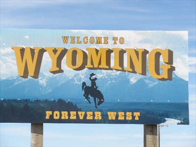
The western side of Wyoming is beautiful – mountainous, scenic and glorious..no other words need apply.  The Tetons rise majestically and Yellowstone is magical.  Mother Nature calls out to you:  hiking, fishing, hunting, skiing, biking, birding, drifting lazily down the Snake River, whitewater rafting, or even a day’s drive looking at scenery and looking for wildlife – people are almost driven to be outdoors.

The eastern side of the state is quite different.  We saw enough of the uninspired landscape (Barbara claims this is not Mother Nature’s fault) of US Highway 85 and Interstate 25 traveling south through eastern Wyoming to last a lifetime.  Wyoming reminded us of the difference between the Hill Country and the desolate, deserted expanse of Western Texas.

But check out the adventures we had getting from here to there!

If you’ve never been to or heard of Buffalo, Wyoming (population 4590 souls), you probably imagine it as some hick cowboy town.  Sure, it is a crossroads to reach the eastern entry to Yellowstone or to head a little further south to reach the Tetons, but Buffalo is a pretty cool place in its own right and, as we found out, a pretty cool place to park Aimee and explore the surrounding area.

DSC07199 (2)

DSC07203 (2)

DSC07204 (3)

DSC07205 (2)

The town proudly hosts the annual Longmire Days Fan Fest every July.

DSC07200 (2)

DSC07206 (2)

If you’re not familiar with the Netflix series “Longmire”, you can google it and see what all the fuss is about.  The “Longmire” series of books was written by a local, Craig Johnson.  The TV series that was produced from the books has developed an almost cult following, and several of the actors, including Robert Taylor who stars as Sheriff Walt Longmire, make annual appearances for the Fan Fest.  Thousands of fans line the streets to get a glimpse of the actors who put Buffalo on the map.

Buffalo has a lot of other things to be proud of as well.  We had a knee-slappin’ good time at the Occidental Hotel and Saloon on Thursday night listening to a blue grass group and tossing back a couple of locally brewed beers that were delicious.

DSC07201 (2)

The Thursday Night Jam Night is a tradition that was started by the hotel owners – no cover charge and the place was SRO.  We did manage to find a couple of chairs just inside the front door of the saloon, and once the music started we had a grand time. We even got a piece of  birthday cake, courtesy of a local whose mother decided the best way to celebrate her daughter’s birthday was to share the festivities with all of the bar patrons.

The saloon has a colorful history for being a place where the lawful and the lawless gathered to drink, play poker, and occasionally shoot up the place!  The saloon was transformed in1908, and today it retains the long, 25-foot imposing back bar with stained glass accents, an intricately embossed tin ceiling and impressive period decorations. Even some of the chairs used by guests of the bar are said to be chairs from the original hotel.  Imagine being surrounded by larger-than-life moose heads, elk heads, bear, mountain lions and other local animals that have been shot, stuffed and mounted and then used as decor.  Apparently, if you look close enough, you can still see countless original bullet holes in the old tin ceiling.

DSC07202 (2)

The “Ox”, as the Occidental Hotel is loving referred to today, was built in 1880, and it is an elegant hotel with period decor and antique furnishings. The Ox is adjacent to the rowdy saloon. Famous historical hotel guests include Butch Cassidy, Teddy Roosevelt and Calamity Jane.  The beautifully embossed ceilings in the lobby are the original ceilings. The hotel struggled financially like many other hotels of the Old West.  While others were torn down, the Ox went into disrepair and limped along.  In 1997, Dawn Dawson bought the building and through her tireless efforts, uncovered this gem of an Old West hotel with all of its architectural treasures and history.  She was able to revive its original character that had been hidden by years and years of endless remodeling by former owners.  The hotel rooms have been updated with modern conveniences but they still retain much of their historic authenticity.

DSC07207 (2)

DSC07208 (2)

The Ox has been named “The Best Hotel in the West” – twice.

DSC07419 (2)

DSC07209 (3)

DSC07210 (2)

We traveled to Crazy Woman Canyon one bright sunny morning to hike the canyon and to be open to whatever we might discover.  We were not disappointed.  It’s about an 18-mile drive south from Buffalo, but the lush green prairies that stretch from the highway to the horizon kept us entertained along the way.

The legend of Crazy Women is the saga of the Morgan family; while traveling by covered wagon westward they were attacked by Sioux warriors.  Three children and their father were killed, leaving only Mrs. Morgan to survive the attack.  She lost her mind, stole an axe from one of the warriors and proceeded to kill four of the Sioux as they fled.  Mrs. Morgan and her dead family were soon discovered by a mountain man named Johnson. He buried the remains of the family members and tried without success to get Mrs. Morgan to leave.  Johnson built her a small cabin, but when he returned in the winter, he found her frozen body, dead from starvation.

DSC07229 (2)

DSC07214 (2)

DSC07213 (2)

We turned on Crazy Woman Road, and arrived at what we presumed was a parking lot for large vehicles.  Two tour busses were parked at the top of a winding road so we maneuvered our way down and around them and headed into the canyon.  Not a hundred yards in front of us were a gaggle of hiking teens and a few adults.  Some of the teens looked like they would rather be back on the bus; others seemed to be having a grand time. We questioned our wisdom in choosing to drive this narrow dusty road, and we headed for the first available turn out to park.  The rushing Crazy Woman Creek was the first thing we heard as we stepped out of our car.

The next thing we heard were the bays of a hunting hound.  To our surprise, around the corner came an old pickup truck barreling its way up the road. On the cab of the truck the driver had constructed a pen of sorts for his three dogs: a hound, some other mutt and a St. Bernard.

DSC07223 (2)

The bed of his truck was filled to the brim with stuff, and attached to the truck was a trailer hauling what looked to be a mule.  The driver stopped by the side of the road, detached the trailer, and headed back to the entrance of the canyon in search of his horse that had gotten loose.  Pretty soon he was headed back into the canyon without his horse, and he announced as he drove by us “he knows the way home.” He reattached his trailer and continued his journey.

As we drove into the canyon, we had passed what looked like a cove in the rocks and we wanted to get a closer look.  Imagine our surprise to find the runaway horse nonchalantly eating grass along the sides of the road.  He didn’t seem bothered by us so we walked around him and headed into the cove.

DSC07211 (2)

The cove looked like it had been a refuge in the past for travelers, and today it serves as a place to hang out and party in the woods.  The cove was littered with trash and graffiti, and we could still see the smoke-charred walls that indicated fires had been used sometime in the past.  We left our new friend munching away and decided to see what else there was to see in this peaceful canyon surrounded by powerful towering cliffs.

Along the way we had to endure the dust from several ATVs, other vehicles, and the 50-60 teens and their chaperones returning from their forced march.  We walked a couple of miles more to reach what we decided was probably the highlight – a geologist’s treasure of volcanic rock that looked like it had once belonged on the side of the mountain.  Huge boulders were stacked on top of one another, and a roaring river made its way over, around and through these massive boulders.  It was a sight to behold.

DSC07217 (2)

DSC07219 (2)

DSC07231 (2)
Blue Flax
DSC07215 (2)
Lewis Flax
DSC07216 (2)
Wood’s Rose
DSC07220 (2)
Common Yarrow
DSC07221 (2)
Royal Penstemon

DSC07224 (2)

DSC07226 (2)

DSC07228 (2)

Heading back to the car, we marveled at what a hidden treasure this canyon is for Buffalo.  The easy walk loaded with all kinds of fragrant wildflowers and trees made for another lovely way to spend the day with nature.

DSC07230 (2)
Yellow Salsify
DSC07417
Spearleaf Stonecrop With Friend
DSC07420 (2)
Subalpine Mariposa Lily
DSC07421 (2)
Prairie Smoke

On sunny days, we prefer to spend our time outdoors hiking, biking and discovering unusual places unique to the town or city where we are camping.  However we were intrigued by the description of a different kind of art gallery near Buffalo: Ucross – “an exhibition celebrating the Ucross fellowship for Native American visual artists.”  We wanted to know more about this gallery because we had read that Ucross provides residency programs for indigenous writers, visual artists, composers, performing artists, etc., from around the world.  The mission of the organization “is to foster the creative work of both accomplished and emerging artists by providing uninterrupted time, studio space, living accommodation, and the experience of Wyoming’s majestic High Plains, and to serve as a responsible steward of its historic 20,000-acre ranch.”

DSC07416 (2)

We drove to Clearmont, WY – about 16 miles north of Buffalo. The lovely shady, tree-lined road onto the property was so welcoming, and two white-tailed deer in the fields greeted us.  We parked and headed to the gallery only to discover that we had to go to the office first.  As we approached the office building, we were welcomed by an old yellow lab who didn’t seem alarmed by two strangers opening the screen door.  The young woman who met us said it was perfectly fine to tour the gallery, so with no further ado, off we went.

The gallery is small:  just two rooms for the imaginative and compelling exhibition titled “Intricate Forms”, the works of two Native American artists – Brenda Mallory (Cherokee Nation) and Sydney Jane Brooke Campbell Maybrier Pursel (Ioway Tribe of Kansas and Nebraska).

DSC07414 (2)

Brenda’s creativity takes many forms.  The framed wall hangings feature exquisitely crafted hand-made white paper with lines and stripes in ink or wool.  Brenda also uses found objects to explore not only what’s inside the object but to reconstruct these found objects into something new and thought-provoking.  We felt the large firehose that had been dissected and reassembled emitted an amazing energy.  Two other large wall hangings constructed with a commercial floor scrubber brush, paint and smaller deconstructed firehose that hung in long strings was reminiscent of a warrior’s shield.  So much to think about.  Brenda’s works stimulated good discussions as we moved to the other side of the room to view Sydney’s exhibits.

DSC07410 (2)

DSC07411 (2)

DSC07412 (2)

Sydney’s works had a younger feel to them.  She is comfortable using a mixed bag of media to inform and express her art.  A video that ran in a continuous loop accompanied a mannequin in a Victorian-era styled dress that Sydney had created using paper copies of the old treaties between the Ioway peoples and the U.S. government.  The accompanying video depicts the artist in the dress, running through the forest, tripping, falling, and tearing the dress.  It was up to us to decide who or what she was running from.  As she makes her way home, we see the artist on the couch, some family members in the background, watching mindless TV, eating junk food and drinking soda.  She eventually sheds the remains of the dress and we experience her as she is today – a tattooed member of her tribe.  We reacted to the “life” that many indigenous people have been forced to live, sequestered on their reservations, many of them alienated from their history and their culture.  Suicide and alcoholism are major issues for many indigenous people in the West, and we saw several billboards in our travels designed to raise awareness for motorists of these critical issues.

DSC07413 (2)

DSC07415 (2)

We walked away from the gallery grateful that we had found this gem during our stay in Buffalo.

See the source image

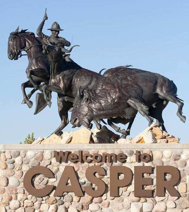
Traveling south to then go east, our next stop in Wyoming is Casper.  Casper (population 57,461) is the second most populous city in Wyoming, and it is known as an oil boomtown and for its cowboy culture.  We stayed in a campground along the banks of the North Platte River that was approximately 10 miles east of downtown Casper.  Once set-up we were greeted by an intense, brief, hellacious afternoon wind and rain storm; after which, well…take a look.

DSC07422 (3)DSC07423 (2)

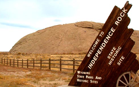
We found 2 not-to-be-missed attractions near Casper – Independence Rock and Hell’s Half Acre.

Independence Rock is a large granite rock, approximately 130 feet high, 1,900 feet long, and 850 feet wide.  During the middle of the 19th century, it became a prominent and well-known landmark on the Oregon, Mormon, and California emigrant trails. Many of those passing through carved their names on the rock, causing missionary Father Pierre-Jean De Smet to call Independence Rock the Register of the Desert.  In 1961 the site was designated a National Historic Landmark, and it is now part of Independence Rock State Historic Site, owned and operated by the state of Wyoming.

See the source image

Hell’s Half Acre drew our attention as a must see because many of the battle scenes from the 1997 movie Starship Troopers were filmed there.  We drove the 43 miles west northwest of Casper through absolutely flat and uninteresting countryside.  It was nice to see pronghorn grazing in the vastness of open fields, but nothing else of much interest is visible along the way.  We found the parking lot, parked, got out to stretch our legs, and  we were then amazed to find an awesome expanse of badlands within a shallow canyon.  If we didn’t know there was such a site to see, we would have passed on by – we thought that the boredom of the surrounding countryside just stretched on and on.   Unfortunately though the public can only view the badlands from the parking lot.  But all-in-all an amazing site.

DSC07424 (2)

DSC07425 (2)

DSC07426 (2)

DSC07427 (2)

DSC07428 (2)

DSC07429 (2)

DSC07429 (3)

DSC07430 (2)

DSC07431 (2)

Many of the friends we’ve made during our travels prefer to use secondary roads to get from here to there – avoiding the Interstates.  They tell us that those secondary routes are less direct but much more interesting – winding 2-lane roads and through many, many small towns (you never know what you’ll find).  We did come to appreciate their philosophy for the southbound 341 miles we rode through eastern Wyoming on Interstate 25.

While the roadway may have been less than inspiring, we found our time in and around Buffalo and Casper to be rewarding.

Next stop…Colorado.

Barbara and Brian

DAKOTAS ON OUR MINDS: PART II

See the source image

July, 2019

So, did you get the bonus point?  Could you name the 3 National Parks, 2 National Monuments, 2 cities you have to visit, a highly recommended State Park, the world’s largest mountain carving, most advertised and famous apothecary in the U.S., and the city that has memorialized every U.S. President with statues on their downtown street corners that are all in or near the western Dakotas? Bonus points for territories and non-state commonwealths?

You’re more than halfway home from our times in the Dakotas.  Hope you enjoy the ride!

See the source image

Korczak Ziolkowski was the sculptor for the memorial, and Oglala Lakota leader Crazy Horse is the model.  Commissioned by Lakota Elder Chief Henry Standing Bear on behalf of the Ancient People of the Plains, Crazy Horse is a hero to all Ancient Peoples, representing their fierce independence and pride.  He was never known to have signed a treaty or touched a pen; he never surrendered to the U.S. Government.

The monument is the world’s largest mountain carving; standing at 564 architectural feet from its base, it is taller than the Washington Monument, and well over two football fields wide.  The carving was started in 1948, and it continues as a work in progress.

DSC07314 (2)

See the source image

DSC07315 (2)

Once we were through the fee gate and had parked the car, we were directed into the Indian Museum of North America.  The museum is an educational opportunity for visitors to explore the culture of Ancient Peoples through preserved artifacts including clothing, everyday tools, weapons, artifacts and other necessary community implements, pictures and sculptures of daily life.  Busts of many great chiefs as well as stories related to the customs of the various tribes were also on display.  Everything is told in honor of those who have come before us, and to bring to light cultural values and tribal dignity.  This might be considered a small museum, but is so fascinating and competently thought-out that we found ourselves well engaged.

See the source image

The sculptor’s vision and model is on display and gave us a  chance to imagine what the monument will look like when completed.

DSC07312 (2)

DSC07313 (2)

The directions from our campground in Rapid City to Deadwood (Brian loved the TV show) were pretty simple:  drive 10 miles to Interstate 90, then go 29 miles west to the exit for Sturgis (!!), then go 13 miles south on US-14A.

DSC07316 (2)

The discovery of gold in the southern Black Hills in 1874 set off one of the great gold rushes in America.  Legend has it that the earliest miners came across a gulch full of dead trees and a creek full of gold…Deadwood was born.  Practically overnight the tiny gold camp boomed into a town that played by its own rules and attracted outlaws, madams and their ladies; gamblers and gunslingers along with the gold seekers.

DSC07318 (2)

DSC07319 (2)

DSC07320 (2)

Wild Bill Hickok was one of those men who came looking for fortune, but just a few short weeks after arriving he was gunned down while holding a poker hand of aces and eights – forever after known as the Dead Man’s Hand.  Calamity Jane also made a name for herself in Deadwood, and she is buried next to Hickok in Mount Moriah Cemetery.

DSC07321 (3)

DSC07322 (2)

DSC07324 (2)
Wild Bill Hickok’s Grave Marker In The Foreground With Calamity Jane In The Back
DSC07323 (2)
Back Of Wild Bill’s Grave…Stuff Left To Commemorate The Life Of A Gambler

Closed to burials since 1949, Mount Moriah Cemetery has served Deadwood as its boothill (potter’s field) and city cemetery since 1878, and it is the resting place for 3,267 deceased.  In addition to the preponderance of Christian graves, sections of Mount Moriah Cemetery were set aside for Chinese and Jewish interments.  Mind-boggling that Jews were living in the Old West in numbers great enough to have so many burial sites.

DSC07327 (2)

DSC07330 (2)

…and last, but not least, we understand from our son-in-law, Ben Bullock, that one of Deadwood’s founders, Seth Bullock, is not a relation…

See the source image

2019 marked the 79th annual motorcycle rally in Sturgis, South Dakota.  For 10 days beginning the first Friday in August, the historically small town of 6,800 souls becomes the motorcycle capitol of the United States with a population estimated by the South Dakota Department of Transportation of more than 500,000.

DSC07332 (2)

We’re grateful that our nephew, Manual Ayala, who, upon hearing the timing of our plans alerted us we’d be in the neighborhood during Rally Week.  We changed our plans so that we’d be out of the area when the shenanigans kicked off.  We did drive around town as the merchants and townsfolk were in process of setting-up for the onslaught…

DSC07335 (2)
Main Street Sturgis Two Weeks Before Rally

DSC07334 (3)

DSC07336 (2)

DSC07331 (3)
Even The McDonalds Is Getting Ready!

Theodore Roosevelt National Park earned its name for 2 reasons:  it honors the President who, more than any other leader of our Country,  believed in the conservation of our Country’s natural beauty, and he assured the preservation of the pristine nature of enormous tracks of land by initiating our National Parks system; the man actually owned a ranch in the Park.  As President, Theodore Roosevelt established the U.S. Forestry Service, signed the 1906 Antiquities Act which directly lead to the proclamation of 18 National Monuments, created 5 National Parks, and 150 National Forests; over 250 million acres of protected land.  Theodore Roosevelt NP was originally established in 1947 as a national memorial park to honor the man.

DSC07352 (2)There are 3 distinct sections of the park, each with its own visitors center:   The Painted Canyon, South Unit and North Unit.  The Painted Canyon and South Unit are along Interstate 94 and approximately 16 miles apart; the South Unit being farther west.  The North Unit is 68 miles away.  Each offers a topography unlike the other 2; the North and South Units have scenic drives with pullouts and parking areas for viewing, and all of the Park’s sections offer hiking trails, and the chance to see wildlife.

The panoramic views from the overlook at the Painted Canyon visitors center are a great introduction to Theodore Roosevelt National Park, and we started to imagine that this park might out badlands the Badlands!

DSC07340 (2)

DSC07339 (2)

Entering the South Unit and beginning our travel along the scenic drive, to Brian’s delight, we found a prairie dog town!

DSC07341 (2)

DSC07342

DSC07347 (2)

Finally looking up from the antics of these playful creatures, a harras of wild horses could be seen in the distance.  The coolest thing about the group was the foals; couldn’t be more than a month or 2 in age.

DSC07343 (2)

DSC07344 (2)

DSC07346 (2)

DSC07345 (2)

Roosevelt’s Maltese Cross Ranch was near the South Unit’s visitor center.  The cabin is all that remains of this ranch.

Roosevelt’s other homestead within the Park was the Elkhorn Ranch.  The buildings no longer exist, but standing in the space once inhabited by Roosevelt and looking out onto the grasslands, it’s not difficult to imagine cattle ranching in the early 20th century.

The scenic drive afforded views of the terrain.  Perhaps we’ve become jaded with all of the beauty, geography and topography we’ve seen during our travels and the hikes we’ve taken and maybe we didn’t know what to expect, but while the South Unit was indeed beautiful and much more green than expected, it failed to leave an “oh wow” impression.  Trails intersected and branched off of each other, and trails were much longer than we were comfortable hiking.  We were interested in seeing the petrified forest areas, but these, too, were well off the beaten path out in the Park’s wilderness area, requiring a good 6-8 mile hike in (and eventually back out) before reaching any of the petrified forest trails.

DSC07348 (4)

DSC07349 (3)

DSC07350 (2)

DSC07351 (2)

In contrast, the North Unit was immediately impressive.  We found ourselves easily drawn into several hikes.  The first brought us to the wonderful River Bend overlook.  Here’s a great spot to view the Little Missouri River floodplain, and to see the river as it flows eastward on its journey eventually northward to Hudson Bay (!).

DSC07353 (2)

DSC07355 (2)

DSC07356 (2)

Not sure why we didn’t know this before, but badlands were formed by glacial activity.  Views from the Oxbow Overlook of the badlands were pretty cool.

DSC07358 (2)

DSC07359 (2)

DSC07360 (2)

DSC07362 (2)
Barbara Thinks This Is A Female Pheasant – Anyone Want To Weigh In?

By far the best attraction of the Park is its most unusual:  the Cannonball Concretions.  “Cannonballs” were formed when sand grains from ancient river deposits were cemented together by minerals dissolved in the groundwater…or… a concretion is a hard, compact mass of matter formed by the precipitation of mineral cement within the spaces between particles, and it is found in sedimentary rock or soil.  Yeah, right…why spheroid?   We may try to explain Mother Nature, but us mere mortals just can’t do her justice.  Check it out…

DSC07363 (2)

DSC07366 (2)

DSC07367 (2)

DSC07368 (2)

DSC07369 (2)

DSC07370 (2)

DSC07371 (2)

DSC07372 (2)

DSC07373 (2)

DSC07372 (2)

DSC07373 (2)

DSC07374 (2)We might have rushed our time at Theodore Roosevelt National Park, not given the South Unit a proper amount of time, and maybe we should have taken a hike.  The North Unit is well worth the visit, and the vistas from the Painted Canyon Overlook are worth the stop while traveling through the area.  Most of all stopping to honor the father of our national parks is a must.

Devils Tower National Monument is in Wyoming, 49 miles from the South Dakota border and 40 miles to the border of Montana.  Devils Tower is a butte composed of igneous rock that rises 1,267 feet above the Belle Fourche River, standing 867 feet from summit to base, and it is 5,112 feet above sea level.  Geologists believe the butte has remained unchanged for tens of thousands of years.

Devils Tower might look familiar. The Tower features heavily in Steven Spielberg’s 1977 film “Close Encounters of The Third Kind.”  In the climax of the film, several characters — who have been so unknowingly obsessed with the structure that they have sculpted it in mashed potatoes and repeatedly sketched it — descend on Devils Tower, where they greet a gargantuan alien mother ship.

DSC07379 (3)

It is an incredibly impressive monolith that, because of the vast prairie and relatively flat topography in the region, can be seen from miles and miles away.

DSC07375 (2)DSC07376 (2)

In 1906 President Theodore Roosevelt proclaimed Devils Tower our first National Monument.  We walked the 1.3 mile trail around the base of the Monument amazed at the ridged face of the structure – Ancient Peoples of the Northern Plains Tribes believed that those ridges are the claw marks of a giant bear.

DSC07378 (3)

DSC07380 (2)

DSC07381

DSC07383 (3)

Barbara had a jones to visit the Tower, and she was right-on. Devils Tower is spectacular!

See the source image

We had a day to kill before pulling out of the Dakotas and decided to take a little trip into Rapid City to check out the line-up of U.S. Presidents on the downtown’s street corners.  This is a project begun in 2000 to honor the legacy of the American Presidency.  Each of the sculptures is privately funded, and the pattern of placement was chosen to maintain a coherent structure and eliminate any sense of favoritism or political gain.  Check on-line or visit one of the merchants on Main Street to get a map.  Here’s a sampling of the statues.

DSC07385 (2)
Thomas Jefferson
DSC07386 (2)
James Madison
DSC07387 (2)
Gerald Ford…Go Blue!
DSC07390 (2)
Sunflower
DSC07394 (2)
Dense Blazing Star
DSC07395 (2)
Andrew Johnson
DSC07396 (3)
Thomas Dewey?
DSC07397 (2)
John Tyler
DSC07398 (2)
Zachary Taylor
DSC07399 (2)
Warren G. Harding
DSC07402 (2)
Woodrow Wilson
DSC07403 (2)
Millard Fillmore
DSC07405 (2)
William Henry Harrison

We were very busy during our time in the Dakotas.  The Black Hills are beautiful, and during summertime, even with tourists, it’s easy to do and see the sights at your pace.  There is just so much to see and do that we found our days to be very full.

Barbara and Brian

DAKOTAS ON OUR MINDS: PART I

See the source image

July, 2019

Pop Quiz, Hot Shot (name that movie for a bonus point).

Name the 3 National Parks, 2 National Monuments, 2 cities you just must visit when in the area; South Dakota’s first State Park, the world’s largest mountain carving, the most advertised and famous apothecary in the U.S., and the city that has memorialized every US President with statues on their downtown street corners that are all in or near the western Dakotas?  Hint – 1 of the National Monuments is not in the Dakotas.

We’re guessing that there’s really no mystery knowing where our journey started so long ago has taken us.  We’re in the Black Hills, a small mountain range rising from the Great Plains of North America that extends from western South Dakota into Wyoming. The name “Black Hills” is a translation of the Lakota phrase “Pahá Sápa,” and is thought to have been so named because of their dark appearance from a distance.

Our campground was 5 miles or so east of downtown Rapid City, South Dakota (population a bit more than 74,000 souls), and when we pulled in we were given the choice of a shady back-in site or a pull through in an open field with no protection from the July sun.  Temperatures were predicted to be in the high 80s and lower 90s, and as road warriors for the past 14 months backing in is an easy task – there was no hesitation in our decision.

DSC07232 (2)

In doing our research, we read that every evening at sundown there is a lighting ceremony at the Mount Rushmore National Memorial that honors the enshrined 4 US Presidents.  Could this be a hidden gem?

As much as we love to hike, and there are trails in the park, we thought it’d be ok this time to just relax and enjoy the ceremony.  If you get there early enough (and we didn’t, and the lines were way, way too long), you can get yourself an ice cream made from Thomas Jefferson’s chef’s recipe.

After parking our car and walking up a short flight of steps to enter the Memorial we were greeted by our first view of Mount Rushmore.  We were so focused on the carvings, we barely noticed walking through the Avenue of Flags.  There are 56 flags representing the 50 states, one district, three territories and two commonwealths of the USA (more bonus points if you can name the territories and commonwealths; minus one if you ask what district?).

Photo of Mount Rushmore National Memorial - Keystone, SD, United States

DSC07236 (3)

DSC07234 (2)

DSC07235 (2)

The ceremony begins after the sun has set, and many people arrive a good hour or so before sunset to be able to pick a prime spot from which to observe the monument being lit (and to get an ice cream – sic).  The well-thought-out ceremony is pre-recorded and performed by a Park Ranger who begins with a brief introduction about the Memorial followed by a reading of inspiring thoughts on liberty written by each of the 4 enshrined Presidents.  The ceremony then pauses to honor veterans and active-duty servicemen and women in attendance, and it concludes with the playing of our National Anthem.  At the end of the Star Spangled Banner the monument is bathed in light.  Listening to what these 4 men had to say about liberty and, in their opinion, what it means to live in the United States we both realized that it’s been a long time since we felt so proud to be Americans.

DSC07239 (2)

Kea went to Carleton College in Northfield, Minnesota (yeah – of the Jesse James Gang fame!), and after graduation some 28 years ago, Badlands National Park was on the agenda for the trip back to Colorado Springs.  Barbara was along for that trip, and she wouldn’t say much about the Park – she wanted Brian to form his own first-timer impression.

DSC07241 (2)

Badlands National Park has 5 entrances.  An entrance on the Oglala Lakota Pine Ridge Reservation which is south and west of the Interior Entrance (Ben Reifel Visitors Center) – not a touristy location to see the badlands, but great if you want to experience Oglala Lakota culture.

The Interior, Northeast and Pinnacles Entrances connect to the paved 28-mile Park Loop Road which winds through the Park – a number of pull-outs along the way afford a chance to view the topography, uniqueness and beauty of the Park.

Travel a gravel road for 25 miles or so to the Park’s entrance off of Sage Creek Rim Road.  This entrance brings the visitor through the Badlands Wilderness and provides views along the Park’s Northern Rim, past prairie dog towns and herds of mountain goats before connecting to the Park Loop Road.  We just can’t help ourselves – really – gravel roads must just be to our liking as we chose the Sage Creek Rim Road as our way into the Park.

DSC07242 (2)
Badlands National Park Far In The Distance – View From The Sage Creek Rim Road

DSC07247 (2)

As we entered the Park we were greeted by a prairie dog town, and we were very lucky on this intensely hot day that the prairie dogs were scampering about from one burrow entrance to another, visiting with each other, and just hanging out outside their burrows. Someone must have paid them to pose for pictures!

Prairie dogs are gregarious herbivorous ground squirrels (related to marmots!) found on the great American prairie, that live in a community of interconnected burrows.  Their warning call sounds like a domestic dog’s bark  – well, you can figure out why these ground squirrels are called prairie dogs…

Brian could have sat and watched those little rascals for hours.

DSC07246 (2)

DSC07243 (2)

DSC07244 (2)

DSC07245 (2)

DSC07250 (2)

DSC07248 (2)

As we traveled along the North Rim we could just begin to make out what was to come…from the vistas it was a pretty obvious conclusion as to why this is called The Badlands.

DSC07251 (2)

DSC07252 (2)

DSC07253 (3)

DSC07254 (2)

A few miles further and we saw vehicles parked on both sides of the roadway.  In Yellowstone NP this is a sure giveaway of a wildlife sighting.  Of course, we had to stop…

DSC07255 (2)
Mountain Goats

DSC07258 (2)

DSC07256 (2)

DSC07257 (2)
So How Cute Am I?

The Park Loop Road can be traveled in an hour to an hour and a half, and visitors have plenty of time to stop at each of the dozen pull-outs for sight seeing, even at the busiest of times in the Park.

DSC07260 (2)

DSC07261 (2)
Hoary Verbena

DSC07262 (3)

DSC07264 (2)

DSC07265 (2)

DSC07266 (2)

DSC07267 (2)

DSC07268 (2)

Our visit took a bit longer.  We added a short hike to the top of the Yellow Mounds…

DSC07269 (2)

DSC07270 (2)

DSC07271 (2)

…and took a 2-3 mile hike in Burns Basin along the Castle Trail with dazzling views of the sandstone formations.

DSC07272 (2)

DSC07273 (2)

DSC07274 (2)

DSC07275 (2)

DSC07276 (2)

DSC07277 (2)

DSC07279 (2)

DSC07280 (2)

Badlands National Park is a unique place on earth for 2 reasons:  the Park is half geologic formations and half mixed-grass prairie ecosystem, and the Park’s geologic deposits contain one of the world’s richest fossil beds. Preserved in the layers of exposed rock and ancient soils are examples of brontotheres ( ancestors of rhinoceroses and horses); oreodonts (hogs, boars); camels, entelodonts (pigs), rabbits, rodents, and carnivores.

See the source image

See the source image

From the Ben Reifel Visitors Center it is only 30 miles to Wall, South Dakota.  The story of Wall Drug is the story of American ingenuity and capitalism. In 1931, Ted and Dorothy Hustead moved from Nebraska to Wall, South Dakota in order to establish Ted’s pharmacy practice.  Almost to the point of failure, Dorothy came up with the brilliant idea of giving anyone who stopped a free glass of ice water.  Ted posted oh so many advertising signs along the highway drawing visitors in for that cold drink.  Move forward almost 90 years and Wall Drug has become a roadside attraction, a family amusement destination, play ground and water pad, shopping and souvenir mecca, a place for a decent meal and fabulous ice cream, and museum.  Don’t worry, you can still get that free glass of ice water!  Had to stop…

See the source image

DSC07281 (2)

See the source image

The discovery of Wind Cave National Park occurred in 1881, when the Bingham brothers heard a loud whistling noise coming out of the ground.  On further investigation they discovered the only natural entrance to what is now known as Wind Cave.  More than 130 miles of passages have been explored and mapped, the overall distance making it one of the world’s longest caves.

The uniqueness of Wind Cave is the speleothems that exist within the cave.  Speleothems are structures formed by the deposition of minerals from water, and they are classified by their shape:  popcorn, frostwork, dogtooth spar crystals, and flowstone.  However, Wind Cave’s most famous formation is boxwork; a speleogen (formed by erosion not deposition) in a honeycomb pattern.  Wind Cave contains almost all of the boxwork found in the world.

DSC07298 (2)

We called ahead to schedule our visit Wind Cave National Park only to find out that the elevator (and only way to descend into the cave) was under repair, and the repairs were not expected to be completed much before Fall.  We were pretty disappointed that we couldn’t descend into the cave, but we were determined to visit this National Park.  We asked about Ranger tours or talks, and we were able to sign on for a Ranger hike to the area’s buffalo jump and talk about what life was like when the Sanson family lived here in the 1880s.  The Sansons were early settlers, and in spite of the extreme conditions found in the Black Hills, they were able to run a successful cattle ranch.  They donated their ranch to the Park as a way to teach others about their life.

DSC07299 (2)
Showy Milkweed
DSC07301 (2)
View From The Buffalo Jump

The Ranger who lead our hike gave us an appreciation for the austere life faced by settlers on this prairie.

DSC07302 (2)

Custer State Park is a short ride north of Wind Cave NP, is named after, you guessed it, George Armstrong Custer, and it is South Dakota’s first and largest state park.  Its 71,000 acres are filled with hiking trails, play areas for youth and families, visitor and educational centers, pavilions for events such as the wedding taking place the day we were there; a truly beautiful ride along any of the roads:  Iron Mountain Road, Needles Highway, Wildlife Loop Road, or Peter Norbeck Scenic Byway.  There are scheduled activities day and night – truly one of the nicest state parks we’ve seen to date.

Did we mention that Custer State Park is also a wildlife refuge?  As we entered the Park from the south, Brian heard what he thought was a motorcycle club riding the Iron Mountain Road.  Nope – the sounds were being made by a heard of bison!  We’ve all heard a bison’s snort, but this was nothing like that.  We could hear them before we saw them – a deep guttural rumbling sound that filled “the whole space” in the valley.  Barbara recorded the sounds, and she will play it for you if you ask.

DSC07304 (2)

DSC07305 (2)

DSC07303

We decided to hike the Lovers Leap Trail, a difficult 4.2 mile loop, 695-foot ascent hike that features beautiful wild flowers and provides scenic views of the surrounding Black Hills from the top of the hill.  The trail also features at least 8-9 crossings of the French Broad River.

DSC07306 (2)
Dame”s Rocket
DSC07307 (2)
Flame Lily

We were a little more than 2 miles into the hike when Brian jumped backward and screamed like a little girl…now Barbara was very kind and swears that he yelled snake.  And wouldn’t you know it?  After all the miles hoofing it in so many different kinds of environments and weather conditions we finally encountered a rattlesnake.  The rattle was barely off of our path and it could be easily seen (and heard!); the body of the snake was visible in the tall grass, and it was wrapped over a fallen tree trunk.  At first we couldn’t see the viper’s head.  We leaned forward and the rattle rattled.  We moved laterally and the rattle rattled.  We gave the tree trunk a kick and the rattle rattled.  When we moved backward or stood still there was no rattle.  Brian could finally see the viper’s head on top of the tree trunk and he (she?) was starring us down.  Barbara suggested running past the snake.  Brian reminded her that the rule with bears is that the slowest person is lunch, but with snakes they simply strike out at whatever moves within their range.  Discretion being the better part of stupidity we turned around…after all, it’s the snake’s home, not ours. (Elyssa…Warning! Warning!—pass on the next 2 pictures)

DSC07308 (2)

DSC07309 (2)
See The Rattlesnake’s Rattle? How About Its Head?

Good start…enjoying the blog, the story and pictures?  Well, hold on for the next installment of our time in the Dakotas…Exceptional!

Barbara and Brian

MONTANA

See the source image

June – July, 2019

Leaving our campsite in Kalispell and saying goodbye to Glacier National Park was difficult, but on our way to The Dakotas we found more than our fair share of terrific adventures all along Interstate 90/94.

Kalispell was home for 10 days while we visited Glacier National Park. We were in Kalispell for the July 4th celebration, and while there we caught up with some needed maintenance for Aimee and replenished our pantry and freezer.

Beginning Of The July 4th Parade In Kalispell. Who Better Then The Marines To Lead Things Off?

What to do in Missoula? The time we were in town was the weekend of the Missoula Marathon which included many shorter runs, and we were lucky enough to be able to cheer on the children and families’ walk/run after visiting the town’s incredible farmer’s market. We took a wonderful bike ride along Rattlesnake Creek, saw the U of Montana Grizzlies stadium, and the Grizzly Statute in honor of Theodore Roosevelt and his dedication to conservation that stands in front of the old railroad station.

A Carousel for Missoula is a volunteer-built, hand-carved carousel located on the Clark Fork River in Missoula’s downtown.

The Dragon Holds Rings That Riders Can Grab As They Go Past. Grab The Golden Ring For A Free Ride
Amazing Detail

20 miles north of town is another of Missoula’s hidden wonders and oddities:  the Garden of One Thousand Buddhas.

Scarlet Beebalm
Orange Daylily
Dane’s Blood
Garden Lupine

Within the Garden of One Thousand Buddhas rests the inspiring central figure of Yum Chenmom, the Great Mother of Transcendent Wisdom.

One thousand Montana-made images of the Buddha, arranged in the shape of an eight-spoked dharma wheel, encircle Yum Chenmo. The dharma wheel literally represents the wheel of transformation; spiritual change; the turning toward awakening. The directions in which the eight spokes radiate represent the Buddhist noble eight-fold path of right view, right intention, right speech, right action, right livelihood, right effort, right mindfulness, and right concentration.

Mining put Butte on the map, and with a little bit more luck, Butte might have become the State Capitol.

See the source image But why “the richest hill on earth”?  Between 1880 and when the last mine closed in 2004, the 2-mile by 4-mile Butte District Strike had been home to not less than 45 different mining companies.  The yield of mineral and precious metal extraction from the Strike was astounding:  10.75 million tons of copper, 700K tons of zinc, 2.5 million tons of manganese, 1.85 million tons of lead, 22.7 tons of silver, 90.6 tons of gold, and 17.6K tons of molybdenum.  Not a bad day at the office!

Beginning at the visitor’s center we enjoyed a trolley tour of historic downtown Butte.  Our tour guide is the history teacher at the high school, and as a multigenerational life-long resident of Butte he had first-hand knowledge of the history of the city.  He also learned facts, anecdotes and myths by listening to family members and their friends talk about the city and events “back in the day.”  Driving the trolley is his summer job.  Those stories, some back to the late 1800s and early 1900s, were re-told today as we rode around downtown.  How interesting that one of our fellow tourists, a woman in her early 90s, had grown up in Butte and could verify most of what we were being told, and then again was surprised at some things even she had not known!

By the 1900s the town’s population grew to over 100,000; based on the miner’s country of origin, various ethnic neighborhoods sprang up.  Violence between neighborhoods occurred frequently and bloodshed was common.  But as long as the mine owners were happy, law enforcement was glad to look the other way.  An abundance of breweries and bars sprang up and businesses had no difficulty finding customers.  With a thriving red light district on Mercury Street, Butte was known as a pretty lawless town.  Our tour guide did let all of the passengers know that Brian’s credit card was on file at the Dumas Brothel (which only stopped operation in 1982!).  Oh yeah, on the other side of the coin, Butte is home to 9 Catholic churches and, at one time, 3 synagogues.

The tour included a stop at the remains of the Berkeley Pit Mine – in its day the largest copper mine on the “hill.”

Berkeley Pit – Now Filled In With Highly Toxic Water Colored By Copper Oxide That Has Leached Into The Water. The “Pit” Is 1 Mile Long, A Half Mile Wide, And Filled To A Depth Of 900 Feet.
Sky Looking Northward From The Berkeley Pit
What Better City For This Museum?
Opened As A Restaurant In 1898, The Building Is Now A Museum Representing Chinese Miners And Their Culture
What Was One Of The Town’s Brothels
The Dumas House – This Was Butte’s Premier Brothel
Ladies Of The Evening Would Try To Entice Customers From The Windows At Both Street Level And From The Second Floor
Butte’s Remaining Operating Synagogue First Opened In 1903

A hidden wonder of the continental divide sits 3500 feet above Butte.  Completed in 1985 after 6 years in the making, Our Lady of the Rockies is a 90-foot tall homage to the Virgin Mary.  Somehow the sculptor believed this to be a non-denominational tribute to all women?

See the source image

Bozeman is Montana’s 4th largest city with a current population of 50,000, and it is often on the list of America’s top 10 places to live.  The source of the Missouri River is 30 miles away in Three Forks, and from Bozeman it is a 90-mile drive along the scenic Beartooth Highway to the north entrance to Yellowstone National Park.  Plenty to do in this neighborhood…

On the way to Palisade Falls we passed Hyalite Reservoir…

DSC07086 (3)

It is a beautiful half-mile hike on a paved path to Palisade Falls, and with a little bit of work climbing over and around large rocks (boulders?) we were able to get as close to the falls as we wished.

DSC07078 (2)
Forked Bluecurls
DSC07080 (2)
Sticky Purple Geranium
DSC07083 (2)
Palisade Falls

DSC07085 (2)All of the travel advisories recommended a visit to Montana State University’s Museum of the Rockies in Bozeman.  We really prefer to stay outdoors, but the museum was  exhibiting a commemoration of Genghis Khan, the Mongol Empire, and the Mongol culture which included a performance of live music and dance from a region of the world neither of us have explored in literature or in person.  Really sounded like something we shouldn’t miss.

DSC07150
DSC07160 (2)
Alpine Thistle
DSC07173 (2)
Barbara Loved This Sculpture
DSC07157 (2)
Welcome To The Museum!
DSC07164 (2)
DSC07162 (2)
DSC07172 (2)
Mongolian Masks Representing Many Deities
DSC07171 (2)
Skeleton Lord Mask
DSC07169 (2)

Ancestral Peoples of the Plains would stampede a herd of buffalo towards the edge of a cliff, and because of the animals’ poor eyesight and the momentum of the herd, most would to fall to their death or become incapacitated after the fall.  People of the tribe would butcher all of the animals, and in addition to drying meat for food throughout the year, every part of the animal was used.  These areas were named Buffalo Jumps.  Near Bozeman is the Madison Buffalo Jump.

DSC07087 (2)
DSC07088 (2)
Musk Thistle
DSC07089 (2)
Goatsbeard
DSC07094 (3)
View Up To The Buffalo Jump
DSC07092 (2)
View Near The Top Of The Jump

Atlas Obscura recommended seeing the Bleu Horses – a set of 39 horse sculptures made primarily of steel and permanently installed on a hillside off Highway 287 just north of Three Forks.  Signs all along Highway 287 prohibit stopping and hiking up to the sculptures, but wouldn’t you know we found an unpaved area cut into the shoulder of the road to stop for a minute and take a picture or 2.

See the source image
DSC07111 (2)
DSC07112 (2)
DSC07118
DSC07114 (2)
DSC07117 (2)

Located in Whitehall, another shouldn’t-be-missed attraction near Bozeman is the Lewis and Clark Caverns.

DSC07149 (2)
DSC07119 (2)
View Of The Jefferson River From The Mouth Of The Cave
DSC07120 (2)
DSC07124
DSC07121 (2)
Western Big Eared Bats
DSC07122 (2)
DSC07123 (2)
DSC07129 (2)
DSC07130 (2)
DSC07131 (2)
Check Out The Shadows
DSC07133 (2)
DSC07135 (2)
DSC07136 (2)
DSC07137 (2)
DSC07139 (2)
DSC07140 (2)
DSC07142 (2)
DSC07143 (2)
DSC07145 (2)

We have to admit that we saved the “most odd” in and around Bozeman for last.  Atlas Obscura describes Jim’s Horn House, Three Forks, as “a collection of 16,000 antlers crammed beautifully into a small shed.”  We couldn’t pass that up now could we?

Jim asks that you call and make an appointment for a personal tour of his collection.  He is engaging and personable, easily offering descriptions of his 60-year collection, the anomalies he’s found (and been given), as well as regaling his visitors with stories about hunting horns.  Jim is quite a conservationist, and he has dedicated time and work-energy to a long hiking trail that winds around and through Three Forks and the countryside.  Anyhow…check it out…

DSC07108 (2)
DSC07103 (2)
DSC07101 (3)
DSC07096 (2)
DSC07097 (3)
DSC07098 (2)
DSC07104 (2)
DSC07105 (2)
DSC07107 (2)
DSC07106 (2)

By making Billings our last stop in Montana we were within reach of Little Bighorn National Monument.  But what about Billings itself?

Billings is the largest city in Montana, but maintains the feeling of a welcoming small town.  The city is surrounded by geological outcroppings of sandstone formations known as The Rimrocks, and we decided to ride our bikes up to Zimmerman Park, and spend some time at the top.  After an easy 5-mile ride, we discovered an additional 5-mile fartoosteeptomakeituptothetop trek…oh well…time to turn around and get the car.

While riding our bikes through a nice residential area a motorist stopped and yelled something unintelligible to us – nothing angry or threatening – just something.  A little while later we were cutting through one of the parking lots at Montana State University Billings (Yellowjackets; mascot is Buzz!), and passed an employee who cleared up what we couldn’t hear from what turned out to be a kind and concerned motorist…a mountain lion had been sighted the last 2 nights roaming the very streets we were riding.  We must not have looked tasty enough?

So we finally made it to Zimmerman Park…nice view of Billings from up there…

DSC07191 (2)

…Do you know the tale of Yellowstone Kelly?  Did you see the 1959 movie about his life?   Neither did we.  Yellowstone Kelly is entombed in Zimmerman Park, and his story is memorialized on a series of posters along the short hiking trail in the park.  Briefly, Luther Sage “Yellowstone” Kelly was an American soldier, hunter and trapper, scout, adventurer and administrator. He served briefly in the American Civil War and then in an 1898 expedition to Alaska. He commanded a U.S. Army company in the Philippine–American War and later served in the civilian administration of the Philippines.  Yellowstone Kelly sounds like quite the patriot, and well deserving of being laid to rest with full military honors.

DSC07190 (3)

Pompey’s Pillar National Monument is a sandstone rock formation that stands 150 feet above the Yellowstone River.  But why a national monument?  Well, an abundance of petroglyphs are carved into the rock formation.  Not enough?  How about the signature of William Clark, co-leader of the Lewis and Clark Expedition?  After all, Clark’s signature on the formation is the only remaining physical evidence found along the route followed by the expedition that exists. He named the outcropping after the son of expedition member Sacagawea—whom he nicknamed “Pompy”.

DSC07194 (2)
DSC07195 (2)
DSC07196 (2)
That Blue Is The Yellowstone River
DSC07198 (3)

Little Big Horn Battlefield.  For us as children educated in the 1950s, Custer’s Last Stand had been the story of outnumbered and heroic American soldiers slaughtered by Northern Plains Ancestral People (Lakota and Northern Cheyenne) led by Sitting Bull.

DSC07174 (2)

The only part of the story that is true is that all of Custer’s troops died during the battle.  President Ulysses S. Grant’s administration was aggressively pursuing imminent domain and driving the Northern Plains Ancestral Peoples from their lands and nomadic lifestyle into reservations.  Custer failed to honor a peace treaty he personally negotiated 2 years before, and the other officers in the Plains command who were within 5 miles of Custer’s battle disliked him to the point of not offering a helping hand.  Hard to say absolutely, but our guess is that The Northern Plains Ancestral Peoples, left alone would not have waged war.

DSC07186 (2)

Little Bighorn National Monument is a memorial to all of the Americans who fought and died on the plains adjacent to the Little Big Horn river in 1876.  There are many tombstones for the US Army Soldiers, and a few for the Lakota and Northern Cheyenne who fell in battle.

DSC07180 (2)
DSC07181
DSC07176 (2)
George Armstrong Custer’s Brother
DSC07175 (2)
DSC07183

The Memorial for the US Army Soldiers is located on high ground above the battlefield.  It also happens to be where their bodies were found.

DSC07178 (2)

However, the Memorial constructed by the Northern Plains Ancestral Peoples respectfully presents a time-line of the struggles with the US Government, the unification of tribes in response to threats and in preparation for war, the battles associated with the Little Big Horn River, and an ultimate prayer for peace.  The Memorial has a direct opening to the Army Memorial symbolically inviting the spirit of all the dead to unite and seek amity.

DSC07182 (2)
DSC07184 (2)
DSC07187 (2)

We have to admit that Montana has a whole lot more to offer than we expected!

Barbara and Brian

CALGARY, ALBERTA, CANADA

DSC06986 (2)

July, 2019

We took a slight pause from our visits to Glacier National Park and enjoyed a 5-star out of 5-star long weekend visit with Bob and Marlene Gill, friends made during the month we spent in Mesa last March.  They live in Calgary, Alberta, and not only were they incredibly gracious, welcoming and warm hosts, but they took us to visit Lake Louise and Banff National Park and treated us to a Stampede pancake breakfast. What great friends!

Alberta is known for the oil industry, for its vast farming and cattle ranching areas, northern forests, the Rocky Mountains, cold winters, excellent skiing, and fossils, including the discovery of a dinosaur fossil – a species that goes by the common name of “Albertosaurus.”

See the source imageCalgary is the largest city in Alberta with a population of nearly 1.1 million, and it ranks high for quality of living, according to the Mercer Quality of Living Surveys, and it is listed as one of the cleanest cities in the world by Forbes Magazine.

DSC06987 (2)
Calgary Skyline From Bob And Marlene’s Neighborhood

Calgary is best known for the “ Calgary Stampede”.  About a million people visit the show a year, and it is billed as “The Largest Outdoor Show in the World”; it’s all about Rodeos, Native Indians, Food, and of course rides.  The City hosted the Winter Olympics in 1988, and it was pretty cool to see the ski jump venue as we drove along the highway.

See the source image

Bob and Marlene let us know that between December and the end of February the average daily daytime temperatures are below freezing (below 32 degrees fahrenheit), and that the overnight temperatures frequently dip into the single digits or colder.  There is a monthly average of 20 days of snow (!) during the same period of time.  There is wintry weather in November (average 16 days of snow), March (average 16 days of snow), April (average 7 days of snow), and October ( average 5 days of snow) as well; temperatures aren’t quite so severe.  With average daytime temperatures during the winter months in the 70s and overnight in the mid-to-high 40s, Mesa may just be a little bit better alternative than their winter home!

See the source image

Lake Louise and Banff National Park are small communities in the Canadian Rockies.  The overcast skies we encountered on our ride into the Rockies cleared as the day went along.

DSC06989 (4)

Canadian tourism describes Lake Louise as “a hamlet in Alberta, Canada that was named for the nearby Lake Louise.  Lake Louise was in turn named after the Princess Louise Caroline Alberta, the fourth daughter of Queen Victoria and the wife of John Campbell, the 9th Duke of Argyll, who was the Governor General of Canada from 1878 to 1883.”  The area is a year-’round recreation and vacation destination.  Winter skiing and hiking the rest of the year is complemented with water activities on the lake during summer months.  Sitting on the water’s edge, The Fairmont Chateau Lake Louise (sister hotel of the Chateau Frontenac we visited in Quebec City) provides first-class accommodations, and it is an icon of the hamlet.  The vista from the Hotel begins with the phenomenal color of the waters of Lake Louise that rise to the heights of the surrounding mountainsides.  Beautiful!

DSC06990 (2)
DSC06991 (2)
DSC06993 (2)
DSC06994 (2)
Victoria Glacier Rising Above Lake Louise
DSC06997 (2)
From The Plaza Behind The Fairmont Lake Louise Hotel
DSC06998 (2)

From humble beginnings as a 10-square-mile hot springs reserve, Banff National Park became Canada’s first national park.  It now extends to more than 2500 square miles of mountain scenery nestled in the heart of the magnificent Canadian Rockies.  The forest is thick and deep, the mountains as majestic as the Colorado Rockies, and the Bow River supplied by waters from Bow Glacier melt, runs swiftly through town (as well as through Calgary – 79 miles away).  Banff is a touristy town that has the usual t-shirt and souvenir traps, a broad range of restaurants as well as an assortment of upscale and exclusive shops.  However, visit the Rimrock Hotel or the Fairmont Banff Springs Hotel and be transported to Old World Europe, perhaps even feeling like you’ve been transported to Switzerland.

DSC06999 (3)
DSC07000 (2)
DSC07001 (2)
Check Out The Natural Grass Roof On The Visitor’s Center
DSC07002 (2)
…We Love This Picture…
DSC07004 (2)
Rimrock Hotel Entry Portal
DSC07005 (2)
DSC07006 (2)
Bow River – Downtown Banff
DSC07007 (2)
DSC07008 (2)
Fairmont Banff Springs Hotel
DSC07009 (2)
DSC07010 (2)
DSC07012 (2)
Welcome to My Campground!
DSC07013 (3)

After enjoying our Stampede pancake breakfast we were treated to a drive through downtown Calgary…

DSC07014 (2)
Sculpture – Downtown Calgary

…and before taking our leave from a marvelous weekend with such wonderful friends the sky offered us one last view that we had never seen before!

Clouds In Calgary I (2)
Cotton Puffs?
Clouds In Calgary II (2)

Lake Louise and Banff offer a different view of the Rockies than we have ever seen during times we’ve spent in Colorado Springs and Rocky Mountain National Park, in Yellowstone, or hanging out at Glacier National Park.  Lakes of glacial waters are that great teal blue color, the mountains intimidating, and the outdoors inviting and challenging.

Calgary is an active metropolitan city that is sophisticated and upbeat, and well worth exploring, especially when it’s not Stampede.  Just be forewarned – if Marlene asks you to play pickleball, prepare to be humbled.

Barbara and Brian

GLACIER NATIONAL PARK – PART II

DSC06852

July, 2019

Glacier National Park has 4 distinct areas to explore: Lake McDonald; Logan Pass, Saint Mary and Many Glacier; Two  Medicine; and Goat Haunt and North Fork Trails.  By traveling Going to the Sun Road we were able to experience the Lake McDonald, Logan Pass, and Saint Mary areas of the Park, and following Park Ranger recommendations we spent hiking time in Many Glacier.  Our education of the Park was enhanced by the Red Bus Tour, we saw a bear within 10 yards or so of our Bus, and Brian fell in love with the Mountain Goats.  We didn’t spend time in Two Medicine or Goat Haunt and North Fork Trails.  Even considering the parts of the Park we did explore, we barely touched much of what Glacier National Park has to offer.

The ecosystems within the Park are incredibly varied, and enhanced the specialness of this place.  Our Grinnell Glacier hike took us above the tree line and into a sub-alpine tundra; the east side of the Park is home to Saint Mary Lake, and features grasslands and foothills for the surrounding mountains and their majestic peaks.  Around Logan Pass we found mountain passes, snowfields and an alpine lake; it is gloriously beautiful along Lake McDonald and Saint Mary Lake with their rocky shores and adjacent pine forest trails; pine forest abounds at lower elevations, the cedar forest is estimated to be over 700 years old and is representative of a rain forest environment, and, of course, at the highest elevations there are icefields and glaciers.  Desert environs were missing!

The hike to Avalanche Lake is 4.6 miles long, starting out along Avalanche Creek and through a thick cedar and pine forest.  The path meanders up and down slight inclines and declines as it makes its way to the lake – beautiful at every turn.  On the return we were told that a bear had been sighted, but that it was heading up into the woods and away from the hiking path.  Damn, no bear spray (pepper spray) or bear bells (bears are supposedly frightened by the sound) to protect us just in case. Reminded Barbara of a joke…what’s the difference between black bear scat and grizzly bear scat?  Black bear scat contains pine nuts and huckleberries…Grizzly bear scat contains bear bells and smells like pepper!

DSC06959 (2)
On The Way to Avalanche Lake
DSC06960 (2)
Avalanche Creek
DSC06961 (2)
DSC06962 (2)
DSC06963 (2)
DSC06964 (2)
DSC06971 (2)
Avalanche Lake

Rocky Point is on the northside of Lake McDonald, across the lake from Going to the Sun Road.  This side of the lake is almost, but not quite, backcountry; dirt roads, tent camping and, other than the hike to Rocky Point, unimproved and not well traveled hiking trails.  The view of the lake and the mountains to the west is outstanding!

DSC07015 (2)
DSC07020 (2)
DSC07021 (3)

Boat rides are offered on Lake McDonald and Saint Mary Lake, and both have the option of adding a Ranger-lead hike.  The Saint Mary Lake excursion included a hike to Saint Mary Falls…easy choice!

DSC07024 (4)
Cruising Saint Mary Lake
DSC07026 (2)
DSC07028 (2)
And Who Should Wander By As We Began Our Hike?
DSC07036 (2)
Approaching Saint Mary Falls
DSC07031 (2)
Lower Half – Saint Mary Falls
DSC07035 (2)
Saint Mary Falls

The Hidden Lake Overlook Trail is behind the Logan Pass Visitors Center, and it is a 2.6-mile hike with slight elevation changes.   Even though we completed the hike in July we had to cross some pretty slippery snowfields.  We had hoped to continue 2.4 miles further to Hidden Lake, but found that the trail was closed, because a mother bear and 2 cubs had been sighted in the area.  Since this was our last adventure up to Logan Pass we stopped along the way for a few last pictures before heading out on our hike.

DSC07037 (2)
Jackson Glacier
DSC07039 (3)
DSC07040 (3)
Logan Pass Is Up There Somewhere!
DSC07041 (2)
DSC07068 (2)
DSC07043 (2)
On The Way To Hidden Lake

A herd of Mountain Goats decided the path really belonged to them!

DSC07044 (2)
DSC07045 (2)
DSC07046 (2)
DSC07047 (2)
DSC07069 (2)

And of course, a Marmot was hanging around looking for a handout…

DSC07050 (2)
DSC07059 (2)
DSC07051 (2)
Just A Part Of Hidden Lake
DSC07063 (2)
More Of Hidden Lake
DSC07064 (2)
To The Left – Love The Reflections In The Lake
DSC07065 (2)
DSC07066 (2)

There are 2 tunnels along the Going to the Sun Road; one east and one west.  We couldn’t help ourselves and had to have a picture of Heavens Peak from the tunnel on the west side of Glacier NP…

DSC07072 (2)
DSC07073 (2)

One day while driving out of the Park we ended up at a dead stop for about an hour and a half.  A visitor had fallen asleep at the wheel, drove off of the road and down the forested embankment he went.  The medivac helicopter was needed for the driver, and a very perplexed tow truck driver had the difficult task of figuring out how to salvage the vehicle.  As a matter of fact, once we were again on our way back to Aimee, the tow truck driver barreled out of the woods startling Barbara.  Oddly, or perhaps not, in the next week there was a news report of another traffic jam from another knuckleheaded driver.

Our last hike before saying good-bye to Glacier NP was perhaps our shortest, but moved Barbara more than any other.  The Trail of the Cedars is a flat 0.9-mile loop through a 750-year-old forest of tall and imperial cedar trees.  As mentioned earlier this is a rainforest ecosystem – unique to the Park.  The walk is beautiful, peaceful, shaded, and begged us to just slow down, pause and take it all in.  We found the forest to be centering, and a perfect place to reflect on the grandeur of Glacier National Park, all we had done and seen, and the enjoy all that the Park had given us.  See the source image

DSC07074 (2)
DSC07076 (2)
DSC07077 (2)
See the source image

Glacier National Park is our second favorite National Park to date.  It’s a long way from there to here, and it doesn’t matter how you figure out to get here anyhow…just do it.

Barbara and Brian

GLACIER NATIONAL PARK – PART I

DSC06852

July, 2019

We’ve raved about National Parks in the blogs you’ve been so kind to read.  We’ve provided pictures as a means to document the magnificent, majestic and beautiful geography and topography, flora and fauna we’ve seen.  Not always about National Parks, the blog has become our journal of adventures no matter where the road has taken us.

Zion, Arches, Capitol Reef and Yellowstone are, in our opinion, the best of the best.  Next in line is – and in no particular order – Acadia, Bryce Canyon, Saguaro, Joshua Tree and Big Bend National Parks during this part of our journey started so long ago, and the Great Smoky Mountains and Yosemite National Parks from the recent past.  In total we’ve visited 29 of the 46 National Parks in the contiguous United States, and we wouldn’t have missed a one.  We just have our favorites.

We thought that Glacier National Park would be something special…at least that’s what “everyone” who has been there has told us.  The National Park Service calls Glacier NP “one of the crown jewels of the National Park system,” and the Park is not shy about its fame, importance and eminence either – calling itself the “Crown of the Continent.”  Pretty heady press to live up to!

We visited Glacier Bay during a trip to Alaska a bunch of years ago, and we found out that glaciers in the Bay grew from the middle out creating a pressure on the “cliff face.”  Eventually the pressure becomes so great that, with a sound like a gun shot, massive chunks of ice split off of the glacier and float away on the tides as the icebergs they are.

Glaciers are accumulations of ice and snow compacted and persistent over time, and, by the way, because of their weight, are, albeit very, very slowly, constantly moving.  Glaciers form when the accumulation of snow exceeds its melting and absorption rate back into the atmosphere and refreezes as ice, often over centuries.  To be glacial the snow/ice pack must be at least 25 acres in size (that’s 22.5 football fields with the endzones included!) and it must have a depth of at least 100 feet.  Smaller snow/ice packs do not have the size or depth to meet the constantly in motion criteria; i.e., they are not glaciers.

By the way – the water within The Park is particularly blue (Barbara says it’s a beautiful shade of teal) because glacial movement grinds rocks and stones into a sediment that mixes with glacial ice melt and feeds the rivers, pool, and lakes .

Glacier National Park was created in 1910, and at the time 150 glaciers were documented within the Park.  Today the number totals less than 30.  Fear has existed that the glaciers would disappear from the Park between 2030 and 2080, but the Park Service, with the help of the USGS have determined that several of the present day glaciers have actually begun growing.

What did “everyone” say was so wonderful?  Well, Going to the Sun Road and Logan Pass, Lake McDonald Lake and Lodge, and St. Mary Lake were tops of the list, and, oh yeah, “everyone” was sure we’d see bear, big horn sheep and rocky mountain goats…maybe even moose.

Contiguous with Glacier NP to the north is Waterton Lakes National Park, Alberta, Canada, and we were told, if we had time and our passports that its pretty cool to take a boat ride on Upper Waterton Lake from Waterton Park to Goat Haunt…from Canada to the US – all within Glacier NP.

The village of West Glacier was our access point into The Park.  There are approximately 30 miles from Kalispell to Glacier NP, and we enjoyed passing through the small communities of Columbia Falls and (smaller still) Hungry Horse, Montana on our way.  West Glacier is a place for a quick bite to eat, souvenirs, and to stop for snacks and water before entering The Park.  We showed our geezer passes at the entry fee station, obtained our map and Park newspaper and drove just a little more than 2 miles to the Apgar Village Visitors Center.

As we’ve written before it’s well worth the effort to stop at the Visitors Center, take a look at the displays, examine the range, time and dates of available Ranger talks, see what special events may be taking place in the Park during your visit (night sky?), and to spend time planning your visit.  If you let the Rangers know how long you’ll be visiting and what physical limitations you might have they will help you maximize your stay.  In our case and with 5 days to spend in Glacier NP the Ranger we spoke with recommended taking a day to drive the entire length of Going to the Sun Road and stopping along the way to enjoy the views from the many parking spots along the road’s 50 miles.  Hiking the Avalanche Lake, Rocky Point, Trail of the Cedars, Grinnel Glacier Viewpoint and Hidden Lake Overlook trails were also recommended.  By hiking those particular trails we’d have a chance to view the many climates and ecosystems in The Park.  We also planned on an all-day excursion with the renowned red bus tours (more on that later).

After visiting with the Rangers we felt a need to stretch our legs and do a bit of a warm-up before jumping into something more strenuous.  There is a 1.5 mile hike from the Apgar Visitors Center along a paved path (as long as you follow it!) that took us through a pine forest, along the Middle Fork Flathead River, and past some pretty nice wildflowers.

DSC06853 (2)
Looking Back On The Apgar Visitors Center
DSC06855 (2)
Lodge Pole Pine and Clear Blue Skies Greet Us On Our First Walk In Glacier NP
DSC06858 (2)
Thimbleberry
DSC06859 (2)
Middle Fork Flathead River
DSC06860 (2)
Tasselflowers
DSC06861 (2)
Meadow Hawkweed
DSC06863 (2)
DSC06864 (2)
Crowfoot, A Species of Buttercups

After 11 years of construction Going to the Sun Road opened in 1932, and it is a 50-mile miracle of the Civilian Conservation Corps’ work.  Going to the Sun Road heads north from the Apgar Visitor’s Center, traveling along Lake McDonald before gaining an elevation of 3300 feet, arriving at Logan Pass.  During the ascent there is only 1 switchback and 1 tunnel, and the edge at the most dangerous curves is protected by 2-3 foot walls that have stood since completion of the road.  There is a sharp turn south at Logan Pass before the decent turns northeast and leaves The Park at St. Mary.

Winter snows average 10-12 feet annually; however, with avalanches and neverendinginthewinterblowinganddriftingsnows, snow depths have been recorded up to 80 feet in some locations along Going to the Sun Road.  Typically the road closes the 3rd week in October.  Opening is uncertain and absolutely weather dependent.  At best the road opens sometime in mid-June, but late June to early July is not unusual.  Beginning sometime in the spring, snowplows begin working from the St. Mary and West Glacier entrances and meet at Logan Pass to officially open the road.  However, there is no guarantee of the road staying open since a June or July snowstorm is not uncommon and may temporarily delay opening, causing re-closure until the snow is removed.  So off we went – a little rain, but no snow!!  Here’s what we saw and thought was worth a picture….

DSC06865 (2)
Beginning Our Drive On Going To The Sun Road
DSC06866 (2)
The Road Goes Where?
Red Rock Glacier (2)
McDonald Creek
DSC06868 (2)
The Road Goes Where?
DSC06869 (2)
Heaven’s Peak
DSC06870 (2)
Heaven’s Peak
DSC06871 (4)
Blackfoot Glacier
DSC06872 (2)
DSC06873 (2)
Run Off From Glaciers Create Creeks Throughout The Park
DSC06931 (2)
A Common View Along Going To The Sun Road
DSC06874 (2)
See the source image
DSC06875 (2)
Salamander Glacier
DSC06876 (2)
DSC06877 (2)
Swiftcurrent Glacier

About half a mile from Logan Pass we were surprised to encounter Rocky Mountain Goats, still cloaked for winter, enjoying their breakfast.

DSC06879 (2)
DSC06880 (2)
DSC06881 (2)
DSC06883 (2)
DSC06884 (2)

Whew!  1st half of Going to the Sun Road completed.  Time for a break at Logan Pass…

DSC07042 (2)
DSC06933 (2)
Behind The Logan Pass Visitors Center – We Noticed That These Avalanche Lilies Were “Upside Down” Overnight Awaiting Full Sunlught, And Seemed To Collect Dew On The Underside Of Their Petals

…A small herd of Big Horn Sheep came down the slope to grab a bite to eat and to pose for a picture or 2.  Talk about timing!

DSC06885 (2)
Alpha Male Standing Guard?
DSC06886 (2)
DSC06887 (2)
DSC06888 (2)
Think He Just Remembered A Joke?
DSC06889 (2)
DSC06890 (2)

It’s downhill from Logan Pass to St. Mary and when passing the next turnout Barbara happened to notice a furry animal beneath one of the parked cars.  When Brian took a quick look he saw a single low to the ground brown and white coated mammal with clawed paws and what he thought were stripes on the head.  Could this be the elusive wolverine? Nah – it turned out to be a marmot.  By the way, marmots are rodents – large ground squirrels, just cooler looking.

DSC06891 (2)
DSC06894 (2)

Honestly, the Going to the Sun Road on the east side of the Park is not as harrowing to drive, nor are the views as spectacular as they are on the west side.  Don’t get us wrong though, we loved the east side of the Park as well.  More to come…

Operating within the theory of “might as well get the toughest and nastiest out of the way (?)” we decided to start our hiking in Glacier NP by challenging ourselves to complete the Grinnell Glacier Viewpoint Trail.  The trail is usually a 10.2 mile roundtrip hike with an elevation gain of almost 2,600 feet – yeah a little less than a half mile up, up, and up. However, there was dangerous snowpack right around the 3.5 mile marker, and the trail was not open beyond that point to us mortal and amateur hikers…this knocked off a few miles and became one 7-mile strenuous hike.

Grinnell Glacier Viewpoint Trail is located in Many Glacier, a part of The Park that has its own entrance.  Since we were camped south and west of The Park, and we entered from West Glacier Village the easiest way for us to get to the trailhead was to drive the entire Going to the Sun Road, leave the Park at St. Mary, travel through the Blackfeet Indian Reservation north for 9 miles and re-enter the Park at the Many Glacier entrance.  Really!  Sounds more complicated than it was, and seemed a pretty cool way to go since we thought it would give us a second chance to see more of the magnificent views we had experienced the day before.  However, and about 2/3’s of the way up to Logan Pass, the morning’s low hanging clouds remained, and driving through the clouds gave us an incredible otherworldly adventure.

The kick-ass tiring hike was glorious with views of the Glacier and Grinnel Lake, as well as fields and fields of beautiful wildflowers to see along the way.  We had heard from other hikers that a mother bear and 2 cubs and a moose were sighted at the top of the climb, but alas and alack each had moved on by the time we arrived.

DSC06896 (2)
DSC06897 (2)
Bear Grass
DSC06905 (2)
Lake Josephine
DSC06899 (2)

DSC06906 (2)
DSC06914 (2)
Grinnell Lake
DSC06908 (2)
Brunnera or Great Forget-Me-Not
DSC06922 (2)
Subalpine Mariposa Lily
DSC06923 (2)
Rose Meadowsweet
DSC06915 (3)
Grinnell Glacier In The Background…Grinnell Lake In The Foreground
DSC06912 (2)
Scarlet Indian-Paintbrush
DSC06916 (3)
DSC06917 (2)
DSC06918 (2)
DSC06919 (3)
DSC06921 (2)
Waterfall And Snow Pack
DSC06920 (2)

Since the late 1930’s Red Bus tours have been giving visitors to Glacier National Park an opportunity to learn about the Park from experienced guides.  There are half-day tours for each of the west and east sides of the Park, as well as a full-day tour encompassing the entire Going to the Sun Road and Many Glacier.  The fleet was originally built by the White Motor Company, and the buses are open-air extended passenger vehicles with a reinforced chasis and suspension that hold up to 17 passengers.  The fleet has been entirely restored, and, with the help of Ford Motor Company, they are now going through a gradual conversion from burning gasoline to an environmentally friendly hybrid engine.

DSC06947 (2)

This isn’t one of those “canned” trips on a “get here from there vacation with the Griswolds” schedule.  Each guide is also your driver, and brings his or her own personality to the tour.  The drivers are called jammers because back in the day of clutches and shifting gears, one had to jam the shifter when changing gears.  Our guide, Jammer Karl, was more than willing to share parts of his life, his own experiences of working and living within Glacier NP, and took the time to know his passengers well enough to ensure a personal experience.  Turns out Jammer Karl’s from Indiana and wouldn’t you know that he, Barbara and I have chewed the same turf along the way!

Our all-day tour traversed the Going to the Sun Road and made long enough stops at Lake McDonald and Many Glacier Lodge, Logan Pass, Saint Mary Lodge and Resort, and the most photographed location along Saint Mary Lake to stretch our legs, use the facilities, grab some snacks and slow down just a bit before continuing our tour.  We stopped along the way at points of interest – chances for us to learn about what we were seeing.  Karl answered our questions, pointed out glaciers, told us tales and facts about the Park (e.g.: Going to the Sun Road is named after an ancient tribe’s Chief), made bad jokes, and gave us permission to “prairie dog” (pop up to take pictures), and take up song when the mood struck.  Luckily our fellow passengers had as warped a sense of humor as Brian, and responded to Karl as well as each others with laughs and on-going banter.

DSC06958 (2)
McDonald River
DSC06925 (2)
Lake McDonald
DSC06926 (2)
McDonald River
DSC06927 (3)
DSC06957 (2)
DSC06928 (2)
Blackfoot Glacier
DSC06930 (2)
DSC06934 (2)
Clouds Hanging On Logan Pass
DSC06936 (3)
Jackson Glacier
DSC06937 (2)
Saint Mary Lake
DSC06938 (2)
View Of The Park From The Blackfeet Indian Reservation
DSC06939 (3)
Grinnell Glacier
DSC06942 (2)
Swallows’ Nests – Many Glacier Hotel
DSC06943 (2)
DSC06944 (3)
Lake Josephine From Many Glacier Hotel.  Grinnell Glacier Is A Long Way Off.
DSC06946 (4)

After driving Going to the Sun Road west to east, and then heading to Many Glacier Hotel for lunchtime we started back to the Apgar Visitors Center.  This meant that we’d start by traveling the east side of the Park…remember we mentioned that the road was not as harrowing to drive, and that the views aren’t as spectacular as they are on the west side?  Well, that doesn’t include animal viewing…yup, a bear, and then a rather large herd of Big Horned Sheep.

DSC06948 (2)
DSC06949 (2)
DSC06950 (2)
DSC06951 (2)
DSC06953 (2)
DSC06954 (2)
You Looking At Me?
DSC06956 (2)

We thoroughly enjoyed our day, and while we had seen many of the sites on the tour before our tour, what we learned enhanced our experience of the Park.  We highly recommend that if you have the chance to visit Glacier National Park, take an all-day red bus tour.

Bleary-eyed?  Take a breath before heading into our Glacier National Park Blog Part II.

Barbara and Brian

YELLOWSTONE NATIONAL PARK

DSC06694 (2)

June, 2019

We’ve mentioned before that a few years ago we shared a week or so with the Toporskis and the Stephens, friends from Pennsylvania, rambling around Yellowstone National Park.  We fell in love with our nation’s first national park (thank you Theodore Roosevelt!), and since we were heading up to Glacier National Park anyhow a stop over in Yellowstone NP was calling out to us!  We so looked forward to exploring parts of the Park we hadn’t seen before as well as setting aside some time to visit some of our favorite spots from the previous trip.  And if we saw a bear or 2, a wolf or moose, pronghorn, coyote, and an eagle it would even make the visit sweeter.  No doubt we would see the ubiquitous bison and elk.

DSC06659

We stayed in a campground about 20 miles west of the West Yellowstone entrance to the Park.  The campground was situated in a location that may have been the most beautiful we have experienced to date.

DSC06664 (2)
DSC06787 (3)
DSC06666 (3)
DSC06788 (2)
DSC06665 (2)

What we didn’t count on was the weather.  By this time in mid-to-late June it’s turning the corner into summer, and shouldn’t Yellowstone NP have warm days and cool nights?  Nah.  Not sure why, but Brian keeps forgetting that we’re in the Rocky Mountains, and at an elevation of 8,000 feet or so, and he obviously didn’t learn his lesson about elevation and precipitation from our experience traveling from Kanab to Richfield.  It snowed (blizzard for about 20 minutes) on us, it rained, day time temperatures ranged from a high in the 40s to highs in the 70s, and somedays we had to pull out our warmest warmer clothes.

snow storm yellowstone
The Morning After A Snowstorm

Except for Saturday, traffic in Yellowstone NP was far worse than we remembered.  On Saturday we were able to drive freely, and we actually wondered where all of the other visitors might be hiding.  We found that on weekdays every parking lot near major attractions was pretty well filled by 10am, the roadways around the Park were jammed, and then the tour buses just clogged things up even more.  Vacationers, we guessed.  A traffic back-up is expected if there’s an animal sighting.  People will pass slowly by in order to get a good look or to take a picture – maybe they’ll jockey to find a place to park their vehicle to get a closer look.  It’s expected that if bison or elk are on the road and blocking the direction to which you want to go or maybe even if the animals are surrounding your vehicle, you will wait for them to clear off of the road (and pray they don’t take offense to your vehicle being in their way).  Doesn’t matter if it’s 5 minutes or 2 hours.  After all it is their home – we’re just visitors.  Rangers do sometimes help move rubbernecking tourists along a little more quickly, but rangers have no influence on 20-30 bison hanging out on the road.  So whether caused by human frailties or by residential imminent domain when driving through the Park, patience is required.

DSC06628 (2)
Mystic Falls

We looked forward to participating in talks, walks and hikes lead by Park Rangers; we chose the Mystic Falls hike.  Along with a dozen of our closest friends we met the Ranger at the Firehole River Bridge for a 2-1/2 mile hike to Mystic Falls along Biscuit Basin.  The hike starts out gloriously with a walk past Sapphire Pool and Black Opal Geyser…

DSC06624 (2)
Black Opal Geyser
DSC06631 (2)
Black Opal Geyser – The Geyser Empties Of Water After Each EruptionDSC06633 (2)
DSC06635 (2)
Sapphire Pool
DSC06625 (2)
DSC06634 (2)
The Thermal Resistant Algae Living In Sapphire Pool Create The Color

…And then follows along the Little Firehole River before getting to the Falls.

DSC06626 (2)
Little Firehole River

After the mandatory “watch out for bears” and why you should always carry bear spray talk, the Ranger guiding our hike taught us about how to differentiate the type of pine trees in this forest, and the effect recent fires have had on the forest itself.  We didn’t know that the Lodge Pole Pine is extremely heat resistant and can survive a fire that devastates other pine species, that some pine trees drops their seeds as soon as the forest temperature reache a certain degree, and that other pine trees are constantly losing their cones (seed pods) in order to propagate their species.

DSC06636 (2)

We were chilled after our hike and decided to eat our lunch in the Old Faithful Inn…guess we felt we had to pay our respects.

DSC06638 (3)

Our next adventure took us out to the Lamar Valley in pursuit of animals.  Along the way we stopped to enjoy Gibbon Falls.

DSC06639 (2)
DSC06641 (2)
DSC06643 (3)

In the Lamar Valley we were able to see pronghorn, bison and their calves.  We were pretty disappointed at not seeing any bear, at least until we found one fast asleep behind a tree.

DSC06654 (2)
By The Way, Pronghorns Are Not Antelope.  Their Closest Living Genetic Relatives Are Giraffes And Okapi.
DSC06657 (2)
DSC06660
DSC06661
DSC06646 (2)

The Harlequin Lake Ranger Walk meets just west of Madison Junction, and is an easy 1.5 mile hike through the forest to a beautiful beaver pond.  Along the way we did see a snake slithering quickly into the underbrush, and we encountered a vole while down by the pond.

DSC06667 (2)
DSC06668 (2)
Morning Dew
DSC06673 (2)
DSC06674 (2)
DSC06676 (2)

Steamboat Geyser is considered the tallest active geyser on earth.  Its major eruptions shoot water more than 300 feet into the air.  Listening to the Ranger we found out that Steamboat Geyser has had a history of inconsistent times between eruptions, and until recently, eruptions could be decades apart.  The geyser’s eruptions have become closer and closer together, the most recent 2 eruptions a mere 10 days apart.

DSC06678 (2)
Steamboat Geyser

Steamboat Geyser is located in the Norris Geyser Basin, which is home to many other thermal springs, pools and geysers.  Less spectacular than Steamboat is Vixen Geyser, which erupts every 12-14 minutes.

DSC06684 (2)
Vixen Geyser
DSC06687 (2)
DSC06682 (2)
DSC06688 (3)
View Of The Norris Geyser Basin

Returning to Aimee from our day hiking to Harlequin Lake and around the Norris Geyser Basin we ended up caught in a traffic jam…bison on the roadway.  We were one of the lead vehicles and soon surrounded by the obstinacy close enough to reach out and give several a nice scratch behind their ears…did we forget to mentioned they are huge?  We were very glad our Jeep didn’t look threatening to any of the bison as we suspected we could have easily been pushed aside.

DSC06690 (2)
Here They Come – Marching Down The Street. They Get The Funniest Looks From Everyone They Meet.
DSC06691 (2)
DSC06693 (2)

The Mammoth Hot Springs area of Yellowstone NP is Brian’s favorite for several reasons.  There’s historic Fort Yellowstone to visit, but the real treat is the elk who wander around as if they own the place (they do!), and to explore the Upper and Lower Terraces.  The Terraces are formed by thermal waters traveling more than 50 miles from Geyser Basin, picking up minerals and other deposits during the journey and surfacing in such a way as to create a pretty bizarre landscape.

DSC06727 (2)
DSC06703 (2)
DSC06705 (4)
DSC06708 (3)
DSC06709 (3)
Looking Southwest From The Upper Terrace
DSC06711 (2)
DSC06713 (3)
DSC06714 (4)
DSC06716 (2)
DSC06717 (2)
DSC06724 (2)
Looking North From The Upper Terrace
DSC06721 (2)
DSC06718 (2)
DSC06719 (3)
DSC06697
DSC06702
DSC06726 (2)
DSC06725
DSC06729 (2)

We finally had another chance to see a bear.  As happens in Yellowstone NP there were a number of cars parked along the roadside with their occupants standing at the edge of a field looking into the distance.  We stopped and were told there was a bear in the meadow, but we just couldn’t see the animal.  A short drive to another parking cutout, and we joined others now able to watch, about 20 yards away the bear hanging out in the meadow.  Barbara’s binoculars came in handy!

DSC06739
DSC06733
DSC06733 (2)

Barbara’s favorite place in Yellowstone NP is Grand Prismatic Spring.  It is the largest hot spring in the United States, and next to Old Faithful the most photographed attraction in the Park.  We parked and walked along the Firehole River to then cross a bridge and access the boardwalk that would take us to the Spring.  The walk to the bridge is spectacular in its own right as runoff from Grand Prismatic Spring colors the riverbank.

DSC06744 (2)
DSC06745 (3)
DSC06760 (2)

We passed Morning Glory Pool on our way to Grand Prismatic Spring.

DSC06747 (2)

Grand Prismatic Spring is bigger than a football field and bright bands of orange, yellow, and green ring the deep blue waters in the spring.

DSC06749 (2)
DSC06750 (2)
DSC06751 (2)
DSC06753 (2)
DSC06754 (2)
DSC06755 (2)
Walking On The Sun?
DSC06757 (2)
DSC06758 (2)
DSC06759 (3)

Bison can be anywhere in Yellowstone NP.  Elk can be anywhere in the Park (one barely stopped at the forest’s edge or it would have run into the Jeep!), but they can be found in large numbers hanging out near Mammoth Hot Springs.  To see bear and wolf we have been told that the Lamar Valley and Hayden Valley should be explored.  We had driven through the Lamar Valley so it was time for an adventure in the Hayden Valley.

We did see several bald eagles during our time in the Park, but as of yet we had not seen a wolf.  During our Harlequin Lake Walk the Ranger spoke about the wolf packs in the park, how they have changed over time, and about each of the pack’s territories.

Unfortunately other than a bird or 2 we saw no other wildlife in the Hayden Valley.

But this trip was cool – on the way we stopped to attend a Ranger talk at West Thumb Geyser Basin, spent some time admiring Yellowstone Lake,  and ate a delightful lunch in the woods.

DSC06771 (2)
Yellowstone Lake Looking South To The Teton Mountains
DSC06772 (3)
DSC06773 (2)
DSC06774 (2)

This little fellow decided to join us for lunch!

DSC06761 (2)
DSC06767 (2)
DSC06768 (2)
Canada Jay
DSC06770 (2)

As a farewell to The Park we couldn’t resist a walk to Artist’s Point and a couple of pictures of the Canyon and the Falls on the Yellowstone River.

DSC06779 (2)
DSC06781 (2)
DSC06786 (3)
DSC06782 (2)
DSC06783 (2)

Both of our visits to Yellowstone National Park have left us in awe.  This visit allowed us to stroll a bit more leisurely and to explore with eyes wide open – to revisit iconic and favorite places.  The Park doesn’t disappoint.

And with apologies to Frank Zappa, We’re Heading To Montana!

Barbara and Brian

PS:  We took a drive the back way into West Yellowstone, which passes Quake Lake.

See the source image

On August 17, 1959 an earthquake in the Madison Canyon River Area, near West Yellowstone, formed Quake Lake. The earthquake created a massive landslide of about 80 million tons of rock, which stopped the flow of the Madison River in the Madison River Canyon gorge. The landslide caused 28 deaths, flooding, and about $11 million in damage to the forests and highways in the area.

Along the way…anyone recognize this bird?

DSC06790 (2)

…and we bumped into an osprey’s nest.

DSC06793 (3)
DSC06794 (2)

CRATERS OF THE MOON

DSC06590 (2)

June, 2019

Craters of the Moon National Monument is about an hour and a half from Idaho Falls, Idaho, and yes, there are falls in Idaho Falls.

DSC06620 (2)
Idaho Falls Falls

Once out of the Salt Lake City metroplex the ride to Craters of the Moon starts out due west for a little less than an hour.  Once reaching the town of Arco (population 869), turn south to reach the National Monument.  For such a small town Arco has an interesting history…

DSC06617 (2)
DSC06618 (3)
The Arco High School Student Tradition Of Identifying Their Graduation Class Year

Imagine that only 15,000 years ago a number of deep fissures in the earth opened all along a single 100 miles in length; this has become known as the Great Rift. Below the fissures, lava is ever-flowing over below-ground volcanos and shifting tectonic plates. Imagine the pressure from the overlapping of tectonic plates is compounded by the eruption of volcanos launching volcanic rock and spewing hot lava out of the fissures. Imagine the lava flowing and rocks falling over 750,000 acres. Imagine this happening a time or 2 or 3 or more; the last eruption a mere 2,000 years ago (a few hours ago in geologic terms).  Imagine that the result is a topography of hills and valleys of black volcanic rock, few trees and scrubs, a little grassland and flowers growing low to the ground, lava bombs, splatter cones (miniature volcanoes), lava tubes (caves) formed when the surface lava cooled quicker than the lava underground, and that the only other place in the world that looks like this is in Hawaii, some 3000 air miles away.  In 1923 geologist Harold T. Sterns described the area as “the surface of the moon seen through a telescope.” Welcome to Craters of The Moon National Monument.

DSC06594 (2)
Looking Down The Great Rift
DSC06595 (2)
Another View Of The Great Rift
DSC06576 (3)
First View As We Entered The Monument
DSC06577 (3)
DSC06578 (3)
Splatter Cone
DSC06579 (3)
DSC06580 (3)
DSC06583 (3)
Looking On North Crater
DSC06585 (2)
DSC06586 (2)
Syringa – Adding A Little Color To A Lava Field
DSC06592 (2)
DSC06593 (2)
Lava Bomb – A Big Glob Of Lava That Hardens In Flight
DSC06596 (2)
Bitterroot – Adding A Little Beauty To A Lava Field
DSC06597 (2)
DSC06598 (2)
DSC06599 (2)
The Big Sink
DSC06600 (3)
DSC06602 (2)
Snow At The Bottom Of A Splatter Cone
DSC06606 (2)
DSC06607 (2)
Wood Burned By Lava Then Petrified
DSC06608
Rope Lava Coils
DSC06612 (2)
Colors Are From The Different Types Of Lichen That Adhere To The Rocks
DSC06613 (2)
From Inside Indian Lava Tube
DSC06615 (2)
DSC06616 (2)
DSC06611 (3)

Craters of the Moon National Monument is just simply one of those otherworldly places to put on your bucket list – it’s definitely worth your time.

Barbara and Brian

ROAMING AROUND IN UTAH

June, 2019

We’re on our way to Glacier National Park, some 890 miles by motorhome from Moab, Utah.  Brian’s a planner and it made sense to him to split the trip up into manageable 200 mile segments with stops in North Salt Lake, Idaho Falls, ID and Butte, Montana before arriving at the gateway to Glacier NP and our campground in Kalispell.

4 years ago we spent some time in Salt Lake City with friends Neil, Gail, Tammy and Ben after a trip together to Yellowstone National Park.  We spent quite a lot of time in Temple Square taking a tour of the LDS history museum and convention center, listening to some organ music in the very same venue used by the Mormon Tabernacle Choir, researching our family’s genealogy at the Family Resource Center, and walking around the neighborhood.  We had driven over the causeway to spend time on Antelope Island, and we looked out over the Great Salt Lake.  What other attractions could there be?

Brian wanted to see the Bonneville Salt Flats.  Barbara discovered an unusual statue placed in the middle of nowhere entitled, depending on whom you ask, Metaphor, Tree of Life and/or The Tree of Utah.  We spontaneously stopped at The Great Salt Lake Park, couldn’t resist visiting Promontory Point, the Golden Spike National Historical Park, and the migrating bird preserve.  And Atlas Obscura said Spiral Jetty and Summum shouldn’t be missed.  Seemed like a fair way to spend a couple of days so off we went…

DSC06516 (3)
Metaphor

Metaphor is an abstract sculpture standing on the edge of the highway on the barren Bonneville Salt Flats west of Salt Lake City.  Swedish artist Karl Momen created the 87-foot high sculpture between 1982-1986 to bring bold color and beauty to the stark, flat, salty landscape.  At least that’s what Mr. Momen said before he beat feet back to Sweden, never to return.  Utah isn’t too happy about the placement and made it clear that there should be no parking near the statue…does stopping for a few minutes constitute parking? By the way — those canoe shaped things on the ground are supposed to be leaves that have fallen off the tree.

DSC06523

Managed by the Bureau of Land Management, the Bonneville Salt Flats are a 12-mile long and 5-mile wide, 30,000-acre expanse of hard, white salt crust on the western edge of the Great Salt Lake Basin.  The raceway crust is more than 5 miles deep.

Most of the Salt Flats are usually underwater until late June to early July.  Runoff from this winter’s heavy snowfall and a very rainy spring has delayed the Flats becoming the expected white expanse.  The site was beautiful nonetheless, and a real treat to see the place in person.

Brian - Salt Flats
DSC06519 (2)
Looking North Across What Will Be A Never-Ending, Brilliant White Salt Flat In A Month Or So
DSC06521 (2)
DSC06522 (2)
Can You Guess Who’s Feet These Are Standing Ankle-Deep In The Salty Brine?
DSC06524 (2)
DSC06525 (2)
DSC06526 (2)
DSC06527 (2)

Since 1914 professional and amateur racing teams from around the world have come to a section of the salt flats known as the Bonneville Raceway to try to set land speed records.  More recently different vehicle classes have been added, and events such as Speedweek are held annually.

DSC06528 (2)

Not sure why, but the Salt Flats were the location for the completion of the first intercontinental telephone line.  And the environment is just unique enough that it has been the backdrop for filming major motion pictures, fashion layouts, and automobile commercials.

DSC06529 (2)
The Great Saltair
DSC06535 (2)

While traveling east from the Salt Flats to North Salt Lake and back to Aimee, we detoured off of the highway along the southern shore of The Great Salt Lake to see up close an out-of-place Arabian-looking structure.  Atlas Obscura claims that The Great Saltair was in its day “the finest bathing resort on the shores of The Great Salt Lake.”  It is now used as a special events and music venue, and, from our observation, it has fallen into hard times.  The pier out into the Lake was gone, the parking lot in ill repair, and it just looked tired.

Leaving the parking lot we were drawn to a sign directing us to the Great Salt Lake Park where we were treated to a wonderful overlook of The Great Salt Lake.

DSC06530 (2)
Yeah It Did Look Like This…Sun’s Position Was Perfect And The Clouds Were In A Perfect Position
DSC06531 (2)
DSC06532 (2)
Antelope Island
DSC06533 (3)
The Great Saltair To The Right In The Distance

While at the Great Salt Lake Park we had the opportunity to meet a new feathered friend!

DSC06556 (2)
We Believe This Is A Yellow-Headed Blackbird
DSC06534 (2)

Promontory Point is the location at which the transcontinental railroad was completed, and the Golden Spike National Historical Park stands to commemorate the place and the occasion.

DSC06536 (2)
DSC06537 (2)
Imagine A Huge Hell-On-Wheels Camp Here In 1869

The Central Pacific Railroad began its work in early 1863 starting from Sacramento; late that year the Union Pacific started working on the rails from Omaha.  Early progress was slow since able-bodied men were fighting in the Civil War.  In 1865 and once the war was over manpower was readily available (unemployed, Civil War vets).  The base camps established along the route became known as “Hell on Wheels” Towns; lawlessness and bloodshed (particularly between different nationalities of Western Europeans) reduced the workforce daily.  Eventually Chinese immigrants became the backbone of the workforce, and the construction proceeded along in a more orderly fashion.  In all 1,776 miles of track were laid over deserts, rivers and mountains by 8,000 – 10,000 men.

DSC06541 (2)

There are twice-daily reenactments of driving the ‘golden spike’ into the rail tie, including period costumes, recitation of the speeches given by the owners of the Union Pacific and Central Pacific railroad companies as well as local governmental officials of the day, and a simulation of steam power by the 2 locomotives:  Central Pacific’s Jupiter and Union Pacific’s No. 119, facing each other on the track…just as if it was May 10, 1869.

DSC06538 (3)
DSC06544 (2)
Replica Of Central Pacific’s Jupiter
DSC06539 (2)
DSC06542 (2)
Replica Of Union Pacific’s Locomotive #119
DSC06540 (2)

Perhaps the time of year was wrong to view all that the migratory bird preserve could offer, but we did find a fairly large flock of, well we’re not sure what kind of bird it is, feeding in the fields.

DSC06553 (2)
DSC06557 (2)
DSC06558 (2)
DSC06561 (2)
Is This An Ibis?
DSC06564 (2)
DSC06565 (2)
DSC06566 (2)
DSC06568 (2)

Robert Smithson’s iconic earthwork Spiral Jetty (1970) is a 1,500-foot long and 15-foot wide coil of local basalt rock, mud (earth), and salt crystals that extends into the waters of the northern shore of The Great Salt Lake near Rozel Point.

DSC06545 (2)
Spiral Jetty And Adjacent Salt Flat
DSC06552 (2)

The water can take on a red hue because of the presence of salt-tolerant bacteria and algae that thrive in the extreme 27 percent salinity of the Lake’s north arm that is isolated from freshwater sources.

The sculpture is best seen after an easy, but steep climb halfway or more up a hillside.  As we maneuvered ourselves up the hillside, a flock of white pelicans flew overhead.  What could possibly bring these magnificent birds here?  The only chance for something to eat swimming around in The Great Salt Lake is near the freshwater feeds – not anywhere near the north shore!

See the source image
DSC06546 (2)
DSC06547 (2)
Looking Southeast From The Northern Arm Of The Great Salt Lake
DSC06549 (2)
Not Sure What Got This Fella’s Tail Or Is It A Tail-less Lizard?
DSC06551 (3)
DSC06548 (2)

Now here’s the odd part…the sculpture can only be seen during a drought.  At all other times it is submerged in the Lake.

DSC06574 (2)

Summum is the pyramid shaped home to an obscure religious group that practices modern mummification.  Based out of Salt Lake City, the Summum religion has its own principles of creation and laws of learning.  To an outside observer, the Summum religion resembles a blend of science fiction (belief in encounters with aliens and that cloning has occurred) and new age mysticism  It draws upon both the Ancient Egyptian religion and the teachings of the Hebrew prophet Moses.  Yup – the Summum practice modern mummification.

DSC06569 (2)
DSC06575 (2)

Talk about finding new adventures and enjoying ourselves in a place we had been before!  So much to see and do if you just look.

Barbara and Brian

DSC06572 (2)
Other Street Art Across The Street From Summum
DSC06571 (2)
Other Street Art (?) Down The Street From Summum